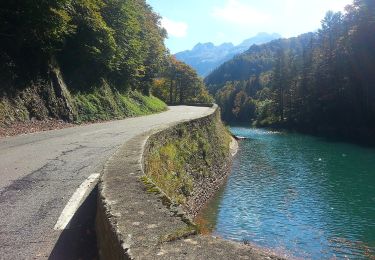
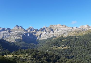
Tocht Stappen Borce - Pic de Gabedaille (2258m) - Photo
 tracegps
tracegps

Gebruiker

© OpenStreetMap contributors
Lengte
Lengte
11,7 km
Max. hoogte
Max. hoogte
2236 m
Positief hoogteverschil
893 m
Km-Effort
Km-Effort  
24 km
Min. hoogte
Min. hoogte
1342 m
Negatief hoogteverschil
895 m
Boucle
Boucle
Ja
Datum van aanmaak :
2014-12-10 00:00:00.0
Laatste wijziging :
2014-12-10 00:00:00.0

(0 Bericht)

Stappen
Stappen
4h30
Moeilijkheid : Moeilijk

Scan deze QR-code om de tocht te openen in de SityTrail-applicatie

Gratisgps-wandelapplicatie

Logo SityTrail SityTrail

IGN / Geografische instituten

SityTrail uit de App Store downloaden SityTrail uit Google Play downloaden

Logo SityTrail SityTrail World

De wereld gaat voor u open

SityTrail uit de App Store downloaden SityTrail uit Google Play downloaden SityTrail op Huawei AppGallery downloaden

Over ons

Tocht Stappen van 11,7 km beschikbaar op Nieuw-Aquitanië, Pyrénées-Atlantiques, Borce. Deze tocht wordt voorgesteld door tracegps.

Beschrijving

Pic Gabedaille 2258m depuis parking d'Espélunguère (1350m) Malgré son altitude modeste, le pic de Gabedaille (ou signal d'Espélunguère) constitue un exceptionnel belvédère. Peu de circuits aussi courts offrent à la fois une telle variété de paysages et un panorama aussi somptueux. Difficulté: Aucune en aller retour, mais des pentes raides quand on désire revenir en circuit où il faut éviter des parois rocheuses vers 1900m (Pour randonneur expérimenté). D’autres indications, photos et panoramiques sur le site « Les Pyrénées vues par Mariano ».

Hoogteprofiel

Foto's

POI's

POI Borce - CabaneCaillabèr - Photo
tracegps
POI Borce - CabaneGrosse - Photo
tracegps
POI Ansó - ColdelaContende - Photo
tracegps
POI Borce - Depart - Photo
tracegps
BORCE 
POI Ansó - EscaléD'AigueTo - Photo
tracegps
POI Ansó - Gabedaille - Photo
tracegps
ANSÓ 

Plaatsbepaling

Land:
France
Regio :
Nieuw-Aquitanië
Departement/Provincie :
Pyrénées-Atlantiques
Gemeente :
Borce
Locatie:
Unknown
Vertrek:(Dec)
Vertrek:(UTM)
697656 ; 4743022 (30T) N.

Wandeltochten in de omgeving

Tocht Te voet Urdos - Sentier de Peyranère au Refuge de Larry PNP - Photo
Te voet
GUIDE+

Te voet

Gemakkelijk
Urdos, Nieuw-Aquitanië, Pyrénées-Atlantiques, France
10,4 km | 19,6 km-effort
4h 27min
Neen
Tocht Te voet Urdos - Sentier du Plateau de la Gentiane PNP - Photo
Te voet
GUIDE+

Te voet

Gemakkelijk
Urdos, Nieuw-Aquitanië, Pyrénées-Atlantiques, France
3,6 km | 7,3 km-effort
1h 39min
Neen
Tocht Te voet Urdos - Sentier du Lac d'Estaëns PNP - Photo
Te voet
GUIDE+

Te voet

Gemakkelijk
Urdos, Nieuw-Aquitanië, Pyrénées-Atlantiques, France
5,1 km | 10,1 km-effort
2h 17min
Neen
Tocht Stappen Borce - Boucle Lescun 4J - E4 - Photo
Stappen
veneon

Stappen

Heel gemakkelijk
(1)
Borce, Nieuw-Aquitanië, Pyrénées-Atlantiques, France
18 km | 27 km-effort
4h 59min
Neen
Tocht Stappen Borce - hrp Arlet to candanchu  - Photo
Stappen
markloopt

Stappen

Medium
(1)
Borce, Nieuw-Aquitanië, Pyrénées-Atlantiques, France
21 km | 33 km-effort
9h 17min
Neen
Tocht Stappen Borce - Chemin de l'escalé - Photo
Stappen
bedous

Stappen

Medium
Borce, Nieuw-Aquitanië, Pyrénées-Atlantiques, France
7,9 km | 12,6 km-effort
2h 52min
Ja
Tocht Stappen Borce - Lac d'Estaens - Photo
Stappen
bedous

Stappen

Moeilijk
Borce, Nieuw-Aquitanië, Pyrénées-Atlantiques, France
10,2 km | 18,3 km-effort
4h 10min
Ja
Tocht Stappen Urdos - Plateau de la gentiane - Photo
Stappen
bedous

Stappen

Medium
Urdos, Nieuw-Aquitanië, Pyrénées-Atlantiques, France
7,7 km | 13,2 km-effort
3h 18min
Ja
Tocht Stappen Urdos - Lac d'Estaens et environs - Photo
Stappen
bedous

Stappen

Moeilijk
Urdos, Nieuw-Aquitanië, Pyrénées-Atlantiques, France
14,9 km | 26 km-effort
7h 42min
Ja


Sluiten
Mijn abonnementen