

Grand tour de Latrape

tracegps
Gebruiker

Lengte
9,2 km

Max. hoogte
368 m

Positief hoogteverschil
171 m

Km-Effort
11,5 km

Min. hoogte
245 m

Negatief hoogteverschil
171 m
Boucle
Ja
Datum van aanmaak :
2014-12-10 00:00:00.0
Laatste wijziging :
2014-12-10 00:00:00.0
3h00
Moeilijkheid : Medium

Gratisgps-wandelapplicatie
Over ons
Tocht Stappen van 9,2 km beschikbaar op Occitanië, Haute-Garonne, Latrape. Deze tocht wordt voorgesteld door tracegps.
Beschrijving
Balades en Volvestre sur les chemins de Latrape. Promenade autour du village, sur les coteaux et terreforts combinant un magnifique panorama sur la chaîne des Pyrénées. Bocage riche en faune et flore le long du ruisseau, du Camedon, de l'Aunat et le pont de Brucelle.
Plaatsbepaling
Land:
France
Regio :
Occitanië
Departement/Provincie :
Haute-Garonne
Gemeente :
Latrape
Locatie:
Unknown
Vertrek:(Dec)
Vertrek:(UTM)
361026 ; 4789428 (31T) N.
Opmerkingen
Wandeltochten in de omgeving
Latrape


Stappen
Gemakkelijk
Latrape,
Occitanië,
Haute-Garonne,
France

10,7 km | 14 km-effort
2h 41min
Ja
Lézat sur Lèze - Saint Ybard


Paard
Medium
Lézat-sur-Lèze,
Occitanië,
Ariège,
France

9,1 km | 11,9 km-effort
1h 0min
Neen
Boucle de Latrape


Stappen
Medium
Latrape,
Occitanië,
Haute-Garonne,
France

10,2 km | 12,8 km-effort
3h 0min
Ja

De Latrape au Cap del Bose


Stappen
Medium
Latrape,
Occitanië,
Haute-Garonne,
France

6,4 km | 8,1 km-effort
2h 45min
Ja
De Latrape à l'Aunat


Stappen
Medium
Latrape,
Occitanië,
Haute-Garonne,
France

7,2 km | 9,4 km-effort
2h 0min
Ja

De Latrape au château de Mailholas


Stappen
Medium
Latrape,
Occitanië,
Haute-Garonne,
France

8,7 km | 11,4 km-effort
2h 30min
Ja
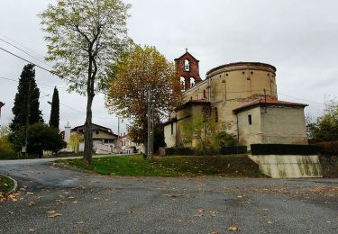
De Latrape à Règue Longue


Stappen
Gemakkelijk
Latrape,
Occitanië,
Haute-Garonne,
France

7,3 km | 9,9 km-effort
1h 30min
Ja

Lézat sans boue fait 2022


Stappen
Medium
Lézat-sur-Lèze,
Occitanië,
Ariège,
France

10,7 km | 13,7 km-effort
2h 28min
Ja

De la Cathédrale au chemin de la Coque et du Vila


Te voet
Gemakkelijk
Rieux-Volvestre,
Occitanië,
Haute-Garonne,
France

3,9 km | 5,4 km-effort
1h 13min
Neen


 SityTrail


