Latrape, Haute-Garonne: Top van de beste wandelroutes, trajecten, tochten en wandelingen

1 opmerkingen

Latrape: Ontdek de beste tochten: 15 te voet. Al deze tochten, trajecten, routes en outdoor activiteiten zijn beschikbaar in onze SityTrail-apps voor smartphones en tablets.


De beste trajecten (15)

Tocht Stappen Latrape - Latrape - Photo
Stappen 10.7
Km

Stappen

Gemakkelijk
Latrape, Occitanië, Haute-Garonne, France
10,7 km | 14 km-effort
2h 41min
250 m
255 m
Ja
pidjam

• Marche dans la campagne le chemin suit en partie le parcours éducatif du "balcon des étoiles" (du côté de Marqueflous...
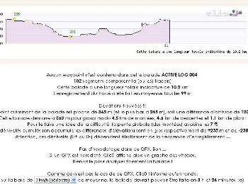
Tocht Stappen Latrape - Boucle de Latrape - Photo
Stappen 10.225
Km

Stappen

Medium
Latrape, Occitanië, Haute-Garonne, France
10,2 km | 12,8 km-effort
3h 0min
194 m
195 m
Ja
tracegps

Tocht Stappen Latrape - Grand tour de Latrape - Photo
Stappen 9.197
Km

Stappen

Medium
Latrape, Occitanië, Haute-Garonne, France
9,2 km | 11,5 km-effort
3h 0min
171 m
171 m
Ja
tracegps

Tocht Stappen Latrape - De Latrape au Cap del Bose - Photo
Stappen 6.432
Km

Stappen

Medium
Latrape, Occitanië, Haute-Garonne, France
6,4 km | 8,1 km-effort
2h 45min
123 m
123 m
Ja
tracegps

Tocht Stappen Latrape - De Latrape à l'Aunat - Photo
Stappen 7.21
Km

Stappen

Medium
Latrape, Occitanië, Haute-Garonne, France
7,2 km | 9,4 km-effort
2h 0min
164 m
164 m
Ja
tracegps

Tocht Stappen Latrape - De Latrape au château de Mailholas - Photo
Stappen 8.748
Km

Stappen

Medium
Latrape, Occitanië, Haute-Garonne, France
8,7 km | 11,4 km-effort
2h 30min
200 m
203 m
Ja
tracegps

Tocht Stappen Latrape - De Latrape à Règue Longue - Photo
Stappen 7.28
Km

Stappen

Gemakkelijk
Latrape, Occitanië, Haute-Garonne, France
7,3 km | 9,9 km-effort
1h 30min
194 m
194 m
Ja
tracegps

Tocht Stappen Latrape - Circuit court LATRAPE - Photo
Stappen 7.91
Km

Stappen

Gemakkelijk
Latrape, Occitanië, Haute-Garonne, France
7,9 km | 9,9 km-effort
2h 10min
152 m
154 m
Ja
DEDIEUJ

Tocht Stappen Latrape - latrape  par le soleil fait 2024 - Photo
Stappen 10.385
Km

Stappen

Gemakkelijk
Latrape, Occitanië, Haute-Garonne, France
10,4 km | 13,8 km-effort
2h 23min
256 m
258 m
Ja
pidjam

Tocht Stappen Latrape - Latrape pis fait 2022 - Photo
Stappen 10.673
Km

Stappen

Medium
Latrape, Occitanië, Haute-Garonne, France
10,7 km | 14,1 km-effort
2h 45min
255 m
256 m
Ja
pidjam

Tocht Stappen Latrape - Latrape courtaou fait - Photo
Stappen 10.858
Km

Stappen

Gemakkelijk
Latrape, Occitanië, Haute-Garonne, France
10,9 km | 14,3 km-effort
3h 3min
255 m
259 m
Ja
pidjam

Tocht Stappen Latrape - Latrape - Photo
Stappen 7.646
Km

Stappen

Gemakkelijk
Latrape, Occitanië, Haute-Garonne, France
7,6 km | 9,6 km-effort
2h 4min
144 m
146 m
Ja
catrouze

Tocht Stappen Latrape - reco latrape - Photo
Stappen 9.398
Km

Stappen

Heel gemakkelijk
Latrape, Occitanië, Haute-Garonne, France
9,4 km | 11,6 km-effort
2h 32min
165 m
167 m
Ja
DEDIEUJ

Tocht Stappen Latrape - Circuit Latrape - Photo
Stappen 7.575
Km

Stappen

Heel gemakkelijk
Latrape, Occitanië, Haute-Garonne, France
7,6 km | 9,5 km-effort
2h 5min
145 m
147 m
Ja
DEDIEUJ

Tocht Stappen Latrape - latrape - Photo
Stappen 9.197
Km

Stappen

Heel gemakkelijk
(1)
Latrape, Occitanië, Haute-Garonne, France
9,2 km | 11,5 km-effort
2h 31min
170 m
170 m
Ja
DEDIEUJ

15 tochten weergegeven op 15

Gratisgps-wandelapplicatie

Logo SityTrail SityTrail

IGN / Geografische instituten

SityTrail uit de App Store downloaden SityTrail uit Google Play downloaden

Logo SityTrail SityTrail World

De wereld gaat voor u open

SityTrail uit de App Store downloaden SityTrail uit Google Play downloaden SityTrail op Huawei AppGallery downloaden

Activiteiten

Sluiten
Mijn abonnementen