![](/images/other/stat-length.png)
![Tocht Mountainbike Thorame-Haute - Espace VTT FFC Val d'Allos - Circuit n° 14 - Champlatte - Photo](https://media.geolcdn.com/t/1900/400/ext.pjpeg?maxdim=2&url=https%3A%2F%2Fservices.sitytrail.com%2FGeolivesWS%2FDownloadMedia.ashx%3FTrailID%3D102554%26Media%3D3426_1.jpg)
Espace VTT FFC Val d'Allos - Circuit n° 14 - Champlatte
tracegps
Gebruiker
![Lengte](/images/other/stat-length.png)
![Max. hoogte](https://static1.geolcdn.com/siteimages/upload/files/1508320355ic_sort_altitude_max_24dp.png)
![Positief hoogteverschil](https://static1.geolcdn.com/siteimages/upload/files/1508320355ic_sort_den_pos_24dp.png)
![Km-Effort](/images/other/stat-length.png)
![Min. hoogte](https://static1.geolcdn.com/siteimages/upload/files/1508320355ic_sort_altitude_min_24dp.png)
![Negatief hoogteverschil](https://static1.geolcdn.com/siteimages/upload/files/1508320355ic_sort_den_neg_24dp.png)
![Boucle](https://static1.geolcdn.com/siteimages/upload/files/16400158638029165_repeat_loop_refresh_sync_direction_icon.png)
![Mountainbike](https://static1.geolcdn.com/sitytour/trail-icons/202.png)
1h30
Moeilijkheid : Moeilijk
![Scan deze QR-code om de tocht te openen in de SityTrail-applicatie](https://capi.geolives.com/qq0zvz2zws4bq2lad0pu/sitytour/trails/102554/qr.png?size=200)
Gratisgps-wandelapplicatie
Over ons
Tocht Mountainbike van 16,8 km beschikbaar op Provence-Alpes-Côte d'Azur, Alpes-de-Haute-Provence, Thorame-Haute. Deze tocht wordt voorgesteld door tracegps.
Beschrijving
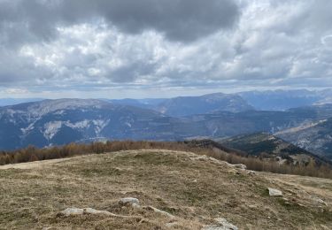
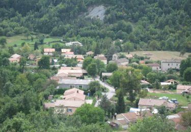
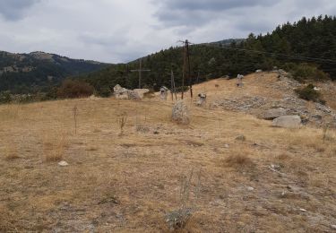
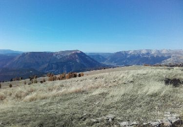
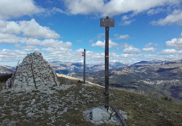
Espace VTT FFC Val d’Allos . Espace VTT FFC Val d'Allos - Circuit n° 14 - Champlatte Départ de La Colle St Michel Circuit officiel labellisé par la Fédération Française de Cyclisme. L’espace VTT FFC du Val d’Allos – Haut Verdon vous propose plus de 100 kilomètres de pistes et chemins forestiers. Sous le soleil des Alpes de Haute Provence vous profiterez de la montagne sur des circuits adaptés pour tous les niveaux et toutes les envies. Parcours à profil descendant sur le site de Val d’Allos 1500 – Le Seignus, ou parcours vallonnés dans le reste de la vallée vous roulerez dans les sous-bois ou les alpages du pays des sources, des lacs et des montagnes. Là où la Provence se fond dans les hauteurs alpines et les plateaux bleus de lavande font place à des vallées encaissées, le Val d'Allos déploie des sites riches de leur complémentarité. Situé dans la haute vallée du Verdon, au coeur du Parc National du Mercantour, le Val d'Allos bénéficie en plus d'un climat à la fois alpin et méditerranéen. De sapins en mélèzes, de prairies en alpages, plusieurs dizaines de kilomètres balisés pour la pratique du VTT vous attendent... De plus, une diversité d'itinéraires descendants vous sont proposés au départ des remontées mécaniques ouvertes. Envie d'une paisible randonnée ou d'une descente endiablée... un dépliant est à votre disposition dans les offices de tourisme.
Plaatsbepaling
Opmerkingen
Wandeltochten in de omgeving
![Tocht Stappen Méailles - M’égailles tête du Ruch - Photo](https://media.geolcdn.com/t/375/260/ext.jpg?maxdim=2&url=https%3A%2F%2Fmedia.geolcdn.com%2Ff%2F401bfe9f-c51e-4875-aec2-03cd717ee019.jpg)
![Stappen Stappen](https://static1.geolcdn.com/sitytour/trail-icons/101.png)
Stappen
![](/images/other/stat-length.png)
![](https://static1.geolcdn.com/siteimages/upload/files/16400158638029165_repeat_loop_refresh_sync_direction_icon.png)
![Tocht Te voet Le Fugeret - 2021-09-20_Le Fugeret - Photo](https://media.geolcdn.com/t/375/260/ext.jpg?maxdim=2&url=https%3A%2F%2Fmedia.geolcdn.com%2Ff%2F9defe012-30a0-4c1e-97fb-d30267b4f527.JPG)
![Te voet Te voet](https://static1.geolcdn.com/sitytour/trail-icons/100.png)
Te voet
![](/images/other/stat-length.png)
![](https://static1.geolcdn.com/siteimages/upload/files/16400158638029165_repeat_loop_refresh_sync_direction_icon.png)
![Tocht Stappen Thorame-Haute - peyrus.le couradour - Photo](https://media.geolcdn.com/t/375/260/ext.jpg?maxdim=2&url=https%3A%2F%2Fmedia.geolcdn.com%2Ff%2F640cf9c5-29c5-4926-9180-ff1f8edc3051.jpg)
![Stappen Stappen](https://static1.geolcdn.com/sitytour/trail-icons/101.png)
Stappen
![](/images/other/stat-length.png)
![](https://static1.geolcdn.com/siteimages/upload/files/16400158638029165_repeat_loop_refresh_sync_direction_icon.png)
![Tocht Stappen Thorame-Haute - pic de courradour - Photo](https://media.geolcdn.com/t/375/260/ext.jpg?maxdim=2&url=https%3A%2F%2Fservices.sitytrail.com%2FGeolivesWS%2FDownloadMedia.ashx%3FTrailID%3D658595%26Media%3Dfix__20161031115838.jpg)
![Stappen Stappen](https://static1.geolcdn.com/sitytour/trail-icons/101.png)
Stappen
![](/images/other/stat-length.png)
![](https://static1.geolcdn.com/siteimages/upload/files/16400158638029165_repeat_loop_refresh_sync_direction_icon.png)
![Tocht Stappen Allons - puy de rent, descente par la colle - Photo](https://media.geolcdn.com/t/375/260/ext.jpg?maxdim=2&url=https%3A%2F%2Fservices.sitytrail.com%2FGeolivesWS%2FDownloadMedia.ashx%3FTrailID%3D658591%26Media%3Dfix__20160920124101.jpg)
![Stappen Stappen](https://static1.geolcdn.com/sitytour/trail-icons/101.png)
Stappen
![](/images/other/stat-length.png)
![](https://static1.geolcdn.com/siteimages/upload/files/16400158638029165_repeat_loop_refresh_sync_direction_icon.png)
![Tocht Stappen Thorame-Haute - Pré Thorame - Photo](https://media.geolcdn.com/t/375/260/ext.jpg?maxdim=2&url=https%3A%2F%2Fmedia.geolcdn.com%2Ff%2Fef7251d9-cae8-4976-9846-29770f8ea6a1.jpg)
![Stappen Stappen](https://static1.geolcdn.com/sitytour/trail-icons/101.png)
Stappen
![](/images/other/stat-length.png)
![](https://static1.geolcdn.com/siteimages/upload/files/16400158638029165_repeat_loop_refresh_sync_direction_icon.png)
![Tocht Stappen Thorame-Haute - Puy de rent - Photo](https://media.geolcdn.com/t/375/260/ext.jpg?maxdim=2&url=https%3A%2F%2Fmedia.geolcdn.com%2Ff%2F1693db8c-0134-4f40-83d2-d565a4d80c78.jpg)
![Stappen Stappen](https://static1.geolcdn.com/sitytour/trail-icons/101.png)
Stappen
![](/images/other/stat-length.png)
![](https://static1.geolcdn.com/siteimages/upload/files/16400158638029165_repeat_loop_refresh_sync_direction_icon.png)
![Tocht Langlaufen Thorame-Haute - ski de fond colle baudet - Photo](https://media.geolcdn.com/t/375/260/ext.jpg?maxdim=2&url=https%3A%2F%2Fmedia.geolcdn.com%2Ff%2Fbc86fd16-c23f-4bb9-aeb9-0e1158c4a5d0.jpg)
![Langlaufen Langlaufen](https://static1.geolcdn.com/sitytour/trail-icons/502.png)
Langlaufen
![](/images/other/stat-length.png)
![](https://static1.geolcdn.com/siteimages/upload/files/16400158638029165_repeat_loop_refresh_sync_direction_icon.png)
![Tocht Sneeuwschoenen Thorame-Haute - Le Courradour (2230m)en raquettes - Photo](https://media.geolcdn.com/t/375/260/ext.jpg?maxdim=2&url=https%3A%2F%2Fservices.sitytrail.com%2FGeolivesWS%2FDownloadMedia.ashx%3FTrailID%3D129668%26Media%3D13196_2.jpg)
![Sneeuwschoenen Sneeuwschoenen](https://static1.geolcdn.com/sitytour/trail-icons/504.png)
Sneeuwschoenen
![](/images/other/stat-length.png)
![](https://static1.geolcdn.com/siteimages/upload/files/16400158638029165_repeat_loop_refresh_sync_direction_icon.png)