![](/images/other/stat-length.png)
Landkreis Eichstätt, Beieren: Top van de beste wandelroutes, trajecten, tochten en wandelingen
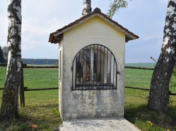
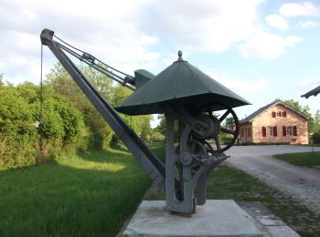
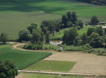
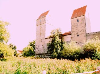
Landkreis Eichstätt: Ontdek de beste tochten: 74 te voet. Al deze tochten, trajecten, routes en outdoor activiteiten zijn beschikbaar in onze SityTrail-apps voor smartphones en tablets.
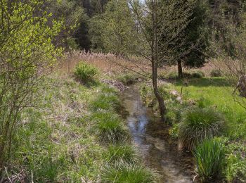
De beste trajecten (74)
![Tocht Te voet Beilngries - Beilngries-Altmannstein-Wanderweg - Photo](https://media.geolcdn.com/t/350/260/bb0197ab-0d53-4bd5-8bb8-2add71dab11a.jpeg&format=jpg&maxdim=2)
![Te voet Te voet](https://static1.geolcdn.com/sitytour/trail-icons/100.png)
Km
Te voet
![](/images/other/stat-length.png)
![](https://static1.geolcdn.com/siteimages/upload/files/1508320355ic_sort_den_pos_24dp.png)
![](https://static1.geolcdn.com/siteimages/upload/files/1508320355ic_sort_den_neg_24dp.png)
![](https://static1.geolcdn.com/siteimages/upload/files/16400158638029165_repeat_loop_refresh_sync_direction_icon.png)
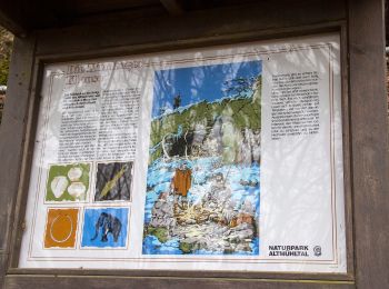
• Trail created by Naturpark Altmühltal.
![Tocht Te voet Beilngries - Buckel-Runde - Photo](https://media.geolcdn.com/t/350/260/48f847e0-ab40-4220-a5de-9eedb8594ca2.jpeg&format=jpg&maxdim=2)
![Te voet Te voet](https://static1.geolcdn.com/sitytour/trail-icons/100.png)
Km
Te voet
![](/images/other/stat-length.png)
![](https://static1.geolcdn.com/siteimages/upload/files/1508320355ic_sort_den_pos_24dp.png)
![](https://static1.geolcdn.com/siteimages/upload/files/1508320355ic_sort_den_neg_24dp.png)
![](https://static1.geolcdn.com/siteimages/upload/files/16400158638029165_repeat_loop_refresh_sync_direction_icon.png)
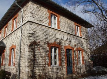
• Trail created by Stadt Beilngries. Symbol: Schwarze Drei
![Tocht Te voet Beilngries - Arzberg-Meile - Photo](https://media.geolcdn.com/t/350/260/e1462979-d840-4178-9aae-a5d9fa5b9374.jpeg&format=jpg&maxdim=2)
![Te voet Te voet](https://static1.geolcdn.com/sitytour/trail-icons/100.png)
Km
Te voet
![](/images/other/stat-length.png)
![](https://static1.geolcdn.com/siteimages/upload/files/1508320355ic_sort_den_pos_24dp.png)
![](https://static1.geolcdn.com/siteimages/upload/files/1508320355ic_sort_den_neg_24dp.png)
![](https://static1.geolcdn.com/siteimages/upload/files/16400158638029165_repeat_loop_refresh_sync_direction_icon.png)
• Trail created by Stadt Beilngries. Symbol: Rote Zwei
![Tocht Te voet Beilngries - Zwiebeltreter-Runde - Photo](https://media.geolcdn.com/t/350/260/e187f3d4-f9b7-4cfb-a66a-52521747a1b3.jpeg&format=jpg&maxdim=2)
![Te voet Te voet](https://static1.geolcdn.com/sitytour/trail-icons/100.png)
Km
Te voet
![](/images/other/stat-length.png)
![](https://static1.geolcdn.com/siteimages/upload/files/1508320355ic_sort_den_pos_24dp.png)
![](https://static1.geolcdn.com/siteimages/upload/files/1508320355ic_sort_den_neg_24dp.png)
![](https://static1.geolcdn.com/siteimages/upload/files/16400158638029165_repeat_loop_refresh_sync_direction_icon.png)
• Trail created by Stadt Beilngries. Symbol: Blaue Eins
![Tocht Te voet Nassenfels - Speckbergrunde - Photo](https://media.geolcdn.com/t/350/260/0709679e-bd4e-4c6d-a715-0a9a4fd2f82e.jpeg&format=jpg&maxdim=2)
![Te voet Te voet](https://static1.geolcdn.com/sitytour/trail-icons/100.png)
Km
Te voet
![](/images/other/stat-length.png)
![](https://static1.geolcdn.com/siteimages/upload/files/1508320355ic_sort_den_pos_24dp.png)
![](https://static1.geolcdn.com/siteimages/upload/files/1508320355ic_sort_den_neg_24dp.png)
![](https://static1.geolcdn.com/siteimages/upload/files/16400158638029165_repeat_loop_refresh_sync_direction_icon.png)
• Trail created by Gemeinde Nassenfeld. Symbol: t.b.d.
![Tocht Te voet Nassenfels - Mühlenrunde Nassenfels - Photo](https://media.geolcdn.com/t/350/260/37047977-f104-408d-9a05-97ede88728dc.jpeg&format=jpg&maxdim=2)
![Te voet Te voet](https://static1.geolcdn.com/sitytour/trail-icons/100.png)
Km
Te voet
![](/images/other/stat-length.png)
![](https://static1.geolcdn.com/siteimages/upload/files/1508320355ic_sort_den_pos_24dp.png)
![](https://static1.geolcdn.com/siteimages/upload/files/1508320355ic_sort_den_neg_24dp.png)
![](https://static1.geolcdn.com/siteimages/upload/files/16400158638029165_repeat_loop_refresh_sync_direction_icon.png)
• Trail created by Markt Nassenfels. Symbol: t.b.d.
![Tocht Te voet Kösching - Rundweg Kösching 6 - Photo](https://media.geolcdn.com/t/350/260/f6a78246-1ace-4314-87f6-d51454934c82.jpeg&format=jpg&maxdim=2)
![Te voet Te voet](https://static1.geolcdn.com/sitytour/trail-icons/100.png)
Km
Te voet
![](/images/other/stat-length.png)
![](https://static1.geolcdn.com/siteimages/upload/files/1508320355ic_sort_den_pos_24dp.png)
![](https://static1.geolcdn.com/siteimages/upload/files/1508320355ic_sort_den_neg_24dp.png)
![](https://static1.geolcdn.com/siteimages/upload/files/16400158638029165_repeat_loop_refresh_sync_direction_icon.png)
• Trail created by Markt Kösching. abgeschlossen (August 2014, by cycling_zno) Symbol: Grüne 6 auf gelbem Pfeil
![Tocht Te voet Kösching - Rundweg Kösching 5 - Photo](https://media.geolcdn.com/t/350/260/ded37e26-f5b4-4d63-9967-f69726432ffa.jpeg&format=jpg&maxdim=2)
![Te voet Te voet](https://static1.geolcdn.com/sitytour/trail-icons/100.png)
Km
Te voet
![](/images/other/stat-length.png)
![](https://static1.geolcdn.com/siteimages/upload/files/1508320355ic_sort_den_pos_24dp.png)
![](https://static1.geolcdn.com/siteimages/upload/files/1508320355ic_sort_den_neg_24dp.png)
![](https://static1.geolcdn.com/siteimages/upload/files/16400158638029165_repeat_loop_refresh_sync_direction_icon.png)
• Trail created by Markt Kösching. abgeschlossen (August 2014, by cycling_zno) Symbol: Grüne 5 auf gelbem Pfeil
![Tocht Te voet Kösching - Rundweg Kösching 3 - Photo](https://media.geolcdn.com/t/350/260/3126ea14-692e-4368-9646-c2364d7d11b7.jpeg&format=jpg&maxdim=2)
![Te voet Te voet](https://static1.geolcdn.com/sitytour/trail-icons/100.png)
Km
Te voet
![](/images/other/stat-length.png)
![](https://static1.geolcdn.com/siteimages/upload/files/1508320355ic_sort_den_pos_24dp.png)
![](https://static1.geolcdn.com/siteimages/upload/files/1508320355ic_sort_den_neg_24dp.png)
![](https://static1.geolcdn.com/siteimages/upload/files/16400158638029165_repeat_loop_refresh_sync_direction_icon.png)
• Trail created by Markt Kösching. abgeschlossen (August 2014, by cycling_zno) Symbol: Grüne 3 auf gelbem Pfeil
![Tocht Te voet Kösching - Rundweg Kösching 2 - Photo](https://media.geolcdn.com/t/350/260/3126ea14-692e-4368-9646-c2364d7d11b7.jpeg&format=jpg&maxdim=2)
![Te voet Te voet](https://static1.geolcdn.com/sitytour/trail-icons/100.png)
Km
Te voet
![](/images/other/stat-length.png)
![](https://static1.geolcdn.com/siteimages/upload/files/1508320355ic_sort_den_pos_24dp.png)
![](https://static1.geolcdn.com/siteimages/upload/files/1508320355ic_sort_den_neg_24dp.png)
![](https://static1.geolcdn.com/siteimages/upload/files/16400158638029165_repeat_loop_refresh_sync_direction_icon.png)
• Trail created by Markt Kösching. abgeschlossen (August 2014, by cycling_zno) Symbol: Grüne 2 auf gelbem Pfeil
![Tocht Te voet Kinding - Kindinger Burgenweg - Photo](https://media.geolcdn.com/t/350/260/5d2b1af9-4a6d-4fbd-942b-b78155bba50f.jpeg&format=jpg&maxdim=2)
![Te voet Te voet](https://static1.geolcdn.com/sitytour/trail-icons/100.png)
Km
Te voet
![](/images/other/stat-length.png)
![](https://static1.geolcdn.com/siteimages/upload/files/1508320355ic_sort_den_pos_24dp.png)
![](https://static1.geolcdn.com/siteimages/upload/files/1508320355ic_sort_den_neg_24dp.png)
![](https://static1.geolcdn.com/siteimages/upload/files/16400158638029165_repeat_loop_refresh_sync_direction_icon.png)
• Trail created by Gemeinde Kinding. abgeschlossen (August 2014, by cycling_zno) Symbol: Blaue Burg auf weißem Grund
![Tocht Te voet Kinding - Rundweg Kinding K2 - Photo](https://media.geolcdn.com/t/350/260/f8769300-99af-4eb2-be29-219c1a4b3f81.jpeg&format=jpg&maxdim=2)
![Te voet Te voet](https://static1.geolcdn.com/sitytour/trail-icons/100.png)
Km
Te voet
![](/images/other/stat-length.png)
![](https://static1.geolcdn.com/siteimages/upload/files/1508320355ic_sort_den_pos_24dp.png)
![](https://static1.geolcdn.com/siteimages/upload/files/1508320355ic_sort_den_neg_24dp.png)
![](https://static1.geolcdn.com/siteimages/upload/files/16400158638029165_repeat_loop_refresh_sync_direction_icon.png)
• Trail created by Gemeinde Kinding. abgeschlossen (August 2014, by cycling_zno) Symbol: Grüne K2 auf gelbem Pfeil
![Tocht Te voet Kinding - Rundweg Kinding 1 - Photo](https://media.geolcdn.com/t/350/260/47dee171-7921-4cad-9610-c69c00be0d9d.jpeg&format=jpg&maxdim=2)
![Te voet Te voet](https://static1.geolcdn.com/sitytour/trail-icons/100.png)
Km
Te voet
![](/images/other/stat-length.png)
![](https://static1.geolcdn.com/siteimages/upload/files/1508320355ic_sort_den_pos_24dp.png)
![](https://static1.geolcdn.com/siteimages/upload/files/1508320355ic_sort_den_neg_24dp.png)
![](https://static1.geolcdn.com/siteimages/upload/files/16400158638029165_repeat_loop_refresh_sync_direction_icon.png)
• Trail created by Gemeinde Kinding. abgeschlossen (August 2014, by cycling_zno) Symbol: Grüne 1 auf gelbem Pfeil
![Tocht Te voet Kipfenberg - Wanderweg Kipfenberg 17 - Photo](https://media.geolcdn.com/t/350/260/b03a1778-2385-4a96-b451-dc4f5af36d02.jpeg&format=jpg&maxdim=2)
![Te voet Te voet](https://static1.geolcdn.com/sitytour/trail-icons/100.png)
Km
Te voet
![](/images/other/stat-length.png)
![](https://static1.geolcdn.com/siteimages/upload/files/1508320355ic_sort_den_pos_24dp.png)
![](https://static1.geolcdn.com/siteimages/upload/files/1508320355ic_sort_den_neg_24dp.png)
![](https://static1.geolcdn.com/siteimages/upload/files/16400158638029165_repeat_loop_refresh_sync_direction_icon.png)
• Trail created by Markt Kipfenberg. abgeschlossen (Juni 2014, by cycling_zno) Symbol: Grüne 17 auf gelbem Grund
![Tocht Te voet Walting - Rundwanderweg Kipfenberg 5 - Photo](https://media.geolcdn.com/t/350/260/3d9bfb1b-7f12-424e-810a-7809a247d332.jpeg&format=jpg&maxdim=2)
![Te voet Te voet](https://static1.geolcdn.com/sitytour/trail-icons/100.png)
Km
Te voet
![](/images/other/stat-length.png)
![](https://static1.geolcdn.com/siteimages/upload/files/1508320355ic_sort_den_pos_24dp.png)
![](https://static1.geolcdn.com/siteimages/upload/files/1508320355ic_sort_den_neg_24dp.png)
![](https://static1.geolcdn.com/siteimages/upload/files/16400158638029165_repeat_loop_refresh_sync_direction_icon.png)
• Trail created by Markt Kipfenberg. abgeschlossen (Mai 2014, by cycling_zno) Symbol: Grüne 5 auf gelbem Grund
![Tocht Te voet Kipfenberg - Rundwanderweg Kipfenberg 6 - Photo](https://media.geolcdn.com/t/350/260/2ee38834-628a-43f1-800a-4401c6133de1.jpeg&format=jpg&maxdim=2)
![Te voet Te voet](https://static1.geolcdn.com/sitytour/trail-icons/100.png)
Km
Te voet
![](/images/other/stat-length.png)
![](https://static1.geolcdn.com/siteimages/upload/files/1508320355ic_sort_den_pos_24dp.png)
![](https://static1.geolcdn.com/siteimages/upload/files/1508320355ic_sort_den_neg_24dp.png)
![](https://static1.geolcdn.com/siteimages/upload/files/16400158638029165_repeat_loop_refresh_sync_direction_icon.png)
• Trail created by Markt Kipfenberg. abgeschlossen (Mai 2014, by cycling_zno) Symbol: Grüne 6 auf gelbem Grund
![Tocht Te voet Kipfenberg - Rundwanderweg Kipfenberg 9 - Photo](https://media.geolcdn.com/t/350/260/2ee38834-628a-43f1-800a-4401c6133de1.jpeg&format=jpg&maxdim=2)
![Te voet Te voet](https://static1.geolcdn.com/sitytour/trail-icons/100.png)
Km
Te voet
![](/images/other/stat-length.png)
![](https://static1.geolcdn.com/siteimages/upload/files/1508320355ic_sort_den_pos_24dp.png)
![](https://static1.geolcdn.com/siteimages/upload/files/1508320355ic_sort_den_neg_24dp.png)
![](https://static1.geolcdn.com/siteimages/upload/files/16400158638029165_repeat_loop_refresh_sync_direction_icon.png)
• Trail created by Markt Kipfenberg. abgeschlossen (Mai 2014, by cycling_zno) Symbol: Grüne 9 auf gelbem Grund
![Tocht Te voet Kipfenberg - Rundwanderweg Kipfenberg 10 - Photo](https://media.geolcdn.com/t/350/260/33d65b98-0ecc-486e-bb90-4ccbdd0cd187.jpeg&format=jpg&maxdim=2)
![Te voet Te voet](https://static1.geolcdn.com/sitytour/trail-icons/100.png)
Km
Te voet
![](/images/other/stat-length.png)
![](https://static1.geolcdn.com/siteimages/upload/files/1508320355ic_sort_den_pos_24dp.png)
![](https://static1.geolcdn.com/siteimages/upload/files/1508320355ic_sort_den_neg_24dp.png)
![](https://static1.geolcdn.com/siteimages/upload/files/16400158638029165_repeat_loop_refresh_sync_direction_icon.png)
• Trail created by Markt Kipfenberg. abgeschlossen (Mai 2014, by cycling_zno) Symbol: Grüne 10 auf gelbem Grund
![Tocht Te voet Kipfenberg - Rundwanderweg Kipfenberg 7 - Photo](https://media.geolcdn.com/t/350/260/2ee38834-628a-43f1-800a-4401c6133de1.jpeg&format=jpg&maxdim=2)
![Te voet Te voet](https://static1.geolcdn.com/sitytour/trail-icons/100.png)
Km
Te voet
![](/images/other/stat-length.png)
![](https://static1.geolcdn.com/siteimages/upload/files/1508320355ic_sort_den_pos_24dp.png)
![](https://static1.geolcdn.com/siteimages/upload/files/1508320355ic_sort_den_neg_24dp.png)
![](https://static1.geolcdn.com/siteimages/upload/files/16400158638029165_repeat_loop_refresh_sync_direction_icon.png)
• Trail created by Markt Kipfenberg. abgeschlossen (Mai 2014, by cycling_zno) Symbol: Grüne 7 auf gelbem Grund
![Tocht Te voet Kipfenberg - Rundwanderweg Kipfenberg 8 (Muckenbergweg) - Photo](https://media.geolcdn.com/t/350/260/6dcf6e62-82fe-4979-b828-2c616fb60961.jpeg&format=jpg&maxdim=2)
![Te voet Te voet](https://static1.geolcdn.com/sitytour/trail-icons/100.png)
Km
Te voet
![](/images/other/stat-length.png)
![](https://static1.geolcdn.com/siteimages/upload/files/1508320355ic_sort_den_pos_24dp.png)
![](https://static1.geolcdn.com/siteimages/upload/files/1508320355ic_sort_den_neg_24dp.png)
![](https://static1.geolcdn.com/siteimages/upload/files/16400158638029165_repeat_loop_refresh_sync_direction_icon.png)
• Trail created by Markt Kipfenberg. abgeschlossen (Mai 2014, by cycling_zno) Symbol: Grüne 8 auf gelbem Grund
20 tochten weergegeven op 74
Gratisgps-wandelapplicatie