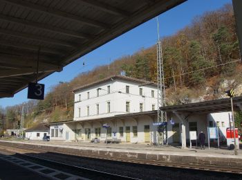
![](/images/other/stat-length.png)
- Tochten
- Outdoor
- Germany
- Beieren
- Landkreis Eichstätt
- Eichstätt
Eichstätt, Landkreis Eichstätt: Top van de beste wandelroutes, trajecten, tochten en wandelingen
Eichstätt: Ontdek de beste tochten: 8 te voet. Al deze tochten, trajecten, routes en outdoor activiteiten zijn beschikbaar in onze SityTrail-apps voor smartphones en tablets.
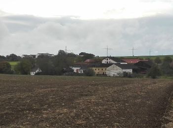
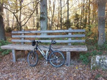
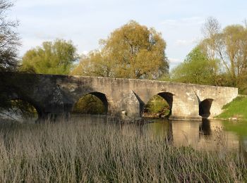
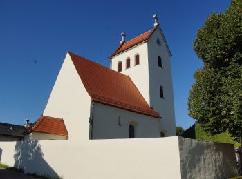
De beste trajecten (8)
![Tocht Te voet Eichstätt - Rundwanderweg Eichstätt Nr. 5 - Photo](https://media.geolcdn.com/t/350/260/dd47755c-8cbc-4e76-bd09-6dc32708639f.jpeg&format=jpg&maxdim=2)
![Te voet Te voet](https://static1.geolcdn.com/sitytour/trail-icons/100.png)
Km
Te voet
![](/images/other/stat-length.png)
![](https://static1.geolcdn.com/siteimages/upload/files/1508320355ic_sort_den_pos_24dp.png)
![](https://static1.geolcdn.com/siteimages/upload/files/1508320355ic_sort_den_neg_24dp.png)
![](https://static1.geolcdn.com/siteimages/upload/files/16400158638029165_repeat_loop_refresh_sync_direction_icon.png)
• Trail created by Tourist-Information Stadt Eichstätt. abgeschlossen (Mai 2014, by cycling_zno) Symbol: grüne Ziffer...
![Tocht Te voet Eichstätt - Rundwanderweg Eichstätt Nr. 2 - Photo](https://media.geolcdn.com/t/350/260/71b7cef4-5176-413f-a64a-0f671453c942.jpeg&format=jpg&maxdim=2)
![Te voet Te voet](https://static1.geolcdn.com/sitytour/trail-icons/100.png)
Km
Te voet
![](/images/other/stat-length.png)
![](https://static1.geolcdn.com/siteimages/upload/files/1508320355ic_sort_den_pos_24dp.png)
![](https://static1.geolcdn.com/siteimages/upload/files/1508320355ic_sort_den_neg_24dp.png)
![](https://static1.geolcdn.com/siteimages/upload/files/16400158638029165_repeat_loop_refresh_sync_direction_icon.png)
• Trail created by Tourist-Information Stadt Eichstätt. abgeschlossen (März 2014, by cycling_zno) Symbol: grüne Ziffe...
![Tocht Te voet Eichstätt - Rundweg Walting 7 - Photo](https://media.geolcdn.com/t/350/260/27217c4d-7691-4f5e-bfe1-c3253383f5ad.jpeg&format=jpg&maxdim=2)
![Te voet Te voet](https://static1.geolcdn.com/sitytour/trail-icons/100.png)
Km
Te voet
![](/images/other/stat-length.png)
![](https://static1.geolcdn.com/siteimages/upload/files/1508320355ic_sort_den_pos_24dp.png)
![](https://static1.geolcdn.com/siteimages/upload/files/1508320355ic_sort_den_neg_24dp.png)
![](https://static1.geolcdn.com/siteimages/upload/files/16400158638029165_repeat_loop_refresh_sync_direction_icon.png)
• Trail created by Gemeinde Walting. abgeschlossen (Mai 2014, by cycling_zno) Symbol: Grüne 7 auf gelbem Grund
![Tocht Te voet Eichstätt - Feuchtgebiets-Lehrpfad Pfünz - Photo](https://media.geolcdn.com/t/350/260/17cf4753-4b3d-4341-b31f-6657af07dc3f.jpeg&format=jpg&maxdim=2)
![Te voet Te voet](https://static1.geolcdn.com/sitytour/trail-icons/100.png)
Km
Te voet
![](/images/other/stat-length.png)
![](https://static1.geolcdn.com/siteimages/upload/files/1508320355ic_sort_den_pos_24dp.png)
![](https://static1.geolcdn.com/siteimages/upload/files/1508320355ic_sort_den_neg_24dp.png)
![](https://static1.geolcdn.com/siteimages/upload/files/16400158638029165_repeat_loop_refresh_sync_direction_icon.png)
• Trail created by Gemeinde Walting. abgeschlossen (März 2014, by cycling_zno) Symbol: t.b.d.
![Tocht Te voet Eichstätt - Rundwanderweg Eichstätt Nr. 1 - Photo](https://media.geolcdn.com/t/350/260/4f6b9922-798c-49be-9366-c5a086156464.jpeg&format=jpg&maxdim=2)
![Te voet Te voet](https://static1.geolcdn.com/sitytour/trail-icons/100.png)
Km
Te voet
![](/images/other/stat-length.png)
![](https://static1.geolcdn.com/siteimages/upload/files/1508320355ic_sort_den_pos_24dp.png)
![](https://static1.geolcdn.com/siteimages/upload/files/1508320355ic_sort_den_neg_24dp.png)
![](https://static1.geolcdn.com/siteimages/upload/files/16400158638029165_repeat_loop_refresh_sync_direction_icon.png)
• Trail created by Tourist-Information Stadt Eichstätt. abgeschlossen (März 2014, by cycling_zno) Symbol: grüne Ziffe...
![Tocht Te voet Eichstätt - Nordic Walking Park Eichstätt Route 3 Auwäldchen - Photo](https://media.geolcdn.com/t/350/260/a30ce428-0efb-48cf-9cca-17de53a76b4e.jpeg&format=jpg&maxdim=2)
![Te voet Te voet](https://static1.geolcdn.com/sitytour/trail-icons/100.png)
Km
Te voet
![](/images/other/stat-length.png)
![](https://static1.geolcdn.com/siteimages/upload/files/1508320355ic_sort_den_pos_24dp.png)
![](https://static1.geolcdn.com/siteimages/upload/files/1508320355ic_sort_den_neg_24dp.png)
![](https://static1.geolcdn.com/siteimages/upload/files/16400158638029165_repeat_loop_refresh_sync_direction_icon.png)
• Trail created by Tourist-Information Stadt Eichstätt. Symbol: rote Ziffer 3 und grünes Nordic-Walking-Piktogramm auf...
![Tocht Te voet Eichstätt - KultURwald - Photo](https://media.geolcdn.com/t/350/260/a30ce428-0efb-48cf-9cca-17de53a76b4e.jpeg&format=jpg&maxdim=2)
![Te voet Te voet](https://static1.geolcdn.com/sitytour/trail-icons/100.png)
Km
Te voet
![](/images/other/stat-length.png)
![](https://static1.geolcdn.com/siteimages/upload/files/1508320355ic_sort_den_pos_24dp.png)
![](https://static1.geolcdn.com/siteimages/upload/files/1508320355ic_sort_den_neg_24dp.png)
![](https://static1.geolcdn.com/siteimages/upload/files/16400158638029165_repeat_loop_refresh_sync_direction_icon.png)
• Trail created by Stadt Eichstätt. Symbol: grün auf weiss, KultURwald
![Tocht Te voet Eichstätt - Rundwanderweg Eichstätt Nr. 7 - Photo](https://media.geolcdn.com/t/350/260/9e700382-e37e-4833-a042-2d5d47ff2cfa.jpeg&format=jpg&maxdim=2)
![Te voet Te voet](https://static1.geolcdn.com/sitytour/trail-icons/100.png)
Km
Te voet
![](/images/other/stat-length.png)
![](https://static1.geolcdn.com/siteimages/upload/files/1508320355ic_sort_den_pos_24dp.png)
![](https://static1.geolcdn.com/siteimages/upload/files/1508320355ic_sort_den_neg_24dp.png)
![](https://static1.geolcdn.com/siteimages/upload/files/16400158638029165_repeat_loop_refresh_sync_direction_icon.png)
• Trail created by Tourist-Information Stadt Eichstätt. abgeschlossen (März 2014, by cycling_zno) Symbol: grüne Ziffe...
8 tochten weergegeven op 8
Gratisgps-wandelapplicatie