![](/images/other/stat-length.png)
- Tochten
- Outdoor
- Austria
- Burgenland
- Bezirk Eisenstadt-Umgebung
Bezirk Eisenstadt-Umgebung, Burgenland: Top van de beste wandelroutes, trajecten, tochten en wandelingen
Bezirk Eisenstadt-Umgebung: Ontdek de beste tochten: 41 te voet. Al deze tochten, trajecten, routes en outdoor activiteiten zijn beschikbaar in onze SityTrail-apps voor smartphones en tablets.
De beste trajecten (41)
![Tocht Te voet Siegendorf/Cindrof - 3-Gemeinde-Tour (Vital-Parcours Siegendorf) - Photo](https://media.geolcdn.com/t/350/260/cbd595dd-4264-41fd-b29d-cb7d7e20bd22.jpeg&format=jpg&maxdim=2)
![Te voet Te voet](https://static1.geolcdn.com/sitytour/trail-icons/100.png)
Km
Te voet
![](/images/other/stat-length.png)
![](https://static1.geolcdn.com/siteimages/upload/files/1508320355ic_sort_den_pos_24dp.png)
![](https://static1.geolcdn.com/siteimages/upload/files/1508320355ic_sort_den_neg_24dp.png)
![](https://static1.geolcdn.com/siteimages/upload/files/16400158638029165_repeat_loop_refresh_sync_direction_icon.png)
• Trail created by Tourismusverband Siegendorf.
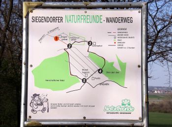
![Tocht Te voet Siegendorf/Cindrof - Siegendorfer Naturfreunde-Wanderweg - Photo](https://media.geolcdn.com/t/350/260/e19bd10c-f51c-4356-b05c-b92ea36bf626.jpeg&format=jpg&maxdim=2)
![Te voet Te voet](https://static1.geolcdn.com/sitytour/trail-icons/100.png)
Km
Te voet
![](/images/other/stat-length.png)
![](https://static1.geolcdn.com/siteimages/upload/files/1508320355ic_sort_den_pos_24dp.png)
![](https://static1.geolcdn.com/siteimages/upload/files/1508320355ic_sort_den_neg_24dp.png)
![](https://static1.geolcdn.com/siteimages/upload/files/16400158638029165_repeat_loop_refresh_sync_direction_icon.png)
• Trail created by Naturfreunde Ortsgruppe Siegendorf.
![Tocht Te voet Siegendorf/Cindrof - Natura 2000-Tour (Vital-Parcours Siegendorf) - Photo](https://media.geolcdn.com/t/350/260/cbd595dd-4264-41fd-b29d-cb7d7e20bd22.jpeg&format=jpg&maxdim=2)
![Te voet Te voet](https://static1.geolcdn.com/sitytour/trail-icons/100.png)
Km
Te voet
![](/images/other/stat-length.png)
![](https://static1.geolcdn.com/siteimages/upload/files/1508320355ic_sort_den_pos_24dp.png)
![](https://static1.geolcdn.com/siteimages/upload/files/1508320355ic_sort_den_neg_24dp.png)
![](https://static1.geolcdn.com/siteimages/upload/files/16400158638029165_repeat_loop_refresh_sync_direction_icon.png)
• Trail created by Tourismusverband Siegendorf.
![Tocht Te voet Siegendorf/Cindrof - Puszta-Tour (Vital-Parcours Siegendorf) - Photo](https://media.geolcdn.com/t/350/260/6a5469a4-d9e3-4138-bb29-b218b8983f77.jpeg&format=jpg&maxdim=2)
![Te voet Te voet](https://static1.geolcdn.com/sitytour/trail-icons/100.png)
Km
Te voet
![](/images/other/stat-length.png)
![](https://static1.geolcdn.com/siteimages/upload/files/1508320355ic_sort_den_pos_24dp.png)
![](https://static1.geolcdn.com/siteimages/upload/files/1508320355ic_sort_den_neg_24dp.png)
![](https://static1.geolcdn.com/siteimages/upload/files/16400158638029165_repeat_loop_refresh_sync_direction_icon.png)
• Trail created by Tourismusverband Siegendorf.
![Tocht Te voet Siegendorf/Cindrof - Kapellenweg-Tour (Vital-Parcours Siegendorf) - Photo](https://media.geolcdn.com/t/350/260/cbd595dd-4264-41fd-b29d-cb7d7e20bd22.jpeg&format=jpg&maxdim=2)
![Te voet Te voet](https://static1.geolcdn.com/sitytour/trail-icons/100.png)
Km
Te voet
![](/images/other/stat-length.png)
![](https://static1.geolcdn.com/siteimages/upload/files/1508320355ic_sort_den_pos_24dp.png)
![](https://static1.geolcdn.com/siteimages/upload/files/1508320355ic_sort_den_neg_24dp.png)
![](https://static1.geolcdn.com/siteimages/upload/files/16400158638029165_repeat_loop_refresh_sync_direction_icon.png)
• Trail created by Tourismusverband Siegendorf.
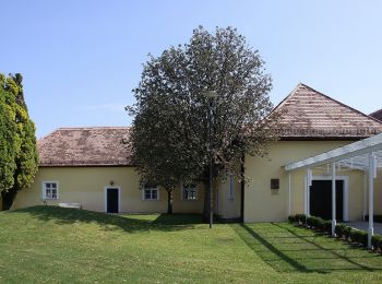
![Tocht Te voet Siegendorf/Cindrof - Naturweg-Tour (Vital-Parcours Siegendorf) - Photo](https://media.geolcdn.com/t/350/260/4a5d9a44-2cca-463e-a564-6eccaecf8406.jpeg&format=jpg&maxdim=2)
![Te voet Te voet](https://static1.geolcdn.com/sitytour/trail-icons/100.png)
Km
Te voet
![](/images/other/stat-length.png)
![](https://static1.geolcdn.com/siteimages/upload/files/1508320355ic_sort_den_pos_24dp.png)
![](https://static1.geolcdn.com/siteimages/upload/files/1508320355ic_sort_den_neg_24dp.png)
![](https://static1.geolcdn.com/siteimages/upload/files/16400158638029165_repeat_loop_refresh_sync_direction_icon.png)
• Trail created by Tourismusverband Siegendorf.
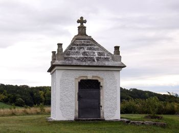
![Tocht Te voet Siegendorf/Cindrof - Königsschüssel-Tour (Vital-Parcours Siegendorf) - Photo](https://media.geolcdn.com/t/350/260/9981737e-831a-4a05-a2bd-4587e773d796.jpeg&format=jpg&maxdim=2)
![Te voet Te voet](https://static1.geolcdn.com/sitytour/trail-icons/100.png)
Km
Te voet
![](/images/other/stat-length.png)
![](https://static1.geolcdn.com/siteimages/upload/files/1508320355ic_sort_den_pos_24dp.png)
![](https://static1.geolcdn.com/siteimages/upload/files/1508320355ic_sort_den_neg_24dp.png)
![](https://static1.geolcdn.com/siteimages/upload/files/16400158638029165_repeat_loop_refresh_sync_direction_icon.png)
• Trail created by Tourismusverband Siegendorf.
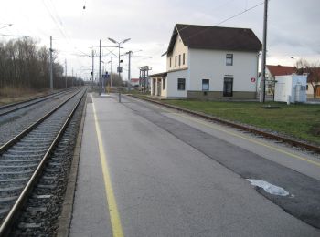
![Tocht Te voet Gemeinde Schützen am Gebirge - Rundweg Schützen/Geb. Nord - Photo](https://media.geolcdn.com/t/350/260/9c9bd7e9-fa25-4e84-a87e-378b76a2acc1.jpeg&format=jpg&maxdim=2)
![Te voet Te voet](https://static1.geolcdn.com/sitytour/trail-icons/100.png)
Km
Te voet
![](/images/other/stat-length.png)
![](https://static1.geolcdn.com/siteimages/upload/files/1508320355ic_sort_den_pos_24dp.png)
![](https://static1.geolcdn.com/siteimages/upload/files/1508320355ic_sort_den_neg_24dp.png)
![](https://static1.geolcdn.com/siteimages/upload/files/16400158638029165_repeat_loop_refresh_sync_direction_icon.png)
• Trail created by Gemeinde Schützen am Gebirge.
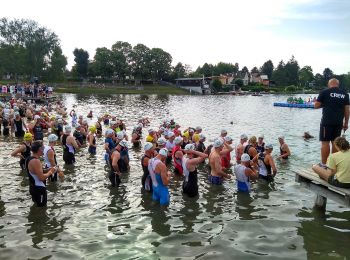
![Tocht Te voet Gemeinde Hornstein - Seerunde - Photo](https://media.geolcdn.com/t/350/260/0edf5080-b8f8-43b4-a9bd-f4e302c36c1e.jpeg&format=jpg&maxdim=2)
![Te voet Te voet](https://static1.geolcdn.com/sitytour/trail-icons/100.png)
Km
Te voet
![](/images/other/stat-length.png)
![](https://static1.geolcdn.com/siteimages/upload/files/1508320355ic_sort_den_pos_24dp.png)
![](https://static1.geolcdn.com/siteimages/upload/files/1508320355ic_sort_den_neg_24dp.png)
![](https://static1.geolcdn.com/siteimages/upload/files/16400158638029165_repeat_loop_refresh_sync_direction_icon.png)
• Trail created by Bewegungsarena Hornbach. Symbol: blauer Pfeil, 4
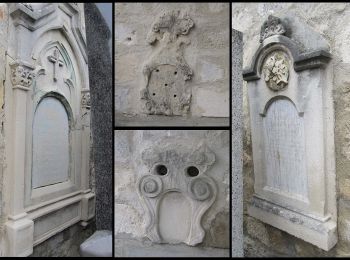
![Tocht Te voet Gemeinde Leithaprodersdorf - Kreuz & Quer-Weg Friedhofberg - Photo](https://media.geolcdn.com/t/350/260/37fe3d07-ca89-47ac-bd48-539213643613.jpeg&format=jpg&maxdim=2)
![Te voet Te voet](https://static1.geolcdn.com/sitytour/trail-icons/100.png)
Km
Te voet
![](/images/other/stat-length.png)
![](https://static1.geolcdn.com/siteimages/upload/files/1508320355ic_sort_den_pos_24dp.png)
![](https://static1.geolcdn.com/siteimages/upload/files/1508320355ic_sort_den_neg_24dp.png)
![](https://static1.geolcdn.com/siteimages/upload/files/16400158638029165_repeat_loop_refresh_sync_direction_icon.png)
• Symbol: Weißer Pfeil mit Schriftzug "Kreuz & Quer-Weg" auf gelbem Hintergrund
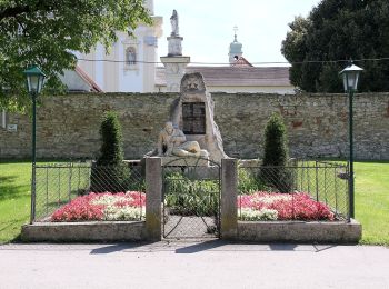
![Tocht Te voet Gemeinde Leithaprodersdorf - Kreuz & Quer-Weg Dreifaltigkeit - Photo](https://media.geolcdn.com/t/350/260/ba08e9e9-e0f5-4aec-a1e2-811d627a0e1a.jpeg&format=jpg&maxdim=2)
![Te voet Te voet](https://static1.geolcdn.com/sitytour/trail-icons/100.png)
Km
Te voet
![](/images/other/stat-length.png)
![](https://static1.geolcdn.com/siteimages/upload/files/1508320355ic_sort_den_pos_24dp.png)
![](https://static1.geolcdn.com/siteimages/upload/files/1508320355ic_sort_den_neg_24dp.png)
![](https://static1.geolcdn.com/siteimages/upload/files/16400158638029165_repeat_loop_refresh_sync_direction_icon.png)
• Trail created by Leithaland. Symbol: Weißer Pfeil mit Schriftzug "Kreuz & Quer-Weg" auf rotbraunem Hintergrund
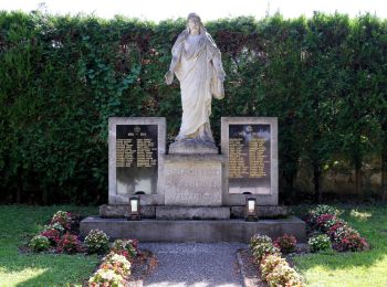
![Tocht Te voet Gemeinde Stotzing - Stotzing (Dorfwirt) - Langackerkreuz - Kleinhalbjoch - Hoher Berg - Dorfwirt - Photo](https://media.geolcdn.com/t/350/260/617e26f7-7328-43ad-8c71-f5b61df66d91.jpeg&format=jpg&maxdim=2)
![Te voet Te voet](https://static1.geolcdn.com/sitytour/trail-icons/100.png)
Km
Te voet
![](/images/other/stat-length.png)
![](https://static1.geolcdn.com/siteimages/upload/files/1508320355ic_sort_den_pos_24dp.png)
![](https://static1.geolcdn.com/siteimages/upload/files/1508320355ic_sort_den_neg_24dp.png)
![](https://static1.geolcdn.com/siteimages/upload/files/16400158638029165_repeat_loop_refresh_sync_direction_icon.png)
• Trail created by Leithaland. beim Hohen Berg teilweise fast zugewachsen
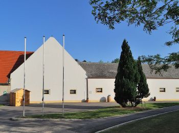
![Tocht Te voet Gemeinde Hornstein - Leitharunde - Photo](https://media.geolcdn.com/t/350/260/3f3d942c-f636-4289-bdca-e98767e6e8e0.jpeg&format=jpg&maxdim=2)
![Te voet Te voet](https://static1.geolcdn.com/sitytour/trail-icons/100.png)
Km
Te voet
![](/images/other/stat-length.png)
![](https://static1.geolcdn.com/siteimages/upload/files/1508320355ic_sort_den_pos_24dp.png)
![](https://static1.geolcdn.com/siteimages/upload/files/1508320355ic_sort_den_neg_24dp.png)
![](https://static1.geolcdn.com/siteimages/upload/files/16400158638029165_repeat_loop_refresh_sync_direction_icon.png)
• Trail created by Bewegungsarena Hornbach. Symbol: roter Pfeil, 2
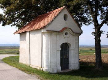
![Tocht Te voet Zagersdorf/Cogrštof - Siedlerweg der Poljanci - Photo](https://media.geolcdn.com/t/350/260/60bd3cd7-dee2-442f-afcc-5855dc4b7f82.jpeg&format=jpg&maxdim=2)
![Te voet Te voet](https://static1.geolcdn.com/sitytour/trail-icons/100.png)
Km
Te voet
![](/images/other/stat-length.png)
![](https://static1.geolcdn.com/siteimages/upload/files/1508320355ic_sort_den_pos_24dp.png)
![](https://static1.geolcdn.com/siteimages/upload/files/1508320355ic_sort_den_neg_24dp.png)
![](https://static1.geolcdn.com/siteimages/upload/files/16400158638029165_repeat_loop_refresh_sync_direction_icon.png)
• Symbol: blau-gelbes Schild mit blauem Pfeil
![Tocht Te voet Gemeinde Großhöflein - Marterlweg bei Müllendorf - Photo](https://media.geolcdn.com/t/350/260/24311144-f838-4e2b-9872-ee30426c5a71.jpeg&format=jpg&maxdim=2)
![Te voet Te voet](https://static1.geolcdn.com/sitytour/trail-icons/100.png)
Km
Te voet
![](/images/other/stat-length.png)
![](https://static1.geolcdn.com/siteimages/upload/files/1508320355ic_sort_den_pos_24dp.png)
![](https://static1.geolcdn.com/siteimages/upload/files/1508320355ic_sort_den_neg_24dp.png)
![](https://static1.geolcdn.com/siteimages/upload/files/16400158638029165_repeat_loop_refresh_sync_direction_icon.png)
• Symbol: gelb/weiß
![Tocht Te voet Gemeinde Loretto - Loretto (Waldrandsiedlung) - Leithabergstraße - Photo](https://media.geolcdn.com/t/350/260/7489d1eb-331b-49f9-990e-7582040ab6b5.jpeg&format=jpg&maxdim=2)
![Te voet Te voet](https://static1.geolcdn.com/sitytour/trail-icons/100.png)
Km
Te voet
![](/images/other/stat-length.png)
![](https://static1.geolcdn.com/siteimages/upload/files/1508320355ic_sort_den_pos_24dp.png)
![](https://static1.geolcdn.com/siteimages/upload/files/1508320355ic_sort_den_neg_24dp.png)
![](https://static1.geolcdn.com/siteimages/upload/files/16400158638029165_repeat_loop_refresh_sync_direction_icon.png)
• Trail created by Österreichischer Touristenklub. Symbol: gelber, waagerechter Balken
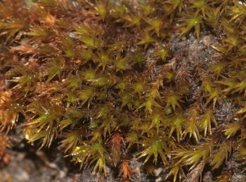
![Tocht Te voet Gemeinde Breitenbrunn - Weinkulturweg (Breitenbrunn) - Photo](https://media.geolcdn.com/t/350/260/9bcc524f-d0c9-4d69-8817-663ecf95cfe2.jpeg&format=jpg&maxdim=2)
![Te voet Te voet](https://static1.geolcdn.com/sitytour/trail-icons/100.png)
Km
Te voet
![](/images/other/stat-length.png)
![](https://static1.geolcdn.com/siteimages/upload/files/1508320355ic_sort_den_pos_24dp.png)
![](https://static1.geolcdn.com/siteimages/upload/files/1508320355ic_sort_den_neg_24dp.png)
![](https://static1.geolcdn.com/siteimages/upload/files/16400158638029165_repeat_loop_refresh_sync_direction_icon.png)
• Trail created by Welterbe Naturpark Neusiedler See Leithagebirge.
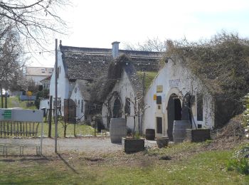
![Tocht Te voet Gemeinde Breitenbrunn - Bildstockweg (Breitenbrunn) - Photo](https://media.geolcdn.com/t/350/260/28e04ebf-67be-42d8-aea3-ff51166b582a.jpeg&format=jpg&maxdim=2)
![Te voet Te voet](https://static1.geolcdn.com/sitytour/trail-icons/100.png)
Km
Te voet
![](/images/other/stat-length.png)
![](https://static1.geolcdn.com/siteimages/upload/files/1508320355ic_sort_den_pos_24dp.png)
![](https://static1.geolcdn.com/siteimages/upload/files/1508320355ic_sort_den_neg_24dp.png)
![](https://static1.geolcdn.com/siteimages/upload/files/16400158638029165_repeat_loop_refresh_sync_direction_icon.png)
• Trail created by Welterbe Naturpark Neusiedler See Leithagebirge.
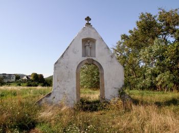
![Tocht Te voet Gemeinde Purbach - Purbach - Donnerskirchen - Wilder Jäger - Photo](https://media.geolcdn.com/t/350/260/e9818eb7-fbb8-4fb3-b51d-27956b65d009.jpeg&format=jpg&maxdim=2)
![Te voet Te voet](https://static1.geolcdn.com/sitytour/trail-icons/100.png)
Km
Te voet
![](/images/other/stat-length.png)
![](https://static1.geolcdn.com/siteimages/upload/files/1508320355ic_sort_den_pos_24dp.png)
![](https://static1.geolcdn.com/siteimages/upload/files/1508320355ic_sort_den_neg_24dp.png)
![](https://static1.geolcdn.com/siteimages/upload/files/16400158638029165_repeat_loop_refresh_sync_direction_icon.png)
• Trail created by Österreichischer Touristenklub, Sektion Eisenstadt. Symbol: grüner, waagrechter Balken
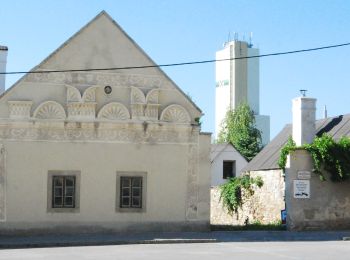
![Tocht Te voet Gemeinde Donnerskirchen - Mannersdorf - Kaisereiche - Donnerskirchen - Photo](https://media.geolcdn.com/t/350/260/027db282-59c7-4907-ad17-f01304815f28.jpeg&format=jpg&maxdim=2)
![Te voet Te voet](https://static1.geolcdn.com/sitytour/trail-icons/100.png)
Km
Te voet
![](/images/other/stat-length.png)
![](https://static1.geolcdn.com/siteimages/upload/files/1508320355ic_sort_den_pos_24dp.png)
![](https://static1.geolcdn.com/siteimages/upload/files/1508320355ic_sort_den_neg_24dp.png)
![](https://static1.geolcdn.com/siteimages/upload/files/16400158638029165_repeat_loop_refresh_sync_direction_icon.png)
• Trail created by Naturfreunde Österreich, Ortsgruppe Mannersdorf. Symbol: roter, waagrechter Balken
20 tochten weergegeven op 41
Gratisgps-wandelapplicatie
Activiteiten
Nabije regio's
- Gemeinde Breitenbrunn
- Gemeinde Donnerskirchen
- Gemeinde Großhöflein
- Gemeinde Hornstein
- Gemeinde Leithaprodersdorf
- Gemeinde Loretto
- Gemeinde Müllendorf
- Gemeinde Oggau
- Gemeinde Purbach
- Gemeinde Schützen am Gebirge
- Gemeinde Stotzing
- Gemeinde Wimpassing an der Leitha
- Klingenbach/Klimpuh
- Mörbisch am See
- Siegendorf/Cindrof
- Zagersdorf/Cogrštof