


11,4 km | 12,3 km-effort
Bezirk Eisenstadt-Umgebung: Ontdek de beste tochten: 41 te voet. Al deze tochten, trajecten, routes en outdoor activiteiten zijn beschikbaar in onze SityTrail-apps voor smartphones en tablets.
Te voet


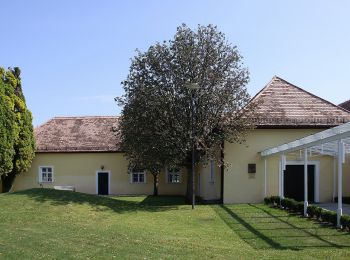
• Trail created by Tourismusverband Siegendorf.
Te voet
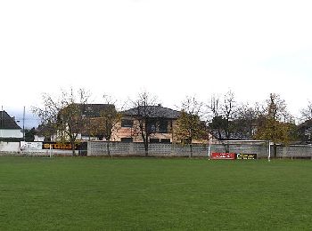
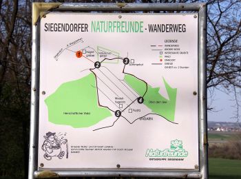
• Trail created by Naturfreunde Ortsgruppe Siegendorf.
Te voet
• Trail created by Tourismusverband Siegendorf.
Te voet
• Trail created by Tourismusverband Siegendorf.
Te voet
• Trail created by Tourismusverband Siegendorf.
Te voet
• Trail created by Tourismusverband Siegendorf.
Te voet
• Trail created by Tourismusverband Siegendorf.
Te voet
• Trail created by Gemeinde Schützen am Gebirge.
Te voet
• Trail created by Bewegungsarena Hornbach. Symbol: blauer Pfeil, 4
Te voet
• Symbol: Weißer Pfeil mit Schriftzug "Kreuz & Quer-Weg" auf gelbem Hintergrund
Te voet
• Trail created by Leithaland. Symbol: Weißer Pfeil mit Schriftzug "Kreuz & Quer-Weg" auf rotbraunem Hintergrund
Te voet
• Trail created by Leithaland. beim Hohen Berg teilweise fast zugewachsen
Te voet
• Trail created by Bewegungsarena Hornbach. Symbol: roter Pfeil, 2
Te voet
• Symbol: blau-gelbes Schild mit blauem Pfeil

Te voet
• Symbol: gelb/weiß
Te voet
• Trail created by Österreichischer Touristenklub. Symbol: gelber, waagerechter Balken
Te voet
• Trail created by Welterbe Naturpark Neusiedler See Leithagebirge.
Te voet
• Trail created by Welterbe Naturpark Neusiedler See Leithagebirge.
Te voet
• Trail created by Österreichischer Touristenklub, Sektion Eisenstadt. Symbol: grüner, waagrechter Balken
Te voet
• Trail created by Naturfreunde Österreich, Ortsgruppe Mannersdorf. Symbol: roter, waagrechter Balken
20 tochten weergegeven op 41
Gratisgps-wandelapplicatie
 SityTrail
IGN / Geografische instituten
SityTrail World
De wereld gaat voor u open