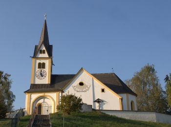
![](/images/other/stat-length.png)
- Tochten
- Outdoor
- Austria
- Stiermarken
- Bezirk Weiz
Bezirk Weiz, Stiermarken: Top van de beste wandelroutes, trajecten, tochten en wandelingen
Bezirk Weiz: Ontdek de beste tochten: 103 te voet. Al deze tochten, trajecten, routes en outdoor activiteiten zijn beschikbaar in onze SityTrail-apps voor smartphones en tablets.
De beste trajecten (103)
![Tocht Te voet Ludersdorf-Wilfersdorf - Wanderweg 15 - Photo](https://media.geolcdn.com/t/350/260/55fde9cb-2918-4c0a-855f-6f02a54bea2e.jpeg&format=jpg&maxdim=2)
![Te voet Te voet](https://static1.geolcdn.com/sitytour/trail-icons/100.png)
Km
Te voet
![](/images/other/stat-length.png)
![](https://static1.geolcdn.com/siteimages/upload/files/1508320355ic_sort_den_pos_24dp.png)
![](https://static1.geolcdn.com/siteimages/upload/files/1508320355ic_sort_den_neg_24dp.png)
![](https://static1.geolcdn.com/siteimages/upload/files/16400158638029165_repeat_loop_refresh_sync_direction_icon.png)
• Trail created by ??. Symbol: rot-weiss-rot 15
![Tocht Te voet St. Margarethen an der Raab - Wanderweg 5 - Photo](https://media.geolcdn.com/t/350/260/e9e441b2-dec2-4074-aea9-3ef1e3d6aed3.jpeg&format=jpg&maxdim=2)
![Te voet Te voet](https://static1.geolcdn.com/sitytour/trail-icons/100.png)
Km
Te voet
![](/images/other/stat-length.png)
![](https://static1.geolcdn.com/siteimages/upload/files/1508320355ic_sort_den_pos_24dp.png)
![](https://static1.geolcdn.com/siteimages/upload/files/1508320355ic_sort_den_neg_24dp.png)
![](https://static1.geolcdn.com/siteimages/upload/files/16400158638029165_repeat_loop_refresh_sync_direction_icon.png)
• Trail created by ÖAV Sektion St. Margarethen. Symbol: rot-weiss-rot 5
![Tocht Te voet Birkfeld - Hoadaholz Rundwanderweg - Photo](https://media.geolcdn.com/t/350/260/62d24a54-2f70-4f73-98a2-bc1eff33fb24.jpeg&format=jpg&maxdim=2)
![Te voet Te voet](https://static1.geolcdn.com/sitytour/trail-icons/100.png)
Km
Te voet
![](/images/other/stat-length.png)
![](https://static1.geolcdn.com/siteimages/upload/files/1508320355ic_sort_den_pos_24dp.png)
![](https://static1.geolcdn.com/siteimages/upload/files/1508320355ic_sort_den_neg_24dp.png)
![](https://static1.geolcdn.com/siteimages/upload/files/16400158638029165_repeat_loop_refresh_sync_direction_icon.png)
• Trail created by ?. Symbol: rot-grün-rot, Schilder
![Tocht Te voet Fladnitz an der Teichalm - Gh. Holzmeister - Teichalmsee - Photo](https://media.geolcdn.com/t/350/260/8891ccf1-2538-4d7d-9260-a275ce8632f7.jpeg&format=jpg&maxdim=2)
![Te voet Te voet](https://static1.geolcdn.com/sitytour/trail-icons/100.png)
Km
Te voet
![](/images/other/stat-length.png)
![](https://static1.geolcdn.com/siteimages/upload/files/1508320355ic_sort_den_pos_24dp.png)
![](https://static1.geolcdn.com/siteimages/upload/files/1508320355ic_sort_den_neg_24dp.png)
![](https://static1.geolcdn.com/siteimages/upload/files/16400158638029165_repeat_loop_refresh_sync_direction_icon.png)
• Trail created by Almenland. http://wiki.openstreetmap.org/index.php?title=WikiProject_Austria/Wanderwege Symbol: ro...
![Tocht Te voet St. Kathrein am Hauenstein - Christmettenweg - Photo](https://media.geolcdn.com/t/350/260/f5ba6cf6-0cc6-40ec-9b33-92f8486a975f.jpeg&format=jpg&maxdim=2)
![Te voet Te voet](https://static1.geolcdn.com/sitytour/trail-icons/100.png)
Km
Te voet
![](/images/other/stat-length.png)
![](https://static1.geolcdn.com/siteimages/upload/files/1508320355ic_sort_den_pos_24dp.png)
![](https://static1.geolcdn.com/siteimages/upload/files/1508320355ic_sort_den_neg_24dp.png)
![](https://static1.geolcdn.com/siteimages/upload/files/16400158638029165_repeat_loop_refresh_sync_direction_icon.png)
• Symbol: Rot-Weiss-Rot
![Tocht Te voet Sankt Ruprecht an der Raab - Kernkapellenweg - Photo](https://media.geolcdn.com/t/350/260/6128073e-49ea-486d-894e-e543dc7ae7fd.jpeg&format=jpg&maxdim=2)
![Te voet Te voet](https://static1.geolcdn.com/sitytour/trail-icons/100.png)
Km
Te voet
![](/images/other/stat-length.png)
![](https://static1.geolcdn.com/siteimages/upload/files/1508320355ic_sort_den_pos_24dp.png)
![](https://static1.geolcdn.com/siteimages/upload/files/1508320355ic_sort_den_neg_24dp.png)
![](https://static1.geolcdn.com/siteimages/upload/files/16400158638029165_repeat_loop_refresh_sync_direction_icon.png)
• Die Region Weiz und St. Ruprecht an der Raab besticht mit einer faszinierenden Landschaft. Sport- und Naturbegeistert...
![Tocht Te voet Sankt Ruprecht an der Raab - Wanderweg Breiteggerweg - Photo](https://media.geolcdn.com/t/350/260/42d94480-a026-4f1c-905f-6e47ef2dab57.jpeg&format=jpg&maxdim=2)
![Te voet Te voet](https://static1.geolcdn.com/sitytour/trail-icons/100.png)
Km
Te voet
![](/images/other/stat-length.png)
![](https://static1.geolcdn.com/siteimages/upload/files/1508320355ic_sort_den_pos_24dp.png)
![](https://static1.geolcdn.com/siteimages/upload/files/1508320355ic_sort_den_neg_24dp.png)
![](https://static1.geolcdn.com/siteimages/upload/files/16400158638029165_repeat_loop_refresh_sync_direction_icon.png)
• Die Region Weiz und St. Ruprecht an der Raab besticht mit einer faszinierenden Landschaft. Sport- und Naturbegeistert...
![Tocht Te voet Miesenbach bei Birkfeld - Wanderweg 1 - Photo](https://media.geolcdn.com/t/350/260/44a439ad-ac79-4376-ac5f-70fd4c80eca0.jpeg&format=jpg&maxdim=2)
![Te voet Te voet](https://static1.geolcdn.com/sitytour/trail-icons/100.png)
Km
Te voet
![](/images/other/stat-length.png)
![](https://static1.geolcdn.com/siteimages/upload/files/1508320355ic_sort_den_pos_24dp.png)
![](https://static1.geolcdn.com/siteimages/upload/files/1508320355ic_sort_den_neg_24dp.png)
![](https://static1.geolcdn.com/siteimages/upload/files/16400158638029165_repeat_loop_refresh_sync_direction_icon.png)
• http://wiki.openstreetmap.org/wiki/WikiProject_Austria/Wanderwege Website: http://www.tourismus-miesenbach.at/bewe...
![Tocht Te voet Gemeinde Rettenegg - Kalteneggerweg - Photo](https://media.geolcdn.com/t/350/260/70c6f18e-0235-4a1b-b926-8423d2b1bb8f.jpeg&format=jpg&maxdim=2)
![Te voet Te voet](https://static1.geolcdn.com/sitytour/trail-icons/100.png)
Km
Te voet
![](/images/other/stat-length.png)
![](https://static1.geolcdn.com/siteimages/upload/files/1508320355ic_sort_den_pos_24dp.png)
![](https://static1.geolcdn.com/siteimages/upload/files/1508320355ic_sort_den_neg_24dp.png)
![](https://static1.geolcdn.com/siteimages/upload/files/16400158638029165_repeat_loop_refresh_sync_direction_icon.png)
• Trail created by ???. http://wiki.openstreetmap.org/wiki/WikiProject_Austria/Wanderwege Symbol: weiss-gelb-weiss 3
![Tocht Te voet Mortantsch - Wanderweg 4 - Photo](https://media.geolcdn.com/t/350/260/fdd16baf-e923-44dc-9e9c-1fa6a9692d35.jpeg&format=jpg&maxdim=2)
![Te voet Te voet](https://static1.geolcdn.com/sitytour/trail-icons/100.png)
Km
Te voet
![](/images/other/stat-length.png)
![](https://static1.geolcdn.com/siteimages/upload/files/1508320355ic_sort_den_pos_24dp.png)
![](https://static1.geolcdn.com/siteimages/upload/files/1508320355ic_sort_den_neg_24dp.png)
![](https://static1.geolcdn.com/siteimages/upload/files/16400158638029165_repeat_loop_refresh_sync_direction_icon.png)
• Trail created by Naturfreunde Weiz. Symbol: Rot-Weiss-Rot 4
![Tocht Te voet Ilztal - Von Dorf zu Dorf - Photo](https://media.geolcdn.com/t/350/260/3691f5b9-e198-49fd-a6d1-9ef3d6e6b122.jpeg&format=jpg&maxdim=2)
![Te voet Te voet](https://static1.geolcdn.com/sitytour/trail-icons/100.png)
Km
Te voet
![](/images/other/stat-length.png)
![](https://static1.geolcdn.com/siteimages/upload/files/1508320355ic_sort_den_pos_24dp.png)
![](https://static1.geolcdn.com/siteimages/upload/files/1508320355ic_sort_den_neg_24dp.png)
![](https://static1.geolcdn.com/siteimages/upload/files/16400158638029165_repeat_loop_refresh_sync_direction_icon.png)
• Trail created by Gemeinde Ilztal. http://wiki.openstreetmap.org/index.php?title=WikiProject_Austria/Wanderwege Symb...
![Tocht Te voet Weiz - Weizer Erlebniswanderweg - Photo](https://media.geolcdn.com/t/350/260/ef29118a-8c2e-4d73-9a2f-1bc926cc976d.jpeg&format=jpg&maxdim=2)
![Te voet Te voet](https://static1.geolcdn.com/sitytour/trail-icons/100.png)
Km
Te voet
![](/images/other/stat-length.png)
![](https://static1.geolcdn.com/siteimages/upload/files/1508320355ic_sort_den_pos_24dp.png)
![](https://static1.geolcdn.com/siteimages/upload/files/1508320355ic_sort_den_neg_24dp.png)
![](https://static1.geolcdn.com/siteimages/upload/files/16400158638029165_repeat_loop_refresh_sync_direction_icon.png)
• Trail created by ?. http://wiki.openstreetmap.org/index.php?title=WikiProject_Austria/Wanderwege Symbol: Rot-Weiss-...
![Tocht Te voet Sinabelkirchen - Wanderweg 3 - Photo](https://media.geolcdn.com/t/350/260/033b832d-6d15-4325-943f-d5f1602e42b7.jpeg&format=jpg&maxdim=2)
![Te voet Te voet](https://static1.geolcdn.com/sitytour/trail-icons/100.png)
Km
Te voet
![](/images/other/stat-length.png)
![](https://static1.geolcdn.com/siteimages/upload/files/1508320355ic_sort_den_pos_24dp.png)
![](https://static1.geolcdn.com/siteimages/upload/files/1508320355ic_sort_den_neg_24dp.png)
![](https://static1.geolcdn.com/siteimages/upload/files/16400158638029165_repeat_loop_refresh_sync_direction_icon.png)
• Symbol: rot-weiss-rot 3
![Tocht Te voet Miesenbach bei Birkfeld - Wanderweg 6 - Wildwiesenrunde - Photo](https://media.geolcdn.com/t/350/260/027c9ebb-61ea-4c34-bcff-bb25fd30e82f.jpeg&format=jpg&maxdim=2)
![Te voet Te voet](https://static1.geolcdn.com/sitytour/trail-icons/100.png)
Km
Te voet
![](/images/other/stat-length.png)
![](https://static1.geolcdn.com/siteimages/upload/files/1508320355ic_sort_den_pos_24dp.png)
![](https://static1.geolcdn.com/siteimages/upload/files/1508320355ic_sort_den_neg_24dp.png)
![](https://static1.geolcdn.com/siteimages/upload/files/16400158638029165_repeat_loop_refresh_sync_direction_icon.png)
• http://wiki.openstreetmap.org/wiki/WikiProject_Austria/Wanderwege
![Tocht Te voet Birkfeld - Bärenhof Rundwanderweg - Photo](https://media.geolcdn.com/t/350/260/123ac2d7-ee82-4c18-a7dc-879608b4d6ea.jpeg&format=jpg&maxdim=2)
![Te voet Te voet](https://static1.geolcdn.com/sitytour/trail-icons/100.png)
Km
Te voet
![](/images/other/stat-length.png)
![](https://static1.geolcdn.com/siteimages/upload/files/1508320355ic_sort_den_pos_24dp.png)
![](https://static1.geolcdn.com/siteimages/upload/files/1508320355ic_sort_den_neg_24dp.png)
![](https://static1.geolcdn.com/siteimages/upload/files/16400158638029165_repeat_loop_refresh_sync_direction_icon.png)
• Trail created by ?. Symbol: rot-grün-rot, Schilder
![Tocht Te voet Strallegg - Wanderweg 13 - Photo](https://media.geolcdn.com/t/350/260/ab22a938-232a-4a58-ae1c-b372ca63b069.jpeg&format=jpg&maxdim=2)
![Te voet Te voet](https://static1.geolcdn.com/sitytour/trail-icons/100.png)
Km
Te voet
![](/images/other/stat-length.png)
![](https://static1.geolcdn.com/siteimages/upload/files/1508320355ic_sort_den_pos_24dp.png)
![](https://static1.geolcdn.com/siteimages/upload/files/1508320355ic_sort_den_neg_24dp.png)
![](https://static1.geolcdn.com/siteimages/upload/files/16400158638029165_repeat_loop_refresh_sync_direction_icon.png)
• http://wiki.openstreetmap.org/wiki/WikiProject_Austria/Wanderwege Symbol: Gelbe Punkte mit schwarzer 13
![Tocht Te voet Miesenbach bei Birkfeld - Wanderweg 5 - Photo](https://media.geolcdn.com/t/350/260/a857da93-f6f4-4578-8002-8d28eb04e16a.jpeg&format=jpg&maxdim=2)
![Te voet Te voet](https://static1.geolcdn.com/sitytour/trail-icons/100.png)
Km
Te voet
![](/images/other/stat-length.png)
![](https://static1.geolcdn.com/siteimages/upload/files/1508320355ic_sort_den_pos_24dp.png)
![](https://static1.geolcdn.com/siteimages/upload/files/1508320355ic_sort_den_neg_24dp.png)
![](https://static1.geolcdn.com/siteimages/upload/files/16400158638029165_repeat_loop_refresh_sync_direction_icon.png)
• http://wiki.openstreetmap.org/wiki/WikiProject_Austria/Wanderwege Website: http://www.tourismus-miesenbach.at/bewe...
![Tocht Te voet Fladnitz an der Teichalm - Wanderweg 9 - Photo](https://media.geolcdn.com/t/350/260/2dcff8bd-6726-45b0-ae76-62e0c82804ff.jpeg&format=jpg&maxdim=2)
![Te voet Te voet](https://static1.geolcdn.com/sitytour/trail-icons/100.png)
Km
Te voet
![](/images/other/stat-length.png)
![](https://static1.geolcdn.com/siteimages/upload/files/1508320355ic_sort_den_pos_24dp.png)
![](https://static1.geolcdn.com/siteimages/upload/files/1508320355ic_sort_den_neg_24dp.png)
![](https://static1.geolcdn.com/siteimages/upload/files/16400158638029165_repeat_loop_refresh_sync_direction_icon.png)
• Trail created by ?. http://wiki.openstreetmap.org/wiki/WikiProject_Austria/Wanderwege Symbol: rot-weiss-rot 9
![Tocht Te voet Fischbach - Wanderweg 7 - Fischbacher Höhenweg - Photo](https://media.geolcdn.com/t/350/260/9bde8e97-b2e7-4094-920e-476eb623c0a0.jpeg&format=jpg&maxdim=2)
![Te voet Te voet](https://static1.geolcdn.com/sitytour/trail-icons/100.png)
Km
Te voet
![](/images/other/stat-length.png)
![](https://static1.geolcdn.com/siteimages/upload/files/1508320355ic_sort_den_pos_24dp.png)
![](https://static1.geolcdn.com/siteimages/upload/files/1508320355ic_sort_den_neg_24dp.png)
![](https://static1.geolcdn.com/siteimages/upload/files/16400158638029165_repeat_loop_refresh_sync_direction_icon.png)
• http://wiki.openstreetmap.org/wiki/WikiProject_Austria/Wanderwege Symbol: Gelber Punkt 7
![Tocht Te voet Mortantsch - Wanderweg 27 - Photo](https://media.geolcdn.com/t/350/260/f502aa6b-9b08-470b-9199-1521d79c9473.jpeg&format=jpg&maxdim=2)
![Te voet Te voet](https://static1.geolcdn.com/sitytour/trail-icons/100.png)
Km
Te voet
![](/images/other/stat-length.png)
![](https://static1.geolcdn.com/siteimages/upload/files/1508320355ic_sort_den_pos_24dp.png)
![](https://static1.geolcdn.com/siteimages/upload/files/1508320355ic_sort_den_neg_24dp.png)
![](https://static1.geolcdn.com/siteimages/upload/files/16400158638029165_repeat_loop_refresh_sync_direction_icon.png)
• Trail created by Naturfreunde Weiz.
20 tochten weergegeven op 103
Gratisgps-wandelapplicatie
Activiteiten
Nabije regio's
- Albersdorf-Prebuch
- Anger
- Birkfeld
- Fischbach
- Fladnitz an der Teichalm
- Gemeinde Rettenegg
- Gleisdorf
- Gutenberg-Stenzengreith
- Ilztal
- Ludersdorf-Wilfersdorf
- Miesenbach bei Birkfeld
- Mitterdorf an der Raab
- Mortantsch
- Naas
- Passail
- Puch bei Weiz
- Ratten
- Sankt Ruprecht an der Raab
- Sinabelkirchen
- St. Kathrein am Hauenstein
- St. Kathrein am Offenegg
- St. Margarethen an der Raab
- Strallegg
- Thannhausen
- Weiz