![](/images/other/stat-length.png)
Imperia, Ligurië, Te voet: Top van de beste wandelroutes, trajecten, tochten en wandelingen
Imperia: Ontdek de beste tochten: 45 te voet, 47 stappen en 1 lopen. Al deze tochten, trajecten, routes en outdoor activiteiten zijn beschikbaar in onze SityTrail-apps voor smartphones en tablets.
De beste trajecten (93)
![Tocht Te voet Airole - Traversée Airole-Breil - Photo](https://media.geolcdn.com/t/350/260/62b54dcb-d617-407a-81a2-9f5c93e8261f.jpeg&format=jpg&maxdim=2)
![Te voet Te voet](https://static1.geolcdn.com/sitytour/trail-icons/100.png)
Km
Te voet
![](/images/other/stat-length.png)
![](https://static1.geolcdn.com/siteimages/upload/files/1508320355ic_sort_den_pos_24dp.png)
![](https://static1.geolcdn.com/siteimages/upload/files/1508320355ic_sort_den_neg_24dp.png)
![](https://static1.geolcdn.com/siteimages/upload/files/16400158638029165_repeat_loop_refresh_sync_direction_icon.png)
• Trail created by Département des Alpes-Maritimes. Symbol: Trait jaune
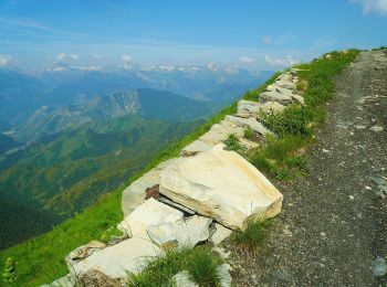
![Tocht Te voet Triora - (SI G34) Sella della Valletta - Tetti delle Donzelle - Photo](https://media.geolcdn.com/t/350/260/409bcfcb-f998-4979-918b-8cddb4b9a596.jpeg&format=jpg&maxdim=2)
![Te voet Te voet](https://static1.geolcdn.com/sitytour/trail-icons/100.png)
Km
Te voet
![](/images/other/stat-length.png)
![](https://static1.geolcdn.com/siteimages/upload/files/1508320355ic_sort_den_pos_24dp.png)
![](https://static1.geolcdn.com/siteimages/upload/files/1508320355ic_sort_den_neg_24dp.png)
![](https://static1.geolcdn.com/siteimages/upload/files/16400158638029165_repeat_loop_refresh_sync_direction_icon.png)
• Trail created by Club Alpino Italiano. Sentiero Italia CAI 2019
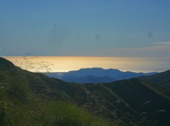
![Tocht Te voet Triora - Sentiero del Parco delle Alpi Liguri - Valle Arroscia e Giara di Rezzo - Photo](https://media.geolcdn.com/t/350/260/0ddacc95-6f02-433b-bb43-5a60c8281c09.jpeg&format=jpg&maxdim=2)
![Te voet Te voet](https://static1.geolcdn.com/sitytour/trail-icons/100.png)
Km
Te voet
![](/images/other/stat-length.png)
![](https://static1.geolcdn.com/siteimages/upload/files/1508320355ic_sort_den_pos_24dp.png)
![](https://static1.geolcdn.com/siteimages/upload/files/1508320355ic_sort_den_neg_24dp.png)
![](https://static1.geolcdn.com/siteimages/upload/files/16400158638029165_repeat_loop_refresh_sync_direction_icon.png)
• Trail created by Club Alpino Italiano. Symbol: unmarked
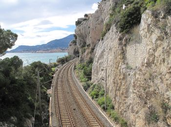
![Tocht Te voet Ventimiglia - AM0 - ALPI MARE 0 - Photo](https://media.geolcdn.com/t/350/260/6cc1eb13-113d-4d04-9dbb-12c9f2aaa749.jpeg&format=jpg&maxdim=2)
![Te voet Te voet](https://static1.geolcdn.com/sitytour/trail-icons/100.png)
Km
Te voet
![](/images/other/stat-length.png)
![](https://static1.geolcdn.com/siteimages/upload/files/1508320355ic_sort_den_pos_24dp.png)
![](https://static1.geolcdn.com/siteimages/upload/files/1508320355ic_sort_den_neg_24dp.png)
![](https://static1.geolcdn.com/siteimages/upload/files/16400158638029165_repeat_loop_refresh_sync_direction_icon.png)
• relation mantained by AlfredoSP (CAI-SP) Symbol: white red flag Website: https://www.cailaspezia.it/
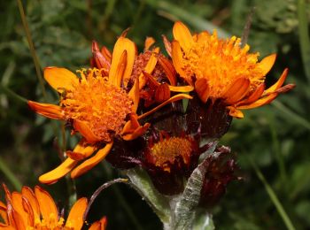
![Tocht Te voet Triora - Sella della Valletta - San Bernardo di Mendatica - Photo](https://media.geolcdn.com/t/350/260/9b435f27-99ec-4027-aeb7-3c8ec7c858b5.jpeg&format=jpg&maxdim=2)
![Te voet Te voet](https://static1.geolcdn.com/sitytour/trail-icons/100.png)
Km
Te voet
![](/images/other/stat-length.png)
![](https://static1.geolcdn.com/siteimages/upload/files/1508320355ic_sort_den_pos_24dp.png)
![](https://static1.geolcdn.com/siteimages/upload/files/1508320355ic_sort_den_neg_24dp.png)
![](https://static1.geolcdn.com/siteimages/upload/files/16400158638029165_repeat_loop_refresh_sync_direction_icon.png)
• Trail created by Club Alpino Italiano. Sentiero Italia CAI 2019 Symbol: AV on white red flag
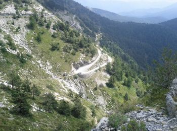
![Tocht Te voet Pigna - Colle Scarassan - Sella d'Agnaira - Photo](https://media.geolcdn.com/t/350/260/d8790286-424c-448d-96a0-38ca6dd16227.jpeg&format=jpg&maxdim=2)
![Te voet Te voet](https://static1.geolcdn.com/sitytour/trail-icons/100.png)
Km
Te voet
![](/images/other/stat-length.png)
![](https://static1.geolcdn.com/siteimages/upload/files/1508320355ic_sort_den_pos_24dp.png)
![](https://static1.geolcdn.com/siteimages/upload/files/1508320355ic_sort_den_neg_24dp.png)
![](https://static1.geolcdn.com/siteimages/upload/files/16400158638029165_repeat_loop_refresh_sync_direction_icon.png)
• Trail created by Club Alpino Italiano. Symbol: AV on white red flag
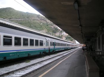
![Tocht Te voet Ventimiglia - Ventimiglia - La Colla - Photo](https://media.geolcdn.com/t/350/260/7ef10317-42ba-466b-8245-81478c41cab9.jpeg&format=jpg&maxdim=2)
![Te voet Te voet](https://static1.geolcdn.com/sitytour/trail-icons/100.png)
Km
Te voet
![](/images/other/stat-length.png)
![](https://static1.geolcdn.com/siteimages/upload/files/1508320355ic_sort_den_pos_24dp.png)
![](https://static1.geolcdn.com/siteimages/upload/files/1508320355ic_sort_den_neg_24dp.png)
![](https://static1.geolcdn.com/siteimages/upload/files/16400158638029165_repeat_loop_refresh_sync_direction_icon.png)
• Trail created by Club Alpino Italiano. Symbol: AV on white red flag
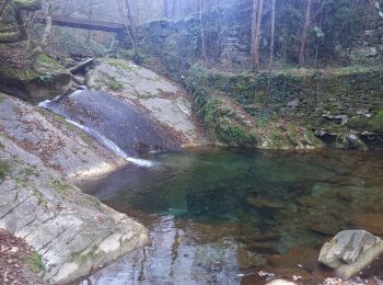
![Tocht Stappen Dolcedo - Laghetti di Lecchiore 27.12.24 - Photo](https://media.geolcdn.com/t/350/260/d506e64c-eb3e-486b-a8d3-1e3fb213dd22.jpg&format=jpg&maxdim=2)
![Stappen Stappen](https://static1.geolcdn.com/sitytour/trail-icons/101.png)
Km
Stappen
![](/images/other/stat-length.png)
![](https://static1.geolcdn.com/siteimages/upload/files/1508320355ic_sort_den_pos_24dp.png)
![](https://static1.geolcdn.com/siteimages/upload/files/1508320355ic_sort_den_neg_24dp.png)
![](https://static1.geolcdn.com/siteimages/upload/files/16400158638029165_repeat_loop_refresh_sync_direction_icon.png)
![Tocht Stappen Sanremo - Monte Caggio 25.12.24 - Photo](https://media.geolcdn.com/t/350/260/9663de2c-8e96-4cad-b7b0-6ba43dd5874a.jpg&format=jpg&maxdim=2)
![Stappen Stappen](https://static1.geolcdn.com/sitytour/trail-icons/101.png)
Km
Stappen
![](/images/other/stat-length.png)
![](https://static1.geolcdn.com/siteimages/upload/files/1508320355ic_sort_den_pos_24dp.png)
![](https://static1.geolcdn.com/siteimages/upload/files/1508320355ic_sort_den_neg_24dp.png)
![](https://static1.geolcdn.com/siteimages/upload/files/16400158638029165_repeat_loop_refresh_sync_direction_icon.png)
![Tocht Stappen Imperia - Montegrazie - Liguria - Photo](https://media.geolcdn.com/t/350/260/ec36081b-e2ea-43c3-9e89-bc805bd37dda.jpg&format=jpg&maxdim=2)
![Stappen Stappen](https://static1.geolcdn.com/sitytour/trail-icons/101.png)
Km
Stappen
![](/images/other/stat-length.png)
![](https://static1.geolcdn.com/siteimages/upload/files/1508320355ic_sort_den_pos_24dp.png)
![](https://static1.geolcdn.com/siteimages/upload/files/1508320355ic_sort_den_neg_24dp.png)
![](https://static1.geolcdn.com/siteimages/upload/files/16400158638029165_repeat_loop_refresh_sync_direction_icon.png)
![Tocht Te voet Montalto Carpasio - Anello Borghi Valle Carpasina - Photo](https://media.geolcdn.com/t/350/260/f37d5245-32c0-4d89-a179-45d2ab20ebfb.jpeg&format=jpg&maxdim=2)
![Te voet Te voet](https://static1.geolcdn.com/sitytour/trail-icons/100.png)
Km
Te voet
![](/images/other/stat-length.png)
![](https://static1.geolcdn.com/siteimages/upload/files/1508320355ic_sort_den_pos_24dp.png)
![](https://static1.geolcdn.com/siteimages/upload/files/1508320355ic_sort_den_neg_24dp.png)
![](https://static1.geolcdn.com/siteimages/upload/files/16400158638029165_repeat_loop_refresh_sync_direction_icon.png)
![Tocht Te voet Airole - Anello del Gramondo - Photo](https://media.geolcdn.com/t/350/260/a83852fd-a46b-4921-bf67-5c05a5b0232d.jpeg&format=jpg&maxdim=2)
![Te voet Te voet](https://static1.geolcdn.com/sitytour/trail-icons/100.png)
Km
Te voet
![](/images/other/stat-length.png)
![](https://static1.geolcdn.com/siteimages/upload/files/1508320355ic_sort_den_pos_24dp.png)
![](https://static1.geolcdn.com/siteimages/upload/files/1508320355ic_sort_den_neg_24dp.png)
![](https://static1.geolcdn.com/siteimages/upload/files/16400158638029165_repeat_loop_refresh_sync_direction_icon.png)
![Tocht Te voet Badalucco - Anello Madonna della Neve - Photo](https://media.geolcdn.com/t/350/260/5e24fe13-72ad-4080-abdc-1518791a7b9e.jpeg&format=jpg&maxdim=2)
![Te voet Te voet](https://static1.geolcdn.com/sitytour/trail-icons/100.png)
Km
Te voet
![](/images/other/stat-length.png)
![](https://static1.geolcdn.com/siteimages/upload/files/1508320355ic_sort_den_pos_24dp.png)
![](https://static1.geolcdn.com/siteimages/upload/files/1508320355ic_sort_den_neg_24dp.png)
![](https://static1.geolcdn.com/siteimages/upload/files/16400158638029165_repeat_loop_refresh_sync_direction_icon.png)
![Tocht Te voet Triora - Triora-Goina-Triora - Photo](https://media.geolcdn.com/t/350/260/2ef0ff58-319e-40c9-a18f-3eb6e5eb32c3.jpeg&format=jpg&maxdim=2)
![Te voet Te voet](https://static1.geolcdn.com/sitytour/trail-icons/100.png)
Km
Te voet
![](/images/other/stat-length.png)
![](https://static1.geolcdn.com/siteimages/upload/files/1508320355ic_sort_den_pos_24dp.png)
![](https://static1.geolcdn.com/siteimages/upload/files/1508320355ic_sort_den_neg_24dp.png)
![](https://static1.geolcdn.com/siteimages/upload/files/16400158638029165_repeat_loop_refresh_sync_direction_icon.png)
![Tocht Te voet Mendatica - Anello delle Malghe - Photo](https://media.geolcdn.com/t/350/260/5ff86875-625a-43f1-92d2-cdce8835e8c3.jpeg&format=jpg&maxdim=2)
![Te voet Te voet](https://static1.geolcdn.com/sitytour/trail-icons/100.png)
Km
Te voet
![](/images/other/stat-length.png)
![](https://static1.geolcdn.com/siteimages/upload/files/1508320355ic_sort_den_pos_24dp.png)
![](https://static1.geolcdn.com/siteimages/upload/files/1508320355ic_sort_den_neg_24dp.png)
![](https://static1.geolcdn.com/siteimages/upload/files/16400158638029165_repeat_loop_refresh_sync_direction_icon.png)
![Tocht Te voet Airole - Anello del Gramondo - Photo](https://media.geolcdn.com/t/350/260/9fe7e0b5-8198-4662-8b3c-f48a75f07d69.jpeg&format=jpg&maxdim=2)
![Te voet Te voet](https://static1.geolcdn.com/sitytour/trail-icons/100.png)
Km
Te voet
![](/images/other/stat-length.png)
![](https://static1.geolcdn.com/siteimages/upload/files/1508320355ic_sort_den_pos_24dp.png)
![](https://static1.geolcdn.com/siteimages/upload/files/1508320355ic_sort_den_neg_24dp.png)
![](https://static1.geolcdn.com/siteimages/upload/files/16400158638029165_repeat_loop_refresh_sync_direction_icon.png)
![Tocht Te voet Airole - Anello del Colombin - Photo](https://media.geolcdn.com/t/350/260/16914238-78f2-4214-b920-a884aa69e150.jpeg&format=jpg&maxdim=2)
![Te voet Te voet](https://static1.geolcdn.com/sitytour/trail-icons/100.png)
Km
Te voet
![](/images/other/stat-length.png)
![](https://static1.geolcdn.com/siteimages/upload/files/1508320355ic_sort_den_pos_24dp.png)
![](https://static1.geolcdn.com/siteimages/upload/files/1508320355ic_sort_den_neg_24dp.png)
![](https://static1.geolcdn.com/siteimages/upload/files/16400158638029165_repeat_loop_refresh_sync_direction_icon.png)
![Tocht Te voet Rezzo - AM2 - Alpi Mare 2 - Photo](https://media.geolcdn.com/t/350/260/1701c6ec-fb5a-434c-a05a-e69dc77120b7.jpeg&format=jpg&maxdim=2)
![Te voet Te voet](https://static1.geolcdn.com/sitytour/trail-icons/100.png)
Km
Te voet
![](/images/other/stat-length.png)
![](https://static1.geolcdn.com/siteimages/upload/files/1508320355ic_sort_den_pos_24dp.png)
![](https://static1.geolcdn.com/siteimages/upload/files/1508320355ic_sort_den_neg_24dp.png)
![](https://static1.geolcdn.com/siteimages/upload/files/16400158638029165_repeat_loop_refresh_sync_direction_icon.png)
![Tocht Te voet Montegrosso Pian Latte - Montegrosso Pian Latte - Passo Frontè - Photo](https://media.geolcdn.com/t/350/260/9b435f27-99ec-4027-aeb7-3c8ec7c858b5.jpeg&format=jpg&maxdim=2)
![Te voet Te voet](https://static1.geolcdn.com/sitytour/trail-icons/100.png)
Km
Te voet
![](/images/other/stat-length.png)
![](https://static1.geolcdn.com/siteimages/upload/files/1508320355ic_sort_den_pos_24dp.png)
![](https://static1.geolcdn.com/siteimages/upload/files/1508320355ic_sort_den_neg_24dp.png)
![](https://static1.geolcdn.com/siteimages/upload/files/16400158638029165_repeat_loop_refresh_sync_direction_icon.png)
![Tocht Te voet Dolcedo - AM2 - Alpi Mare 2 - Photo](https://media.geolcdn.com/t/350/260/125e51ae-9093-4c3b-a8c0-79fc8284b6db.jpeg&format=jpg&maxdim=2)
![Te voet Te voet](https://static1.geolcdn.com/sitytour/trail-icons/100.png)
Km
Te voet
![](/images/other/stat-length.png)
![](https://static1.geolcdn.com/siteimages/upload/files/1508320355ic_sort_den_pos_24dp.png)
![](https://static1.geolcdn.com/siteimages/upload/files/1508320355ic_sort_den_neg_24dp.png)
![](https://static1.geolcdn.com/siteimages/upload/files/16400158638029165_repeat_loop_refresh_sync_direction_icon.png)
20 tochten weergegeven op 93
Gratisgps-wandelapplicatie
Activiteiten
Nabije regio's
- Airole
- Apricale
- Armo
- Aurigo
- Badalucco
- Bajardo
- Bordighera
- Borghetto d'Arroscia
- Borgomaro
- Camporosso
- Caravonica
- Castel Vittorio
- Ceriana
- Cervo
- Cesio
- Chiusanico
- Cipressa
- Civezza
- Cosio di Arroscia
- Costarainera
- Diano Arentino
- Diano Marina
- Diano San Pietro
- Dolceacqua
- Dolcedo
- Imperia
- Isolabona
- Lucinasco
- Mendatica
- Molini di Triora
- Montalto Carpasio
- Montegrosso Pian Latte
- Olivetta San Michele
- Ospedaletti
- Perinaldo
- Pietrabruna
- Pieve di Teco
- Pigna
- Pornassio
- Prelà
- Rezzo
- Riva Ligure
- Rocchetta Nervina
- San Bartolomeo al Mare
- San Lorenzo al Mare
- Sanremo
- Santo Stefano al Mare
- Seborga
- Taggia
- Terzorio
- Triora
- Vallebona
- Vallecrosia
- Ventimiglia