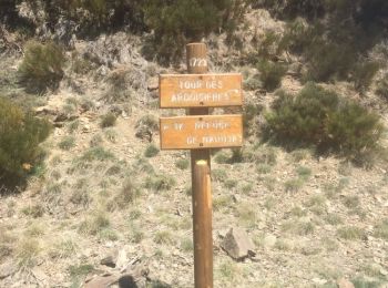
![](/images/other/stat-length.png)
Pyrénées-Orientales, Occitanië, Te voet: Top van de beste wandelroutes, trajecten, tochten en wandelingen
Pyrénées-Orientales: Ontdek de beste tochten: 4454 stappen, 105 lopen, 20 noords wandelen, 55 trail en 147 te voet. Al deze tochten, trajecten, routes en outdoor activiteiten zijn beschikbaar in onze SityTrail-apps voor smartphones en tablets.
De beste trajecten (4767)
![Tocht Stappen Port-Vendres - Le sentier des douaniers (Port-Vendres) - Photo](https://media.geolcdn.com/t/350/260/ext.jpg?maxdim=2&url=https%3A%2F%2Fservices.sitytrail.com%2FGeolivesWS%2FDownloadMedia.ashx%3FTrailID%3D109697%26Media%3D4388_1.jpg)
![Stappen Stappen](https://static1.geolcdn.com/sitytour/trail-icons/101.png)
Km
Stappen
![](/images/other/stat-length.png)
![](https://static1.geolcdn.com/siteimages/upload/files/1508320355ic_sort_den_pos_24dp.png)
![](https://static1.geolcdn.com/siteimages/upload/files/1508320355ic_sort_den_neg_24dp.png)
![](https://static1.geolcdn.com/siteimages/upload/files/16400158638029165_repeat_loop_refresh_sync_direction_icon.png)
![Tocht Stappen Le Boulou - rando de la bataille du Boulou - Photo](https://media.geolcdn.com/t/350/260/aa2b3d38-bac5-4589-a4ac-8bd34f744e79.jpg&format=jpg&maxdim=2)
![Stappen Stappen](https://static1.geolcdn.com/sitytour/trail-icons/101.png)
Km
Stappen
![](/images/other/stat-length.png)
![](https://static1.geolcdn.com/siteimages/upload/files/1508320355ic_sort_den_pos_24dp.png)
![](https://static1.geolcdn.com/siteimages/upload/files/1508320355ic_sort_den_neg_24dp.png)
![](https://static1.geolcdn.com/siteimages/upload/files/16400158638029165_repeat_loop_refresh_sync_direction_icon.png)
![Tocht Stappen Ille-sur-Têt - ILLE TÊT 66 - PIC PEDROUS - CASESNOVES - Photo](https://media.geolcdn.com/t/350/260/ext.jpg?maxdim=2&url=https%3A%2F%2Fstatic1.geolcdn.com%2Fsiteimages%2Fupload%2Ffiles%2F1553511878bg_sport_marche.png)
![Stappen Stappen](https://static1.geolcdn.com/sitytour/trail-icons/101.png)
Km
Stappen
![](/images/other/stat-length.png)
![](https://static1.geolcdn.com/siteimages/upload/files/1508320355ic_sort_den_pos_24dp.png)
![](https://static1.geolcdn.com/siteimages/upload/files/1508320355ic_sort_den_neg_24dp.png)
![](https://static1.geolcdn.com/siteimages/upload/files/16400158638029165_repeat_loop_refresh_sync_direction_icon.png)
![Tocht Stappen Les Cluses - LES CLUSES 66 - Photo](https://media.geolcdn.com/t/350/260/ext.jpg?maxdim=2&url=https%3A%2F%2Fstatic1.geolcdn.com%2Fsiteimages%2Fupload%2Ffiles%2F1553511878bg_sport_marche.png)
![Stappen Stappen](https://static1.geolcdn.com/sitytour/trail-icons/101.png)
Km
Stappen
![](/images/other/stat-length.png)
![](https://static1.geolcdn.com/siteimages/upload/files/1508320355ic_sort_den_pos_24dp.png)
![](https://static1.geolcdn.com/siteimages/upload/files/1508320355ic_sort_den_neg_24dp.png)
![](https://static1.geolcdn.com/siteimages/upload/files/16400158638029165_repeat_loop_refresh_sync_direction_icon.png)
![Tocht Stappen Céret - Céret pont du Diable . Saint Feriol (boucle sens aiguilles de la montre) - Photo](https://media.geolcdn.com/t/350/260/8174b494-818a-4476-83a2-ed6c10d0c0a6.jpg&format=jpg&maxdim=2)
![Stappen Stappen](https://static1.geolcdn.com/sitytour/trail-icons/101.png)
Km
Stappen
![](/images/other/stat-length.png)
![](https://static1.geolcdn.com/siteimages/upload/files/1508320355ic_sort_den_pos_24dp.png)
![](https://static1.geolcdn.com/siteimages/upload/files/1508320355ic_sort_den_neg_24dp.png)
![](https://static1.geolcdn.com/siteimages/upload/files/16400158638029165_repeat_loop_refresh_sync_direction_icon.png)
![Tocht Stappen Laroque-des-Albères - Laroque-des-Albères, petit tour des mas - Photo](https://media.geolcdn.com/t/350/260/a38763d0-1e12-4df0-8310-6577414297bd.jpg&format=jpg&maxdim=2)
![Stappen Stappen](https://static1.geolcdn.com/sitytour/trail-icons/101.png)
Km
Stappen
![](/images/other/stat-length.png)
![](https://static1.geolcdn.com/siteimages/upload/files/1508320355ic_sort_den_pos_24dp.png)
![](https://static1.geolcdn.com/siteimages/upload/files/1508320355ic_sort_den_neg_24dp.png)
![](https://static1.geolcdn.com/siteimages/upload/files/16400158638029165_repeat_loop_refresh_sync_direction_icon.png)
![Tocht Stappen Collioure - Collioure-le racou - Photo](https://media.geolcdn.com/t/350/260/4f99edd2-3783-4586-a076-7bfd0caed82a.jpg&format=jpg&maxdim=2)
![Stappen Stappen](https://static1.geolcdn.com/sitytour/trail-icons/101.png)
Km
Stappen
![](/images/other/stat-length.png)
![](https://static1.geolcdn.com/siteimages/upload/files/1508320355ic_sort_den_pos_24dp.png)
![](https://static1.geolcdn.com/siteimages/upload/files/1508320355ic_sort_den_neg_24dp.png)
![](https://static1.geolcdn.com/siteimages/upload/files/16400158638029165_repeat_loop_refresh_sync_direction_icon.png)
![Tocht Stappen Casteil - rando casteil du cady - Photo](https://media.geolcdn.com/t/350/260/352b0394-d6dc-4c9d-b4d3-5f316da4dd05.jpg&format=jpg&maxdim=2)
![Stappen Stappen](https://static1.geolcdn.com/sitytour/trail-icons/101.png)
Km
Stappen
![](/images/other/stat-length.png)
![](https://static1.geolcdn.com/siteimages/upload/files/1508320355ic_sort_den_pos_24dp.png)
![](https://static1.geolcdn.com/siteimages/upload/files/1508320355ic_sort_den_neg_24dp.png)
![](https://static1.geolcdn.com/siteimages/upload/files/16400158638029165_repeat_loop_refresh_sync_direction_icon.png)
![Tocht Stappen Tautavel - Tautavel chemin des bacs - Photo](https://media.geolcdn.com/t/350/260/4347d338-087b-4ab9-a23d-b90780ad37c2.jpg&format=jpg&maxdim=2)
![Stappen Stappen](https://static1.geolcdn.com/sitytour/trail-icons/101.png)
Km
Stappen
![](/images/other/stat-length.png)
![](https://static1.geolcdn.com/siteimages/upload/files/1508320355ic_sort_den_pos_24dp.png)
![](https://static1.geolcdn.com/siteimages/upload/files/1508320355ic_sort_den_neg_24dp.png)
![](https://static1.geolcdn.com/siteimages/upload/files/16400158638029165_repeat_loop_refresh_sync_direction_icon.png)
![Tocht Stappen Sournia - sournia st michel - Photo](https://media.geolcdn.com/t/350/260/ext.jpg?maxdim=2&url=https%3A%2F%2Fservices.sitytrail.com%2FGeolivesWS%2FDownloadMedia.ashx%3FTrailID%3D923146%26Media%3Dfix__20171104121831.jpg)
![Stappen Stappen](https://static1.geolcdn.com/sitytour/trail-icons/101.png)
Km
Stappen
![](/images/other/stat-length.png)
![](https://static1.geolcdn.com/siteimages/upload/files/1508320355ic_sort_den_pos_24dp.png)
![](https://static1.geolcdn.com/siteimages/upload/files/1508320355ic_sort_den_neg_24dp.png)
![](https://static1.geolcdn.com/siteimages/upload/files/16400158638029165_repeat_loop_refresh_sync_direction_icon.png)
• rando pour famille
![Tocht Stappen Font-Romeu-Odeillo-Via - Coll del Pam lac des Bouillouses - Photo](https://media.geolcdn.com/t/350/260/ext.jpg?maxdim=2&url=https%3A%2F%2Fservices.sitytrail.com%2FGeolivesWS%2FDownloadMedia.ashx%3FTrailID%3D802013%26Media%3Dfix__20170803141713.jpg)
![Stappen Stappen](https://static1.geolcdn.com/sitytour/trail-icons/101.png)
Km
Stappen
![](/images/other/stat-length.png)
![](https://static1.geolcdn.com/siteimages/upload/files/1508320355ic_sort_den_pos_24dp.png)
![](https://static1.geolcdn.com/siteimages/upload/files/1508320355ic_sort_den_neg_24dp.png)
![](https://static1.geolcdn.com/siteimages/upload/files/16400158638029165_repeat_loop_refresh_sync_direction_icon.png)
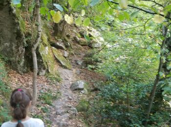
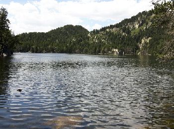
• Beau parcours mais attention entre l'Estany Llarg et l'Estany Negre le Gps était éteint mais le sentier est bien bali...
![Tocht Stappen Ur - de Ur vers La Chapelle de Belloc - Photo](https://media.geolcdn.com/t/350/260/ext.jpg?maxdim=2&url=https%3A%2F%2Fservices.sitytrail.com%2FGeolivesWS%2FDownloadMedia.ashx%3FTrailID%3D661447%26Media%3D20161117163202.jpg)
![Stappen Stappen](https://static1.geolcdn.com/sitytour/trail-icons/101.png)
Km
Stappen
![](/images/other/stat-length.png)
![](https://static1.geolcdn.com/siteimages/upload/files/1508320355ic_sort_den_pos_24dp.png)
![](https://static1.geolcdn.com/siteimages/upload/files/1508320355ic_sort_den_neg_24dp.png)
![](https://static1.geolcdn.com/siteimages/upload/files/16400158638029165_repeat_loop_refresh_sync_direction_icon.png)
• Une belle randonnée pas difficile
![Tocht Stappen Ria-Sirach - Sirach-Taurinya-Saint Michel de Cuxa - Photo](https://media.geolcdn.com/t/350/260/ext.jpg?maxdim=2&url=https%3A%2F%2Fservices.sitytrail.com%2FGeolivesWS%2FDownloadMedia.ashx%3FTrailID%3D631724%26Media%3D20160916113736.jpg)
![Stappen Stappen](https://static1.geolcdn.com/sitytour/trail-icons/101.png)
Km
Stappen
![](/images/other/stat-length.png)
![](https://static1.geolcdn.com/siteimages/upload/files/1508320355ic_sort_den_pos_24dp.png)
![](https://static1.geolcdn.com/siteimages/upload/files/1508320355ic_sort_den_neg_24dp.png)
![](https://static1.geolcdn.com/siteimages/upload/files/16400158638029165_repeat_loop_refresh_sync_direction_icon.png)
• Ballade agréable en parcours ombrage. Aucune difficulté
![Tocht Stappen Vivès - Le sentier de Vinés - Photo](https://media.geolcdn.com/t/350/260/ext.jpg?maxdim=2&url=https%3A%2F%2Fservices.sitytrail.com%2FGeolivesWS%2FDownloadMedia.ashx%3FTrailID%3D609704%26Media%3Dfix__20160806141744.jpg)
![Stappen Stappen](https://static1.geolcdn.com/sitytour/trail-icons/101.png)
Km
Stappen
![](/images/other/stat-length.png)
![](https://static1.geolcdn.com/siteimages/upload/files/1508320355ic_sort_den_pos_24dp.png)
![](https://static1.geolcdn.com/siteimages/upload/files/1508320355ic_sort_den_neg_24dp.png)
![](https://static1.geolcdn.com/siteimages/upload/files/16400158638029165_repeat_loop_refresh_sync_direction_icon.png)
![Tocht Stappen Laroque-des-Albères - 66 LAROQUE DES ALBERES (maison) SOREDE, par pistes DFCI AL12 et 19, mas del Ca et mas Manere, Itin.16 - Photo](https://media.geolcdn.com/t/350/260/ext.jpg?maxdim=2&url=https%3A%2F%2Fservices.sitytrail.com%2FGeolivesWS%2FDownloadMedia.ashx%3FTrailID%3D585179%26Media%3D20160616145650.jpg)
![Stappen Stappen](https://static1.geolcdn.com/sitytour/trail-icons/101.png)
Km
Stappen
![](/images/other/stat-length.png)
![](https://static1.geolcdn.com/siteimages/upload/files/1508320355ic_sort_den_pos_24dp.png)
![](https://static1.geolcdn.com/siteimages/upload/files/1508320355ic_sort_den_neg_24dp.png)
![](https://static1.geolcdn.com/siteimages/upload/files/16400158638029165_repeat_loop_refresh_sync_direction_icon.png)
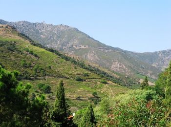
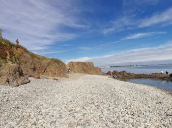
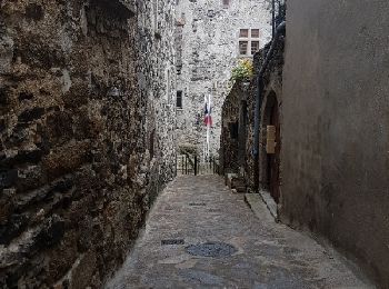
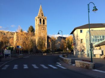
• 66 LAROQUE DES ALBERES (maison) place des Vernédes, av. du Roussillon, rue de Roca-Vella, mas PEYRE, chapelle St fruc...
![Tocht Stappen Céret - Cretes de Ceret_Fontfrede - Photo](https://media.geolcdn.com/t/350/260/ext.jpg?maxdim=2&url=https%3A%2F%2Fservices.sitytrail.com%2FGeolivesWS%2FDownloadMedia.ashx%3FTrailID%3D574188%26Media%3Dfix__20160524173735.jpg)
![Stappen Stappen](https://static1.geolcdn.com/sitytour/trail-icons/101.png)
Km
Stappen
![](/images/other/stat-length.png)
![](https://static1.geolcdn.com/siteimages/upload/files/1508320355ic_sort_den_pos_24dp.png)
![](https://static1.geolcdn.com/siteimages/upload/files/1508320355ic_sort_den_neg_24dp.png)
![](https://static1.geolcdn.com/siteimages/upload/files/16400158638029165_repeat_loop_refresh_sync_direction_icon.png)
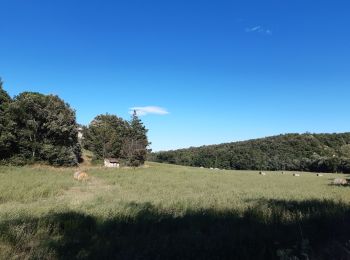
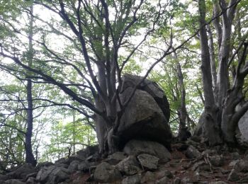
• site conseil general 66. Belle randonnée en grande partie en sous bois
![Tocht Stappen Nahuja - boucle de Nahuja - Photo](https://media.geolcdn.com/t/350/260/ext.jpg?maxdim=2&url=https%3A%2F%2Fservices.sitytrail.com%2FGeolivesWS%2FDownloadMedia.ashx%3FTrailID%3D558835%26Media%3D20160425135530.jpg)
![Stappen Stappen](https://static1.geolcdn.com/sitytour/trail-icons/101.png)
Km
Stappen
![](/images/other/stat-length.png)
![](https://static1.geolcdn.com/siteimages/upload/files/1508320355ic_sort_den_pos_24dp.png)
![](https://static1.geolcdn.com/siteimages/upload/files/1508320355ic_sort_den_neg_24dp.png)
![](https://static1.geolcdn.com/siteimages/upload/files/16400158638029165_repeat_loop_refresh_sync_direction_icon.png)
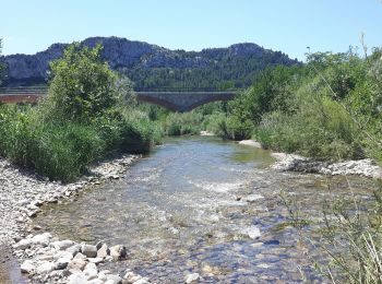
• Chemin de Nahuja au refuge et retour avec une vue splendide tout au long de la descente qui se termine par un petit r...
![Tocht Stappen Laroque-des-Albères - 66 SOREDE, LAROQUE DES ALBERES, chemins des Mas - Photo](https://media.geolcdn.com/t/350/260/ext.jpg?maxdim=2&url=https%3A%2F%2Fservices.sitytrail.com%2FGeolivesWS%2FDownloadMedia.ashx%3FTrailID%3D534699%26Media%3D20160303171633.jpg)
![Stappen Stappen](https://static1.geolcdn.com/sitytour/trail-icons/101.png)
Km
Stappen
![](/images/other/stat-length.png)
![](https://static1.geolcdn.com/siteimages/upload/files/1508320355ic_sort_den_pos_24dp.png)
![](https://static1.geolcdn.com/siteimages/upload/files/1508320355ic_sort_den_neg_24dp.png)
![](https://static1.geolcdn.com/siteimages/upload/files/16400158638029165_repeat_loop_refresh_sync_direction_icon.png)
• 66 SOREDE, mas del Ca, maison de retraite, DFCI AL11, mas d'en Lys, mas Dels Serrallers, mas St Joseph, citerne DFCI ...
![Tocht Stappen Eyne - Eyne,col de Nuria,pic d'Eyne,Torre d'Eyne,Eyne. - Photo](https://media.geolcdn.com/t/350/260/ext.jpg?maxdim=2&url=https%3A%2F%2Fservices.sitytrail.com%2FGeolivesWS%2FDownloadMedia.ashx%3FTrailID%3D530520%26Media%3D20150811115220.jpg)
![Stappen Stappen](https://static1.geolcdn.com/sitytour/trail-icons/101.png)
Km
Stappen
![](/images/other/stat-length.png)
![](https://static1.geolcdn.com/siteimages/upload/files/1508320355ic_sort_den_pos_24dp.png)
![](https://static1.geolcdn.com/siteimages/upload/files/1508320355ic_sort_den_neg_24dp.png)
![](https://static1.geolcdn.com/siteimages/upload/files/16400158638029165_repeat_loop_refresh_sync_direction_icon.png)
20 tochten weergegeven op 4767
Gratisgps-wandelapplicatie
Activiteiten
Nabije regio's
- Alénya
- Amélie-les-Bains-Palalda
- Angoustrine-Villeneuve-des-Escaldes
- Ansignan
- Arboussols
- Argelès-sur-Mer
- Arles-sur-Tech
- Ayguatébia-Talau
- Bages
- Baho
- Baillestavy
- Baixas
- Banyuls-dels-Aspres
- Banyuls-sur-Mer
- Bélesta
- Bolquère
- Bompas
- Boule-d'Amont
- Bouleternère
- Bourg-Madame
- Brouilla
- Cabestany
- Caixas
- Calce
- Calmeilles
- Camélas
- Campôme
- Campoussy
- Canaveilles
- Canet-en-Roussillon
- Canohès
- Caramany
- Casefabre
- Cases-de-Pène
- Cassagnes
- Casteil
- Castelnou
- Catllar
- Caudiès-de-Conflent
- Caudiès-de-Fenouillèdes
- Cerbère
- Céret
- Claira
- Clara-Villerach
- Codalet
- Collioure
- Conat
- Corbère
- Corbère-les-Cabanes
- Corneilla-de-Conflent
- Corneilla-del-Vercol
- Corneilla-la-Rivière
- Corsavy
- Coustouges
- Dorres
- Égat
- Elne
- Enveitg
- Err
- Escaro
- Espira-de-Conflent
- Espira-de-l'Agly
- Estagel
- Estavar
- Estoher
- Eus
- Eyne
- Feilluns
- Fenouillet
- Fillols
- Finestret
- Font-Romeu-Odeillo-Via
- Fontpédrouse
- Fontrabiouse
- Formiguères
- Fosse
- Fourques
- Fuilla
- Glorianes
- Ille-sur-Têt
- Joch
- Jujols
- L'Albère
- La Bastide
- La Cabanasse
- La Llagonne
- Lamanère
- Lansac
- Laroque-des-Albères
- Latour-Bas-Elne
- Latour-de-Carol
- Latour-de-France
- Le Barcarès
- Le Boulou
- Le Perthus
- Le Soler
- Le Tech
- Le Vivier
- Les Angles
- Les Cluses
- Lesquerde
- Llauro
- Llo
- Llupia
- Los Masos
- Mantet
- Marquixanes
- Matemale
- Maureillas-las-Illas
- Maury
- Millas
- Molitg-les-Bains
- Mont-Louis
- Montalba-le-Château
- Montauriol
- Montbolo
- Montescot
- Montesquieu-des-Albères
- Montferrer
- Montner
- Mosset
- Nahuja
- Néfiach
- Nohèdes
- Nyer
- Olette
- Oms
- Opoul-Périllos
- Oreilla
- Ortaffa
- Osséja
- Palau-de-Cerdagne
- Palau-del-Vidre
- Passa
- Perpignan
- Peyrestortes
- Pézilla-de-Conflent
- Pézilla-la-Rivière
- Pia
- Planès
- Planèzes
- Pollestres
- Ponteilla
- Port-Vendres
- Porta
- Porté-Puymorens
- Prades
- Prats-de-Mollo-la-Preste
- Prats-de-Sournia
- Prugnanes
- Prunet-et-Belpuig
- Puyvalador
- Py
- Rabouillet
- Railleu
- Rasiguères
- Réal
- Reynès
- Ria-Sirach
- Rigarda
- Rivesaltes
- Rodès
- Sahorre
- Saillagouse
- Saint-André
- Saint-Arnac
- Saint-Cyprien
- Saint-Estève
- Saint-Féliu-d'Amont
- Saint-Féliu-d'Avall
- Saint-Génis-des-Fontaines
- Saint-Hippolyte
- Saint-Jean-Lasseille
- Saint-Jean-Pla-de-Corts
- Saint-Laurent-de-Cerdans
- Saint-Laurent-de-la-Salanque
- Saint-Marsal
- Saint-Martin-de-Fenouillet
- Saint-Michel-de-Llotes
- Saint-Nazaire
- Saint-Paul-de-Fenouillet
- Saint-Pierre-dels-Forcats
- Sainte-Colombe-de-la-Commanderie
- Sainte-Léocadie
- Sainte-Marie-la-Mer
- Saleilles
- Salses-le-Château
- Sansa
- Sauto
- Serdinya
- Serralongue
- Sorède
- Souanyas
- Sournia
- Taillet
- Tarerach
- Targassonne
- Taulis
- Taurinya
- Tautavel
- Terrats
- Théza
- Thuès-Entre-Valls
- Thuir
- Tordères
- Torreilles
- Toulouges
- Tresserre
- Trévillach
- Trilla
- Trouillas
- Ur
- Urbanya
- Valcebollère
- Valmanya
- Vernet-les-Bains
- Villefranche-de-Conflent
- Villelongue-de-la-Salanque
- Villelongue-dels-Monts
- Villemolaque
- Villeneuve-de-la-Raho
- Villeneuve-la-Rivière
- Vinça
- Vingrau
- Vira
- Vivès