![](/images/other/stat-length.png)
Landkreis Rosenheim, Beieren, Te voet: Top van de beste wandelroutes, trajecten, tochten en wandelingen
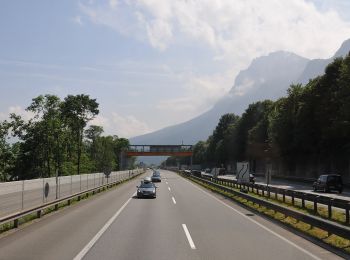
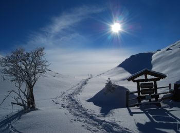
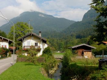
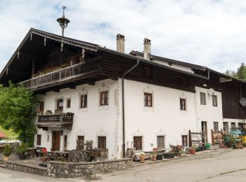
Landkreis Rosenheim: Ontdek de beste tochten: 213 te voet. Al deze tochten, trajecten, routes en outdoor activiteiten zijn beschikbaar in onze SityTrail-apps voor smartphones en tablets.
De beste trajecten (213)
![Tocht Te voet Kiefersfelden - Kaiser Max Weg - Photo](https://media.geolcdn.com/t/350/260/d9479138-c4d4-4de4-9913-7bba84071432.jpeg&format=jpg&maxdim=2)
![Te voet Te voet](https://static1.geolcdn.com/sitytour/trail-icons/100.png)
Km
Te voet
![](/images/other/stat-length.png)
![](https://static1.geolcdn.com/siteimages/upload/files/1508320355ic_sort_den_pos_24dp.png)
![](https://static1.geolcdn.com/siteimages/upload/files/1508320355ic_sort_den_neg_24dp.png)
![](https://static1.geolcdn.com/siteimages/upload/files/16400158638029165_repeat_loop_refresh_sync_direction_icon.png)
• Trail created by IVV. Im Bereich Kieferfelden sehr schlecht ausgeschildert (2020) Symbol: Grüne Rechtecke mit Reich...
![Tocht Te voet Nußdorf am Inn - Kranzhorn über Bubenaualm - Photo](https://media.geolcdn.com/t/350/260/e3c5b70e-000e-4248-8f68-0461d1126b7e.jpeg&format=jpg&maxdim=2)
![Te voet Te voet](https://static1.geolcdn.com/sitytour/trail-icons/100.png)
Km
Te voet
![](/images/other/stat-length.png)
![](https://static1.geolcdn.com/siteimages/upload/files/1508320355ic_sort_den_pos_24dp.png)
![](https://static1.geolcdn.com/siteimages/upload/files/1508320355ic_sort_den_neg_24dp.png)
![](https://static1.geolcdn.com/siteimages/upload/files/16400158638029165_repeat_loop_refresh_sync_direction_icon.png)
• Symbol: Blaue Farbstreifen auf Steinen
![Tocht Te voet Aschau im Chiemgau - Wanderweg 1 - Von Sachrang nach Walchsee - Photo](https://media.geolcdn.com/t/350/260/d0aba310-1364-491c-a5a9-de0387879306.jpeg&format=jpg&maxdim=2)
![Te voet Te voet](https://static1.geolcdn.com/sitytour/trail-icons/100.png)
Km
Te voet
![](/images/other/stat-length.png)
![](https://static1.geolcdn.com/siteimages/upload/files/1508320355ic_sort_den_pos_24dp.png)
![](https://static1.geolcdn.com/siteimages/upload/files/1508320355ic_sort_den_neg_24dp.png)
![](https://static1.geolcdn.com/siteimages/upload/files/16400158638029165_repeat_loop_refresh_sync_direction_icon.png)
• Trail created by Tourist Info Aschau i.Ch.. Symbol: Grüne Schilder mit weißer Schrift
![Tocht Te voet Aschau im Chiemgau - Öko-Kultur-Weg - Photo](https://media.geolcdn.com/t/350/260/f9e0c46c-713d-4420-8056-2cdeb226aa8f.jpeg&format=jpg&maxdim=2)
![Te voet Te voet](https://static1.geolcdn.com/sitytour/trail-icons/100.png)
Km
Te voet
![](/images/other/stat-length.png)
![](https://static1.geolcdn.com/siteimages/upload/files/1508320355ic_sort_den_pos_24dp.png)
![](https://static1.geolcdn.com/siteimages/upload/files/1508320355ic_sort_den_neg_24dp.png)
![](https://static1.geolcdn.com/siteimages/upload/files/16400158638029165_repeat_loop_refresh_sync_direction_icon.png)
• Symbol: Holzschilder mit der Aufschrift "Öko-Kultur-Weg" oder hellblaue Blechschilder mit weißen Silouetten von Kirch...
![Tocht Te voet Aschau im Chiemgau - Wanderweg 10 - Aschau - Photo](https://media.geolcdn.com/t/350/260/93b3eb26-eb80-4cf9-86bf-ccd0a1b83df3.jpeg&format=jpg&maxdim=2)
![Te voet Te voet](https://static1.geolcdn.com/sitytour/trail-icons/100.png)
Km
Te voet
![](/images/other/stat-length.png)
![](https://static1.geolcdn.com/siteimages/upload/files/1508320355ic_sort_den_pos_24dp.png)
![](https://static1.geolcdn.com/siteimages/upload/files/1508320355ic_sort_den_neg_24dp.png)
![](https://static1.geolcdn.com/siteimages/upload/files/16400158638029165_repeat_loop_refresh_sync_direction_icon.png)
• Trail created by Tourist Info Aschau i.Ch..
![Tocht Te voet Nußdorf am Inn - Wanderweg 4 - Kranzhorn - Photo](https://media.geolcdn.com/t/350/260/e3c5b70e-000e-4248-8f68-0461d1126b7e.jpeg&format=jpg&maxdim=2)
![Te voet Te voet](https://static1.geolcdn.com/sitytour/trail-icons/100.png)
Km
Te voet
![](/images/other/stat-length.png)
![](https://static1.geolcdn.com/siteimages/upload/files/1508320355ic_sort_den_pos_24dp.png)
![](https://static1.geolcdn.com/siteimages/upload/files/1508320355ic_sort_den_neg_24dp.png)
![](https://static1.geolcdn.com/siteimages/upload/files/16400158638029165_repeat_loop_refresh_sync_direction_icon.png)
• Beschilderung ist alt und nicht mehr durchgängig. Weg ist NICHT identisch mit Wanderweg 4-Nußdorf (Grüne Schilder mit...
![Tocht Te voet Aschau im Chiemgau - Wanderweg 8 - Von Innerwald zum Spitzsteinhaus bzw. Klausenhütte - Photo](https://media.geolcdn.com/t/350/260/7065dbec-1bfa-44b5-81e5-053df54127dd.jpeg&format=jpg&maxdim=2)
![Te voet Te voet](https://static1.geolcdn.com/sitytour/trail-icons/100.png)
Km
Te voet
![](/images/other/stat-length.png)
![](https://static1.geolcdn.com/siteimages/upload/files/1508320355ic_sort_den_pos_24dp.png)
![](https://static1.geolcdn.com/siteimages/upload/files/1508320355ic_sort_den_neg_24dp.png)
![](https://static1.geolcdn.com/siteimages/upload/files/16400158638029165_repeat_loop_refresh_sync_direction_icon.png)
• Trail created by Tourist Info Aschau i.Ch.. Symbol: Orange Blechschilder mit der Zahl 8 oder gelbe Wegweisschilder
![Tocht Te voet Kiefersfelden - Kieferer Energiewanderweg (Blaue Tour) - Photo](https://media.geolcdn.com/t/350/260/5884fdb8-670f-44d3-a3a7-2c3acffc48c3.jpeg&format=jpg&maxdim=2)
![Te voet Te voet](https://static1.geolcdn.com/sitytour/trail-icons/100.png)
Km
Te voet
![](/images/other/stat-length.png)
![](https://static1.geolcdn.com/siteimages/upload/files/1508320355ic_sort_den_pos_24dp.png)
![](https://static1.geolcdn.com/siteimages/upload/files/1508320355ic_sort_den_neg_24dp.png)
![](https://static1.geolcdn.com/siteimages/upload/files/16400158638029165_repeat_loop_refresh_sync_direction_icon.png)
• Symbol: Gelbe Wegweisschilder mit Mühlensymbol, der Überschrift "KIEFERER ENERGIEWANDERWEG" und einem blauen Richtung...
![Tocht Te voet Kiefersfelden - Kieferer Energiewanderweg (Grüne Tour) - Photo](https://media.geolcdn.com/t/350/260/237a11fb-e0ff-4973-bc94-cded82acda5b.jpeg&format=jpg&maxdim=2)
![Te voet Te voet](https://static1.geolcdn.com/sitytour/trail-icons/100.png)
Km
Te voet
![](/images/other/stat-length.png)
![](https://static1.geolcdn.com/siteimages/upload/files/1508320355ic_sort_den_pos_24dp.png)
![](https://static1.geolcdn.com/siteimages/upload/files/1508320355ic_sort_den_neg_24dp.png)
![](https://static1.geolcdn.com/siteimages/upload/files/16400158638029165_repeat_loop_refresh_sync_direction_icon.png)
• Symbol: Gelbe Wegweisschilder mit Mühlensymbol, der Überschrift "KIEFERER ENERGIEWANDERWEG" und einem grünen Richtung...
![Tocht Te voet Prien am Chiemsee - Priener Postkartenweg - Photo](https://media.geolcdn.com/t/350/260/e02e5267-41a2-46b2-a4c0-10b7a412546e.jpeg&format=jpg&maxdim=2)
![Te voet Te voet](https://static1.geolcdn.com/sitytour/trail-icons/100.png)
Km
Te voet
![](/images/other/stat-length.png)
![](https://static1.geolcdn.com/siteimages/upload/files/1508320355ic_sort_den_pos_24dp.png)
![](https://static1.geolcdn.com/siteimages/upload/files/1508320355ic_sort_den_neg_24dp.png)
![](https://static1.geolcdn.com/siteimages/upload/files/16400158638029165_repeat_loop_refresh_sync_direction_icon.png)
• Symbol: Grüne, quadratische Blechschilder mit hellgrünem Richtungsdreieck
![Tocht Te voet Prien am Chiemsee - Rundweg 2 - Photo](https://media.geolcdn.com/t/350/260/e02e5267-41a2-46b2-a4c0-10b7a412546e.jpeg&format=jpg&maxdim=2)
![Te voet Te voet](https://static1.geolcdn.com/sitytour/trail-icons/100.png)
Km
Te voet
![](/images/other/stat-length.png)
![](https://static1.geolcdn.com/siteimages/upload/files/1508320355ic_sort_den_pos_24dp.png)
![](https://static1.geolcdn.com/siteimages/upload/files/1508320355ic_sort_den_neg_24dp.png)
![](https://static1.geolcdn.com/siteimages/upload/files/16400158638029165_repeat_loop_refresh_sync_direction_icon.png)
• Symbol: Schwarze Zahl auf weißem, runden Grund mit schwarzem Rand
![Tocht Te voet Frasdorf - Pfaffinger-Runde - Photo](https://media.geolcdn.com/t/350/260/a5698fd7-ec09-415c-8c68-e6c9afe0a1f0.jpeg&format=jpg&maxdim=2)
![Te voet Te voet](https://static1.geolcdn.com/sitytour/trail-icons/100.png)
Km
Te voet
![](/images/other/stat-length.png)
![](https://static1.geolcdn.com/siteimages/upload/files/1508320355ic_sort_den_pos_24dp.png)
![](https://static1.geolcdn.com/siteimages/upload/files/1508320355ic_sort_den_neg_24dp.png)
![](https://static1.geolcdn.com/siteimages/upload/files/16400158638029165_repeat_loop_refresh_sync_direction_icon.png)
• Trail created by Gemeinde Frasdorf.
![Tocht Te voet Frasdorf - Geigeralm-Runde - Photo](https://media.geolcdn.com/t/350/260/6cc2e3eb-14b7-4d09-ac1d-1bfd502e327d.jpeg&format=jpg&maxdim=2)
![Te voet Te voet](https://static1.geolcdn.com/sitytour/trail-icons/100.png)
Km
Te voet
![](/images/other/stat-length.png)
![](https://static1.geolcdn.com/siteimages/upload/files/1508320355ic_sort_den_pos_24dp.png)
![](https://static1.geolcdn.com/siteimages/upload/files/1508320355ic_sort_den_neg_24dp.png)
![](https://static1.geolcdn.com/siteimages/upload/files/16400158638029165_repeat_loop_refresh_sync_direction_icon.png)
• Trail created by Gemeinde Frasdorf.
![Tocht Te voet Frasdorf - Herzogweg - Photo](https://media.geolcdn.com/t/350/260/9b520f38-837e-4f82-bec5-3443748c6377.jpeg&format=jpg&maxdim=2)
![Te voet Te voet](https://static1.geolcdn.com/sitytour/trail-icons/100.png)
Km
Te voet
![](/images/other/stat-length.png)
![](https://static1.geolcdn.com/siteimages/upload/files/1508320355ic_sort_den_pos_24dp.png)
![](https://static1.geolcdn.com/siteimages/upload/files/1508320355ic_sort_den_neg_24dp.png)
![](https://static1.geolcdn.com/siteimages/upload/files/16400158638029165_repeat_loop_refresh_sync_direction_icon.png)
• Trail created by Gemeinde Frasdorf.
![Tocht Te voet Frasdorf - St. Florians-Runde - Photo](https://media.geolcdn.com/t/350/260/51fd970b-0a7a-4cb5-a278-c7660f303ba5.jpeg&format=jpg&maxdim=2)
![Te voet Te voet](https://static1.geolcdn.com/sitytour/trail-icons/100.png)
Km
Te voet
![](/images/other/stat-length.png)
![](https://static1.geolcdn.com/siteimages/upload/files/1508320355ic_sort_den_pos_24dp.png)
![](https://static1.geolcdn.com/siteimages/upload/files/1508320355ic_sort_den_neg_24dp.png)
![](https://static1.geolcdn.com/siteimages/upload/files/16400158638029165_repeat_loop_refresh_sync_direction_icon.png)
• Trail created by Gemeinde Frasdorf.
![Tocht Te voet Frasdorf - Wildenwarter-Runde - Photo](https://media.geolcdn.com/t/350/260/84a2d114-d2df-497f-a9c6-189f656ef06e.jpeg&format=jpg&maxdim=2)
![Te voet Te voet](https://static1.geolcdn.com/sitytour/trail-icons/100.png)
Km
Te voet
![](/images/other/stat-length.png)
![](https://static1.geolcdn.com/siteimages/upload/files/1508320355ic_sort_den_pos_24dp.png)
![](https://static1.geolcdn.com/siteimages/upload/files/1508320355ic_sort_den_neg_24dp.png)
![](https://static1.geolcdn.com/siteimages/upload/files/16400158638029165_repeat_loop_refresh_sync_direction_icon.png)
• Trail created by Gemeinde Frasdorf.
![Tocht Te voet Frasdorf - Sonnseitn-Runde - Photo](https://media.geolcdn.com/t/350/260/84a2d114-d2df-497f-a9c6-189f656ef06e.jpeg&format=jpg&maxdim=2)
![Te voet Te voet](https://static1.geolcdn.com/sitytour/trail-icons/100.png)
Km
Te voet
![](/images/other/stat-length.png)
![](https://static1.geolcdn.com/siteimages/upload/files/1508320355ic_sort_den_pos_24dp.png)
![](https://static1.geolcdn.com/siteimages/upload/files/1508320355ic_sort_den_neg_24dp.png)
![](https://static1.geolcdn.com/siteimages/upload/files/16400158638029165_repeat_loop_refresh_sync_direction_icon.png)
• Trail created by Gemeinde Frasdorf.
![Tocht Te voet Frasdorf - Berghäuser-Runde - Photo](https://media.geolcdn.com/t/350/260/0aca97ea-7a34-4140-bab0-f7ef94908781.jpeg&format=jpg&maxdim=2)
![Te voet Te voet](https://static1.geolcdn.com/sitytour/trail-icons/100.png)
Km
Te voet
![](/images/other/stat-length.png)
![](https://static1.geolcdn.com/siteimages/upload/files/1508320355ic_sort_den_pos_24dp.png)
![](https://static1.geolcdn.com/siteimages/upload/files/1508320355ic_sort_den_neg_24dp.png)
![](https://static1.geolcdn.com/siteimages/upload/files/16400158638029165_repeat_loop_refresh_sync_direction_icon.png)
• Trail created by Gemeinde Frasdorf.
![Tocht Te voet Frasdorf - Winterstuben-Runde - Photo](https://media.geolcdn.com/t/350/260/30ff97fe-12d7-40f4-af5f-8c17310efb7f.jpeg&format=jpg&maxdim=2)
![Te voet Te voet](https://static1.geolcdn.com/sitytour/trail-icons/100.png)
Km
Te voet
![](/images/other/stat-length.png)
![](https://static1.geolcdn.com/siteimages/upload/files/1508320355ic_sort_den_pos_24dp.png)
![](https://static1.geolcdn.com/siteimages/upload/files/1508320355ic_sort_den_neg_24dp.png)
![](https://static1.geolcdn.com/siteimages/upload/files/16400158638029165_repeat_loop_refresh_sync_direction_icon.png)
• Trail created by Gemeinde Frasdorf;Tourist Info Aschau i.Ch..
![Tocht Te voet Frasdorf - Hofalm-Runde - Photo](https://media.geolcdn.com/t/350/260/30ff97fe-12d7-40f4-af5f-8c17310efb7f.jpeg&format=jpg&maxdim=2)
![Te voet Te voet](https://static1.geolcdn.com/sitytour/trail-icons/100.png)
Km
Te voet
![](/images/other/stat-length.png)
![](https://static1.geolcdn.com/siteimages/upload/files/1508320355ic_sort_den_pos_24dp.png)
![](https://static1.geolcdn.com/siteimages/upload/files/1508320355ic_sort_den_neg_24dp.png)
![](https://static1.geolcdn.com/siteimages/upload/files/16400158638029165_repeat_loop_refresh_sync_direction_icon.png)
• Trail created by Gemeinde Frasdorf.
20 tochten weergegeven op 213
Gratisgps-wandelapplicatie
Activiteiten
Nabije regio's
- Amerang
- Aschau im Chiemgau
- Bad Aibling
- Bad Endorf
- Bad Feilnbach
- Bernau am Chiemsee
- Brannenburg
- Bruckmühl
- Chiemsee
- Eggstätt
- Feldkirchen-Westerham
- Flintsbach am Inn
- Frasdorf
- Gstadt am Chiemsee
- Halfing
- Höslwang
- Kiefersfelden
- Neubeuern
- Nußdorf am Inn
- Oberaudorf
- Prien am Chiemsee
- Riedering
- Rimsting
- Rott am Inn
- Samerberg
- Stephanskirchen
- Wasserburg am Inn