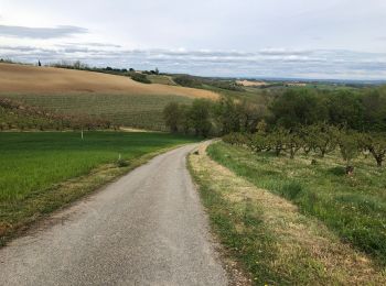
![](/images/other/stat-length.png)
Tarn-et-Garonne, Occitania, A piedi : I migliori sentieri, percorsi e passeggiate
Tarn-et-Garonne: Scopri i migliori percorsi: 17 a piedi, 511 marcia, 6 camminata nordica, 16 corsa a piedi e 9 sentiero. Tutti questi percorsi, itinerari e attività outdoor sono disponibili nelle nostre app SityTrail per smartphone e tablet.
I percorsi migliori (0})
![Percorso Marcia Saint-Beauzeil - Randonnée autour du lac à St Beauzeil - Photo](https://media.geolcdn.com/t/350/260/ext.jpg?maxdim=2&url=https%3A%2F%2Fservices.sitytrail.com%2FGeolivesWS%2FDownloadMedia.ashx%3FTrailID%3D172837%26Media%3D14277_6.jpg)
![Marcia Marcia](https://static1.geolcdn.com/sitytour/trail-icons/101.png)
Km
Marcia
![](/images/other/stat-length.png)
![](https://static1.geolcdn.com/siteimages/upload/files/1508320355ic_sort_den_pos_24dp.png)
![](https://static1.geolcdn.com/siteimages/upload/files/1508320355ic_sort_den_neg_24dp.png)
![](https://static1.geolcdn.com/siteimages/upload/files/16400158638029165_repeat_loop_refresh_sync_direction_icon.png)
• 45% de goudron
![Percorso A piedi Moissac - Les Anciens Chemin de Halage - Photo](https://media.geolcdn.com/t/350/260/c5b1f49e-e332-4385-975e-5902ebb9bf85.jpeg&format=jpg&maxdim=2)
![A piedi A piedi](https://static1.geolcdn.com/sitytour/trail-icons/100.png)
Km
A piedi
![](/images/other/stat-length.png)
![](https://static1.geolcdn.com/siteimages/upload/files/1508320355ic_sort_den_pos_24dp.png)
![](https://static1.geolcdn.com/siteimages/upload/files/1508320355ic_sort_den_neg_24dp.png)
![](https://static1.geolcdn.com/siteimages/upload/files/16400158638029165_repeat_loop_refresh_sync_direction_icon.png)
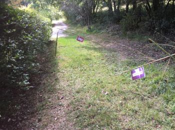
• Symbol: marque jaune
![Percorso Marcia Bruniquel - Bruni quel - Photo](https://media.geolcdn.com/t/350/260/6fb8d380-d7d9-467c-88ab-637a210db92b.jpg&format=jpg&maxdim=2)
![Marcia Marcia](https://static1.geolcdn.com/sitytour/trail-icons/101.png)
Km
Marcia
![](/images/other/stat-length.png)
![](https://static1.geolcdn.com/siteimages/upload/files/1508320355ic_sort_den_pos_24dp.png)
![](https://static1.geolcdn.com/siteimages/upload/files/1508320355ic_sort_den_neg_24dp.png)
![](https://static1.geolcdn.com/siteimages/upload/files/16400158638029165_repeat_loop_refresh_sync_direction_icon.png)
![Percorso Marcia Montricoux - Montricoux - Photo](https://media.geolcdn.com/t/350/260/2655e387-e67f-4901-a5a8-004800180e9a.jpg&format=jpg&maxdim=2)
![Marcia Marcia](https://static1.geolcdn.com/sitytour/trail-icons/101.png)
Km
Marcia
![](/images/other/stat-length.png)
![](https://static1.geolcdn.com/siteimages/upload/files/1508320355ic_sort_den_pos_24dp.png)
![](https://static1.geolcdn.com/siteimages/upload/files/1508320355ic_sort_den_neg_24dp.png)
![](https://static1.geolcdn.com/siteimages/upload/files/16400158638029165_repeat_loop_refresh_sync_direction_icon.png)
![Percorso Marcia Moissac - CHEMIN CLUNISIEN de GUYENNE GASCOGNE - Photo](https://media.geolcdn.com/t/350/260/ext.jpg?maxdim=2&url=https%3A%2F%2Fservices.sitytrail.com%2FGeolivesWS%2FDownloadMedia.ashx%3FTrailID%3D546685%26Media%3D5b692c9c-1592-4a08-9d3d-16b8dc8a7464.jpg)
![Marcia Marcia](https://static1.geolcdn.com/sitytour/trail-icons/101.png)
Km
Marcia
![](/images/other/stat-length.png)
![](https://static1.geolcdn.com/siteimages/upload/files/1508320355ic_sort_den_pos_24dp.png)
![](https://static1.geolcdn.com/siteimages/upload/files/1508320355ic_sort_den_neg_24dp.png)
![](https://static1.geolcdn.com/siteimages/upload/files/16400158638029165_repeat_loop_refresh_sync_direction_icon.png)
![Percorso Marcia Saint-Antonin-Noble-Val - Saint antonin. PR10 - Photo](https://media.geolcdn.com/t/350/260/ext.jpg?maxdim=2&url=https%3A%2F%2Fstatic1.geolcdn.com%2Fsiteimages%2Fupload%2Ffiles%2F1553511878bg_sport_marche.png)
![Marcia Marcia](https://static1.geolcdn.com/sitytour/trail-icons/101.png)
Km
Marcia
![](/images/other/stat-length.png)
![](https://static1.geolcdn.com/siteimages/upload/files/1508320355ic_sort_den_pos_24dp.png)
![](https://static1.geolcdn.com/siteimages/upload/files/1508320355ic_sort_den_neg_24dp.png)
![](https://static1.geolcdn.com/siteimages/upload/files/16400158638029165_repeat_loop_refresh_sync_direction_icon.png)
• rando numéro 10 des Brousses et vieilfour.
![Percorso Marcia Saint-Antonin-Noble-Val - Saint Antonin Noble Val pat le cirque de Nibousou - Photo](https://media.geolcdn.com/t/350/260/8d980b9f-e92a-41a7-8258-3fe72bbabf45.jpg&format=jpg&maxdim=2)
![Marcia Marcia](https://static1.geolcdn.com/sitytour/trail-icons/101.png)
Km
Marcia
![](/images/other/stat-length.png)
![](https://static1.geolcdn.com/siteimages/upload/files/1508320355ic_sort_den_pos_24dp.png)
![](https://static1.geolcdn.com/siteimages/upload/files/1508320355ic_sort_den_neg_24dp.png)
![](https://static1.geolcdn.com/siteimages/upload/files/16400158638029165_repeat_loop_refresh_sync_direction_icon.png)
![Percorso Marcia Nègrepelisse - Le long de l'Aveyron - Photo](https://media.geolcdn.com/t/350/260/50b4018f-04c7-43dc-afce-9b3fb294e571.jpg&format=jpg&maxdim=2)
![Marcia Marcia](https://static1.geolcdn.com/sitytour/trail-icons/101.png)
Km
Marcia
![](/images/other/stat-length.png)
![](https://static1.geolcdn.com/siteimages/upload/files/1508320355ic_sort_den_pos_24dp.png)
![](https://static1.geolcdn.com/siteimages/upload/files/1508320355ic_sort_den_neg_24dp.png)
![](https://static1.geolcdn.com/siteimages/upload/files/16400158638029165_repeat_loop_refresh_sync_direction_icon.png)
![Percorso Marcia Nègrepelisse - Negrepelisse - Photo](https://media.geolcdn.com/t/350/260/94b414a0-99d7-491e-960d-cfee90ede89b.jpg&format=jpg&maxdim=2)
![Marcia Marcia](https://static1.geolcdn.com/sitytour/trail-icons/101.png)
Km
Marcia
![](/images/other/stat-length.png)
![](https://static1.geolcdn.com/siteimages/upload/files/1508320355ic_sort_den_pos_24dp.png)
![](https://static1.geolcdn.com/siteimages/upload/files/1508320355ic_sort_den_neg_24dp.png)
![](https://static1.geolcdn.com/siteimages/upload/files/16400158638029165_repeat_loop_refresh_sync_direction_icon.png)
![Percorso Marcia Nègrepelisse - Parcours des 7 ponts - Photo](https://media.geolcdn.com/t/350/260/cc237538-4a83-40ab-aae0-5e5c1cff75c8.jpg&format=jpg&maxdim=2)
![Marcia Marcia](https://static1.geolcdn.com/sitytour/trail-icons/101.png)
Km
Marcia
![](/images/other/stat-length.png)
![](https://static1.geolcdn.com/siteimages/upload/files/1508320355ic_sort_den_pos_24dp.png)
![](https://static1.geolcdn.com/siteimages/upload/files/1508320355ic_sort_den_neg_24dp.png)
![](https://static1.geolcdn.com/siteimages/upload/files/16400158638029165_repeat_loop_refresh_sync_direction_icon.png)
![Percorso Marcia Montauban - montauban - Photo](https://media.geolcdn.com/t/350/260/2ce8e26c-9875-45ff-b1a0-e2332008cef5.jpg&format=jpg&maxdim=2)
![Marcia Marcia](https://static1.geolcdn.com/sitytour/trail-icons/101.png)
Km
Marcia
![](/images/other/stat-length.png)
![](https://static1.geolcdn.com/siteimages/upload/files/1508320355ic_sort_den_pos_24dp.png)
![](https://static1.geolcdn.com/siteimages/upload/files/1508320355ic_sort_den_neg_24dp.png)
![](https://static1.geolcdn.com/siteimages/upload/files/16400158638029165_repeat_loop_refresh_sync_direction_icon.png)
![Percorso Marcia Auvillar - auvillar mirandoux - Photo](https://media.geolcdn.com/t/350/260/6f195b95-5de6-4c93-9d2d-fc2a6ae4f795.jpg&format=jpg&maxdim=2)
![Marcia Marcia](https://static1.geolcdn.com/sitytour/trail-icons/101.png)
Km
Marcia
![](/images/other/stat-length.png)
![](https://static1.geolcdn.com/siteimages/upload/files/1508320355ic_sort_den_pos_24dp.png)
![](https://static1.geolcdn.com/siteimages/upload/files/1508320355ic_sort_den_neg_24dp.png)
![](https://static1.geolcdn.com/siteimages/upload/files/16400158638029165_repeat_loop_refresh_sync_direction_icon.png)
![Percorso Marcia Moissac - moissac auvillar - Photo](https://media.geolcdn.com/t/350/260/1dd11c1f-fa60-4120-8da6-83192d1d214b.jpg&format=jpg&maxdim=2)
![Marcia Marcia](https://static1.geolcdn.com/sitytour/trail-icons/101.png)
Km
Marcia
![](/images/other/stat-length.png)
![](https://static1.geolcdn.com/siteimages/upload/files/1508320355ic_sort_den_pos_24dp.png)
![](https://static1.geolcdn.com/siteimages/upload/files/1508320355ic_sort_den_neg_24dp.png)
![](https://static1.geolcdn.com/siteimages/upload/files/16400158638029165_repeat_loop_refresh_sync_direction_icon.png)
![Percorso Marcia Lauzerte - lauzerte moissac - Photo](https://media.geolcdn.com/t/350/260/8521affa-2c72-45f7-82af-749c5c0ed3cc.jpg&format=jpg&maxdim=2)
![Marcia Marcia](https://static1.geolcdn.com/sitytour/trail-icons/101.png)
Km
Marcia
![](/images/other/stat-length.png)
![](https://static1.geolcdn.com/siteimages/upload/files/1508320355ic_sort_den_pos_24dp.png)
![](https://static1.geolcdn.com/siteimages/upload/files/1508320355ic_sort_den_neg_24dp.png)
![](https://static1.geolcdn.com/siteimages/upload/files/16400158638029165_repeat_loop_refresh_sync_direction_icon.png)
![Percorso Marcia Saint-Antonin-Noble-Val - Saint Antonin Noble Val - côte de Ouf et cirque de Baune - Photo](https://media.geolcdn.com/t/350/260/ede720ec-eee1-4146-9fff-5e7b3cd1b281.jpg&format=jpg&maxdim=2)
![Marcia Marcia](https://static1.geolcdn.com/sitytour/trail-icons/101.png)
Km
Marcia
![](/images/other/stat-length.png)
![](https://static1.geolcdn.com/siteimages/upload/files/1508320355ic_sort_den_pos_24dp.png)
![](https://static1.geolcdn.com/siteimages/upload/files/1508320355ic_sort_den_neg_24dp.png)
![](https://static1.geolcdn.com/siteimages/upload/files/16400158638029165_repeat_loop_refresh_sync_direction_icon.png)
![Percorso Marcia Saint-Antonin-Noble-Val - Saint antonin Brousses P23 - Photo](https://media.geolcdn.com/t/350/260/57698089-0092-4b74-9970-f68a51da5e4b.jpg&format=jpg&maxdim=2)
![Marcia Marcia](https://static1.geolcdn.com/sitytour/trail-icons/101.png)
Km
Marcia
![](/images/other/stat-length.png)
![](https://static1.geolcdn.com/siteimages/upload/files/1508320355ic_sort_den_pos_24dp.png)
![](https://static1.geolcdn.com/siteimages/upload/files/1508320355ic_sort_den_neg_24dp.png)
![](https://static1.geolcdn.com/siteimages/upload/files/16400158638029165_repeat_loop_refresh_sync_direction_icon.png)
![Percorso A piedi Montricoux - Montricoux - Photo](https://media.geolcdn.com/t/350/260/ext.jpg?maxdim=2&url=https%3A%2F%2Fstatic1.geolcdn.com%2Fsiteimages%2Fupload%2Ffiles%2F1545311037marcheuse_200dpi.jpg)
![A piedi A piedi](https://static1.geolcdn.com/sitytour/trail-icons/100.png)
Km
A piedi
![](/images/other/stat-length.png)
![](https://static1.geolcdn.com/siteimages/upload/files/1508320355ic_sort_den_pos_24dp.png)
![](https://static1.geolcdn.com/siteimages/upload/files/1508320355ic_sort_den_neg_24dp.png)
![](https://static1.geolcdn.com/siteimages/upload/files/16400158638029165_repeat_loop_refresh_sync_direction_icon.png)
![Percorso Marcia Mirabel - Autour de Mirabel - Photo](https://media.geolcdn.com/t/350/260/61cff12f-88ca-4202-819e-eff10b06d7d3.jpg&format=jpg&maxdim=2)
![Marcia Marcia](https://static1.geolcdn.com/sitytour/trail-icons/101.png)
Km
Marcia
![](/images/other/stat-length.png)
![](https://static1.geolcdn.com/siteimages/upload/files/1508320355ic_sort_den_pos_24dp.png)
![](https://static1.geolcdn.com/siteimages/upload/files/1508320355ic_sort_den_neg_24dp.png)
![](https://static1.geolcdn.com/siteimages/upload/files/16400158638029165_repeat_loop_refresh_sync_direction_icon.png)
![Percorso Marcia Lauzerte - Laurzerte ses alentours - Photo](https://media.geolcdn.com/t/350/260/9f0cb866-7ed2-4d6a-8de1-017eac64e440.jpg&format=jpg&maxdim=2)
![Marcia Marcia](https://static1.geolcdn.com/sitytour/trail-icons/101.png)
Km
Marcia
![](/images/other/stat-length.png)
![](https://static1.geolcdn.com/siteimages/upload/files/1508320355ic_sort_den_pos_24dp.png)
![](https://static1.geolcdn.com/siteimages/upload/files/1508320355ic_sort_den_neg_24dp.png)
![](https://static1.geolcdn.com/siteimages/upload/files/16400158638029165_repeat_loop_refresh_sync_direction_icon.png)
20 percorsi visualizzati su 559
Applicazione GPS da escursionismo GRATUITA
Attività
Regioni vicine
- Albefeuille-Lagarde
- Albias
- Angeville
- Asques
- Aucamville
- Auty
- Auvillar
- Bardigues
- Beaumont-de-Lomagne
- Belbèze-en-Lomagne
- Belvèze
- Bessens
- Bioule
- Boudou
- Bouillac
- Bouloc-en-Quercy
- Bourg-de-Visa
- Bourret
- Bressols
- Bruniquel
- Campsas
- Canals
- Castanet
- Castelferrus
- Castelmayran
- Castelsagrat
- Castelsarrasin
- Caumont
- Caussade
- Caylus
- Cayriech
- Cazals
- Cazes-Mondenard
- Corbarieu
- Cordes-Tolosannes
- Dieupentale
- Donzac
- Dunes
- Durfort-Lacapelette
- Escatalens
- Escazeaux
- Espalais
- Espinas
- Fabas
- Faudoas
- Féneyrols
- Finhan
- Garganvillar
- Gasques
- Génébrières
- Gensac
- Gimat
- Ginals
- Golfech
- Goudourville
- Gramont
- Grisolles
- L'Honor-de-Cos
- La Salvetat-Belmontet
- La Ville-Dieu-du-Temple
- Labarthe
- Labastide-Saint-Pierre
- Labastide-de-Penne
- Lacapelle-Livron
- Lacour
- Lacourt-Saint-Pierre
- Lafitte
- Lafrançaise
- Laguépie
- Lamagistère
- Lamothe-Capdeville
- Larrazet
- Lauzerte
- Lavaurette
- Lavit
- Le Causé
- Le Pin
- Léojac
- Lizac
- Loze
- Malause
- Mansonville
- Marignac
- Marsac
- Mas-Grenier
- Maubec
- Meauzac
- Merles
- Mirabel
- Miramont-de-Quercy
- Moissac
- Molières
- Monbéqui
- Monclar-de-Quercy
- Montagudet
- Montaigu-de-Quercy
- Montalzat
- Montastruc
- Montauban
- Montbartier
- Montbeton
- Montech
- Monteils
- Montgaillard
- Montjoi
- Montpezat-de-Quercy
- Montricoux
- Mouillac
- Nègrepelisse
- Nohic
- Orgueil
- Parisot
- Perville
- Piquecos
- Pommevic
- Pompignan
- Puycornet
- Puygaillard-de-Quercy
- Puylagarde
- Puylaroque
- Réalville
- Reyniès
- Roquecor
- Saint-Aignan
- Saint-Amans-de-Pellagal
- Saint-Amans-du-Pech
- Saint-Antonin-Noble-Val
- Saint-Beauzeil
- Saint-Cirice
- Saint-Cirq
- Saint-Clair
- Saint-Étienne-de-Tulmont
- Saint-Georges
- Saint-Loup
- Saint-Michel
- Saint-Nauphary
- Saint-Nazaire-de-Valentane
- Saint-Nicolas-de-la-Grave
- Saint-Paul-d'Espis
- Saint-Porquier
- Saint-Projet
- Saint-Sardos
- Saint-Vincent-Lespinasse
- Sainte-Juliette
- Sauveterre
- Savenès
- Septfonds
- Sérignac
- Sistels
- Touffailles
- Tréjouls
- Vaïssac
- Valeilles
- Valence
- Varen
- Varennes
- Vazerac
- Verdun-sur-Garonne
- Verfeil-sur-Seye
- Verlhac-Tescou
- Vigueron
- Villebrumier