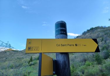
RobinMicheline GUIDE Offline Profil Randonnées Points Listes Sitytrail × Êtes-vous sûr(e) de vouloir retirer ce contact ? SityTrail Êtes-vous sûr(e) de vouloir bloquer ce contact? Randonnées GUIDE RobinMicheline APT S Saturnin d Apt , sentier des Auguiers et des bornes o Marche Moyen Saint-Saturnin-lès-Apt, Provence-Alpes-Côte d'Azur, Vaucluse, France 15,2 km | 21 km-effort 4h 0min Oui GUIDE RobinMicheline APT, Buous , circuit d Aigue Brun o l Marche Moyen Buoux, Provence-Alpes-Côte d'Azur, Vaucluse, France 15,1 km | 21 km-effort 4h 29min Oui GUIDE RobinMicheline AURIBEAU , col dAinac , Ainac , col S Antoine , pointe d Aiguille , pas de Gu... Marche Difficile Hautes-Duyes, Provence-Alpes-Côte d'Azur, Alpes-de-Haute-Provence, France 14,9 km | 25 km-effort 4h 57min Oui GUIDE RobinMicheline AUTHON , Col de Font-elles, Tour d Ardouin o l Marche Moyen Le Castellard-Mélan, Provence-Alpes-Côte d'Azur, Alpes-de-Haute-Provence, France 11,2 km | 17,4 km-effort 3h 13min Oui GUIDE RobinMicheline CHATEAU ARNOUX . Chapelle S Jean o l Marche Facile Château-Arnoux-Saint-Auban, Provence-Alpes-Côte d'Azur, Alpes-de-Haute-Provence, France 9 km | 12,3 km-effort 2h 35min Oui GUIDE RobinMicheline LES DOURBES o l Marche Difficile Digne-les-Bains, Provence-Alpes-Côte d'Azur, Alpes-de-Haute-Provence, France 13,9 km | 24 km-effort 4h 33min Oui GUIDE RobinMicheline LACOSTE , Vaucluse, la forêt des cèdres o Marche Moyen Lacoste, Provence-Alpes-Côte d'Azur, Vaucluse, France 13,3 km | 21 km-effort 4h 15min Oui GUIDE RobinMicheline LINCEL Les Craux , S Michel 2 o Marche Facile Saint-Michel-l'Observatoire, Provence-Alpes-Côte d'Azur, Alpes-de-Haute-Provence, France 11,7 km | 15,2 km-effort 3h 4min Oui GUIDE RobinMicheline TALLARD tête de Boursier o m s Marche Moyen Tallard, Provence-Alpes-Côte d'Azur, Hautes-Alpes, France 11,9 km | 20 km-effort 3h 46min Oui GUIDE RobinMicheline ETOILE SAINTE CYRISE . Les gorges de sainte Cyrise o m s Marche Moyen Étoile-Saint-Cyrice, Provence-Alpes-Côte d'Azur, Hautes-Alpes, France 12 km | 18,2 km-effort 3h 38min Oui GUIDE RobinMicheline SAINT JURS sommet de l Agra , moulin de Mouresse o l s Marche Difficile Saint-Jurs, Provence-Alpes-Côte d'Azur, Alpes-de-Haute-Provence, France 16,1 km | 26 km-effort 4h 37min Oui GUIDE RobinMicheline VENTAVON . crête de Colombier , roc de l Escubier o m s Marche Difficile Ventavon, Provence-Alpes-Côte d'Azur, Hautes-Alpes, France 12 km | 21 km-effort 4h 11min Oui GUIDE RobinMicheline AIGLUN. Le vieil Aiglun , sommet du Puy o l s Marche Moyen Aiglun, Provence-Alpes-Côte d'Azur, Alpes-de-Haute-Provence, France 7 km | 11,9 km-effort 2h 14min Oui GUIDE RobinMicheline SAINTE COLOMBE , les Bègues, autour des versants du Céans o l Marche Moyen Sainte-Colombe, Provence-Alpes-Côte d'Azur, Hautes-Alpes, France 11,3 km | 17,3 km-effort 3h 9min Oui GUIDE RobinMicheline COURBONS , Le tour du Rouveyret o Marche Difficile Digne-les-Bains, Provence-Alpes-Côte d'Azur, Alpes-de-Haute-Provence, France 15,7 km | 23 km-effort 3h 30min Oui GUIDE RobinMicheline DIGNE. Château de la reine Jeanne , hautes bâties du Cousson . chapelle S Jean n Marche Moyen (1) Digne-les-Bains, Provence-Alpes-Côte d'Azur, Alpes-de-Haute-Provence, France 13,2 km | 21 km-effort 3h 46min Oui GUIDE RobinMicheline PEYRUIS . La Haute Sautée o Marche Très difficile Peyruis, Provence-Alpes-Côte d'Azur, Alpes-de-Haute-Provence, France 13,3 km | 20 km-effort 3h 41min Oui GUIDE RobinMicheline DAUPHIN La forêt de Pelissier o Marche Moyen (1) Dauphin, Provence-Alpes-Côte d'Azur, Alpes-de-Haute-Provence, France 15,2 km | 22 km-effort 4h 6min Oui GUIDE RobinMicheline MALIJ AI, les Bertrands , le Rabou , col de Puimichel , église S Florent , C... Marche Moyen Malijai, Provence-Alpes-Côte d'Azur, Alpes-de-Haute-Provence, France 12,2 km | 18,3 km-effort 3h 14min Oui GUIDE RobinMicheline SAINTE COLOMBE . Montagne de Chabre o l A pied Moyen Sainte-Colombe, Provence-Alpes-Côte d'Azur, Hautes-Alpes, France 13,2 km | 21 km-effort 4h 51min Oui GUIDE RobinMicheline MORIEZ. Trou de Chalvet af Marche Très difficile Moriez, Provence-Alpes-Côte d'Azur, Alpes-de-Haute-Provence, France 11,8 km | 22 km-effort 4h 56min Oui < 1 2 3 4 5 6 7 8 9 10 11 12 13 14 15 16 17 18 19 >