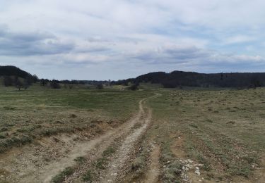
sandrine-s01

Offline

Randonnées

Randonnée V.T.T. Andert-et-Condon - Le serin puis Chavolay depuis Condon.  - Photo
V.T.T.
sandrine-s01

V.T.T.

Moyen
Andert-et-Condon, Auvergne-Rhône-Alpes, Ain, France
29 km | 37 km-effort
2h 30min
Non
Randonnée Marche Valserhône - Cuvéry Grange à Charpy - Photo
Marche
sandrine-s01

Marche

Très difficile
Valserhône, Auvergne-Rhône-Alpes, Ain, France
16,1 km | 21 km-effort
3h 14min
Oui
Randonnée V.T.T. Andert-et-Condon - Boissieu, Armaille, Thoys et Chailloux  - Photo
V.T.T.
sandrine-s01

V.T.T.

Moyen
Andert-et-Condon, Auvergne-Rhône-Alpes, Ain, France
28 km | 36 km-effort
2h 45min
Oui
Randonnée Marche Plateau d'Hauteville - La ferme Guichard  - Photo
Marche
sandrine-s01

Marche

Difficile
Plateau d'Hauteville, Auvergne-Rhône-Alpes, Ain, France
9,7 km | 14,2 km-effort
2h 28min
Oui
Randonnée V.T.T. Andert-et-Condon - Verupt puis la combe de Gevrin - Photo
V.T.T.
sandrine-s01

V.T.T.

Moyen
Andert-et-Condon, Auvergne-Rhône-Alpes, Ain, France
16 km | 21 km-effort
1h 31min
Non
Randonnée V.T.T. Andert-et-Condon - Armaille, Arboreaz, Chailloux  - Photo
V.T.T.
sandrine-s01

V.T.T.

Moyen
Andert-et-Condon, Auvergne-Rhône-Alpes, Ain, France
28 km | 35 km-effort
2h 35min
Oui
Randonnée V.T.T. Andert-et-Condon - A l’envers  - Photo
V.T.T.
sandrine-s01

V.T.T.

Difficile
Andert-et-Condon, Auvergne-Rhône-Alpes, Ain, France
28 km | 36 km-effort
1h 50min
Oui
Randonnée V.T.T. Andert-et-Condon - Tour d’armaille - Photo
V.T.T.
sandrine-s01

V.T.T.

Moyen
Andert-et-Condon, Auvergne-Rhône-Alpes, Ain, France
29 km | 37 km-effort
2h 7min
Oui
Randonnée Marche Valserhône - Cuvéry 1er/04/21 - Photo
Marche
sandrine-s01

Marche

Difficile
Valserhône, Auvergne-Rhône-Alpes, Ain, France
17,7 km | 25 km-effort
6h 33min
Oui
Randonnée V.T.T. Andert-et-Condon - Tour d’armaille et recherche sentier champs de tir  - Photo
V.T.T.
sandrine-s01

V.T.T.

Moyen
Andert-et-Condon, Auvergne-Rhône-Alpes, Ain, France
29 km | 38 km-effort
2h 50min
Oui
Randonnée Marche Haut Valromey - Cuvéry mars - Photo
Marche
sandrine-s01

Marche

Très facile
Haut Valromey, Auvergne-Rhône-Alpes, Ain, France
12,3 km | 15,4 km-effort
4h 15min
Non
Randonnée V.T.T. Andert-et-Condon - Vers St Anne et Armaille - Photo
V.T.T.
sandrine-s01

V.T.T.

Moyen
Andert-et-Condon, Auvergne-Rhône-Alpes, Ain, France
25 km | 32 km-effort
1h 59min
Oui
Randonnée V.T.T. Andert-et-Condon - Sous Gevrin et Chavillieu - Photo
V.T.T.
sandrine-s01

V.T.T.

Moyen
Andert-et-Condon, Auvergne-Rhône-Alpes, Ain, France
16,3 km | 20 km-effort
1h 35min
Oui
Randonnée V.T.T. Andert-et-Condon - Tour à  la dernière minute vers Chailloux  - Photo
V.T.T.
sandrine-s01

V.T.T.

Facile
Andert-et-Condon, Auvergne-Rhône-Alpes, Ain, France
23 km | 29 km-effort
1h 51min
Non
Randonnée Marche Corbonod - Boucle Sur Lyand - Photo
Marche
sandrine-s01

Marche

Très facile
Corbonod, Auvergne-Rhône-Alpes, Ain, France
13,3 km | 17,9 km-effort
4h 21min
Oui
Randonnée V.T.T. Andert-et-Condon - Chailloux , preveysieu et Egieu.  - Photo
V.T.T.
sandrine-s01

V.T.T.

Difficile
Andert-et-Condon, Auvergne-Rhône-Alpes, Ain, France
34 km | 50 km-effort
3h 21min
Oui
Randonnée Marche Arvière-en-Valromey - Brénaz - Photo
Marche
sandrine-s01

Marche

Très facile
Arvière-en-Valromey, Auvergne-Rhône-Alpes, Ain, France
12,2 km | 19 km-effort
4h 34min
Oui
Randonnée Moto Andert-et-Condon - Vers le col de la biche - Photo
Moto
sandrine-s01

Moto

Très facile
Andert-et-Condon, Auvergne-Rhône-Alpes, Ain, France
66 km | 87 km-effort
1h 43min
Oui
Randonnée V.T.T. Innimond - Innimond par le Molard - Photo
V.T.T.
sandrine-s01

V.T.T.

Moyen
Innimond, Auvergne-Rhône-Alpes, Ain, France
34 km | 46 km-effort
3h 3min
Non
Randonnée Course à pied Belley - Petite course et marche - Photo
Course à pied
sandrine-s01

Course à pied

Belley, Auvergne-Rhône-Alpes, Ain, France
3,9 km | 4,1 km-effort
38min
Oui
Randonnée Marche La Burbanche - Cascade de burbanche - Photo
Marche
sandrine-s01

Marche

Très facile
La Burbanche, Auvergne-Rhône-Alpes, Ain, France
1,6 km | 2,2 km-effort
28min
Oui

Fermer
Mes abonnements