baygonvert

Offline

Randonnées

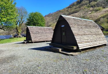
Randonnée Trail  - bridg - Photo
Trail
baygonvert

Trail

Très facile
, Écosse, Argyll and Bute, Royaume-Uni
37 km | 46 km-effort
3h 55min
Non
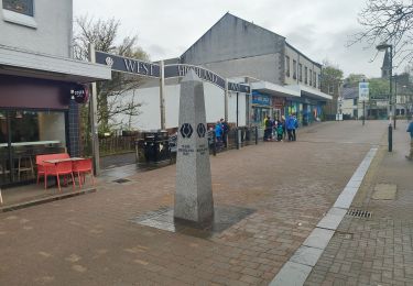
Randonnée Trail  - rowardennan - Beinglas farm - Photo
Trail
baygonvert

Trail

Très facile
, Écosse, Stirling, Royaume-Uni
23 km | 30 km-effort
3h 6min
Non
Randonnée Trail  - milngavie vers drymen - Photo
Trail
baygonvert

Trail

Très facile
, Écosse, East Dunbartonshire, Royaume-Uni
17,9 km | 22 km-effort
2h 0min
Non
Randonnée Avion Nice - Nice - Rome - Photo
Avion
baygonvert

Avion

Très facile
Nice, Provence-Alpes-Côte d'Azur, Alpes-Maritimes, France
506 km | 568 km-effort
59min
Non
Randonnée Avion Hallbergmoos - Munich Nice - Photo
Avion
baygonvert

Avion

Très facile
Hallbergmoos, Bavière, Landkreis Freising, Allemagne
734 km | 1493 km-effort
44min
Non
Randonnée Trail Coursegoules - puy de Tourettes  - Photo
Trail
baygonvert

Trail

Très facile
Coursegoules, Provence-Alpes-Côte d'Azur, Alpes-Maritimes, France
11 km | 16,8 km-effort
1h 53min
Non
Randonnée Avion Törökbálint - Budapest Nice - Photo
Avion
baygonvert

Avion

Très facile
Törökbálint, Hongrie centrale, Pest megye, Hongrie
1114 km | 0 m-effort
1h 38min
Non
Randonnée Trail Utelle - Brec d utelle - Photo
Trail
baygonvert

Trail

Facile
Utelle, Provence-Alpes-Côte d'Azur, Alpes-Maritimes, France
5,6 km | 13,5 km-effort
1h 18min
Non
Randonnée Trail Guillaumes - gorges dalui - Photo
Trail
baygonvert

Trail

Très facile
Guillaumes, Provence-Alpes-Côte d'Azur, Alpes-Maritimes, France
7 km | 13,8 km-effort
51min
Oui
Randonnée Trail Saint-Étienne-de-Tinée - lac de la clapiere - Photo
Trail
baygonvert

Trail

Difficile
Saint-Étienne-de-Tinée, Provence-Alpes-Côte d'Azur, Alpes-Maritimes, France
18,4 km | 39 km-effort
5h 9min
Oui
Randonnée Trail Fréjus - étang villepey plage de la gaillarde  - Photo
Trail
baygonvert

Trail

Très facile
Fréjus, Provence-Alpes-Côte d'Azur, Var, France
17,8 km | 21 km-effort
2h 23min
Oui
Randonnée Course à pied Allons - pic chamatte - colle basse - Photo
Course à pied
baygonvert

Course à pied

Facile
Allons, Provence-Alpes-Côte d'Azur, Alpes-de-Haute-Provence, France
13,1 km | 22 km-effort
2h 18min
Oui
Randonnée Marche Tanneron - tanneron-mimosa - Photo
Marche
baygonvert

Marche

Très difficile
Tanneron, Provence-Alpes-Côte d'Azur, Var, France
13,6 km | 19,9 km-effort
4h 26min
Oui
Randonnée Marche Entraunes - garret -cayolle  - Photo
Marche
baygonvert

Marche

Facile
Entraunes, Provence-Alpes-Côte d'Azur, Alpes-Maritimes, France
2,1 km | 4,8 km-effort
1h 36min
Non
Randonnée Trail Beuil - le Challans/les cluos/ giarons/ - Photo
Trail
baygonvert

Trail

Moyen
Beuil, Provence-Alpes-Côte d'Azur, Alpes-Maritimes, France
14,5 km | 27 km-effort
4h 17min
Oui
Randonnée Trail Le Fugeret - col Mélina via aurent. cabane p. grosse  - Photo
Trail
baygonvert

Trail

Moyen
Le Fugeret, Provence-Alpes-Côte d'Azur, Alpes-de-Haute-Provence, France
23 km | 43 km-effort
3h 38min
Oui
Randonnée Trail Saint-Cézaire-sur-Siagne - Pont des Tuves- st cezaire - Photo
Trail
baygonvert

Trail

Très facile
Saint-Cézaire-sur-Siagne, Provence-Alpes-Côte d'Azur, Alpes-Maritimes, France
12,2 km | 19,8 km-effort
2h 32min
Oui
Randonnée Trail Méailles - Canale de la vaire- meaille. retour hors sentier - Photo
Trail
baygonvert

Trail

Difficile
Méailles, Provence-Alpes-Côte d'Azur, Alpes-de-Haute-Provence, France
14,9 km | 28 km-effort
3h 41min
Non
Randonnée Trail Entraunes - couesto. oustaruma - Photo
Trail
baygonvert

Trail

Très facile
Entraunes, Provence-Alpes-Côte d'Azur, Alpes-Maritimes, France
14,1 km | 27 km-effort
2h 48min
Non
Randonnée Trail Gars - clue mujouls - Photo
Trail
baygonvert

Trail

Très facile
Gars, Provence-Alpes-Côte d'Azur, Alpes-Maritimes, France
2,2 km | 4 km-effort
2h 7min
Non
Randonnée Trail Roquestéron - orientation riou - Photo
Trail
baygonvert

Trail

Très facile
Roquestéron, Provence-Alpes-Côte d'Azur, Alpes-Maritimes, France
4,3 km | 5,6 km-effort
1h 8min
Non

Fermer
Mes abonnements