pierre45

Offline

Randonnées

Randonnée A pied Molines-en-Queyras - Fontgillarde - Photo
A pied
pierre45

A pied

Facile
Molines-en-Queyras, Provence-Alpes-Côte d'Azur, Hautes-Alpes, France
9,2 km | 14 km-effort
4h 28min
Oui
Randonnée A pied Château-Ville-Vieille - Chateau Queyras - Lac de Roue - Souliers - Photo
A pied
pierre45

A pied

Facile
Château-Ville-Vieille, Provence-Alpes-Côte d'Azur, Hautes-Alpes, France
5,5 km | 11,1 km-effort
2h 31min
Non
Randonnée A pied Château-Ville-Vieille - Souliers-1 - Photo
A pied
pierre45

A pied

Facile
Château-Ville-Vieille, Provence-Alpes-Côte d'Azur, Hautes-Alpes, France
7,7 km | 11 km-effort
2h 29min
Oui
Randonnée A pied Saint-Jean-le-Thomas - Saint-jean-le-thomas-Terre-Mer - Photo
A pied
pierre45

A pied

Facile
Saint-Jean-le-Thomas, Normandie, Manche, France
14,8 km | 18,4 km-effort
4h 11min
Oui
Randonnée A pied Granville - Chausey - Photo
A pied
pierre45

A pied

Facile
Granville, Normandie, Manche, France
5,9 km | 6,6 km-effort
1h 29min
Oui
Randonnée Marche Garrigues-Sainte-Eulalie - Olivier - Photo
Marche
pierre45

Marche

Facile
Garrigues-Sainte-Eulalie, Occitanie, Gard, France
726 m | 819 m-effort
6min
Non
Randonnée Marche Moulézan - Fons outre gardon - Photo
Marche
pierre45

Marche

Facile
Moulézan, Occitanie, Gard, France
3 km | 3,9 km-effort
1h 19min
Oui
Randonnée Marche Montaren-et-Saint-Médiers - montaren  - Photo
Marche
pierre45

Marche

Facile
Montaren-et-Saint-Médiers, Occitanie, Gard, France
4 km | 5,1 km-effort
1h 20min
Oui
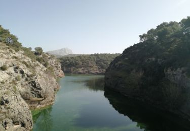
Randonnée Marche Le Tholonet - Le Tholonet, barrage zola, barrage bimont, barrage romain - Photo
Marche
pierre45

Marche

Moyen
Le Tholonet, Provence-Alpes-Côte d'Azur, Bouches-du-Rhône, France
9,6 km | 15,1 km-effort
3h 43min
Oui
Randonnée A pied Sébrazac - 202011-Estaing-Golinhac-GorgesDuLot - Photo
A pied
pierre45

A pied

Difficile
Sébrazac, Occitanie, Aveyron, France
23 km | 33 km-effort
Inconnu
Non
Randonnée A pied Castelnau-de-Mandailles - 202011-CastelanauDeMandailles - Photo
A pied
pierre45

A pied

Moyen
Castelnau-de-Mandailles, Occitanie, Aveyron, France
17,6 km | 26 km-effort
Inconnu
Non
Randonnée A pied Sébrazac - 202011-verrières-sébrazac - Photo
A pied
pierre45

A pied

Moyen
Sébrazac, Occitanie, Aveyron, France
13,8 km | 21 km-effort
Inconnu
Oui
Randonnée A pied Le Cayrol - 22011-Cayrol-bonneval - Photo
A pied
pierre45

A pied

Moyen
Le Cayrol, Occitanie, Aveyron, France
14,2 km | 20 km-effort
Inconnu
Oui
Randonnée A pied Pomayrols - 202011-Bonanace-Pomayrols - Photo
A pied
pierre45

A pied

Moyen
Pomayrols, Occitanie, Aveyron, France
16,8 km | 25 km-effort
Inconnu
Oui
Randonnée A pied Saint-Chély-d'Aubrac - CDC-3 - Photo
A pied
pierre45

A pied

Facile
Saint-Chély-d'Aubrac, Occitanie, Aveyron, France
21 km | 28 km-effort
4h 0min
Non
Randonnée A pied Nasbinals - CDC-2 - Photo
A pied
pierre45

A pied

Facile
Nasbinals, Occitanie, Lozère, France
16,4 km | 21 km-effort
4h 0min
Non
Randonnée A pied Peyre en Aubrac - CDC-1 - Photo
A pied
pierre45

A pied

Facile
Peyre en Aubrac, Occitanie, Lozère, France
19,1 km | 24 km-effort
5h 0min
Non
Randonnée A pied Amfreville-sous-les-Monts - Senneville - Photo
A pied
pierre45

A pied

Facile
Amfreville-sous-les-Monts, Normandie, Eure, France
4,6 km | 6,3 km-effort
1h 30min
Oui
Randonnée A pied Cauterets - Lourdes-j1 - Photo
A pied
pierre45

A pied

Difficile
Cauterets, Occitanie, Hautes-Pyrénées, France
13,7 km | 30 km-effort
5h 0min
Non
Randonnée A pied Gavarnie-Gèdre - Lourdes-j2 - Photo
A pied
pierre45

A pied

Difficile
Gavarnie-Gèdre, Occitanie, Hautes-Pyrénées, France
20 km | 33 km-effort
6h 0min
Non
Randonnée A pied Aragnouet - Neouvielle-J3 - Photo
A pied
pierre45

A pied

Difficile
Aragnouet, Occitanie, Hautes-Pyrénées, France
6,6 km | 19,3 km-effort
6h 30min
Oui

Fermer
Mes abonnements