jll7513

Offline

Randonnées

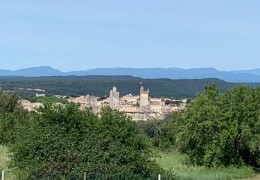
Randonnée Marche Saint-Côme-et-Maruéjols - Saint Côme, boucle par Oppidum de Mauressip et décollage parapente - Photo
Marche
jll7513

Marche

Facile
(1)
Saint-Côme-et-Maruéjols, Occitanie, Gard, France
11,5 km | 14,5 km-effort
3h 17min
Oui
Randonnée Marche Saint-Maximin - Saint Maximin, boucle  par Saint Siffret - Photo
Marche
jll7513

Marche

Facile
Saint-Maximin, Occitanie, Gard, France
12,7 km | 15,7 km-effort
3h 30min
Oui
Randonnée Marche Nîmes - NÎMES. Petite boucle sur les Hauts de Nîmes - Photo
Marche
jll7513

Marche

Facile
Nîmes, Occitanie, Gard, France
7,3 km | 8,9 km-effort
1h 35min
Oui
Randonnée Marche Nîmes - NÎMES. Boucle quartier Montaury par le Cadereau et le bois des Espeisse - Photo
Marche
jll7513

Marche

Moyen
Nîmes, Occitanie, Gard, France
7,8 km | 9,1 km-effort
2h 3min
Oui
Randonnée Marche Nîmes - POULX Boucle du Mas de Font Froide Nord Marguerittes Mas de Cabrières - Photo
Marche
jll7513

Marche

Facile
Nîmes, Occitanie, Gard, France
10 km | 12,6 km-effort
2h 19min
Oui
Randonnée Marche Martigues - Boucle CARRO LA COURONNE CARRO - Photo
Marche
jll7513

Marche

Très facile
(1)
Martigues, Provence-Alpes-Côte d'Azur, Bouches-du-Rhône, France
11,4 km | 12,9 km-effort
2h 56min
Oui
Randonnée Marche Le Puy-Sainte-Réparade - MESSIDOR DIGUE DE VAUCLAIRE - Photo
Marche
jll7513

Marche

Difficile
Le Puy-Sainte-Réparade, Provence-Alpes-Côte d'Azur, Bouches-du-Rhône, France
15,5 km | 17,1 km-effort
3h 48min
Oui
Randonnée Marche La Calmette - La Calmette - Nîmes Avenue Pompidou - Photo
Marche
jll7513

Marche

Difficile
La Calmette, Occitanie, Gard, France
16,9 km | 19,4 km-effort
4h 3min
Non
Randonnée A pied Nîmes - Nîmes à Saint Gilles par GR 700 - Photo
A pied
jll7513

A pied

Moyen
Nîmes, Occitanie, Gard, France
36 km | 39 km-effort
Inconnu
Non
Randonnée Marche La Calmette - La Calmette au Pont St Nicolas par GR6 et GR63 - Photo
Marche
jll7513

Marche

Très difficile
La Calmette, Occitanie, Gard, France
16,7 km | 22 km-effort
9h 10min
Non
Randonnée Marche Saint-Jeannet - St Jeannet Chateau Bresson Gros Chêne St Jeannet - Photo
Marche
jll7513

Marche

Moyen
Saint-Jeannet, Provence-Alpes-Côte d'Azur, Alpes-Maritimes, France
7 km | 12,7 km-effort
2h 33min
Oui
Randonnée Course à pied Nîmes - Nîmes Pompidou Arénas La Fontaine - Photo
Course à pied
jll7513

Course à pied

Très facile
Nîmes, Occitanie, Gard, France
6,9 km | 7,9 km-effort
45min
Oui
Randonnée Marche Lurs - Lurs à St Michel L'Obervatoire Chemin de Compostelle - Photo
Marche
jll7513

Marche

Très difficile
Lurs, Provence-Alpes-Côte d'Azur, Alpes-de-Haute-Provence, France
32 km | 42 km-effort
8h 58min
Non
Randonnée Marche Châteauneuf-Val-Saint-Donat - Chateau Neuf Val St Donnat à Lurs Chemin de Compostelle - Photo
Marche
jll7513

Marche

Très difficile
Châteauneuf-Val-Saint-Donat, Provence-Alpes-Côte d'Azur, Alpes-de-Haute-Provence, France
27 km | 38 km-effort
8h 5min
Non
Randonnée Course à pied Limans - Camping Naturiste Les Lauzons Limans boucle par Les Vignes - Photo
Course à pied
jll7513

Course à pied

Très facile
Limans, Provence-Alpes-Côte d'Azur, Alpes-de-Haute-Provence, France
6,9 km | 9,3 km-effort
Inconnu
Oui
Randonnée Marche Sisteron - Sisteron à Chateau Neuf Val St Donat Chemin de Compostelle - Photo
Marche
jll7513

Marche

Très difficile
Sisteron, Provence-Alpes-Côte d'Azur, Alpes-de-Haute-Provence, France
22 km | 34 km-effort
7h 2min
Non
Randonnée A pied La Motte-du-Caire - La Motte du Caïre à Sisteron Chemin de Compostelle - Photo
A pied
jll7513

A pied

Très facile
La Motte-du-Caire, Provence-Alpes-Côte d'Azur, Alpes-de-Haute-Provence, France
37 km | 54 km-effort
Inconnu
Non
Randonnée Marche Tallard - Tallard à La Mothe du Caïre Chemin de Compostelle - Photo
Marche
jll7513

Marche

Très difficile
Tallard, Provence-Alpes-Côte d'Azur, Hautes-Alpes, France
25 km | 38 km-effort
7h 55min
Non
Randonnée Marche Chorges - Chorges Mongardin Le Pallier Chorges  - Photo
Marche
jll7513

Marche

Moyen
Chorges, Provence-Alpes-Côte d'Azur, Hautes-Alpes, France
11,7 km | 16,4 km-effort
2h 39min
Oui
Randonnée Marche Gap - Gap à Tallard Chemin de Compostelle - Photo
Marche
jll7513

Marche

Très difficile
Gap, Provence-Alpes-Côte d'Azur, Hautes-Alpes, France
16,9 km | 23 km-effort
4h 52min
Non
Randonnée Marche Châteauvieux - Tallard à La Mothe du Caïre Chemin de Compostelle - Photo
Marche
jll7513

Marche

Très difficile
Châteauvieux, Provence-Alpes-Côte d'Azur, Hautes-Alpes, France
27 km | 40 km-effort
8h 25min
Non

Fermer
Mes abonnements