![](/images/other/stat-length.png)
![Randonnée Marche Sainte-Eulalie - Les princes Suc de Sara - Photo](https://media.geolcdn.com/t/1900/400/ext.pjpeg?maxdim=2&url=https%3A%2F%2Fstatic1.geolcdn.com%2Fsiteimages%2Fupload%2Ffiles%2F1553511878bg_sport_marche.png)
Les princes Suc de Sara
jdelettrez
Utilisateur
![Longueur](/images/other/stat-length.png)
![Altitude max](https://static1.geolcdn.com/siteimages/upload/files/1508320355ic_sort_altitude_max_24dp.png)
![Dénivelé positif](https://static1.geolcdn.com/siteimages/upload/files/1508320355ic_sort_den_pos_24dp.png)
![Km-Effort](/images/other/stat-length.png)
![Altitude min](https://static1.geolcdn.com/siteimages/upload/files/1508320355ic_sort_altitude_min_24dp.png)
![Dénivelé négatif](https://static1.geolcdn.com/siteimages/upload/files/1508320355ic_sort_den_neg_24dp.png)
![Boucle](https://static1.geolcdn.com/siteimages/upload/files/16400158638029165_repeat_loop_refresh_sync_direction_icon.png)
![Marche](https://static1.geolcdn.com/sitytour/trail-icons/101.png)
4h31
Difficulté : Difficile
![Scannez ce code QR pour ouvrir la randonnée dans l'application SityTrail](https://capi.geolives.com/qq0zvz2zws4bq2lad0pu/sitytour/trails/823444/qr.png?size=200)
Application GPS de randonnée GRATUITE
À propos
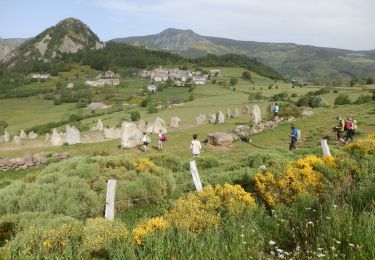
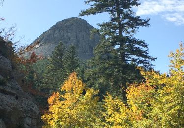
Randonnée Marche de 12,3 km à découvrir à Auvergne-Rhône-Alpes, Ardèche, Sainte-Eulalie. Cette randonnée est proposée par jdelettrez.
Description
Randonnee sportive
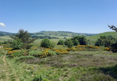
Le sentier de départ est marqué mais en assez mauvais état jusqu’à la Riballasse ou l'on trouve une vraie piste.
La montée à partir de Pradal n'est pas balisée mais on voit la trace sur le terrain.
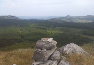
Puis on arrive sur un sentier bien marqué.
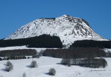
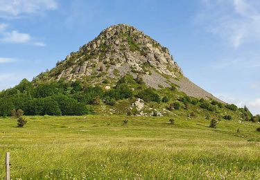
Arrivée à un col on monte nord nord est pour rejoindre le suc sara
commentaire Daniel randogps
Localisation
Commentaires
Randonnées à proximité
![Randonnée Marche Cros-de-Géorand - Le Béage -Tour des Sucs 15km - Photo](https://media.geolcdn.com/t/375/260/6453586f-359e-4cec-ac7d-b8d2edfcbed0.jpg&format=jpg&maxdim=2)
![Marche Marche](https://static1.geolcdn.com/sitytour/trail-icons/101.png)
Marche
![](/images/other/stat-length.png)
![](https://static1.geolcdn.com/siteimages/upload/files/16400158638029165_repeat_loop_refresh_sync_direction_icon.png)
![Randonnée Marche Le Béage - suc du montfol et lauzière - Photo](https://media.geolcdn.com/t/375/260/d7f86ecc-e74b-4b11-a732-571b54443e1e.jpg&format=jpg&maxdim=2)
![Marche Marche](https://static1.geolcdn.com/sitytour/trail-icons/101.png)
Marche
![](/images/other/stat-length.png)
![](https://static1.geolcdn.com/siteimages/upload/files/16400158638029165_repeat_loop_refresh_sync_direction_icon.png)
![Randonnée Marche Sagnes-et-Goudoulet - Les Coux-Sagnes-Tour à Eau 14km - Photo](https://media.geolcdn.com/t/375/260/7bfff9d7-91a3-4852-a6bf-dd6f46240ce8.jpg&format=jpg&maxdim=2)
![Marche Marche](https://static1.geolcdn.com/sitytour/trail-icons/101.png)
Marche
![](/images/other/stat-length.png)
![](https://static1.geolcdn.com/siteimages/upload/files/16400158638029165_repeat_loop_refresh_sync_direction_icon.png)
![Randonnée Marche Borée - Borée Mézenc Croix Boutieres 26km - Photo](https://media.geolcdn.com/t/375/260/cc287dcb-1e8d-4076-b943-e2b204dd23b4.jpg&format=jpg&maxdim=2)
![Marche Marche](https://static1.geolcdn.com/sitytour/trail-icons/101.png)
Marche
![](/images/other/stat-length.png)
![](https://static1.geolcdn.com/siteimages/upload/files/16400158638029165_repeat_loop_refresh_sync_direction_icon.png)
![Marche Marche](https://static1.geolcdn.com/sitytour/trail-icons/101.png)
Marche
![](/images/other/stat-length.png)
![](https://static1.geolcdn.com/siteimages/upload/files/16400158638029165_repeat_loop_refresh_sync_direction_icon.png)
![Randonnée Marche Saint-Andéol-de-Fourchades - Boucle de la ferme de Bourdalier à Sagnes-et-Gourdoulet - Photo](https://media.geolcdn.com/t/375/260/31c1868a-b2a8-47e4-b863-8b44b5da618e.jpg&format=jpg&maxdim=2)
![Marche Marche](https://static1.geolcdn.com/sitytour/trail-icons/101.png)
Marche
![](/images/other/stat-length.png)
![](https://static1.geolcdn.com/siteimages/upload/files/16400158638029165_repeat_loop_refresh_sync_direction_icon.png)
![Randonnée Marche Borée - Le tour du Mont Mézenc en Ardèche - Photo](https://media.geolcdn.com/t/375/260/970aece0-8ccf-44ea-bc9f-1d6489c7e0aa.jpg&format=jpg&maxdim=2)
![Marche Marche](https://static1.geolcdn.com/sitytour/trail-icons/101.png)
Marche
![](/images/other/stat-length.png)
![](https://static1.geolcdn.com/siteimages/upload/files/16400158638029165_repeat_loop_refresh_sync_direction_icon.png)
![Randonnée Marche Sainte-Eulalie - Sucs Montfol et La Lauzière 11km. - Photo](https://media.geolcdn.com/t/375/260/23607b52-b0d6-4888-813e-934a0c1347d5.jpg&format=jpg&maxdim=2)
![Marche Marche](https://static1.geolcdn.com/sitytour/trail-icons/101.png)
Marche
![](/images/other/stat-length.png)
![](https://static1.geolcdn.com/siteimages/upload/files/16400158638029165_repeat_loop_refresh_sync_direction_icon.png)
![Randonnée Marche Saint-Martial - Gerbier Sentier botanique 14km. - Photo](https://media.geolcdn.com/t/375/260/908a31be-ec11-4c97-9939-f22f3cd5b90e.jpg&format=jpg&maxdim=2)
![Marche Marche](https://static1.geolcdn.com/sitytour/trail-icons/101.png)
Marche
![](/images/other/stat-length.png)
![](https://static1.geolcdn.com/siteimages/upload/files/16400158638029165_repeat_loop_refresh_sync_direction_icon.png)