![](/images/other/stat-length.png)
![Randonnée Marche Sainte-Eulalie - sources de la loire - Photo](https://media.geolcdn.com/t/1900/400/ext.pjpeg?maxdim=2&url=https%3A%2F%2Fstatic1.geolcdn.com%2Fsiteimages%2Fupload%2Ffiles%2F1553511878bg_sport_marche.png)
sources de la loire
patetl
Utilisateur
![Longueur](/images/other/stat-length.png)
Longueur
4,3 km
![Altitude max](https://static1.geolcdn.com/siteimages/upload/files/1508320355ic_sort_altitude_max_24dp.png)
Altitude max
1526 m
![Dénivelé positif](https://static1.geolcdn.com/siteimages/upload/files/1508320355ic_sort_den_pos_24dp.png)
Dénivelé positif
168 m
![Km-Effort](/images/other/stat-length.png)
Km-Effort
6,6 km
![Altitude min](https://static1.geolcdn.com/siteimages/upload/files/1508320355ic_sort_altitude_min_24dp.png)
Altitude min
1355 m
![Dénivelé négatif](https://static1.geolcdn.com/siteimages/upload/files/1508320355ic_sort_den_neg_24dp.png)
Dénivelé négatif
170 m
![Boucle](https://static1.geolcdn.com/siteimages/upload/files/16400158638029165_repeat_loop_refresh_sync_direction_icon.png)
Boucle
Non
Date de création :
2024-06-01 08:28:17.965
Dernière modification :
2024-06-01 11:43:23.168
![Marche](https://static1.geolcdn.com/sitytour/trail-icons/101.png)
3h14
Difficulté : Moyen
![Scannez ce code QR pour ouvrir la randonnée dans l'application SityTrail](https://capi.geolives.com/qq0zvz2zws4bq2lad0pu/sitytour/trails/4075695/qr.png?size=200)
Application GPS de randonnée GRATUITE
À propos
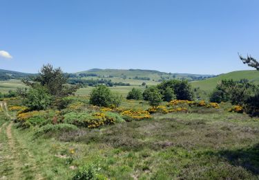
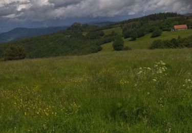
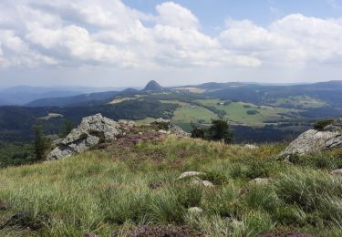
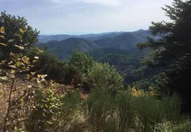
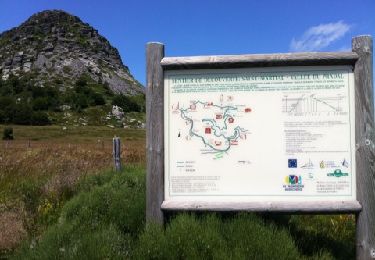
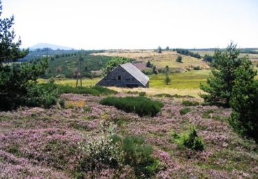
Randonnée Marche de 4,3 km à découvrir à Auvergne-Rhône-Alpes, Ardèche, Sainte-Eulalie. Cette randonnée est proposée par patetl.
Description
petit circuit avec ascension du mont gerbier de jonc et sources de la Loire ( véritable, authentique et géographique).
Localisation
Pays :
France
Région :
Auvergne-Rhône-Alpes
Département/Province :
Ardèche
Commune :
Sainte-Eulalie
Localité :
Unknown
Départ:(Dec)
Départ:(UTM)
596456 ; 4966078 (31T) N.
Commentaires
Randonnées à proximité
![Randonnée Marche Sagnes-et-Goudoulet - Les Coux-Sagnes-Tour à Eau 14km - Photo](https://media.geolcdn.com/t/375/260/ext.jpg?maxdim=2&url=https%3A%2F%2Fmedia.geolcdn.com%2Ff%2F7bfff9d7-91a3-4852-a6bf-dd6f46240ce8.jpg)
![Marche Marche](https://static1.geolcdn.com/sitytour/trail-icons/101.png)
Les Coux-Sagnes-Tour à Eau 14km
Marche
Moyen
Sagnes-et-Goudoulet,
Auvergne-Rhône-Alpes,
Ardèche,
France
![](/images/other/stat-length.png)
14,1 km | 19,4 km-effort
5h 42min
![](https://static1.geolcdn.com/siteimages/upload/files/16400158638029165_repeat_loop_refresh_sync_direction_icon.png)
Oui
![Randonnée Marche Lachamp-Raphaël - 07 lachamp Raphaël orga 10.06.23 - Photo](https://media.geolcdn.com/t/375/260/ext.jpg?maxdim=2&url=https%3A%2F%2Fmedia.geolcdn.com%2Ff%2F07456a0b-3bda-48f2-bd40-fb46d8070303.jpg)
![Marche Marche](https://static1.geolcdn.com/sitytour/trail-icons/101.png)
07 lachamp Raphaël orga 10.06.23
Marche
Moyen
Lachamp-Raphaël,
Auvergne-Rhône-Alpes,
Ardèche,
France
![](/images/other/stat-length.png)
18 km | 27 km-effort
5h 39min
![](https://static1.geolcdn.com/siteimages/upload/files/16400158638029165_repeat_loop_refresh_sync_direction_icon.png)
Non
![Randonnée Marche Saint-Martial - Sucs de Montfol et de La Lauziere 11km - Photo](https://media.geolcdn.com/t/375/260/ext.jpg?maxdim=2&url=https%3A%2F%2Fmedia.geolcdn.com%2Ff%2Ffd91bba3-da8c-4cb2-aef6-1d2d0c70297e.jpg)
![Marche Marche](https://static1.geolcdn.com/sitytour/trail-icons/101.png)
Sucs de Montfol et de La Lauziere 11km
Marche
Moyen
Saint-Martial,
Auvergne-Rhône-Alpes,
Ardèche,
France
![](/images/other/stat-length.png)
10,6 km | 15,4 km-effort
4h 34min
![](https://static1.geolcdn.com/siteimages/upload/files/16400158638029165_repeat_loop_refresh_sync_direction_icon.png)
Oui
![Randonnée Marche Saint-Martial - Gerbier de Jonc par St Martial - Photo](https://media.geolcdn.com/t/375/260/ext.jpg?maxdim=2&url=https%3A%2F%2Fmedia.geolcdn.com%2Ff%2Fbf6aa23c-efb6-4436-b5ba-bc824d16f50f.jpg)
![Marche Marche](https://static1.geolcdn.com/sitytour/trail-icons/101.png)
Gerbier de Jonc par St Martial
Marche
(1)
Saint-Martial,
Auvergne-Rhône-Alpes,
Ardèche,
France
![](/images/other/stat-length.png)
9,2 km | 16,3 km-effort
3h 59min
![](https://static1.geolcdn.com/siteimages/upload/files/16400158638029165_repeat_loop_refresh_sync_direction_icon.png)
Non
![Randonnée Marche Borée - bonnefoy les sucs - Photo](https://media.geolcdn.com/t/375/260/ext.jpg?maxdim=2&url=https%3A%2F%2Fstatic1.geolcdn.com%2Fsiteimages%2Fupload%2Ffiles%2F1553511878bg_sport_marche.png)
![Marche Marche](https://static1.geolcdn.com/sitytour/trail-icons/101.png)
bonnefoy les sucs
Marche
Moyen
(1)
Borée,
Auvergne-Rhône-Alpes,
Ardèche,
France
![](/images/other/stat-length.png)
13,4 km | 0 m-effort
4h 20min
![](https://static1.geolcdn.com/siteimages/upload/files/16400158638029165_repeat_loop_refresh_sync_direction_icon.png)
Oui
![Randonnée Marche Sainte-Eulalie - balade Gerbier de joncs - Photo](https://media.geolcdn.com/t/375/260/ext.jpg?maxdim=2&url=https%3A%2F%2Fstatic1.geolcdn.com%2Fsiteimages%2Fupload%2Ffiles%2F1553511878bg_sport_marche.png)
![Marche Marche](https://static1.geolcdn.com/sitytour/trail-icons/101.png)
balade Gerbier de joncs
Marche
Facile
(1)
Sainte-Eulalie,
Auvergne-Rhône-Alpes,
Ardèche,
France
![](/images/other/stat-length.png)
8,1 km | 10 km-effort
2h 8min
![](https://static1.geolcdn.com/siteimages/upload/files/16400158638029165_repeat_loop_refresh_sync_direction_icon.png)
Oui
![Randonnée Marche Sainte-Eulalie - Gerbier de jonc - Photo](https://media.geolcdn.com/t/375/260/ext.jpg?maxdim=2&url=https%3A%2F%2Fservices.sitytrail.com%2FGeolivesWS%2FDownloadMedia.ashx%3FTrailID%3D141830%26Media%3D20120711135532.jpg)
![Marche Marche](https://static1.geolcdn.com/sitytour/trail-icons/101.png)
Gerbier de jonc
Marche
Moyen
Sainte-Eulalie,
Auvergne-Rhône-Alpes,
Ardèche,
France
![](/images/other/stat-length.png)
16,7 km | 24 km-effort
3h 59min
![](https://static1.geolcdn.com/siteimages/upload/files/16400158638029165_repeat_loop_refresh_sync_direction_icon.png)
Oui
![Randonnée Cheval Sainte-Eulalie - Boucle Le Bouteirou - Mont Gerbier de Jonc - Etape 2 - Photo](https://media.geolcdn.com/t/375/260/ext.jpg?maxdim=2&url=https%3A%2F%2Fservices.sitytrail.com%2FGeolivesWS%2FDownloadMedia.ashx%3FTrailID%3D103194%26Media%3D5041_4.jpg)
![Cheval Cheval](https://static1.geolcdn.com/sitytour/trail-icons/300.png)
Boucle Le Bouteirou - Mont Gerbier de Jonc - Etape 2
Cheval
Moyen
Sainte-Eulalie,
Auvergne-Rhône-Alpes,
Ardèche,
France
![](/images/other/stat-length.png)
25 km | 32 km-effort
4h 0min
![](https://static1.geolcdn.com/siteimages/upload/files/16400158638029165_repeat_loop_refresh_sync_direction_icon.png)
Non
![Randonnée V.T.T. Sainte-Eulalie - Boucle Le Bouteirou - Mont Gerbier de Jonc - Etape 2 - Photo](https://media.geolcdn.com/t/375/260/ext.jpg?maxdim=2&url=https%3A%2F%2Fservices.sitytrail.com%2FGeolivesWS%2FDownloadMedia.ashx%3FTrailID%3D103193%26Media%3D5041_4.jpg)
![V.T.T. V.T.T.](https://static1.geolcdn.com/sitytour/trail-icons/202.png)
Boucle Le Bouteirou - Mont Gerbier de Jonc - Etape 2
V.T.T.
Moyen
Sainte-Eulalie,
Auvergne-Rhône-Alpes,
Ardèche,
France
![](/images/other/stat-length.png)
25 km | 32 km-effort
2h 30min
![](https://static1.geolcdn.com/siteimages/upload/files/16400158638029165_repeat_loop_refresh_sync_direction_icon.png)
Non