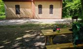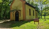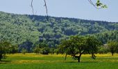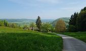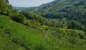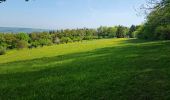

Reco Rando CLAS du 09/05/2024

boubou68
Utilisateur

Longueur
18,9 km

Altitude max
828 m

Dénivelé positif
709 m

Km-Effort
28 km

Altitude min
398 m

Dénivelé négatif
706 m
Boucle
Oui
Date de création :
2024-04-30 06:02:00.638
Dernière modification :
2024-04-30 11:45:26.094
3h54
Difficulté : Très difficile

Application GPS de randonnée GRATUITE
À propos
Randonnée Marche de 18,9 km à découvrir à Grand Est, Haut-Rhin, Wolschwiller. Cette randonnée est proposée par boubou68.
Description
Très belle rando....variante incluse qui mérite une nouvelle trace pour le canyon de Biederthal
Localisation
Pays :
France
Région :
Grand Est
Département/Province :
Haut-Rhin
Commune :
Wolschwiller
Localité :
Unknown
Départ:(Dec)
Départ:(UTM)
380061 ; 5257712 (32T) N.
Commentaires
Randonnées à proximité
JD 15/20 Pedibus Biederthal


Marche
(1)
Biederthal,
Grand Est,
Haut-Rhin,
France

8,2 km | 11,4 km-effort
2h 33min
Oui
sortie vtt 14082024


Vélo électrique
Facile
Bouxwiller,
Grand Est,
Haut-Rhin,
France

41 km | 50 km-effort
2h 55min
Oui
Rando 05/07/2024


Marche
Difficile
Wolschwiller,
Grand Est,
Haut-Rhin,
France

11,7 km | 17,5 km-effort
3h 15min
Oui
Rando CLAS du 09/05/202..par PBo


Marche
Très difficile
Wolschwiller,
Grand Est,
Haut-Rhin,
France

20 km | 30 km-effort
4h 24min
Oui
Le sentier des douaniers - Wolschwiller


Marche
Moyen
(1)
Wolschwiller,
Grand Est,
Haut-Rhin,
France

12,2 km | 18,1 km-effort
3h 30min
Oui
rdpr 20200929 lutter


Marche
Difficile
Lutter,
Grand Est,
Haut-Rhin,
France

15,8 km | 23 km-effort
4h 52min
Oui
wolschwiller


Marche
Facile
Wolschwiller,
Grand Est,
Haut-Rhin,
France

7,3 km | 12,7 km-effort
4h 15min
Non

Bouxwiller Doubs Franche Montagne


Cheval
Difficile
(1)
Bouxwiller,
Grand Est,
Haut-Rhin,
France

104 km | 146 km-effort
18h 22min
Non
randonnée au départ d'Oltingue chapelle St Martin


Marche
Difficile
Oltingue,
Grand Est,
Haut-Rhin,
France

13,4 km | 18,2 km-effort
3h 25min
Oui


 SityTrail


