![](/images/other/stat-length.png)
![Randonnée Marche Heers - Le château de Bovelingen et son allée rouge à Heers - Photo](https://media.geolcdn.com/t/1900/400/7cb2b15e-fb97-4cca-9bad-46eea7191277.jpeg&format=pjpeg&maxdim=2)
Le château de Bovelingen et son allée rouge à Heers
Benjamin27
Utilisateur GUIDE
![Longueur](/images/other/stat-length.png)
![Altitude max](https://static1.geolcdn.com/siteimages/upload/files/1508320355ic_sort_altitude_max_24dp.png)
![Dénivelé positif](https://static1.geolcdn.com/siteimages/upload/files/1508320355ic_sort_den_pos_24dp.png)
![Km-Effort](/images/other/stat-length.png)
![Altitude min](https://static1.geolcdn.com/siteimages/upload/files/1508320355ic_sort_altitude_min_24dp.png)
![Dénivelé négatif](https://static1.geolcdn.com/siteimages/upload/files/1508320355ic_sort_den_neg_24dp.png)
![Boucle](https://static1.geolcdn.com/siteimages/upload/files/16400158638029165_repeat_loop_refresh_sync_direction_icon.png)
![Marche](https://static1.geolcdn.com/sitytour/trail-icons/101.png)
44m
Difficulté : Facile
![Scannez ce code QR pour ouvrir la randonnée dans l'application SityTrail](https://capi.geolives.com/qq0zvz2zws4bq2lad0pu/sitytour/trails/3350268/qr.png?size=200)
Application GPS de randonnée GRATUITE
À propos
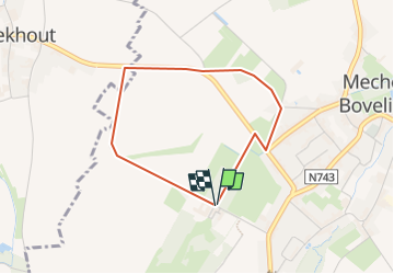
Randonnée Marche de 2,9 km à découvrir à Flandre, Limbourg, Heers. Cette randonnée est proposée par Benjamin27.
Description
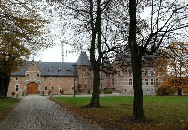
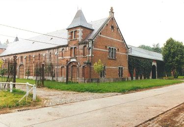
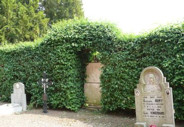
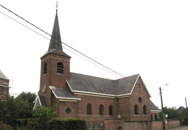
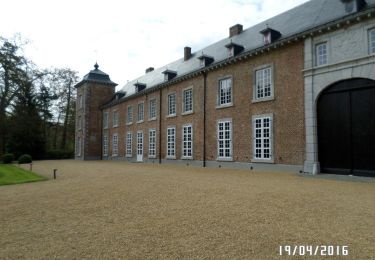
Paysages hesbignons typiques. Promenade agréable entre château, vergers, champs et bois.
👣 Distance : 3km - balisage flèche jaune.
📍 Départ : se garer dans Altenastraat à 3870 Heers au croisement avec « rode dreef ».
🚂🚍 Aller à la gare de Waremme, prendre le bus DE LIJN 37 jusqu’à l’arrêt « Mechelen-Bovelingen Steegske » et marcher 15 minutes jusqu’au départ.
Localisation
Commentaires
Randonnées à proximité
![Randonnée Marche Saint-Trond - Aalst Dorp - Photo](https://media.geolcdn.com/t/375/260/ext.jpg?maxdim=2&url=https%3A%2F%2Fservices.sitytrail.com%2FGeolivesWS%2FDownloadMedia.ashx%3FTrailID%3D238221%26Media%3Dfix__20131125132034.jpg)
![Marche Marche](https://static1.geolcdn.com/sitytour/trail-icons/101.png)
Marche
![](/images/other/stat-length.png)
![](https://static1.geolcdn.com/siteimages/upload/files/16400158638029165_repeat_loop_refresh_sync_direction_icon.png)
![Randonnée Marche Waremme - Lantremange - Photo](https://media.geolcdn.com/t/375/260/ext.jpg?maxdim=2&url=https%3A%2F%2Fstatic1.geolcdn.com%2Fsiteimages%2Fupload%2Ffiles%2F1553511878bg_sport_marche.png)
![Marche Marche](https://static1.geolcdn.com/sitytour/trail-icons/101.png)
![Randonnée A pied Saint-Trond - Cicindria Kerkom blauwe ruit - Photo](https://media.geolcdn.com/t/375/260/06861b0c-4bb0-4416-ae39-787d2bf09bca.jpeg&format=jpg&maxdim=2)
![A pied A pied](https://static1.geolcdn.com/sitytour/trail-icons/100.png)
A pied
![](/images/other/stat-length.png)
![](https://static1.geolcdn.com/siteimages/upload/files/16400158638029165_repeat_loop_refresh_sync_direction_icon.png)
![Randonnée A pied Heers - Hornbos Groen - Photo](https://media.geolcdn.com/t/375/260/504e6508-a890-4ba4-87e9-eb16d6acfb97.jpeg&format=jpg&maxdim=2)
![A pied A pied](https://static1.geolcdn.com/sitytour/trail-icons/100.png)
![Randonnée A pied Saint-Trond - Groot-Gelmen oranje bol - Photo](https://media.geolcdn.com/t/375/260/e3c1a60f-45b7-489f-b886-f877e1eeeb3d.jpeg&format=jpg&maxdim=2)
![A pied A pied](https://static1.geolcdn.com/sitytour/trail-icons/100.png)
A pied
![](/images/other/stat-length.png)
![](https://static1.geolcdn.com/siteimages/upload/files/16400158638029165_repeat_loop_refresh_sync_direction_icon.png)
![Randonnée A pied Saint-Trond - Gelinden rode driehoek - Photo](https://media.geolcdn.com/t/375/260/dc0c05ae-7bd4-4447-94f8-784a4fb67064.jpeg&format=jpg&maxdim=2)
![A pied A pied](https://static1.geolcdn.com/sitytour/trail-icons/100.png)
A pied
![](/images/other/stat-length.png)
![](https://static1.geolcdn.com/siteimages/upload/files/16400158638029165_repeat_loop_refresh_sync_direction_icon.png)
![Randonnée A pied Heers - Mettekoven Oranje bol - Photo](https://media.geolcdn.com/t/375/260/90108129-83cc-42c0-874e-26bc3dd1e893.jpeg&format=jpg&maxdim=2)
![A pied A pied](https://static1.geolcdn.com/sitytour/trail-icons/100.png)
A pied
![](/images/other/stat-length.png)
![](https://static1.geolcdn.com/siteimages/upload/files/16400158638029165_repeat_loop_refresh_sync_direction_icon.png)
![Randonnée A pied Heers - Mettekoven Rode driehoek - Photo](https://media.geolcdn.com/t/375/260/396414c0-a30e-4c91-a80e-8e7581686d25.jpeg&format=jpg&maxdim=2)
![A pied A pied](https://static1.geolcdn.com/sitytour/trail-icons/100.png)
A pied
![](/images/other/stat-length.png)
![](https://static1.geolcdn.com/siteimages/upload/files/16400158638029165_repeat_loop_refresh_sync_direction_icon.png)
![Randonnée Marche Heers - Klein-Gelmen - Photo](https://media.geolcdn.com/t/375/260/b974d725-307d-4727-9f84-41626858fa2c.jpg&format=jpg&maxdim=2)
![Marche Marche](https://static1.geolcdn.com/sitytour/trail-icons/101.png)
Marche
![](/images/other/stat-length.png)
![](https://static1.geolcdn.com/siteimages/upload/files/16400158638029165_repeat_loop_refresh_sync_direction_icon.png)