![](/images/other/stat-length.png)
![Randonnée Marche Ormoy-le-Davien - 030422 - Direction Vaucienne puis Vaumoise et Cave du diable - Photo](https://media.geolcdn.com/t/1900/400/0e67b0e5-82d9-4aeb-838c-c1eadb0b350a.jpg&format=pjpeg&maxdim=2)
030422 - Direction Vaucienne puis Vaumoise et Cave du diable
Vadim
Utilisateur
![Longueur](/images/other/stat-length.png)
Longueur
17 km
![Altitude max](https://static1.geolcdn.com/siteimages/upload/files/1508320355ic_sort_altitude_max_24dp.png)
Altitude max
172 m
![Dénivelé positif](https://static1.geolcdn.com/siteimages/upload/files/1508320355ic_sort_den_pos_24dp.png)
Dénivelé positif
262 m
![Km-Effort](/images/other/stat-length.png)
Km-Effort
21 km
![Altitude min](https://static1.geolcdn.com/siteimages/upload/files/1508320355ic_sort_altitude_min_24dp.png)
Altitude min
110 m
![Dénivelé négatif](https://static1.geolcdn.com/siteimages/upload/files/1508320355ic_sort_den_neg_24dp.png)
Dénivelé négatif
262 m
![Boucle](https://static1.geolcdn.com/siteimages/upload/files/16400158638029165_repeat_loop_refresh_sync_direction_icon.png)
Boucle
Oui
Date de création :
2022-05-03 10:15:17.0
Dernière modification :
2022-05-03 14:32:42.18
![Marche](https://static1.geolcdn.com/sitytour/trail-icons/101.png)
3h30
Difficulté : Moyen
![Scannez ce code QR pour ouvrir la randonnée dans l'application SityTrail](https://capi.geolives.com/qq0zvz2zws4bq2lad0pu/sitytour/trails/3228050/qr.png?size=200)
Application GPS de randonnée GRATUITE
À propos
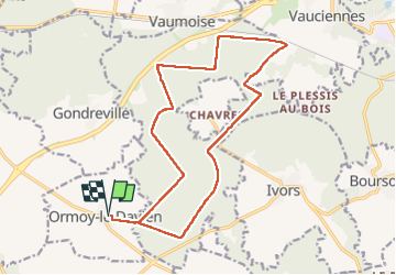
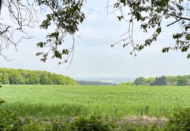
Randonnée Marche de 17 km à découvrir à Hauts-de-France, Oise, Ormoy-le-Davien. Cette randonnée est proposée par Vadim.
Description
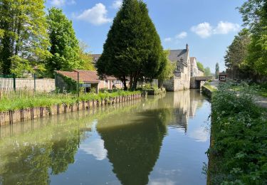
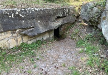
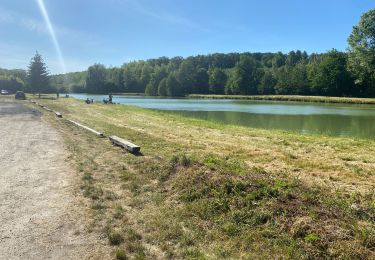
Départ, Ormoy le Davien, boucle de peès de 17 km. Direction Vaucienne puis Vaumoise et Cave du diable
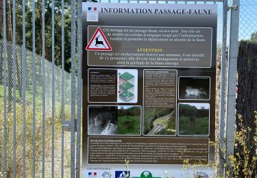
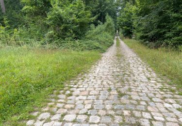
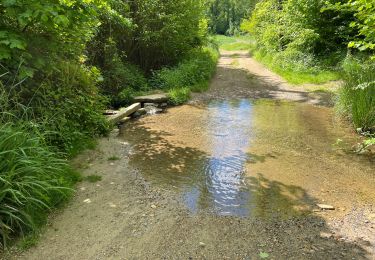
Localisation
Pays :
France
Région :
Hauts-de-France
Département/Province :
Oise
Commune :
Ormoy-le-Davien
Localité :
Unknown
Départ:(Dec)
Départ:(UTM)
497128 ; 5449147 (31U) N.
Commentaires
Randonnées à proximité
![Randonnée Marche Ormoy-le-Davien - 140722 - Ormoy le Davien - Etan de Wallu - Photo](https://media.geolcdn.com/t/375/260/a0fa9d10-3fbc-418f-863b-991340583e78.jpg&format=jpg&maxdim=2)
![Marche Marche](https://static1.geolcdn.com/sitytour/trail-icons/101.png)
140722 - Ormoy le Davien - Etan de Wallu
Marche
Moyen
Ormoy-le-Davien,
Hauts-de-France,
Oise,
France
![](/images/other/stat-length.png)
24 km | 29 km-effort
5h 2min
![](https://static1.geolcdn.com/siteimages/upload/files/16400158638029165_repeat_loop_refresh_sync_direction_icon.png)
Oui
![Randonnée Marche Ormoy-le-Davien - 060722 - Petite rando 10 km - Photo](https://media.geolcdn.com/t/375/260/15cf419f-e6f6-44c3-8671-97fc060afa84.jpg&format=jpg&maxdim=2)
![Marche Marche](https://static1.geolcdn.com/sitytour/trail-icons/101.png)
060722 - Petite rando 10 km
Marche
Ormoy-le-Davien,
Hauts-de-France,
Oise,
France
![](/images/other/stat-length.png)
10,2 km | 12,1 km-effort
1h 53min
![](https://static1.geolcdn.com/siteimages/upload/files/16400158638029165_repeat_loop_refresh_sync_direction_icon.png)
Oui
![Randonnée V.T.T. Ormoy-le-Davien - 130522 - Boucle VTT - Ormoy le davien en passant par le canal de l'Ourc - Photo](https://media.geolcdn.com/t/375/260/feba87b7-69e0-4b33-bb6b-f9399a3fff45.jpg&format=jpg&maxdim=2)
![V.T.T. V.T.T.](https://static1.geolcdn.com/sitytour/trail-icons/202.png)
130522 - Boucle VTT - Ormoy le davien en passant par le canal de l'Ourc
V.T.T.
Facile
Ormoy-le-Davien,
Hauts-de-France,
Oise,
France
![](/images/other/stat-length.png)
35 km | 40 km-effort
2h 41min
![](https://static1.geolcdn.com/siteimages/upload/files/16400158638029165_repeat_loop_refresh_sync_direction_icon.png)
Oui
![Randonnée Marche Ormoy-le-Davien - 060522 - Ormoy le Davien - La Ferté Milon - Photo](https://media.geolcdn.com/t/375/260/9796922a-107f-4281-b115-7bc0491a4bb5.jpg&format=jpg&maxdim=2)
![Marche Marche](https://static1.geolcdn.com/sitytour/trail-icons/101.png)
060522 - Ormoy le Davien - La Ferté Milon
Marche
Difficile
Ormoy-le-Davien,
Hauts-de-France,
Oise,
France
![](/images/other/stat-length.png)
32 km | 38 km-effort
6h 42min
![](https://static1.geolcdn.com/siteimages/upload/files/16400158638029165_repeat_loop_refresh_sync_direction_icon.png)
Oui
![Randonnée Marche Ormoy-le-Davien - 040522 - Boucle Ormoy le Davien - Moulin de Wallu... - Photo](https://media.geolcdn.com/t/375/260/4754e98c-e981-4349-bd96-fb3e5130af09.jpg&format=jpg&maxdim=2)
![Marche Marche](https://static1.geolcdn.com/sitytour/trail-icons/101.png)
040522 - Boucle Ormoy le Davien - Moulin de Wallu...
Marche
Difficile
(1)
Ormoy-le-Davien,
Hauts-de-France,
Oise,
France
![](/images/other/stat-length.png)
25 km | 30 km-effort
4h 51min
![](https://static1.geolcdn.com/siteimages/upload/files/16400158638029165_repeat_loop_refresh_sync_direction_icon.png)
Oui
![Randonnée Marche Ormoy-le-Davien - 290422 - Boucle Ormoy le Davien - au dessus de Chavre - Photo](https://media.geolcdn.com/t/375/260/d6fcf672-f1b4-4299-8bcc-208d1567912b.jpg&format=jpg&maxdim=2)
![Marche Marche](https://static1.geolcdn.com/sitytour/trail-icons/101.png)
290422 - Boucle Ormoy le Davien - au dessus de Chavre
Marche
Facile
Ormoy-le-Davien,
Hauts-de-France,
Oise,
France
![](/images/other/stat-length.png)
12,9 km | 15,3 km-effort
2h 25min
![](https://static1.geolcdn.com/siteimages/upload/files/16400158638029165_repeat_loop_refresh_sync_direction_icon.png)
Oui
![Randonnée Marche Ormoy-le-Davien - Ormoy - Cave du diable - Photo](https://media.geolcdn.com/t/375/260/934b883f-dc95-49b7-87b5-48cebc3b6bdb.jpg&format=jpg&maxdim=2)
![Marche Marche](https://static1.geolcdn.com/sitytour/trail-icons/101.png)
Ormoy - Cave du diable
Marche
Facile
Ormoy-le-Davien,
Hauts-de-France,
Oise,
France
![](/images/other/stat-length.png)
13,6 km | 16 km-effort
2h 29min
![](https://static1.geolcdn.com/siteimages/upload/files/16400158638029165_repeat_loop_refresh_sync_direction_icon.png)
Oui
![Randonnée Marche Ormoy-le-Davien - Boucle départ Ormoy le Davien 60620 - Foret de Retz - Photo](https://media.geolcdn.com/t/375/260/7b73f2ec-6e9e-46eb-b206-78debe313e7c.jpg&format=jpg&maxdim=2)
![Marche Marche](https://static1.geolcdn.com/sitytour/trail-icons/101.png)
Boucle départ Ormoy le Davien 60620 - Foret de Retz
Marche
Très facile
Ormoy-le-Davien,
Hauts-de-France,
Oise,
France
![](/images/other/stat-length.png)
10,4 km | 12,3 km-effort
2h 6min
![](https://static1.geolcdn.com/siteimages/upload/files/16400158638029165_repeat_loop_refresh_sync_direction_icon.png)
Oui
![Randonnée V.T.T. Ormoy-le-Davien - Boucle Ormoy le Davien - Mareuil sur Ourcq - Ormoy le Davien - Photo](https://media.geolcdn.com/t/375/260/35fa14d0-9f41-4e21-b1f4-6f0f01120ccb.jpg&format=jpg&maxdim=2)
![V.T.T. V.T.T.](https://static1.geolcdn.com/sitytour/trail-icons/202.png)
Boucle Ormoy le Davien - Mareuil sur Ourcq - Ormoy le Davien
V.T.T.
Moyen
Ormoy-le-Davien,
Hauts-de-France,
Oise,
France
![](/images/other/stat-length.png)
31 km | 35 km-effort
3h 27min
![](https://static1.geolcdn.com/siteimages/upload/files/16400158638029165_repeat_loop_refresh_sync_direction_icon.png)
Oui