![](/images/other/stat-length.png)
- Randonnées
- Outdoor
- France
- Hauts-de-France
- Oise
- Ormoy-le-Davien
Ormoy-le-Davien, Oise : Les meilleures randonnées, itinéraires, parcours, balades et promenades
Ormoy-le-Davien : découvrez les meilleures randonnées : 8 pédestres et 6 à vélo ou VTT. Tous ces circuits, parcours, itinéraires et activités en plein air sont disponibles dans nos applications SityTrail pour smartphones et tablettes.
Les meilleurs parcours (14)
![Randonnée Marche Ormoy-le-Davien - 140722 - Ormoy le Davien - Etan de Wallu - Photo](https://media.geolcdn.com/t/350/260/a0fa9d10-3fbc-418f-863b-991340583e78.jpg&format=jpg&maxdim=2)
![Marche Marche](https://static1.geolcdn.com/sitytour/trail-icons/101.png)
Km
Marche
![](/images/other/stat-length.png)
![](https://static1.geolcdn.com/siteimages/upload/files/1508320355ic_sort_den_pos_24dp.png)
![](https://static1.geolcdn.com/siteimages/upload/files/1508320355ic_sort_den_neg_24dp.png)
![](https://static1.geolcdn.com/siteimages/upload/files/16400158638029165_repeat_loop_refresh_sync_direction_icon.png)
• cx
![Randonnée Marche Ormoy-le-Davien - 060722 - Petite rando 10 km - Photo](https://media.geolcdn.com/t/350/260/15cf419f-e6f6-44c3-8671-97fc060afa84.jpg&format=jpg&maxdim=2)
![Marche Marche](https://static1.geolcdn.com/sitytour/trail-icons/101.png)
Km
Marche
![](/images/other/stat-length.png)
![](https://static1.geolcdn.com/siteimages/upload/files/1508320355ic_sort_den_pos_24dp.png)
![](https://static1.geolcdn.com/siteimages/upload/files/1508320355ic_sort_den_neg_24dp.png)
![](https://static1.geolcdn.com/siteimages/upload/files/16400158638029165_repeat_loop_refresh_sync_direction_icon.png)
• facile
![Randonnée V.T.T. Ormoy-le-Davien - 130522 - Boucle VTT - Ormoy le davien en passant par le canal de l'Ourc - Photo](https://media.geolcdn.com/t/350/260/feba87b7-69e0-4b33-bb6b-f9399a3fff45.jpg&format=jpg&maxdim=2)
![V.T.T. V.T.T.](https://static1.geolcdn.com/sitytour/trail-icons/202.png)
Km
V.T.T.
![](/images/other/stat-length.png)
![](https://static1.geolcdn.com/siteimages/upload/files/1508320355ic_sort_den_pos_24dp.png)
![](https://static1.geolcdn.com/siteimages/upload/files/1508320355ic_sort_den_neg_24dp.png)
![](https://static1.geolcdn.com/siteimages/upload/files/16400158638029165_repeat_loop_refresh_sync_direction_icon.png)
• Tout terrain...
![Randonnée Marche Ormoy-le-Davien - 060522 - Ormoy le Davien - La Ferté Milon - Photo](https://media.geolcdn.com/t/350/260/9796922a-107f-4281-b115-7bc0491a4bb5.jpg&format=jpg&maxdim=2)
![Marche Marche](https://static1.geolcdn.com/sitytour/trail-icons/101.png)
Km
Marche
![](/images/other/stat-length.png)
![](https://static1.geolcdn.com/siteimages/upload/files/1508320355ic_sort_den_pos_24dp.png)
![](https://static1.geolcdn.com/siteimages/upload/files/1508320355ic_sort_den_neg_24dp.png)
![](https://static1.geolcdn.com/siteimages/upload/files/16400158638029165_repeat_loop_refresh_sync_direction_icon.png)
• Dans cette rando, il y a 3 ou 4 chemins de +/- une centaine de mètres chacun qui ont disparu dans la végétation, mais...
![Randonnée Marche Ormoy-le-Davien - 040522 - Boucle Ormoy le Davien - Moulin de Wallu... - Photo](https://media.geolcdn.com/t/350/260/4754e98c-e981-4349-bd96-fb3e5130af09.jpg&format=jpg&maxdim=2)
![Marche Marche](https://static1.geolcdn.com/sitytour/trail-icons/101.png)
Km
Marche
![](/images/other/stat-length.png)
![](https://static1.geolcdn.com/siteimages/upload/files/1508320355ic_sort_den_pos_24dp.png)
![](https://static1.geolcdn.com/siteimages/upload/files/1508320355ic_sort_den_neg_24dp.png)
![](https://static1.geolcdn.com/siteimages/upload/files/16400158638029165_repeat_loop_refresh_sync_direction_icon.png)
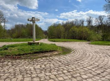
• Boucle Ormoy le Davien - Moulin de Wallu proche Largny sur Automne. Très belle rando...
![Randonnée Marche Ormoy-le-Davien - 030422 - Direction Vaucienne puis Vaumoise et Cave du diable - Photo](https://media.geolcdn.com/t/350/260/0e67b0e5-82d9-4aeb-838c-c1eadb0b350a.jpg&format=jpg&maxdim=2)
![Marche Marche](https://static1.geolcdn.com/sitytour/trail-icons/101.png)
Km
Marche
![](/images/other/stat-length.png)
![](https://static1.geolcdn.com/siteimages/upload/files/1508320355ic_sort_den_pos_24dp.png)
![](https://static1.geolcdn.com/siteimages/upload/files/1508320355ic_sort_den_neg_24dp.png)
![](https://static1.geolcdn.com/siteimages/upload/files/16400158638029165_repeat_loop_refresh_sync_direction_icon.png)
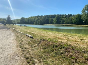
• Départ, Ormoy le Davien, boucle de peès de 17 km. Direction Vaucienne puis Vaumoise et Cave du diable
![Randonnée Marche Ormoy-le-Davien - 290422 - Boucle Ormoy le Davien - au dessus de Chavre - Photo](https://media.geolcdn.com/t/350/260/d6fcf672-f1b4-4299-8bcc-208d1567912b.jpg&format=jpg&maxdim=2)
![Marche Marche](https://static1.geolcdn.com/sitytour/trail-icons/101.png)
Km
Marche
![](/images/other/stat-length.png)
![](https://static1.geolcdn.com/siteimages/upload/files/1508320355ic_sort_den_pos_24dp.png)
![](https://static1.geolcdn.com/siteimages/upload/files/1508320355ic_sort_den_neg_24dp.png)
![](https://static1.geolcdn.com/siteimages/upload/files/16400158638029165_repeat_loop_refresh_sync_direction_icon.png)
• 290422 - Boucle Ormoy le Davien, en contournant, puis en passant par Chavre - 2h25 sans arrêts
![Randonnée Marche Ormoy-le-Davien - Ormoy - Cave du diable - Photo](https://media.geolcdn.com/t/350/260/934b883f-dc95-49b7-87b5-48cebc3b6bdb.jpg&format=jpg&maxdim=2)
![Marche Marche](https://static1.geolcdn.com/sitytour/trail-icons/101.png)
Km
Marche
![](/images/other/stat-length.png)
![](https://static1.geolcdn.com/siteimages/upload/files/1508320355ic_sort_den_pos_24dp.png)
![](https://static1.geolcdn.com/siteimages/upload/files/1508320355ic_sort_den_neg_24dp.png)
![](https://static1.geolcdn.com/siteimages/upload/files/16400158638029165_repeat_loop_refresh_sync_direction_icon.png)
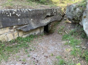
• Ormoy- Cave du diable - Très léger dénivelé vers la cave du diable...
![Randonnée Marche Ormoy-le-Davien - Boucle départ Ormoy le Davien 60620 - Foret de Retz - Photo](https://media.geolcdn.com/t/350/260/7b73f2ec-6e9e-46eb-b206-78debe313e7c.jpg&format=jpg&maxdim=2)
![Marche Marche](https://static1.geolcdn.com/sitytour/trail-icons/101.png)
Km
Marche
![](/images/other/stat-length.png)
![](https://static1.geolcdn.com/siteimages/upload/files/1508320355ic_sort_den_pos_24dp.png)
![](https://static1.geolcdn.com/siteimages/upload/files/1508320355ic_sort_den_neg_24dp.png)
![](https://static1.geolcdn.com/siteimages/upload/files/16400158638029165_repeat_loop_refresh_sync_direction_icon.png)
• Facile
![Randonnée V.T.T. Ormoy-le-Davien - Boucle Ormoy le Davien - Mareuil sur Ourcq - Ormoy le Davien - Photo](https://media.geolcdn.com/t/350/260/35fa14d0-9f41-4e21-b1f4-6f0f01120ccb.jpg&format=jpg&maxdim=2)
![V.T.T. V.T.T.](https://static1.geolcdn.com/sitytour/trail-icons/202.png)
Km
V.T.T.
![](/images/other/stat-length.png)
![](https://static1.geolcdn.com/siteimages/upload/files/1508320355ic_sort_den_pos_24dp.png)
![](https://static1.geolcdn.com/siteimages/upload/files/1508320355ic_sort_den_neg_24dp.png)
![](https://static1.geolcdn.com/siteimages/upload/files/16400158638029165_repeat_loop_refresh_sync_direction_icon.png)
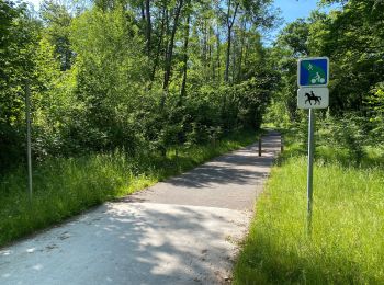
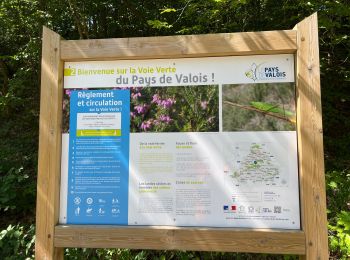
• En passant principalement par la voie verte. Jolie promenade.
![Randonnée V.T.T. Ormoy-le-Davien - Ormoy le Davien - Rouville en VTT - Photo](https://media.geolcdn.com/t/350/260/8f7bc0e5-1ff4-4c02-8e94-f36905b9d5e4.jpg&format=jpg&maxdim=2)
![V.T.T. V.T.T.](https://static1.geolcdn.com/sitytour/trail-icons/202.png)
Km
V.T.T.
![](/images/other/stat-length.png)
![](https://static1.geolcdn.com/siteimages/upload/files/1508320355ic_sort_den_pos_24dp.png)
![](https://static1.geolcdn.com/siteimages/upload/files/1508320355ic_sort_den_neg_24dp.png)
![](https://static1.geolcdn.com/siteimages/upload/files/16400158638029165_repeat_loop_refresh_sync_direction_icon.png)
• Ormoy le Davien - Rouville en passant par la coulée verte
![Randonnée V.T.T. Ormoy-le-Davien - 080722 - VTT 24 km - Photo](https://media.geolcdn.com/t/350/260/66e0e6af-2653-48ce-a078-1f6a933fc755.jpg&format=jpg&maxdim=2)
![V.T.T. V.T.T.](https://static1.geolcdn.com/sitytour/trail-icons/202.png)
Km
V.T.T.
![](/images/other/stat-length.png)
![](https://static1.geolcdn.com/siteimages/upload/files/1508320355ic_sort_den_pos_24dp.png)
![](https://static1.geolcdn.com/siteimages/upload/files/1508320355ic_sort_den_neg_24dp.png)
![](https://static1.geolcdn.com/siteimages/upload/files/16400158638029165_repeat_loop_refresh_sync_direction_icon.png)
• xx
![Randonnée V.T.T. Ormoy-le-Davien - vtt crouy - Photo](https://media.geolcdn.com/t/350/260/0d2cdd2a-2419-4ba9-a704-3a6fc6547caa.jpg&format=jpg&maxdim=2)
![V.T.T. V.T.T.](https://static1.geolcdn.com/sitytour/trail-icons/202.png)
Km
V.T.T.
![](/images/other/stat-length.png)
![](https://static1.geolcdn.com/siteimages/upload/files/1508320355ic_sort_den_pos_24dp.png)
![](https://static1.geolcdn.com/siteimages/upload/files/1508320355ic_sort_den_neg_24dp.png)
![](https://static1.geolcdn.com/siteimages/upload/files/16400158638029165_repeat_loop_refresh_sync_direction_icon.png)
![Randonnée V.T.T. Ormoy-le-Davien - 130522 - Entrainement VTT - Photo](https://media.geolcdn.com/t/350/260/ext.jpg?maxdim=2&url=https%3A%2F%2Fstatic1.geolcdn.com%2Fsiteimages%2Fupload%2Ffiles%2F1524743154velo.jpg)
![V.T.T. V.T.T.](https://static1.geolcdn.com/sitytour/trail-icons/202.png)
Km
V.T.T.
![](/images/other/stat-length.png)
![](https://static1.geolcdn.com/siteimages/upload/files/1508320355ic_sort_den_pos_24dp.png)
![](https://static1.geolcdn.com/siteimages/upload/files/1508320355ic_sort_den_neg_24dp.png)
![](https://static1.geolcdn.com/siteimages/upload/files/16400158638029165_repeat_loop_refresh_sync_direction_icon.png)
14 randonnées affichées sur 14
Application GPS de randonnée GRATUITE