Randonnée A pied Inconnu - Stadtwanderweg 2 - Hermannskogel - Photo

Stadtwanderweg 2 - Hermannskogel

Tous les sentiers balisés d’Europe PRO

© OpenStreetMap contributors
Longueur
Longueur
9,8 km
Altitude max
Altitude max
526 m
Dénivelé positif
Dénivelé positif
377 m
Km-Effort
Km-Effort  
14,8 km
Altitude min
Altitude min
262 m
Dénivelé négatif
Dénivelé négatif
379 m
Boucle
Boucle
Oui
Balise
Balise
Date de création :
2022-02-16 16:12:52.937
Dernière modification :
2022-03-03 04:12:17.522

(0 Avis)

A pied
A pied
3h21
Difficulté : Facile

Scannez ce code QR pour ouvrir la randonnée dans l'application SityTrail

Application GPS de randonnée GRATUITE

Logo SityTrail SityTrail

IGN / Instituts géographiques

Télécharger SityTrail sur l'App Store Télécharger SityTrail sur Google Play

Logo SityTrail SityTrail World

Le monde est à vous

Télécharger SityTrail sur l'App Store Télécharger SityTrail sur Google Play Télécharger SityTrail sur Huawei AppGallery

À propos

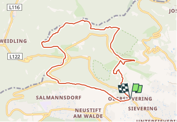
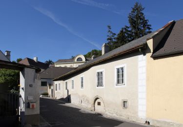
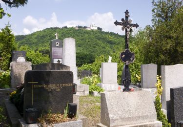
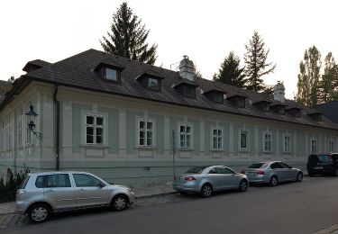
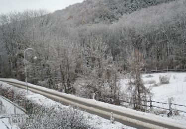
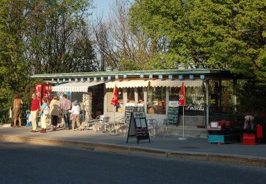
Randonnée A pied de 9,8 km à découvrir à Vienne, Inconnu, Inconnu. Cette randonnée est proposée par SityTrail - itinéraires balisés pédestres.

Photos

Localisation

Pays :
Autriche
Région :
Vienne
Département/Province :
Inconnu
Commune :
Inconnu
Localité :
Döbling
Départ:(UTM)
597740 ; 5345409 (33U) N.

Randonnées à proximité

Randonnée A pied Gemeinde Klosterneuburg - Klosterneuburg - Hohenauer Wiese (Adolf Robl Weg) - Photo
A pied
PRO

A pied

Facile
Gemeinde Klosterneuburg, Basse-Autriche, Bezirk Tulln, Autriche
5,7 km | 7,1 km-effort
1h 36min
Non
Randonnée A pied Gemeinde Klosterneuburg - Weidling - Kierling (Dr. Walter Brandstetter Weg) - Photo
A pied
PRO

A pied

Facile
Gemeinde Klosterneuburg, Basse-Autriche, Bezirk Tulln, Autriche
3,6 km | 6 km-effort
1h 21min
Non
Randonnée A pied Gemeinde Klosterneuburg - Weidling - Hohenauer Wiese - Photo
A pied
PRO

A pied

Facile
Gemeinde Klosterneuburg, Basse-Autriche, Bezirk Tulln, Autriche
4,7 km | 6,8 km-effort
1h 32min
Non
Randonnée A pied Inconnu - Kahlenbergerdorfer Weinrundwanderweg - Photo
A pied
PRO

A pied

Facile
Inconnu, Vienne, Inconnu, Autriche
3,3 km | 5,5 km-effort
1h 14min
Oui
Randonnée A pied Inconnu - Grüß di a Gott Wirt - Cobenzl - Photo
A pied
PRO

A pied

Facile
Inconnu, Vienne, Inconnu, Autriche
3,1 km | 4,1 km-effort
55min
Non
Randonnée A pied Inconnu - Sievering/Gspöttgraben - Habsburgwarte - Photo
A pied
PRO

A pied

Facile
Inconnu, Vienne, Inconnu, Autriche
3,5 km | 6,2 km-effort
1h 24min
Non
Randonnée A pied Gemeinde Klosterneuburg - Klosterneuburg - Hinterweidling - Photo
A pied
PRO

A pied

Facile
Gemeinde Klosterneuburg, Basse-Autriche, Bezirk Tulln, Autriche
4,5 km | 5,6 km-effort
1h 15min
Non
Randonnée A pied Inconnu - Kahlenberg - Jägerwiese - Photo
A pied
PRO

A pied

Facile
Inconnu, Vienne, Inconnu, Autriche
3,2 km | 4,5 km-effort
1h 0min
Non
Randonnée A pied Inconnu - Schwarzenbergpark/Allee - Sophienalpe (nördlicher Ast) - Photo
A pied
PRO

A pied

Facile
Inconnu, Vienne, Inconnu, Autriche
3,1 km | 5 km-effort
1h 8min
Non


Fermer
Mes abonnements