


4,1 km | 6 km-effort
Inconnu : découvrez les meilleures randonnées : 44 pédestres et 1 à vélo ou VTT. Tous ces circuits, parcours, itinéraires et activités en plein air sont disponibles dans nos applications SityTrail pour smartphones et tablettes.
A pied


• Randonnée créée par Naturfreunde.
A pied
• Randonnée créée par Österreichischer Astronomischer Verein.
A pied
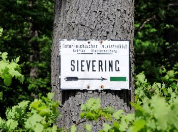
• Randonnée créée par ÖTK-Klosterneuburg. Symbole: weiss-blau-weiss
A pied
• Randonnée créée par ÖTK-Klosterneuburg; Freunde des Kahlenbergerdorfes. another website: http://www.kahlenbergerdorf...
A pied
• Randonnée créée par ÖTK-Klosterneuburg. Symbole: weiss-blau-weiss Site web: https://www.oetk-klosterneuburg.at/ind...
A pied
• Randonnée créée par ÖTK-Klosterneuburg. Symbole: weiss-gruen-weiss Site web: https://www.oetk-klosterneuburg.at/in...
A pied
• Randonnée créée par ÖTK-Klosterneuburg. Symbole: weiss-rot-weiss Site web: https://www.oetk-klosterneuburg.at/inde...
A pied
• Randonnée créée par ÖTK-Klosterneuburg. Symbole: weiss-blau-weiss Site web: https://www.oetk-klosterneuburg.at/ind...
A pied
• Randonnée créée par ÖTK-Klosterneuburg. Symbole: weiss-gruen-weiss Site web: https://www.oetk-klosterneuburg.at/in...
A pied
• Randonnée créée par ÖTK-Klosterneuburg. Symbole: weiss-blau-weiss Site web: https://www.oetk-klosterneuburg.at/ind...
A pied
• Randonnée créée par ÖTK-Klosterneuburg. Symbole: weiss-blau-weiss Site web: https://www.oetk-klosterneuburg.at/ind...
A pied
• Symbole: ohne Markierung
A pied
• Randonnée créée par Österreichischer Touristenklub. Symbole: grüner, waagrechter Balken
A pied
• Randonnée créée par Stadt Wien (Forstamt). http://wiki.openstreetmap.org/index.php?title=WikiProject_Austria/Wanderw...
A pied
• Randonnée créée par Stadt Wien (Forstamt). http://wiki.openstreetmap.org/index.php?title=WikiProject_Austria/Wanderw...
A pied
• Randonnée créée par Stadt Wien (Forstamt). http://wiki.openstreetmap.org/index.php?title=WikiProject_Austria/Wanderw...
A pied
• Randonnée créée par Stadt Wien (Forstamt). http://wiki.openstreetmap.org/index.php?title=WikiProject_Austria/Wanderw...
A pied
• osmc:symbol geändert damit auf Karte sichbar, vorher pink:white:pink_bar Symbole: weiß pink
A pied
• osmc:symbol geändert damit auf Karte sichbar, vorher pink:white:pink_bar Symbole: weiß pink
A pied
• Randonnée créée par Stadt Wien (Forstamt). http://wiki.openstreetmap.org/index.php?title=WikiProject_Austria/Wanderw...
20 randonnées affichées sur 45
Application GPS de randonnée GRATUITE
 SityTrail
IGN / Instituts géographiques
SityTrail World
Le monde est à vous