Randonnée A pied Lich - Residenzenring - Photo

Tous les sentiers balisés d’Europe PRO

© OpenStreetMap contributors
Longueur
Longueur
71 km
Altitude max
Altitude max
354 m
Dénivelé positif
Dénivelé positif
1287 m
Km-Effort
Km-Effort  
88 km
Altitude min
Altitude min
138 m
Dénivelé négatif
Dénivelé négatif
1297 m
Boucle
Boucle
Oui
Balise
Balise
Date de création :
2022-02-11 13:56:38.273
Dernière modification :
2022-02-11 13:56:38.273

(0 Avis)

A pied
A pied
19h59
Difficulté : Très difficile

Scannez ce code QR pour ouvrir la randonnée dans l'application SityTrail

Application GPS de randonnée GRATUITE

Logo SityTrail SityTrail

IGN / Instituts géographiques

Télécharger SityTrail sur l'App Store Télécharger SityTrail sur Google Play

Logo SityTrail SityTrail World

Le monde est à vous

Télécharger SityTrail sur l'App Store Télécharger SityTrail sur Google Play Télécharger SityTrail sur Huawei AppGallery

À propos

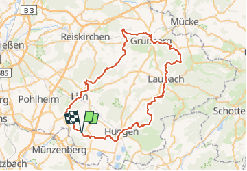
Randonnée A pied de 71 km à découvrir à Hesse, Landkreis Gießen, Lich. Cette randonnée est proposée par SityTrail - itinéraires balisés pédestres.

Description

Randonnée créée par Vogelsberger Höhenclub.

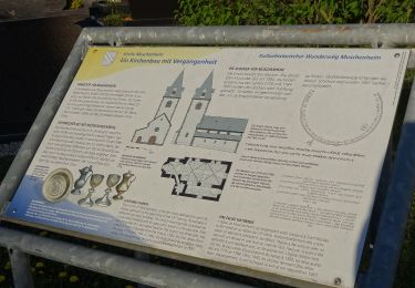
complete (Überprüft und Ergänzt von be-ju nach Beschilderung; Wegführung weicht von den Übersichtstafeln ab) Stand Oktober-2011

Symbole: rote Krone auf gelben Grund

Photos

Localisation

Pays :
Allemagne
Région :
Hesse
Département/Province :
Landkreis Gießen
Commune :
Lich
Localité :
Unknown
Départ:(UTM)
487363 ; 5591262 (32U) N.

Randonnées à proximité

Randonnée A pied Hungen - Hungen Rundweg Nordschleife - Photo
A pied
PRO

A pied

Facile
Hungen, Hesse, Landkreis Gießen, Allemagne
4,4 km | 5,1 km-effort
1h 9min
Non
Randonnée A pied Lich - Kulturhistorischer Weg Muschenheim - Photo
A pied
PRO

A pied

Facile
Lich, Hesse, Landkreis Gießen, Allemagne
3,3 km | 3,9 km-effort
53min
Non


Fermer
Mes abonnements