Randonnée Marche Ille-sur-Têt - 20210720 Ille sur Tet - Photo
 Childebert
Childebert

Utilisateur

© OpenStreetMap contributors
Longueur
Longueur
6,3 km
Altitude max
Altitude max
294 m
Dénivelé positif
Dénivelé positif
159 m
Km-Effort
Km-Effort  
8,4 km
Altitude min
Altitude min
139 m
Dénivelé négatif
Dénivelé négatif
159 m
Boucle
Boucle
Oui
Date de création :
2021-07-20 09:41:01.025
Dernière modification :
2021-07-20 19:11:08.289

(1 Avis)

Marche
Marche
4h04
Difficulté : Très difficile

Scannez ce code QR pour ouvrir la randonnée dans l'application SityTrail

Application GPS de randonnée GRATUITE

Logo SityTrail SityTrail

IGN / Instituts géographiques

Télécharger SityTrail sur l'App Store Télécharger SityTrail sur Google Play

Logo SityTrail SityTrail World

Le monde est à vous

Télécharger SityTrail sur l'App Store Télécharger SityTrail sur Google Play Télécharger SityTrail sur Huawei AppGallery

À propos

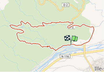
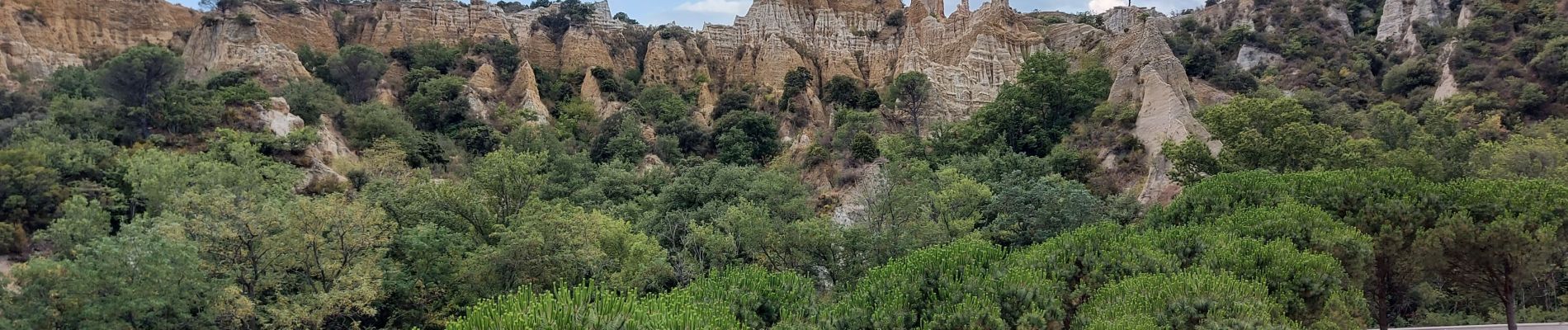
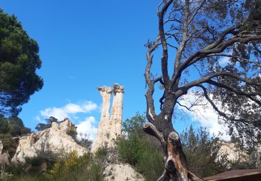
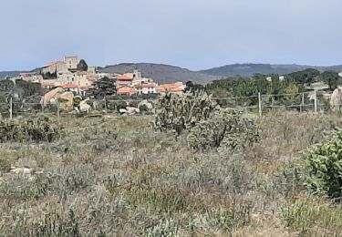
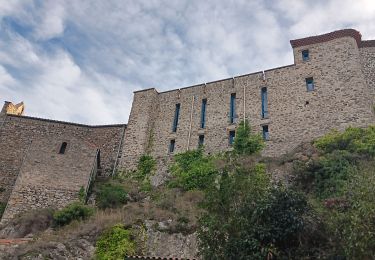
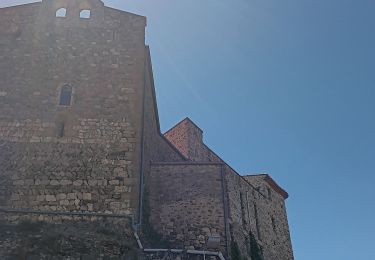
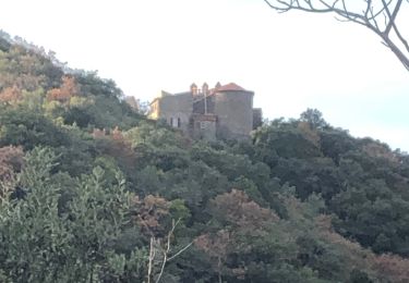
Randonnée Marche de 6,3 km à découvrir à Occitanie, Pyrénées-Orientales, Ille-sur-Têt. Cette randonnée est proposée par Childebert.

Profil altimétrique

Photos

Localisation

Pays :
France
Région :
Occitanie
Département/Province :
Pyrénées-Orientales
Commune :
Ille-sur-Têt
Localité :
Unknown
Départ:(UTM)
468182 ; 4724924 (31T) N.

Commentaires

Veuillez vous connecter pour laisser un commentaire ou une note


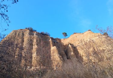
randonnée avec un dénivelé important au début (150m environ) sur de la roche, ensuite relativement plat sur une route engravillonée. sur la descente ensuite, chemin pas du tout entretenu et donc compliqué. par contre, on a mis 2h30 et pas 4h


Randonnées à proximité

Randonnée Marche Ille-sur-Têt - ILLE TÊT 66 - PIC PEDROUS - CASESNOVES - Photo
Marche
jeff66

Marche

Moyen
(10)
Ille-sur-Têt, Occitanie, Pyrénées-Orientales, France
11 km | 15,3 km-effort
2h 22min
Oui
Randonnée Marche Ille-sur-Têt - les Orgues - Ille-sur-Tet - Photo
Marche
GUIDE
stef789

Marche

Très facile
(1)
Ille-sur-Têt, Occitanie, Pyrénées-Orientales, France
2 km | 2,6 km-effort
1h 3min
Oui
Randonnée Marche Bélesta - Boucle du Pic Aubeill - Photo
Marche
bfrogneux

Marche

Facile
(1)
Bélesta, Occitanie, Pyrénées-Orientales, France
8 km | 10,9 km-effort
2h 24min
Oui
Randonnée Marche Montalba-le-Château - Montauban le château corral grandes or - Photo
Marche
66Gribouille83

Marche

Difficile
Montalba-le-Château, Occitanie, Pyrénées-Orientales, France
12,9 km | 16,3 km-effort
3h 42min
Oui
Randonnée Marche Ille-sur-Têt - puig pedros  - Photo
Marche
GUIDE
stef789

Marche

Moyen
Ille-sur-Têt, Occitanie, Pyrénées-Orientales, France
11,7 km | 15,6 km-effort
3h 57min
Oui
Randonnée Marche Bélesta - tour du pic aubeill  - Photo
Marche
GUIDE
stef789

Marche

Moyen
Bélesta, Occitanie, Pyrénées-Orientales, France
8,7 km | 12 km-effort
3h 45min
Oui
Randonnée Marche Bélesta - belesta bousillé par une fermeture du massif - Photo
Marche
GUIDE
stef789

Marche

Moyen
Bélesta, Occitanie, Pyrénées-Orientales, France
4,7 km | 6,3 km-effort
1h 23min
Oui
Randonnée Marche Montalba-le-Château - montant a - Photo
Marche
66Gribouille83

Marche

Difficile
Montalba-le-Château, Occitanie, Pyrénées-Orientales, France
11,8 km | 14,7 km-effort
5h 2min
Non
Randonnée Marche Rodès - 20221222  Rodés - Domanova…. Boucle  - Photo
Marche
ThonyM

Marche

Moyen
Rodès, Occitanie, Pyrénées-Orientales, France
21 km | 33 km-effort
5h 49min
Oui


Fermer
Mes abonnements