![](/images/other/stat-length.png)
![Randonnée Marche Sentheim - Sortie école primaire - Photo](https://media.geolcdn.com/t/1900/400/f42bf971-6b98-4e42-bdad-be206d2b284c.jpg&format=pjpeg&maxdim=2)
Sortie école primaire
helmut68
Utilisateur
![Longueur](/images/other/stat-length.png)
Longueur
7,7 km
![Altitude max](https://static1.geolcdn.com/siteimages/upload/files/1508320355ic_sort_altitude_max_24dp.png)
Altitude max
404 m
![Dénivelé positif](https://static1.geolcdn.com/siteimages/upload/files/1508320355ic_sort_den_pos_24dp.png)
Dénivelé positif
102 m
![Km-Effort](/images/other/stat-length.png)
Km-Effort
9,1 km
![Altitude min](https://static1.geolcdn.com/siteimages/upload/files/1508320355ic_sort_altitude_min_24dp.png)
Altitude min
353 m
![Dénivelé négatif](https://static1.geolcdn.com/siteimages/upload/files/1508320355ic_sort_den_neg_24dp.png)
Dénivelé négatif
111 m
![Boucle](https://static1.geolcdn.com/siteimages/upload/files/16400158638029165_repeat_loop_refresh_sync_direction_icon.png)
Boucle
Non
Date de création :
2021-03-29 09:58:38.889
Dernière modification :
2021-03-31 19:48:31.23
![Marche](https://static1.geolcdn.com/sitytour/trail-icons/101.png)
3h57
Difficulté : Facile
![Scannez ce code QR pour ouvrir la randonnée dans l'application SityTrail](https://capi.geolives.com/qq0zvz2zws4bq2lad0pu/sitytour/trails/2729912/qr.png?size=200)
Application GPS de randonnée GRATUITE
À propos
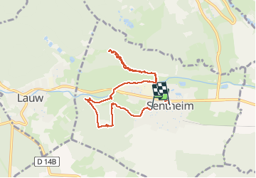
Randonnée Marche de 7,7 km à découvrir à Grand Est, Haut-Rhin, Sentheim. Cette randonnée est proposée par helmut68.
Description
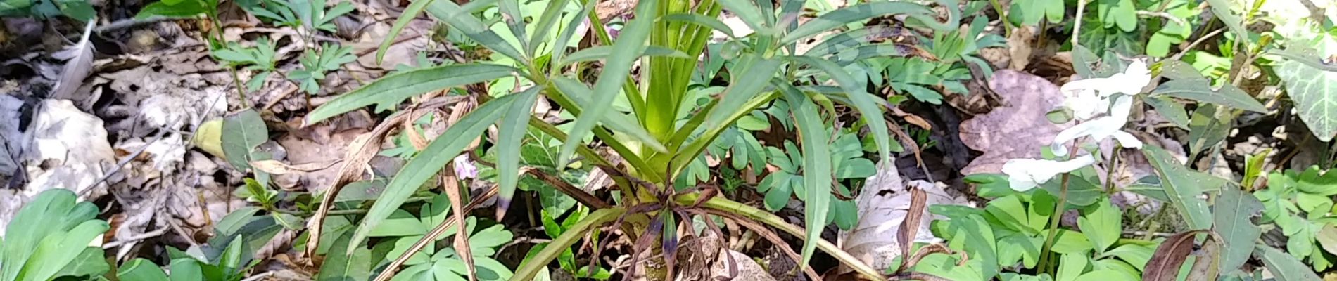
Sortie découverte faune et flore autour de Sentheim ou les élèves ont pu voir ,toucher,sentir mais aussi profiter d'une belle journée ensoleillée ...
Localisation
Pays :
France
Région :
Grand Est
Département/Province :
Haut-Rhin
Commune :
Sentheim
Localité :
Unknown
Départ:(Dec)
Départ:(UTM)
353776 ; 5290864 (32T) N.
Commentaires
Randonnées à proximité
![Randonnée Marche Masevaux-Niederbruck - Masevaux - Rossberg par le belvédère du Fuchsfelsen - Photo](https://media.geolcdn.com/t/375/260/d9cc765c-1250-4953-9d9f-fb8b88eb82a7.jpg&format=jpg&maxdim=2)
![Marche Marche](https://static1.geolcdn.com/sitytour/trail-icons/101.png)
Masevaux - Rossberg par le belvédère du Fuchsfelsen
Marche
Moyen
(1)
Masevaux-Niederbruck,
Grand Est,
Haut-Rhin,
France
![](/images/other/stat-length.png)
19,9 km | 34 km-effort
4h 44min
![](https://static1.geolcdn.com/siteimages/upload/files/16400158638029165_repeat_loop_refresh_sync_direction_icon.png)
Oui
![Randonnée Marche Sentheim - Sentheim Rossberg - Photo](https://media.geolcdn.com/t/375/260/a036ff16-f534-44a4-ad7d-39598edf8c1e.jpg&format=jpg&maxdim=2)
![Marche Marche](https://static1.geolcdn.com/sitytour/trail-icons/101.png)
Sentheim Rossberg
Marche
Moyen
(1)
Sentheim,
Grand Est,
Haut-Rhin,
France
![](/images/other/stat-length.png)
27 km | 40 km-effort
6h 11min
![](https://static1.geolcdn.com/siteimages/upload/files/16400158638029165_repeat_loop_refresh_sync_direction_icon.png)
Oui
![Randonnée Marche Lauw - 2022-07-14 Marche Lauw Refuge CAF Baerenkopf - Photo](https://media.geolcdn.com/t/375/260/e2209d17-65ac-46f6-a404-5274e10a843e.jpg&format=jpg&maxdim=2)
![Marche Marche](https://static1.geolcdn.com/sitytour/trail-icons/101.png)
2022-07-14 Marche Lauw Refuge CAF Baerenkopf
Marche
Très difficile
Lauw,
Grand Est,
Haut-Rhin,
France
![](/images/other/stat-length.png)
18,4 km | 31 km-effort
5h 35min
![](https://static1.geolcdn.com/siteimages/upload/files/16400158638029165_repeat_loop_refresh_sync_direction_icon.png)
Non
![Randonnée A pied Sentheim - Sentier géologique du Wolfloch - Photo](https://media.geolcdn.com/t/375/260/3b31644e-e98b-4e9b-958d-a3c4208c2bbd.jpeg&format=jpg&maxdim=2)
![A pied A pied](https://static1.geolcdn.com/sitytour/trail-icons/100.png)
Sentier géologique du Wolfloch
A pied
Facile
Sentheim,
Grand Est,
Haut-Rhin,
France
![](/images/other/stat-length.png)
3,8 km | 4,8 km-effort
1h 5min
![](https://static1.geolcdn.com/siteimages/upload/files/16400158638029165_repeat_loop_refresh_sync_direction_icon.png)
Non
![Randonnée A pied Sentheim - Sentheim - Bergwald - Eichwald - Guevenheim - Sentheim - Photo](https://media.geolcdn.com/t/375/260/ext.jpg?maxdim=2&url=https%3A%2F%2Fstatic1.geolcdn.com%2Fsiteimages%2Fupload%2Ffiles%2F1545311037marcheuse_200dpi.jpg)
![A pied A pied](https://static1.geolcdn.com/sitytour/trail-icons/100.png)
Sentheim - Bergwald - Eichwald - Guevenheim - Sentheim
A pied
Facile
(1)
Sentheim,
Grand Est,
Haut-Rhin,
France
![](/images/other/stat-length.png)
13,4 km | 16,6 km-effort
Inconnu
![](https://static1.geolcdn.com/siteimages/upload/files/16400158638029165_repeat_loop_refresh_sync_direction_icon.png)
Oui
![Randonnée Marche Masevaux-Niederbruck - Reco avec ALAIN..Rando CLAS du 29/08/2024 - Photo](https://media.geolcdn.com/t/375/260/5dba7985-af1b-4076-a275-05f9cb5145f8.jpg&format=jpg&maxdim=2)
![Marche Marche](https://static1.geolcdn.com/sitytour/trail-icons/101.png)
Reco avec ALAIN..Rando CLAS du 29/08/2024
Marche
Très difficile
Masevaux-Niederbruck,
Grand Est,
Haut-Rhin,
France
![](/images/other/stat-length.png)
20 km | 31 km-effort
6h 2min
![](https://static1.geolcdn.com/siteimages/upload/files/16400158638029165_repeat_loop_refresh_sync_direction_icon.png)
Oui
![Randonnée Marche Sentheim - Randonnée Pentecôte 2024 - Photo](https://media.geolcdn.com/t/375/260/5b01bebc-5c9b-4fee-93d4-97171ac59809.jpg&format=jpg&maxdim=2)
![Marche Marche](https://static1.geolcdn.com/sitytour/trail-icons/101.png)
Randonnée Pentecôte 2024
Marche
Moyen
Sentheim,
Grand Est,
Haut-Rhin,
France
![](/images/other/stat-length.png)
14,8 km | 18,3 km-effort
4h 0min
![](https://static1.geolcdn.com/siteimages/upload/files/16400158638029165_repeat_loop_refresh_sync_direction_icon.png)
Oui
![Randonnée Marche Sentheim - Knapphutte Saegenkopf Hütte - Photo](https://media.geolcdn.com/t/375/260/40c0149e-a232-4115-bfb0-15079675190f.jpg&format=jpg&maxdim=2)
![Marche Marche](https://static1.geolcdn.com/sitytour/trail-icons/101.png)
Knapphutte Saegenkopf Hütte
Marche
Moyen
Sentheim,
Grand Est,
Haut-Rhin,
France
![](/images/other/stat-length.png)
13,8 km | 17,2 km-effort
5h 11min
![](https://static1.geolcdn.com/siteimages/upload/files/16400158638029165_repeat_loop_refresh_sync_direction_icon.png)
Oui
![Randonnée Marche Sentheim - Montori - Photo](https://media.geolcdn.com/t/375/260/60fb76bf-d069-4a22-ad34-ce9de6b50bcf.jpg&format=jpg&maxdim=2)
![Marche Marche](https://static1.geolcdn.com/sitytour/trail-icons/101.png)