![](/images/other/stat-length.png)
- Randonnées
- Outdoor
- France
- Grand Est
- Haut-Rhin
- Sentheim
Sentheim, Haut-Rhin : Les meilleures randonnées, itinéraires, parcours, balades et promenades
Sentheim : découvrez les meilleures randonnées : 89 pédestres et 3 à vélo ou VTT. Tous ces circuits, parcours, itinéraires et activités en plein air sont disponibles dans nos applications SityTrail pour smartphones et tablettes.
Les meilleurs parcours (94)
![Randonnée Marche Sentheim - Sentheim Rossberg - Photo](https://media.geolcdn.com/t/350/260/a036ff16-f534-44a4-ad7d-39598edf8c1e.jpg&format=jpg&maxdim=2)
![Marche Marche](https://static1.geolcdn.com/sitytour/trail-icons/101.png)
Km
Marche
![](/images/other/stat-length.png)
![](https://static1.geolcdn.com/siteimages/upload/files/1508320355ic_sort_den_pos_24dp.png)
![](https://static1.geolcdn.com/siteimages/upload/files/1508320355ic_sort_den_neg_24dp.png)
![](https://static1.geolcdn.com/siteimages/upload/files/16400158638029165_repeat_loop_refresh_sync_direction_icon.png)
• Départ place de l'église de Sentheim, une fois le pont de la Doller passé suivre le balisage " rouge blanc rouge ...
![Randonnée A pied Sentheim - Sentier géologique du Wolfloch - Photo](https://media.geolcdn.com/t/350/260/3b31644e-e98b-4e9b-958d-a3c4208c2bbd.jpeg&format=jpg&maxdim=2)
![A pied A pied](https://static1.geolcdn.com/sitytour/trail-icons/100.png)
Km
A pied
![](/images/other/stat-length.png)
![](https://static1.geolcdn.com/siteimages/upload/files/1508320355ic_sort_den_pos_24dp.png)
![](https://static1.geolcdn.com/siteimages/upload/files/1508320355ic_sort_den_neg_24dp.png)
![](https://static1.geolcdn.com/siteimages/upload/files/16400158638029165_repeat_loop_refresh_sync_direction_icon.png)
• Symbole: red fossils
![Randonnée A pied Sentheim - Sentheim - Bergwald - Eichwald - Guevenheim - Sentheim - Photo](https://media.geolcdn.com/t/350/260/ext.jpg?maxdim=2&url=https%3A%2F%2Fstatic1.geolcdn.com%2Fsiteimages%2Fupload%2Ffiles%2F1545311037marcheuse_200dpi.jpg)
![A pied A pied](https://static1.geolcdn.com/sitytour/trail-icons/100.png)
Km
A pied
![](/images/other/stat-length.png)
![](https://static1.geolcdn.com/siteimages/upload/files/1508320355ic_sort_den_pos_24dp.png)
![](https://static1.geolcdn.com/siteimages/upload/files/1508320355ic_sort_den_neg_24dp.png)
![](https://static1.geolcdn.com/siteimages/upload/files/16400158638029165_repeat_loop_refresh_sync_direction_icon.png)
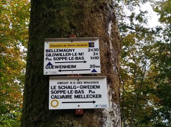
• Repas au restaurant de la Gare à Guewenheim
![Randonnée Marche Sentheim - Randonnée Pentecôte 2024 - Photo](https://media.geolcdn.com/t/350/260/5b01bebc-5c9b-4fee-93d4-97171ac59809.jpg&format=jpg&maxdim=2)
![Marche Marche](https://static1.geolcdn.com/sitytour/trail-icons/101.png)
Km
Marche
![](/images/other/stat-length.png)
![](https://static1.geolcdn.com/siteimages/upload/files/1508320355ic_sort_den_pos_24dp.png)
![](https://static1.geolcdn.com/siteimages/upload/files/1508320355ic_sort_den_neg_24dp.png)
![](https://static1.geolcdn.com/siteimages/upload/files/16400158638029165_repeat_loop_refresh_sync_direction_icon.png)
• Au départ de Sentheim direction col du Schirm ( Bourbach le Haut) .
![Randonnée Marche Sentheim - Knapphutte Saegenkopf Hütte - Photo](https://media.geolcdn.com/t/350/260/40c0149e-a232-4115-bfb0-15079675190f.jpg&format=jpg&maxdim=2)
![Marche Marche](https://static1.geolcdn.com/sitytour/trail-icons/101.png)
Km
Marche
![](/images/other/stat-length.png)
![](https://static1.geolcdn.com/siteimages/upload/files/1508320355ic_sort_den_pos_24dp.png)
![](https://static1.geolcdn.com/siteimages/upload/files/1508320355ic_sort_den_neg_24dp.png)
![](https://static1.geolcdn.com/siteimages/upload/files/16400158638029165_repeat_loop_refresh_sync_direction_icon.png)
• Agréable randonnée au départ de la place de l'église de Sentheim .Suivez le balisage " Rouge blanc rouge " direction ...
![Randonnée Marche Sentheim - Montori - Photo](https://media.geolcdn.com/t/350/260/60fb76bf-d069-4a22-ad34-ce9de6b50bcf.jpg&format=jpg&maxdim=2)
![Marche Marche](https://static1.geolcdn.com/sitytour/trail-icons/101.png)
Km
Marche
![](/images/other/stat-length.png)
![](https://static1.geolcdn.com/siteimages/upload/files/1508320355ic_sort_den_pos_24dp.png)
![](https://static1.geolcdn.com/siteimages/upload/files/1508320355ic_sort_den_neg_24dp.png)
![](https://static1.geolcdn.com/siteimages/upload/files/16400158638029165_repeat_loop_refresh_sync_direction_icon.png)
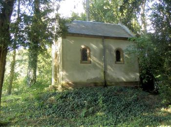
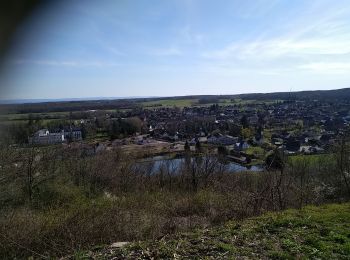
• Belle randonnée au départ de Sentheim pour atteindre les ruines du château de Montori culminant à 792 m dans les ha...
![Randonnée V.T.T. Sentheim - AperoDioller - Photo](https://media.geolcdn.com/t/350/260/24816b30-31ad-46f8-8596-a3b12e2b004e.jpg&format=jpg&maxdim=2)
![V.T.T. V.T.T.](https://static1.geolcdn.com/sitytour/trail-icons/202.png)
Km
V.T.T.
![](/images/other/stat-length.png)
![](https://static1.geolcdn.com/siteimages/upload/files/1508320355ic_sort_den_pos_24dp.png)
![](https://static1.geolcdn.com/siteimages/upload/files/1508320355ic_sort_den_neg_24dp.png)
![](https://static1.geolcdn.com/siteimages/upload/files/16400158638029165_repeat_loop_refresh_sync_direction_icon.png)
• Prendre une bonne bière en vélo à partir de Sentheim ( 0% CO2 ) . Eh oui une petite envie sans culpabiliser c'est pos...
![Randonnée Marche Sentheim - Baerenkopf - Photo](https://media.geolcdn.com/t/350/260/6b8495d2-8858-4f60-b8e9-d949218d0777.jpg&format=jpg&maxdim=2)
![Marche Marche](https://static1.geolcdn.com/sitytour/trail-icons/101.png)
Km
Marche
![](/images/other/stat-length.png)
![](https://static1.geolcdn.com/siteimages/upload/files/1508320355ic_sort_den_pos_24dp.png)
![](https://static1.geolcdn.com/siteimages/upload/files/1508320355ic_sort_den_neg_24dp.png)
![](https://static1.geolcdn.com/siteimages/upload/files/16400158638029165_repeat_loop_refresh_sync_direction_icon.png)
• Rando aller retour Sentheim Baerenkopf . C'est une boucle assez difficile puisqu'après une première montée aux ruines...
![Randonnée Marche Sentheim - Lac Seigneurie Soultzbach - Photo](https://media.geolcdn.com/t/350/260/3cfbaae3-c63e-4112-8e65-d15905061667.jpg&format=jpg&maxdim=2)
![Marche Marche](https://static1.geolcdn.com/sitytour/trail-icons/101.png)
Km
Marche
![](/images/other/stat-length.png)
![](https://static1.geolcdn.com/siteimages/upload/files/1508320355ic_sort_den_pos_24dp.png)
![](https://static1.geolcdn.com/siteimages/upload/files/1508320355ic_sort_den_neg_24dp.png)
![](https://static1.geolcdn.com/siteimages/upload/files/16400158638029165_repeat_loop_refresh_sync_direction_icon.png)
• Randonnée à partir de Sentheim.
![Randonnée Marche Sentheim - Sentheim Bellemagny Sentheim - Photo](https://media.geolcdn.com/t/350/260/18b340bb-efcf-4420-84aa-ce9048293773.jpg&format=jpg&maxdim=2)
![Marche Marche](https://static1.geolcdn.com/sitytour/trail-icons/101.png)
Km
Marche
![](/images/other/stat-length.png)
![](https://static1.geolcdn.com/siteimages/upload/files/1508320355ic_sort_den_pos_24dp.png)
![](https://static1.geolcdn.com/siteimages/upload/files/1508320355ic_sort_den_neg_24dp.png)
![](https://static1.geolcdn.com/siteimages/upload/files/16400158638029165_repeat_loop_refresh_sync_direction_icon.png)
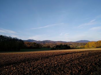
• Belle boucle essentiellement par des sentiers ou des chemins forestiers avec un peu de bitume. Très belles vues du ...
![Randonnée Marche Sentheim - Buchberg - Rocher du Poilu - Photo](https://media.geolcdn.com/t/350/260/65432c7b-12e4-42e5-8499-6e00b906d475.jpg&format=jpg&maxdim=2)
![Marche Marche](https://static1.geolcdn.com/sitytour/trail-icons/101.png)
Km
Marche
![](/images/other/stat-length.png)
![](https://static1.geolcdn.com/siteimages/upload/files/1508320355ic_sort_den_pos_24dp.png)
![](https://static1.geolcdn.com/siteimages/upload/files/1508320355ic_sort_den_neg_24dp.png)
![](https://static1.geolcdn.com/siteimages/upload/files/16400158638029165_repeat_loop_refresh_sync_direction_icon.png)
• Départ et arrivée place de l'église de Sentheim en suivant le balisage " triangle bleu " jusqu'au pont des vignes .En...
![Randonnée Marche Sentheim - SentheimGuew.Sentheim - Photo](https://media.geolcdn.com/t/350/260/9e753fcb-159e-4d8c-9090-98db09892fd9.jpg&format=jpg&maxdim=2)
![Marche Marche](https://static1.geolcdn.com/sitytour/trail-icons/101.png)
Km
Marche
![](/images/other/stat-length.png)
![](https://static1.geolcdn.com/siteimages/upload/files/1508320355ic_sort_den_pos_24dp.png)
![](https://static1.geolcdn.com/siteimages/upload/files/1508320355ic_sort_den_neg_24dp.png)
![](https://static1.geolcdn.com/siteimages/upload/files/16400158638029165_repeat_loop_refresh_sync_direction_icon.png)
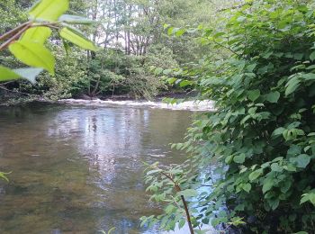
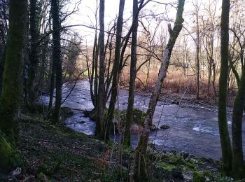
• Belle boucle ou à l'aller on longe la Doller rive gauche .Une fois arrivé à l'entrée de Guewenheim ( parcours pieds n...
![Randonnée Marche Sentheim - Marché de Masevaux bilan carbone : 0 - Photo](https://media.geolcdn.com/t/350/260/d2212a12-ffa4-4a0e-b5e9-68058aac2f57.jpg&format=jpg&maxdim=2)
![Marche Marche](https://static1.geolcdn.com/sitytour/trail-icons/101.png)
Km
Marche
![](/images/other/stat-length.png)
![](https://static1.geolcdn.com/siteimages/upload/files/1508320355ic_sort_den_pos_24dp.png)
![](https://static1.geolcdn.com/siteimages/upload/files/1508320355ic_sort_den_neg_24dp.png)
![](https://static1.geolcdn.com/siteimages/upload/files/16400158638029165_repeat_loop_refresh_sync_direction_icon.png)
• Départ place de jeu de Sentheim en suivant la piste cyclable direction Masevaux , puis suivre le balisage du GR 531 e...
![Randonnée Marche Sentheim - Sortie école primaire - Photo](https://media.geolcdn.com/t/350/260/f42bf971-6b98-4e42-bdad-be206d2b284c.jpg&format=jpg&maxdim=2)
![Marche Marche](https://static1.geolcdn.com/sitytour/trail-icons/101.png)
Km
Marche
![](/images/other/stat-length.png)
![](https://static1.geolcdn.com/siteimages/upload/files/1508320355ic_sort_den_pos_24dp.png)
![](https://static1.geolcdn.com/siteimages/upload/files/1508320355ic_sort_den_neg_24dp.png)
![](https://static1.geolcdn.com/siteimages/upload/files/16400158638029165_repeat_loop_refresh_sync_direction_icon.png)
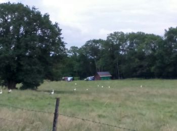
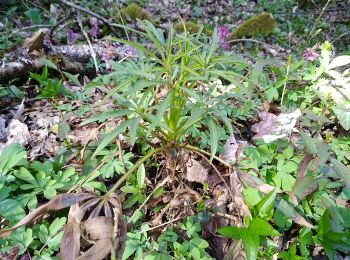
• Sortie découverte faune et flore autour de Sentheim ou les élèves ont pu voir ,toucher,sentir mais aussi profiter d'u...
![Randonnée Marche Sentheim - Sentheim Rammersmatt Bourbach/Bas - Photo](https://media.geolcdn.com/t/350/260/5850f762-f021-4d57-a554-57f80f7ff046.jpg&format=jpg&maxdim=2)
![Marche Marche](https://static1.geolcdn.com/sitytour/trail-icons/101.png)
Km
Marche
![](/images/other/stat-length.png)
![](https://static1.geolcdn.com/siteimages/upload/files/1508320355ic_sort_den_pos_24dp.png)
![](https://static1.geolcdn.com/siteimages/upload/files/1508320355ic_sort_den_neg_24dp.png)
![](https://static1.geolcdn.com/siteimages/upload/files/16400158638029165_repeat_loop_refresh_sync_direction_icon.png)
• Belle boucle printanière au départ et arrivée : place de jeu de Sentheim.Apres avoir traversé la Doller ( pont des vi...
![Randonnée Marche Sentheim - Sentheimtour Covid série 2 bis - Photo](https://media.geolcdn.com/t/350/260/3c9d4b7b-a208-4807-9630-cf8e60b162bc.jpg&format=jpg&maxdim=2)
![Marche Marche](https://static1.geolcdn.com/sitytour/trail-icons/101.png)
Km
Marche
![](/images/other/stat-length.png)
![](https://static1.geolcdn.com/siteimages/upload/files/1508320355ic_sort_den_pos_24dp.png)
![](https://static1.geolcdn.com/siteimages/upload/files/1508320355ic_sort_den_neg_24dp.png)
![](https://static1.geolcdn.com/siteimages/upload/files/16400158638029165_repeat_loop_refresh_sync_direction_icon.png)
• Belle boucle qui permet de respecter les règles du confinement série 2 ( 1 heure, 1 km par jour ) départ et arrivée ...
![Randonnée Marche Sentheim - Sentheimtour Covid série 2 - Photo](https://media.geolcdn.com/t/350/260/4b3c7f4c-db29-4473-823e-776b7207e4e2.jpg&format=jpg&maxdim=2)
![Marche Marche](https://static1.geolcdn.com/sitytour/trail-icons/101.png)
Km
Marche
![](/images/other/stat-length.png)
![](https://static1.geolcdn.com/siteimages/upload/files/1508320355ic_sort_den_pos_24dp.png)
![](https://static1.geolcdn.com/siteimages/upload/files/1508320355ic_sort_den_neg_24dp.png)
![](https://static1.geolcdn.com/siteimages/upload/files/16400158638029165_repeat_loop_refresh_sync_direction_icon.png)
• Départ et arrivée à la place de jeux de Sentheim. Cette boucle permet de se ressourcer tout en respectant les règles ...
![Randonnée Marche Sentheim - Ronde d'automne - Photo](https://media.geolcdn.com/t/350/260/982ca69e-850d-42cb-a28e-b7765636ad0a.jpg&format=jpg&maxdim=2)
![Marche Marche](https://static1.geolcdn.com/sitytour/trail-icons/101.png)
Km
Marche
![](/images/other/stat-length.png)
![](https://static1.geolcdn.com/siteimages/upload/files/1508320355ic_sort_den_pos_24dp.png)
![](https://static1.geolcdn.com/siteimages/upload/files/1508320355ic_sort_den_neg_24dp.png)
![](https://static1.geolcdn.com/siteimages/upload/files/16400158638029165_repeat_loop_refresh_sync_direction_icon.png)
• C'est une boucle , départ et arrivée à Sentheim ( place de jeux). Elle démarre par la route de Mortzwiller , puis 600...
![Randonnée Marche Sentheim - Bucherg - Photo](https://media.geolcdn.com/t/350/260/fd16d970-7922-4d62-bea1-e6dd3856fcc8.jpg&format=jpg&maxdim=2)
![Marche Marche](https://static1.geolcdn.com/sitytour/trail-icons/101.png)
Km
Marche
![](/images/other/stat-length.png)
![](https://static1.geolcdn.com/siteimages/upload/files/1508320355ic_sort_den_pos_24dp.png)
![](https://static1.geolcdn.com/siteimages/upload/files/1508320355ic_sort_den_neg_24dp.png)
![](https://static1.geolcdn.com/siteimages/upload/files/16400158638029165_repeat_loop_refresh_sync_direction_icon.png)
• Départ et arrivée place de l'église de Sentheim Traversez le vieux village , ensuite la Doller par le pont des vignes...
![Randonnée Marche Sentheim - Marché au marcher 3 - Photo](https://media.geolcdn.com/t/350/260/723069cc-84b5-4c93-be4a-7ca2665a37df.jpg&format=jpg&maxdim=2)
![Marche Marche](https://static1.geolcdn.com/sitytour/trail-icons/101.png)
Km
Marche
![](/images/other/stat-length.png)
![](https://static1.geolcdn.com/siteimages/upload/files/1508320355ic_sort_den_pos_24dp.png)
![](https://static1.geolcdn.com/siteimages/upload/files/1508320355ic_sort_den_neg_24dp.png)
![](https://static1.geolcdn.com/siteimages/upload/files/16400158638029165_repeat_loop_refresh_sync_direction_icon.png)
• Eh! On est mercredi , c'est le jour du marché à Masevaux . Comme souvent la petite boucle au départ de Sentheim pour...
20 randonnées affichées sur 94
Application GPS de randonnée GRATUITE