


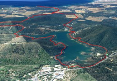
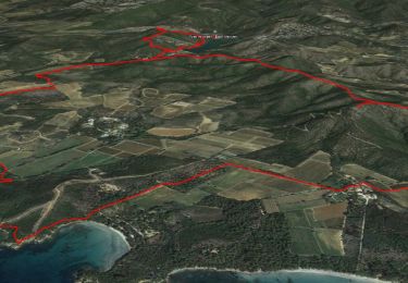
14 km | 22 km-effort


Utilisateur


Application GPS de randonnée GRATUITE
 SityTrail
IGN / Instituts géographiques
SityTrail World
Le monde est à vous
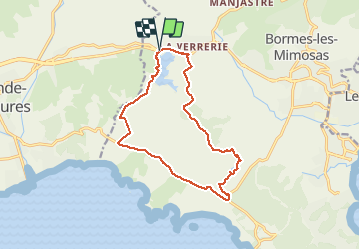
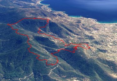
Randonnée Marche de 14,9 km à découvrir à Provence-Alpes-Côte d'Azur, Var, Bormes-les-Mimosas. Cette randonnée est proposée par GILOU440.
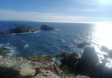
de la piste, par la route de bregancon a leoube mais on peux marcher en bordure des vignes.Apres le réservoir par les crêtes beau point de vue .repas au deuxième barrage.
Fait le 29 mars 2021


Marche
Marche
Marche
Marche

Marche
Trail
Marche
Marche
Marche