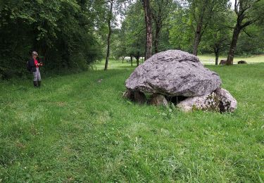
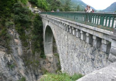
Randonnée A pied Oloron-Sainte-Marie - Boucle du Bois du Bager - G3 - Photo
 mitch1952
mitch1952

Utilisateur

© OpenStreetMap contributors
Longueur
Longueur
11,5 km
Altitude max
Altitude max
566 m
Dénivelé positif
Dénivelé positif
378 m
Km-Effort
Km-Effort  
16,6 km
Altitude min
Altitude min
293 m
Dénivelé négatif
Dénivelé négatif
383 m
Boucle
Boucle
Oui
Date de création :
2021-02-12 15:27:16.816
Dernière modification :
2022-06-08 08:42:54.468

(0 Avis)

A pied
A pied
4h10
Difficulté : Moyen

Scannez ce code QR pour ouvrir la randonnée dans l'application SityTrail

Application GPS de randonnée GRATUITE

Logo SityTrail SityTrail

IGN / Instituts géographiques

Télécharger SityTrail sur l'App Store Télécharger SityTrail sur Google Play

Logo SityTrail SityTrail World

Le monde est à vous

Télécharger SityTrail sur l'App Store Télécharger SityTrail sur Google Play Télécharger SityTrail sur Huawei AppGallery

À propos

Randonnée A pied de 11,5 km à découvrir à Nouvelle-Aquitaine, Pyrénées-Atlantiques, Oloron-Sainte-Marie. Cette randonnée est proposée par mitch1952.

Profil altimétrique

Points d'intérêt

Point d'intérêt Oloron-Sainte-Marie - Parking D918 après le lieu-dit Berguery - Photo
mitch1952
OLORON-SAINTE-MARIE 
Point d'intérêt Oloron-Sainte-Marie - Route : cabane, borne 12 - Photo
mitch1952
OLORON-SAINTE-MARIE 
Point d'intérêt Oloron-Sainte-Marie - Croisement de pistes, à gauche - Photo
mitch1952
OLORON-SAINTE-MARIE 
Point d'intérêt Oloron-Sainte-Marie - Piste forestière - Photo
mitch1952
OLORON-SAINTE-MARIE 
Point d'intérêt Oloron-Sainte-Marie - Embranchement, tout droit - Photo
mitch1952
OLORON-SAINTE-MARIE 
Point d'intérêt Oloron-Sainte-Marie - RD 918. Proche de la - Photo
mitch1952
OLORON-SAINTE-MARIE 
Point d'intérêt Oloron-Sainte-Marie - Intersection balisée - Photo
mitch1952
OLORON-SAINTE-MARIE 
Point d'intérêt Oloron-Sainte-Marie - Deuxième virage en épingle - Photo
mitch1952
OLORON-SAINTE-MARIE 
Point d'intérêt Oloron-Sainte-Marie - Cabane - Photo
mitch1952
OLORON-SAINTE-MARIE 
Point d'intérêt Oloron-Sainte-Marie - Parking D918 après le lieu-dit Berguery - Photo
mitch1952
OLORON-SAINTE-MARIE 

Localisation

Pays :
France
Région :
Nouvelle-Aquitaine
Département/Province :
Pyrénées-Atlantiques
Commune :
Oloron-Sainte-Marie
Localité :
Unknown
Départ:(Dec)
Départ:(UTM)
699467 ; 4776705 (30T) N.

Randonnées à proximité

Randonnée Marche Ogeu-les-Bains - Gr78 fait  - Photo
Marche
LouisROGER

Marche

Très difficile
Ogeu-les-Bains, Nouvelle-Aquitaine, Pyrénées-Atlantiques, France
15,9 km | 22 km-effort
4h 55min
Non
Randonnée A pied Escot - Tour Bilboquet-Barescou asp01 - Photo
A pied
GUIDE+

A pied

Facile
Escot, Nouvelle-Aquitaine, Pyrénées-Atlantiques, France
9,9 km | 15,7 km-effort
3h 34min
Oui
Randonnée Marche Escot - escot le bilboquet G3 fait - Photo
Marche
LouisROGER

Marche

Très facile
Escot, Nouvelle-Aquitaine, Pyrénées-Atlantiques, France
7,1 km | 12,5 km-effort
4h 57min
Non
Randonnée Marche Escot - Pic Roumendarès 1646m - Photo
Marche
tracegps

Marche

Difficile
(1)
Escot, Nouvelle-Aquitaine, Pyrénées-Atlantiques, France
6,2 km | 17,3 km-effort
4h 15min
Oui
Randonnée Vélo Escot - Transpyrénéenne en cyclo - étape 3 - Escot à Luz Saint Sauveur - Photo
Vélo
tracegps

Vélo

Difficile
Escot, Nouvelle-Aquitaine, Pyrénées-Atlantiques, France
138 km | 197 km-effort
10h 30min
Non
Randonnée Marche Oloron-Sainte-Marie - Fôret du Bager - Photo
Marche
HaschKnight

Marche

Moyen
Oloron-Sainte-Marie, Nouvelle-Aquitaine, Pyrénées-Atlantiques, France
4,4 km | 6,2 km-effort
1h 31min
Oui
Randonnée V.T.T. Ogeu-les-Bains - Ogeu  - Randonnée sportive de la vallée de l'Escou  - 44 Km - Photo
V.T.T.
potofe

V.T.T.

Difficile
Ogeu-les-Bains, Nouvelle-Aquitaine, Pyrénées-Atlantiques, France
44 km | 53 km-effort
3h 17min
Oui
Randonnée Marche Escot - Pic Roumendares 1646m - Photo
Marche
DuMarsan

Marche

Moyen
Escot, Nouvelle-Aquitaine, Pyrénées-Atlantiques, France
10,5 km | 25 km-effort
6h 17min
Oui
Randonnée Marche Ogeu-les-Bains - buziet oloron ste Marie - Photo
Marche
luc.gindre@free.fr

Marche

Très facile
Ogeu-les-Bains, Nouvelle-Aquitaine, Pyrénées-Atlantiques, France
4,1 km | 4,6 km-effort
1h 35min
Non


Fermer
Mes abonnements