![](/images/other/stat-length.png)
![Randonnée Marche Cabasse - Autour de Cabasse - Photo](https://media.geolcdn.com/t/1900/400/887f0fe2-6435-40d9-a211-6252d683b8f7.jpg&format=pjpeg&maxdim=2)
Autour de Cabasse
affinetataille
Utilisateur GUIDE
![Longueur](/images/other/stat-length.png)
Longueur
9,8 km
![Altitude max](https://static1.geolcdn.com/siteimages/upload/files/1508320355ic_sort_altitude_max_24dp.png)
Altitude max
339 m
![Dénivelé positif](https://static1.geolcdn.com/siteimages/upload/files/1508320355ic_sort_den_pos_24dp.png)
Dénivelé positif
415 m
![Km-Effort](/images/other/stat-length.png)
Km-Effort
15,4 km
![Altitude min](https://static1.geolcdn.com/siteimages/upload/files/1508320355ic_sort_altitude_min_24dp.png)
Altitude min
188 m
![Dénivelé négatif](https://static1.geolcdn.com/siteimages/upload/files/1508320355ic_sort_den_neg_24dp.png)
Dénivelé négatif
418 m
![Boucle](https://static1.geolcdn.com/siteimages/upload/files/16400158638029165_repeat_loop_refresh_sync_direction_icon.png)
Boucle
Oui
Date de création :
2020-10-09 07:43:17.523
Dernière modification :
2021-01-08 18:14:04.859
![Marche](https://static1.geolcdn.com/sitytour/trail-icons/101.png)
6h10
Difficulté : Moyen
![Scannez ce code QR pour ouvrir la randonnée dans l'application SityTrail](https://capi.geolives.com/qq0zvz2zws4bq2lad0pu/sitytour/trails/2572577/qr.png?size=200)
Application GPS de randonnée GRATUITE
À propos
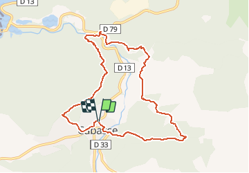
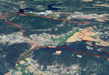
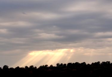
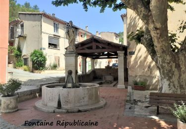
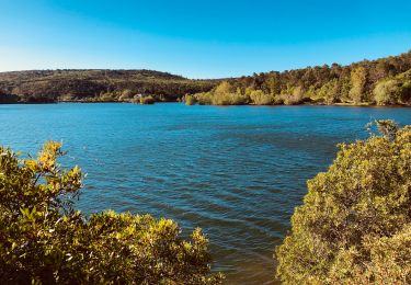
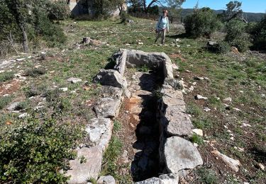
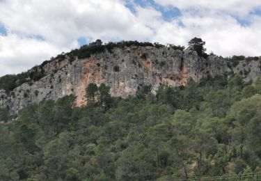
Randonnée Marche de 9,8 km à découvrir à Provence-Alpes-Côte d'Azur, Var, Cabasse. Cette randonnée est proposée par affinetataille.
Description
3 bonnes montées
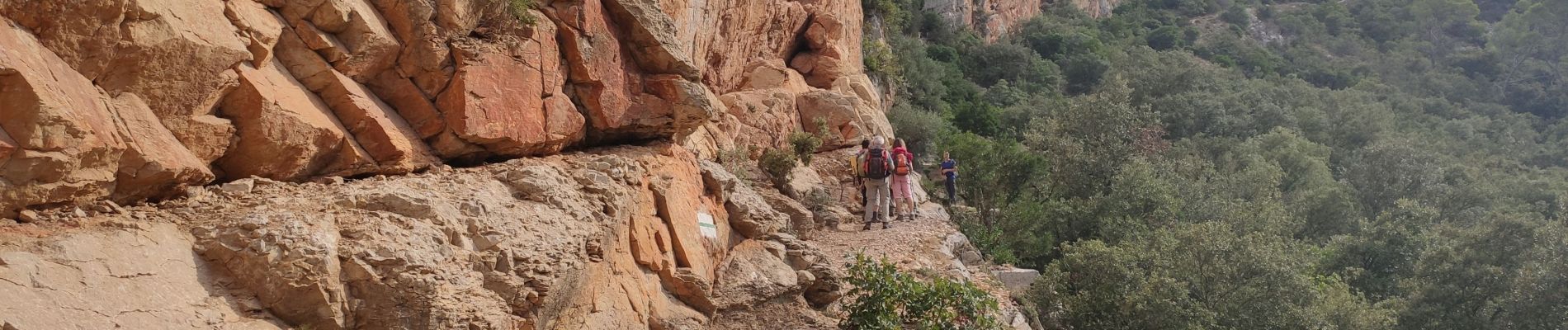
1 passage sur corniche sous les falaises (cordes en place pour se tenir)
Multiples points d'intérêts.
Belle randonnée
Localisation
Pays :
France
Région :
Provence-Alpes-Côte d'Azur
Département/Province :
Var
Commune :
Cabasse
Localité :
Unknown
Départ:(Dec)
Départ:(UTM)
275159 ; 4812084 (32T) N.
Commentaires
Randonnées à proximité
![A pied A pied](https://static1.geolcdn.com/sitytour/trail-icons/100.png)
Autour de Cabasse - 2eme version
A pied
Moyen
(1)
Cabasse,
Provence-Alpes-Côte d'Azur,
Var,
France
![](/images/other/stat-length.png)
15,3 km | 21 km-effort
6h 0min
![](https://static1.geolcdn.com/siteimages/upload/files/16400158638029165_repeat_loop_refresh_sync_direction_icon.png)
Oui
![Randonnée Marche Carcès - Les cascades du Caramy - Le canal d'irrigation - Les fresques de Carces - Photo](https://media.geolcdn.com/t/375/260/1a43adeb-f2d6-4934-8860-c1bc81aec290.jpg&format=jpg&maxdim=2)
![Marche Marche](https://static1.geolcdn.com/sitytour/trail-icons/101.png)
Les cascades du Caramy - Le canal d'irrigation - Les fresques de Carces
Marche
Moyen
(2)
Carcès,
Provence-Alpes-Côte d'Azur,
Var,
France
![](/images/other/stat-length.png)
14,2 km | 18 km-effort
6h 30min
![](https://static1.geolcdn.com/siteimages/upload/files/16400158638029165_repeat_loop_refresh_sync_direction_icon.png)
Oui
![Randonnée Marche Le Thoronet - Abbaye du Thoronet - La Dérobade - La Gagère - Notre dame du Glaive - L'enclos - Photo](https://media.geolcdn.com/t/375/260/c1345155-8a53-4785-b8e1-556f37370f25.jpg&format=jpg&maxdim=2)
![Marche Marche](https://static1.geolcdn.com/sitytour/trail-icons/101.png)
Abbaye du Thoronet - La Dérobade - La Gagère - Notre dame du Glaive - L'enclos
Marche
Moyen
(1)
Le Thoronet,
Provence-Alpes-Côte d'Azur,
Var,
France
![](/images/other/stat-length.png)
12,3 km | 16,5 km-effort
6h 0min
![](https://static1.geolcdn.com/siteimages/upload/files/16400158638029165_repeat_loop_refresh_sync_direction_icon.png)
Oui
![Randonnée Marche Carcès - Lac de Ste Suzanne - Vins-sur- Caramy - Photo](https://media.geolcdn.com/t/375/260/df5eabc7-8cee-4624-bf14-afd6e77949d9.jpg&format=jpg&maxdim=2)
![Marche Marche](https://static1.geolcdn.com/sitytour/trail-icons/101.png)
Lac de Ste Suzanne - Vins-sur- Caramy
Marche
Difficile
Carcès,
Provence-Alpes-Côte d'Azur,
Var,
France
![](/images/other/stat-length.png)
22 km | 30 km-effort
6h 0min
![](https://static1.geolcdn.com/siteimages/upload/files/16400158638029165_repeat_loop_refresh_sync_direction_icon.png)
Oui
![Randonnée Marche Cabasse - CABASSE LE TROU AUX FEES ND DU GLAIVE - Photo](https://media.geolcdn.com/t/375/260/ext.jpg?maxdim=2&url=https%3A%2F%2Fstatic1.geolcdn.com%2Fsiteimages%2Fupload%2Ffiles%2F1553511878bg_sport_marche.png)
![Marche Marche](https://static1.geolcdn.com/sitytour/trail-icons/101.png)
CABASSE LE TROU AUX FEES ND DU GLAIVE
Marche
Moyen
(1)
Cabasse,
Provence-Alpes-Côte d'Azur,
Var,
France
![](/images/other/stat-length.png)
11,2 km | 17,5 km-effort
3h 37min
![](https://static1.geolcdn.com/siteimages/upload/files/16400158638029165_repeat_loop_refresh_sync_direction_icon.png)
Oui
![Randonnée Marche Carcès - Chute de Carami - Photo](https://media.geolcdn.com/t/375/260/ext.jpg?maxdim=2&url=https%3A%2F%2Fstatic1.geolcdn.com%2Fsiteimages%2Fupload%2Ffiles%2F1553511878bg_sport_marche.png)
![Marche Marche](https://static1.geolcdn.com/sitytour/trail-icons/101.png)
Chute de Carami
Marche
Moyen
(1)
Carcès,
Provence-Alpes-Côte d'Azur,
Var,
France
![](/images/other/stat-length.png)
6,9 km | 9,7 km-effort
2h 11min
![](https://static1.geolcdn.com/siteimages/upload/files/16400158638029165_repeat_loop_refresh_sync_direction_icon.png)
Non
![Marche Marche](https://static1.geolcdn.com/sitytour/trail-icons/101.png)
Lac de Carces et les chutes du Caramy
Marche
Facile
Carcès,
Provence-Alpes-Côte d'Azur,
Var,
France
![](/images/other/stat-length.png)
3,3 km | 4 km-effort
54min
![](https://static1.geolcdn.com/siteimages/upload/files/16400158638029165_repeat_loop_refresh_sync_direction_icon.png)
Non
![Randonnée sport Cabasse - Cabasse le dolmen - Photo](https://media.geolcdn.com/t/375/260/bc449768-ff57-4992-928d-f08ffe6a8865.jpg&format=jpg&maxdim=2)
Cabasse le dolmen
sport
Très facile
Cabasse,
Provence-Alpes-Côte d'Azur,
Var,
France
![](/images/other/stat-length.png)
14,9 km | 21 km-effort
Inconnu
![](https://static1.geolcdn.com/siteimages/upload/files/16400158638029165_repeat_loop_refresh_sync_direction_icon.png)
Oui
![Randonnée Marche Cabasse - Cabasse - Le Défens - Trou des Fées - Photo](https://media.geolcdn.com/t/375/260/02914867-022d-4966-8460-526a9342457b.jpg&format=jpg&maxdim=2)
![Marche Marche](https://static1.geolcdn.com/sitytour/trail-icons/101.png)
Cabasse - Le Défens - Trou des Fées
Marche
Moyen
Cabasse,
Provence-Alpes-Côte d'Azur,
Var,
France
![](/images/other/stat-length.png)
7,9 km | 10,4 km-effort
2h 21min
![](https://static1.geolcdn.com/siteimages/upload/files/16400158638029165_repeat_loop_refresh_sync_direction_icon.png)
Oui