![](/images/other/stat-length.png)
![Randonnée A pied Monchique - 15-Cascata de Barbelote - Photo](https://media.geolcdn.com/t/1900/400/17c353f1-6fed-4bcb-bab4-6d3b070fb81d.jpg&format=pjpeg&maxdim=2)
15-Cascata de Barbelote
jeromelacoste
Utilisateur
![Longueur](/images/other/stat-length.png)
Longueur
1,7 km
![Altitude max](https://static1.geolcdn.com/siteimages/upload/files/1508320355ic_sort_altitude_max_24dp.png)
Altitude max
763 m
![Dénivelé positif](https://static1.geolcdn.com/siteimages/upload/files/1508320355ic_sort_den_pos_24dp.png)
Dénivelé positif
0 m
![Km-Effort](/images/other/stat-length.png)
Km-Effort
2,2 km
![Altitude min](https://static1.geolcdn.com/siteimages/upload/files/1508320355ic_sort_altitude_min_24dp.png)
Altitude min
591 m
![Dénivelé négatif](https://static1.geolcdn.com/siteimages/upload/files/1508320355ic_sort_den_neg_24dp.png)
Dénivelé négatif
168 m
![Boucle](https://static1.geolcdn.com/siteimages/upload/files/16400158638029165_repeat_loop_refresh_sync_direction_icon.png)
Boucle
Non
Date de création :
2020-04-21 17:27:39.179
Dernière modification :
2020-05-01 17:15:10.561
![A pied](https://static1.geolcdn.com/sitytour/trail-icons/100.png)
--
Difficulté : Très facile
![Scannez ce code QR pour ouvrir la randonnée dans l'application SityTrail](https://capi.geolives.com/qq0zvz2zws4bq2lad0pu/sitytour/trails/2384105/qr.png?size=200)
Application GPS de randonnée GRATUITE
À propos
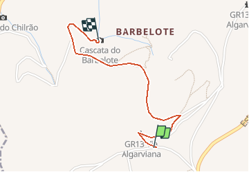
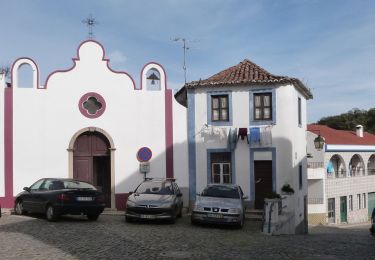
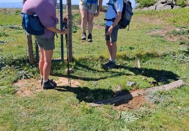
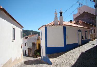
Randonnée A pied de 1,7 km à découvrir à Algarve, Faro, Monchique. Cette randonnée est proposée par jeromelacoste.
Description
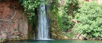
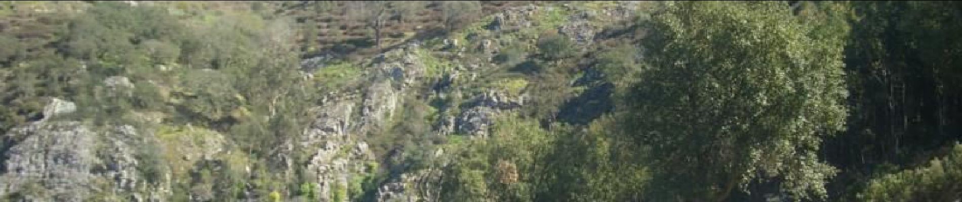
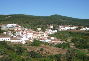
Cascata do Barbelote est un sentier allez-retour de 3.7 kilomètres modérément fréquenté. Le sentier longe une cascade et sa difficulté est évaluée comme modérée. Le sentier est principalement utilisé pour la randonnée et est accessible toute l'année.
Localisation
Pays :
Portugal
Région :
Algarve
Département/Province :
Faro
Commune :
Monchique
Localité :
Unknown
Départ:(Dec)
Départ:(UTM)
534573 ; 4129432 (29S) N.
Commentaires
Randonnées à proximité
![Randonnée A pied Monchique - Circuito da Picota (Rota das Árvores Monumentais) - Photo](https://media.geolcdn.com/t/375/260/32778b79-1004-41ba-9da2-9dc87aae50c8.jpeg&format=jpg&maxdim=2)
![A pied A pied](https://static1.geolcdn.com/sitytour/trail-icons/100.png)
Circuito da Picota (Rota das Árvores Monumentais)
A pied
Difficile
Monchique,
Algarve,
Faro,
Portugal
![](/images/other/stat-length.png)
26 km | 38 km-effort
8h 38min
![](https://static1.geolcdn.com/siteimages/upload/files/16400158638029165_repeat_loop_refresh_sync_direction_icon.png)
Oui
![Randonnée A pied Monchique - Circuito da Fóia (Rota das Árvores Monumentais) - Photo](https://media.geolcdn.com/t/375/260/bf2c1c97-e230-497c-91bc-1909a8348de2.jpeg&format=jpg&maxdim=2)
![A pied A pied](https://static1.geolcdn.com/sitytour/trail-icons/100.png)
Circuito da Fóia (Rota das Árvores Monumentais)
A pied
Moyen
Monchique,
Algarve,
Faro,
Portugal
![](/images/other/stat-length.png)
15,8 km | 24 km-effort
5h 29min
![](https://static1.geolcdn.com/siteimages/upload/files/16400158638029165_repeat_loop_refresh_sync_direction_icon.png)
Oui
![Randonnée A pied Monchique - Árvores da Vila (Rota das Árvores Monumentais) - Photo](https://media.geolcdn.com/t/375/260/524b58a6-69c9-428a-a487-7a1f72b1efcb.jpeg&format=jpg&maxdim=2)
![A pied A pied](https://static1.geolcdn.com/sitytour/trail-icons/100.png)
Árvores da Vila (Rota das Árvores Monumentais)
A pied
Facile
Monchique,
Algarve,
Faro,
Portugal
![](/images/other/stat-length.png)
6,4 km | 9,2 km-effort
2h 6min
![](https://static1.geolcdn.com/siteimages/upload/files/16400158638029165_repeat_loop_refresh_sync_direction_icon.png)
Oui
![Randonnée A pied Monchique - Fóia e área envolvente (Rota da Geologia) - Photo](https://media.geolcdn.com/t/375/260/8de6e975-9cd1-45a1-9d3c-6de1536603ee.jpeg&format=jpg&maxdim=2)
![A pied A pied](https://static1.geolcdn.com/sitytour/trail-icons/100.png)
Fóia e área envolvente (Rota da Geologia)
A pied
Moyen
Monchique,
Algarve,
Faro,
Portugal
![](/images/other/stat-length.png)
15,7 km | 22 km-effort
4h 59min
![](https://static1.geolcdn.com/siteimages/upload/files/16400158638029165_repeat_loop_refresh_sync_direction_icon.png)
Oui
![Randonnée A pied Marmelete - Marmelete (Rota da Geologia) - Photo](https://media.geolcdn.com/t/375/260/8d5691bb-c1a0-4404-a27e-00b161deaebb.jpeg&format=jpg&maxdim=2)
![A pied A pied](https://static1.geolcdn.com/sitytour/trail-icons/100.png)
Marmelete (Rota da Geologia)
A pied
Facile
Marmelete,
Algarve,
Faro,
Portugal
![](/images/other/stat-length.png)
6 km | 8,9 km-effort
2h 0min
![](https://static1.geolcdn.com/siteimages/upload/files/16400158638029165_repeat_loop_refresh_sync_direction_icon.png)
Non
![Randonnée A pied Marmelete - Percurso Pedestre de Marmelete - Photo](https://media.geolcdn.com/t/375/260/8d5691bb-c1a0-4404-a27e-00b161deaebb.jpeg&format=jpg&maxdim=2)
![A pied A pied](https://static1.geolcdn.com/sitytour/trail-icons/100.png)
Percurso Pedestre de Marmelete
A pied
Facile
Marmelete,
Algarve,
Faro,
Portugal
![](/images/other/stat-length.png)
9,2 km | 13,7 km-effort
3h 6min
![](https://static1.geolcdn.com/siteimages/upload/files/16400158638029165_repeat_loop_refresh_sync_direction_icon.png)
Oui
![Randonnée Marche Monchique - Algarve - Monchique n°15 - Photo](https://media.geolcdn.com/t/375/260/ext.jpg?maxdim=2&url=https%3A%2F%2Fstatic1.geolcdn.com%2Fsiteimages%2Fupload%2Ffiles%2F1553511878bg_sport_marche.png)
![Marche Marche](https://static1.geolcdn.com/sitytour/trail-icons/101.png)
Algarve - Monchique n°15
Marche
Facile
(1)
Monchique,
Algarve,
Faro,
Portugal
![](/images/other/stat-length.png)
7,8 km | 11,8 km-effort
2h 19min
![](https://static1.geolcdn.com/siteimages/upload/files/16400158638029165_repeat_loop_refresh_sync_direction_icon.png)
Oui
![Randonnée Marche Monchique - ALGARVE - Le Chemin des cascades dans la Serra de Monchique - Photo](https://media.geolcdn.com/t/375/260/70d72b13-b6a9-4aff-ac2f-cdc27f1ea374.jpg&format=jpg&maxdim=2)
![Marche Marche](https://static1.geolcdn.com/sitytour/trail-icons/101.png)
ALGARVE - Le Chemin des cascades dans la Serra de Monchique
Marche
Moyen
Monchique,
Algarve,
Faro,
Portugal
![](/images/other/stat-length.png)
18,5 km | 28 km-effort
5h 32min
![](https://static1.geolcdn.com/siteimages/upload/files/16400158638029165_repeat_loop_refresh_sync_direction_icon.png)
Non
![Randonnée A pied Monchique - Trilho dos Moinhos - Photo](https://media.geolcdn.com/t/375/260/a64c9fa1-680c-433d-881c-f2e4a2cb6dc1.jpeg&format=jpg&maxdim=2)
![A pied A pied](https://static1.geolcdn.com/sitytour/trail-icons/100.png)
Trilho dos Moinhos
A pied
Facile
Monchique,
Algarve,
Faro,
Portugal
![](/images/other/stat-length.png)
9,3 km | 14,2 km-effort
3h 13min
![](https://static1.geolcdn.com/siteimages/upload/files/16400158638029165_repeat_loop_refresh_sync_direction_icon.png)
Oui