![](/images/other/stat-length.png)
![Randonnée Marche Quenza - Les aiguilles de Bavella - Photo](https://media.geolcdn.com/t/1900/400/ext.pjpeg?maxdim=2&url=https%3A%2F%2Fstatic1.geolcdn.com%2Fsiteimages%2Fupload%2Ffiles%2F1553511878bg_sport_marche.png)
Les aiguilles de Bavella
tracegps
Utilisateur
![Longueur](/images/other/stat-length.png)
![Altitude max](https://static1.geolcdn.com/siteimages/upload/files/1508320355ic_sort_altitude_max_24dp.png)
![Dénivelé positif](https://static1.geolcdn.com/siteimages/upload/files/1508320355ic_sort_den_pos_24dp.png)
![Km-Effort](/images/other/stat-length.png)
![Altitude min](https://static1.geolcdn.com/siteimages/upload/files/1508320355ic_sort_altitude_min_24dp.png)
![Dénivelé négatif](https://static1.geolcdn.com/siteimages/upload/files/1508320355ic_sort_den_neg_24dp.png)
![Boucle](https://static1.geolcdn.com/siteimages/upload/files/16400158638029165_repeat_loop_refresh_sync_direction_icon.png)
![Marche](https://static1.geolcdn.com/sitytour/trail-icons/101.png)
4h30
Difficulté : Difficile
![Scannez ce code QR pour ouvrir la randonnée dans l'application SityTrail](https://capi.geolives.com/qq0zvz2zws4bq2lad0pu/sitytour/trails/105493/qr.png?size=200)
Application GPS de randonnée GRATUITE
À propos
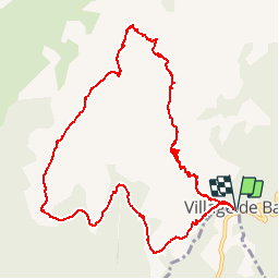
Randonnée Marche de 14,1 km à découvrir à Corse, Corse-du-Sud, Quenza. Cette randonnée est proposée par tracegps.
Description
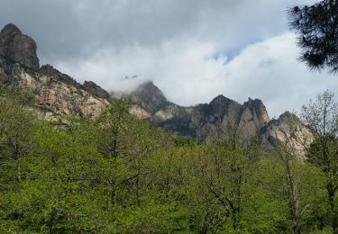
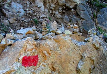
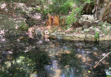
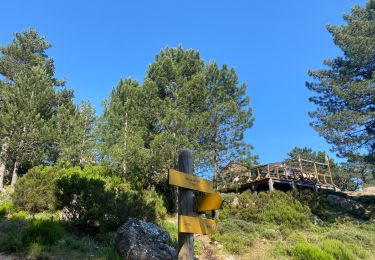
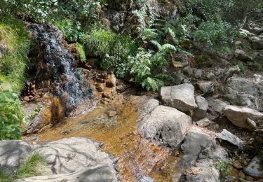
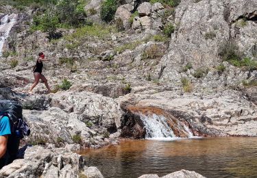
Grand classique et balade incontournable du Sud de l'île! Au col de l'Oiseau, la brèche devant la Punta di l'Acellu, nous offre l'une des ascensions les plus pittoresques de l'île ainsi que quelques escalades faciles et divertissantes au milieu d'un paysage rocheux grandiose. Vous bénéficierez de perspectives à couper le souffle. Le retour se fait par le GR20 et longe le Monte Incudine. Vraiment un must!
Localisation
Commentaires
Randonnées à proximité
![Randonnée Marche Quenza - tour de bavella - Photo](https://media.geolcdn.com/t/375/260/91546040-d47b-499f-8f25-3061dbb3b1e0.jpg&format=jpg&maxdim=2)
![Marche Marche](https://static1.geolcdn.com/sitytour/trail-icons/101.png)
Marche
![](/images/other/stat-length.png)
![](https://static1.geolcdn.com/siteimages/upload/files/16400158638029165_repeat_loop_refresh_sync_direction_icon.png)
![Randonnée Marche Zonza - Boucle du trou de la bombe - Bavella - Photo](https://media.geolcdn.com/t/375/260/57ec4c61-a922-4825-a53b-adb705edbd02.jpg&format=jpg&maxdim=2)
![Marche Marche](https://static1.geolcdn.com/sitytour/trail-icons/101.png)
Marche
![](/images/other/stat-length.png)
![](https://static1.geolcdn.com/siteimages/upload/files/16400158638029165_repeat_loop_refresh_sync_direction_icon.png)
![Randonnée Marche Quenza - chemin corse - Photo](https://media.geolcdn.com/t/375/260/ext.jpg?maxdim=2&url=https%3A%2F%2Fservices.sitytrail.com%2FGeolivesWS%2FDownloadMedia.ashx%3FTrailID%3D743798%26Media%3Dfix__20170501115404.jpg)
![Marche Marche](https://static1.geolcdn.com/sitytour/trail-icons/101.png)
Marche
![](/images/other/stat-length.png)
![](https://static1.geolcdn.com/siteimages/upload/files/16400158638029165_repeat_loop_refresh_sync_direction_icon.png)
![Randonnée Marche Zonza - Bavella_trou de la bombe - Photo](https://media.geolcdn.com/t/375/260/ext.jpg?maxdim=2&url=https%3A%2F%2Fservices.sitytrail.com%2FGeolivesWS%2FDownloadMedia.ashx%3FTrailID%3D198331%26Media%3D1886eeb5-9e06-40d9-ad21-e8df8d175266.jpg)
![Marche Marche](https://static1.geolcdn.com/sitytour/trail-icons/101.png)
Marche
![](/images/other/stat-length.png)
![](https://static1.geolcdn.com/siteimages/upload/files/16400158638029165_repeat_loop_refresh_sync_direction_icon.png)
![Randonnée Marche Conca - Paliri Conca - Photo](https://media.geolcdn.com/t/375/260/8129a798-c8a0-4a1d-9b4b-9f49d3407a5a.jpg&format=jpg&maxdim=2)
![Marche Marche](https://static1.geolcdn.com/sitytour/trail-icons/101.png)
Marche
![](/images/other/stat-length.png)
![](https://static1.geolcdn.com/siteimages/upload/files/16400158638029165_repeat_loop_refresh_sync_direction_icon.png)
![Randonnée Marche Quenza - Refuge Aline Paliri - Photo](https://media.geolcdn.com/t/375/260/64e98614-54d0-47ee-aa13-b132cf042059.jpg&format=jpg&maxdim=2)
![Marche Marche](https://static1.geolcdn.com/sitytour/trail-icons/101.png)
Marche
![](/images/other/stat-length.png)
![](https://static1.geolcdn.com/siteimages/upload/files/16400158638029165_repeat_loop_refresh_sync_direction_icon.png)
![Randonnée Marche Conca - eta 2 - Photo](https://media.geolcdn.com/t/375/260/2e5824f5-cee9-4ee9-b75e-599680df0276.jpg&format=jpg&maxdim=2)
![Marche Marche](https://static1.geolcdn.com/sitytour/trail-icons/101.png)
![Randonnée Marche Conca - Corse - GR20 Paliri à Conca - Photo](https://media.geolcdn.com/t/375/260/374a964b-6d4e-4e78-8a0e-bd563fc5fe7d.jpg&format=jpg&maxdim=2)
![Marche Marche](https://static1.geolcdn.com/sitytour/trail-icons/101.png)
Marche
![](/images/other/stat-length.png)
![](https://static1.geolcdn.com/siteimages/upload/files/16400158638029165_repeat_loop_refresh_sync_direction_icon.png)
![Randonnée Marche Zonza - Trou de la bombe et Punta Velacu - Photo](https://media.geolcdn.com/t/375/260/d5bb3da4-e374-49ec-b561-b8a65b36615c.jpg&format=jpg&maxdim=2)
![Marche Marche](https://static1.geolcdn.com/sitytour/trail-icons/101.png)
Marche
![](/images/other/stat-length.png)
![](https://static1.geolcdn.com/siteimages/upload/files/16400158638029165_repeat_loop_refresh_sync_direction_icon.png)
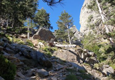
Très belle randonnée, mais prévoir plutôt 6 à 7 heures. Le dénivelé est d'environ 900 mètres. Parcours effectivement difficile dans les aiguilles.