


42 km | 58 km-effort
Saint-Vallier-de-Thiey : découvrez les meilleures randonnées : 15 v.t.t. et 2 vélo électrique. Tous ces circuits, parcours, itinéraires et activités en plein air sont disponibles dans nos applications SityTrail pour smartphones et tablettes.
V.T.T.


• Belle randonnée au départ du village permettant de rejoindre le pas de la Faye, le domaine de la Malle puis le col du...
V.T.T.
• Belle rando très roulante empruntant le gazoduc et de belles pistes. Crochet par la zone incendiée à St Cézaire (trav...

V.T.T.
• Vélo vtt
V.T.T.
• Départ du Grand pré/Col du Ferrier/Plateau de la Malle/Sentier de Gourdon/La Sarrée/Roquevignon/Le Pilon/St Vallier U...
V.T.T.
• Départ du Grand pré/Col du Ferrier/Plateau de la Malle/Sentier de Gourdon/La Sarrée/Roquevignon/Le Pilon/St Vallier U...
V.T.T.
• Tracé de la Bigreen 2019 de St Vallier au stade de la Paoute. Parcours bleu.
V.T.T.
• Tracé de la Bigreen 2019 de St Vallier au stade de la Paoute. Parcours bleu.
V.T.T.
• Belle descente dans le Défends (roulante, peu cassante, en sous-bois boueux à cette période mais peu pierreux). Remon...
V.T.T.
• St-Vallier-Cabris-Bois d'Amon et retour. Rando roulante mis à part une partie un peu cassante dans la descente du gaz...
V.T.T.
• Rando VTT sur piste principalement et qui emprunte un gazoduc. Pas de difficulté particulière, peu de dévers.
V.T.T.
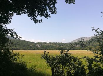
• Belle rando VTT ou à pied autour du village. Permet de découvrir le village et le relief environnant avec une belle v...
V.T.T.
• Belle rando VTT ou à pied autour du village. Permet de découvrir le village et le relief environnant avec une belle v...
V.T.T.
• Rando VTT sans trop de dévers, au départ de St Vallier de Thiey
V.T.T.
• La montée en face sud doit se faire à la fraîche car il peut y faire très chaud. Flore très riche au printemps.
V.T.T.
V.T.T.
V.T.T.
17 randonnées affichées sur 15
Application GPS de randonnée GRATUITE
 SityTrail
IGN / Instituts géographiques
SityTrail World
Le monde est à vous