


39 km | 49 km-effort
Villers-Cotterêts : découvrez les meilleures randonnées : 6 v.t.t.. Tous ces circuits, parcours, itinéraires et activités en plein air sont disponibles dans nos applications SityTrail pour smartphones et tablettes.
V.T.T.


• Long et physique, pour vététistes chevronnés, un circuit en terre royale et littéraire, dans une nature préservée… Au...
V.T.T.
• Eprouvant physiquement, technique en période de chasse en raison du passage des chevaux, ce parcours traverse un supe...
V.T.T.
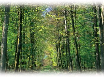
• Avec plus de 13 000 hectares, la forêt de Retz est le plus grand massif forestier de l'Aisne et l'une des plus import...
V.T.T.
• Avec plus de 13 000 hectares, la forêt de Retz est le plus grand massif forestier de l'Aisne et l'une des plus import...

V.T.T.
•
V.T.T.
6 randonnées affichées sur 6
Application GPS de randonnée GRATUITE
 SityTrail
IGN / Instituts géographiques
SityTrail World
Le monde est à vous