![](/images/other/stat-length.png)
- Randonnées
- Outdoor
- Italie
- Sardaigne
Sardaigne, Italie : Les meilleures randonnées, itinéraires, parcours, balades et promenades
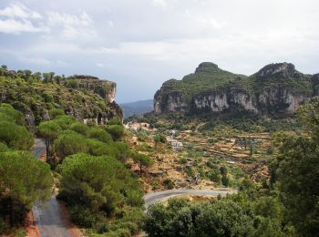
Sardaigne : découvrez les meilleures randonnées : 195 pédestres et 10 à vélo ou VTT. Tous ces circuits, parcours, itinéraires et activités en plein air sont disponibles dans nos applications SityTrail pour smartphones et tablettes.
Les meilleurs parcours (230)
![Randonnée A pied Orgosolo - (SI Z16) Sa Sinepida - Ilodei Malu (Caserma Montes) - Photo](https://media.geolcdn.com/t/350/260/6186697d-1830-426f-b783-f1965d8eab5a.jpeg&format=jpg&maxdim=2)
![A pied A pied](https://static1.geolcdn.com/sitytour/trail-icons/100.png)
Km
A pied
![](/images/other/stat-length.png)
![](https://static1.geolcdn.com/siteimages/upload/files/1508320355ic_sort_den_pos_24dp.png)
![](https://static1.geolcdn.com/siteimages/upload/files/1508320355ic_sort_den_neg_24dp.png)
![](https://static1.geolcdn.com/siteimages/upload/files/16400158638029165_repeat_loop_refresh_sync_direction_icon.png)
• Sentiero Italia CAI 2019
![Randonnée A pied Durgali/Dorgali - (SI Z14) Sa Barva – Monte Maccione - Photo](https://media.geolcdn.com/t/350/260/039e8aa0-1d36-4f43-9b77-6631f1ba7405.jpeg&format=jpg&maxdim=2)
![A pied A pied](https://static1.geolcdn.com/sitytour/trail-icons/100.png)
Km
A pied
![](/images/other/stat-length.png)
![](https://static1.geolcdn.com/siteimages/upload/files/1508320355ic_sort_den_pos_24dp.png)
![](https://static1.geolcdn.com/siteimages/upload/files/1508320355ic_sort_den_neg_24dp.png)
![](https://static1.geolcdn.com/siteimages/upload/files/16400158638029165_repeat_loop_refresh_sync_direction_icon.png)
• Sentiero Italia CAI 2019
![Randonnée A pied 'Onne/Fonni - Grande Traversata Supramontes - Photo](https://media.geolcdn.com/t/350/260/b6efb0cd-ae0c-465a-98f2-532f47d64032.jpeg&format=jpg&maxdim=2)
![A pied A pied](https://static1.geolcdn.com/sitytour/trail-icons/100.png)
Km
A pied
![](/images/other/stat-length.png)
![](https://static1.geolcdn.com/siteimages/upload/files/1508320355ic_sort_den_pos_24dp.png)
![](https://static1.geolcdn.com/siteimages/upload/files/1508320355ic_sort_den_neg_24dp.png)
![](https://static1.geolcdn.com/siteimages/upload/files/16400158638029165_repeat_loop_refresh_sync_direction_icon.png)
• Symbole: No guidepost only isolated cairn Site web: http://www.grandetraversatadelsupramonte.it/
![Randonnée A pied 'Onne/Fonni - Grande Traversata Supramontes Tappa 1 - Photo](https://media.geolcdn.com/t/350/260/6186697d-1830-426f-b783-f1965d8eab5a.jpeg&format=jpg&maxdim=2)
![A pied A pied](https://static1.geolcdn.com/sitytour/trail-icons/100.png)
Km
A pied
![](/images/other/stat-length.png)
![](https://static1.geolcdn.com/siteimages/upload/files/1508320355ic_sort_den_pos_24dp.png)
![](https://static1.geolcdn.com/siteimages/upload/files/1508320355ic_sort_den_neg_24dp.png)
![](https://static1.geolcdn.com/siteimages/upload/files/16400158638029165_repeat_loop_refresh_sync_direction_icon.png)
• Symbole: No guidepost only isolated cairn Site web: http://www.grandetraversatadelsupramonte.it/
![Randonnée A pied Orgosolo - Grande Traversata Supramontes Tappa 2 - Photo](https://media.geolcdn.com/t/350/260/8c35c8fe-c94c-4a7b-ba21-8ace2c7274f8.jpeg&format=jpg&maxdim=2)
![A pied A pied](https://static1.geolcdn.com/sitytour/trail-icons/100.png)
Km
A pied
![](/images/other/stat-length.png)
![](https://static1.geolcdn.com/siteimages/upload/files/1508320355ic_sort_den_pos_24dp.png)
![](https://static1.geolcdn.com/siteimages/upload/files/1508320355ic_sort_den_neg_24dp.png)
![](https://static1.geolcdn.com/siteimages/upload/files/16400158638029165_repeat_loop_refresh_sync_direction_icon.png)
• Symbole: No guidepost only isolated cairn Site web: http://www.grandetraversatadelsupramonte.it/
![Randonnée A pied Ulìana/Oliena - Grande Traversata Supramontes Tappa 4 - Photo](https://media.geolcdn.com/t/350/260/b6efb0cd-ae0c-465a-98f2-532f47d64032.jpeg&format=jpg&maxdim=2)
![A pied A pied](https://static1.geolcdn.com/sitytour/trail-icons/100.png)
Km
A pied
![](/images/other/stat-length.png)
![](https://static1.geolcdn.com/siteimages/upload/files/1508320355ic_sort_den_pos_24dp.png)
![](https://static1.geolcdn.com/siteimages/upload/files/1508320355ic_sort_den_neg_24dp.png)
![](https://static1.geolcdn.com/siteimages/upload/files/16400158638029165_repeat_loop_refresh_sync_direction_icon.png)
• Symbole: No guidepost only isolated cairn Site web: http://www.grandetraversatadelsupramonte.it/
![Randonnée A pied Alghero - Sentiero della Costa - Photo](https://media.geolcdn.com/t/350/260/e848513d-5f20-460f-815b-e72f045397b1.jpeg&format=jpg&maxdim=2)
![A pied A pied](https://static1.geolcdn.com/sitytour/trail-icons/100.png)
Km
A pied
![](/images/other/stat-length.png)
![](https://static1.geolcdn.com/siteimages/upload/files/1508320355ic_sort_den_pos_24dp.png)
![](https://static1.geolcdn.com/siteimages/upload/files/1508320355ic_sort_den_neg_24dp.png)
![](https://static1.geolcdn.com/siteimages/upload/files/16400158638029165_repeat_loop_refresh_sync_direction_icon.png)
• Randonnée créée par Comune di Sassari. Symbole: 003 on white red flag
![Randonnée A pied Lodè - Corru 'e mandra - Badde Viola - Sa 'e Tamponi - Photo](https://media.geolcdn.com/t/350/260/e93bc751-6adf-4554-af50-5b8b4deba203.jpeg&format=jpg&maxdim=2)
![A pied A pied](https://static1.geolcdn.com/sitytour/trail-icons/100.png)
Km
A pied
![](/images/other/stat-length.png)
![](https://static1.geolcdn.com/siteimages/upload/files/1508320355ic_sort_den_pos_24dp.png)
![](https://static1.geolcdn.com/siteimages/upload/files/1508320355ic_sort_den_neg_24dp.png)
![](https://static1.geolcdn.com/siteimages/upload/files/16400158638029165_repeat_loop_refresh_sync_direction_icon.png)
• Randonnée créée par Ente Foreste della Sardegna.
![Randonnée A pied Òsini/Osini - Nuraghi - Photo](https://media.geolcdn.com/t/350/260/a9f0cd7f-fdea-478a-ab62-4124f3160c16.jpeg&format=jpg&maxdim=2)
![A pied A pied](https://static1.geolcdn.com/sitytour/trail-icons/100.png)
Km
A pied
![](/images/other/stat-length.png)
![](https://static1.geolcdn.com/siteimages/upload/files/1508320355ic_sort_den_pos_24dp.png)
![](https://static1.geolcdn.com/siteimages/upload/files/1508320355ic_sort_den_neg_24dp.png)
![](https://static1.geolcdn.com/siteimages/upload/files/16400158638029165_repeat_loop_refresh_sync_direction_icon.png)
• Symbole: parallel horizontal bars red white red
![Randonnée A pied Ulassa/Ulassai - Tisiddu - Photo](https://media.geolcdn.com/t/350/260/20379433-3958-4055-8c40-3055eeee14b9.jpeg&format=jpg&maxdim=2)
![A pied A pied](https://static1.geolcdn.com/sitytour/trail-icons/100.png)
Km
A pied
![](/images/other/stat-length.png)
![](https://static1.geolcdn.com/siteimages/upload/files/1508320355ic_sort_den_pos_24dp.png)
![](https://static1.geolcdn.com/siteimages/upload/files/1508320355ic_sort_den_neg_24dp.png)
![](https://static1.geolcdn.com/siteimages/upload/files/16400158638029165_repeat_loop_refresh_sync_direction_icon.png)
• Symbole: parallel horizontal bars red white red
![Randonnée A pied Ulassa/Ulassai - Su Marmuri - Photo](https://media.geolcdn.com/t/350/260/8b8f6a3c-8c44-423a-b0a0-3be89f611b2a.jpeg&format=jpg&maxdim=2)
![A pied A pied](https://static1.geolcdn.com/sitytour/trail-icons/100.png)
Km
A pied
![](/images/other/stat-length.png)
![](https://static1.geolcdn.com/siteimages/upload/files/1508320355ic_sort_den_pos_24dp.png)
![](https://static1.geolcdn.com/siteimages/upload/files/1508320355ic_sort_den_neg_24dp.png)
![](https://static1.geolcdn.com/siteimages/upload/files/16400158638029165_repeat_loop_refresh_sync_direction_icon.png)
• Symbole: parallel horizontal bars red white red
![Randonnée A pied Seui - Montarbu - San Sebastiano T-112 - Photo](https://media.geolcdn.com/t/350/260/84cbbaa8-d465-4d97-8613-5ae484b122ee.jpeg&format=jpg&maxdim=2)
![A pied A pied](https://static1.geolcdn.com/sitytour/trail-icons/100.png)
Km
A pied
![](/images/other/stat-length.png)
![](https://static1.geolcdn.com/siteimages/upload/files/1508320355ic_sort_den_pos_24dp.png)
![](https://static1.geolcdn.com/siteimages/upload/files/1508320355ic_sort_den_neg_24dp.png)
![](https://static1.geolcdn.com/siteimages/upload/files/16400158638029165_repeat_loop_refresh_sync_direction_icon.png)
• Symbole: parallel horizontal bars red white red
![Randonnée A pied Tonara - Muggianeddu - Photo](https://media.geolcdn.com/t/350/260/f5ee9c7a-7b44-486b-bed3-3a97788a7802.jpeg&format=jpg&maxdim=2)
![A pied A pied](https://static1.geolcdn.com/sitytour/trail-icons/100.png)
Km
A pied
![](/images/other/stat-length.png)
![](https://static1.geolcdn.com/siteimages/upload/files/1508320355ic_sort_den_pos_24dp.png)
![](https://static1.geolcdn.com/siteimages/upload/files/1508320355ic_sort_den_neg_24dp.png)
![](https://static1.geolcdn.com/siteimages/upload/files/16400158638029165_repeat_loop_refresh_sync_direction_icon.png)
• Randonnée créée par Ente Foreste della Sardegna.
![Randonnée A pied Durgali/Dorgali - Sa Portiscra-Cala Luna - Photo](https://media.geolcdn.com/t/350/260/fb8ca2ba-5bfe-4fc7-a0b3-de9d2316cfee.jpeg&format=jpg&maxdim=2)
![A pied A pied](https://static1.geolcdn.com/sitytour/trail-icons/100.png)
Km
A pied
![](/images/other/stat-length.png)
![](https://static1.geolcdn.com/siteimages/upload/files/1508320355ic_sort_den_pos_24dp.png)
![](https://static1.geolcdn.com/siteimages/upload/files/1508320355ic_sort_den_neg_24dp.png)
![](https://static1.geolcdn.com/siteimages/upload/files/16400158638029165_repeat_loop_refresh_sync_direction_icon.png)
• Randonnée créée par Ente foreste della Sardegna.
![Randonnée A pied Orthullè/Urzulei - Sedda ar Baccas–Gorroppu - Photo](https://media.geolcdn.com/t/350/260/99630e3a-a4f1-4af7-90b5-4c319a690c23.jpeg&format=jpg&maxdim=2)
![A pied A pied](https://static1.geolcdn.com/sitytour/trail-icons/100.png)
Km
A pied
![](/images/other/stat-length.png)
![](https://static1.geolcdn.com/siteimages/upload/files/1508320355ic_sort_den_pos_24dp.png)
![](https://static1.geolcdn.com/siteimages/upload/files/1508320355ic_sort_den_neg_24dp.png)
![](https://static1.geolcdn.com/siteimages/upload/files/16400158638029165_repeat_loop_refresh_sync_direction_icon.png)
• Randonnée créée par Ente foreste della Sardegna.
![Randonnée A pied Durgali/Dorgali - Grande Traversata Supramontes Tappa 3 - Photo](https://media.geolcdn.com/t/350/260/7deb16be-ba95-46c2-8a4c-0fb58d732add.jpeg&format=jpg&maxdim=2)
![A pied A pied](https://static1.geolcdn.com/sitytour/trail-icons/100.png)
Km
A pied
![](/images/other/stat-length.png)
![](https://static1.geolcdn.com/siteimages/upload/files/1508320355ic_sort_den_pos_24dp.png)
![](https://static1.geolcdn.com/siteimages/upload/files/1508320355ic_sort_den_neg_24dp.png)
![](https://static1.geolcdn.com/siteimages/upload/files/16400158638029165_repeat_loop_refresh_sync_direction_icon.png)
• Symbole: No guidepost only isolated cairn Site web: http://www.grandetraversatadelsupramonte.it/
![Randonnée A pied Lungòni/Santa Teresa Gallura - (SI Z01) Chiesa della Madonna del Buon Cammino - Saltàra - Photo](https://media.geolcdn.com/t/350/260/776f3768-a1f1-45da-b97a-b38bca234cbd.jpeg&format=jpg&maxdim=2)
![A pied A pied](https://static1.geolcdn.com/sitytour/trail-icons/100.png)
Km
A pied
![](/images/other/stat-length.png)
![](https://static1.geolcdn.com/siteimages/upload/files/1508320355ic_sort_den_pos_24dp.png)
![](https://static1.geolcdn.com/siteimages/upload/files/1508320355ic_sort_den_neg_24dp.png)
![](https://static1.geolcdn.com/siteimages/upload/files/16400158638029165_repeat_loop_refresh_sync_direction_icon.png)
• Sentiero Italia CAI 2019
![Randonnée A pied Sìnnia/Sinnai - (SI Z28 OLD) Caserma Noci Sette Fratelli - Castadias - Photo](https://media.geolcdn.com/t/350/260/7e28cac4-0f09-4402-b7bf-0257eff78a12.jpeg&format=jpg&maxdim=2)
![A pied A pied](https://static1.geolcdn.com/sitytour/trail-icons/100.png)
Km
A pied
![](/images/other/stat-length.png)
![](https://static1.geolcdn.com/siteimages/upload/files/1508320355ic_sort_den_pos_24dp.png)
![](https://static1.geolcdn.com/siteimages/upload/files/1508320355ic_sort_den_neg_24dp.png)
![](https://static1.geolcdn.com/siteimages/upload/files/16400158638029165_repeat_loop_refresh_sync_direction_icon.png)
• Symbole: SI on white ref flag
![Randonnée A pied Monte/Monti - (SI Z06) Monti – Caserma Forestale Bolostiu - Photo](https://media.geolcdn.com/t/350/260/d6a563cb-a80c-4547-8e38-7125b58fe270.jpeg&format=jpg&maxdim=2)
![A pied A pied](https://static1.geolcdn.com/sitytour/trail-icons/100.png)
Km
A pied
![](/images/other/stat-length.png)
![](https://static1.geolcdn.com/siteimages/upload/files/1508320355ic_sort_den_pos_24dp.png)
![](https://static1.geolcdn.com/siteimages/upload/files/1508320355ic_sort_den_neg_24dp.png)
![](https://static1.geolcdn.com/siteimages/upload/files/16400158638029165_repeat_loop_refresh_sync_direction_icon.png)
• Sentiero Italia CAI 2019
![Randonnée A pied Lodè - (SI Z10) Vecchia Cantoniera di Sant’Anna - Irgoli - Photo](https://media.geolcdn.com/t/350/260/490ac679-8675-46c0-9c5b-1fba7c7c7acc.jpeg&format=jpg&maxdim=2)
![A pied A pied](https://static1.geolcdn.com/sitytour/trail-icons/100.png)
Km
A pied
![](/images/other/stat-length.png)
![](https://static1.geolcdn.com/siteimages/upload/files/1508320355ic_sort_den_pos_24dp.png)
![](https://static1.geolcdn.com/siteimages/upload/files/1508320355ic_sort_den_neg_24dp.png)
![](https://static1.geolcdn.com/siteimages/upload/files/16400158638029165_repeat_loop_refresh_sync_direction_icon.png)
• Sentiero Italia CAI 2019
20 randonnées affichées sur 230
Application GPS de randonnée GRATUITE