![](/images/other/stat-length.png)
- Randonnées
- Outdoor
- Italie
- Sardaigne
- Sud Sardegna
Sud Sardegna, Sardaigne : Les meilleures randonnées, itinéraires, parcours, balades et promenades
Sud Sardegna : découvrez les meilleures randonnées : 37 pédestres et 2 à vélo ou VTT. Tous ces circuits, parcours, itinéraires et activités en plein air sont disponibles dans nos applications SityTrail pour smartphones et tablettes.
Les meilleurs parcours (42)
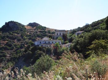
![Randonnée A pied Seui - Montarbu - San Sebastiano T-112 - Photo](https://media.geolcdn.com/t/350/260/84cbbaa8-d465-4d97-8613-5ae484b122ee.jpeg&format=jpg&maxdim=2)
![A pied A pied](https://static1.geolcdn.com/sitytour/trail-icons/100.png)
Km
A pied
![](/images/other/stat-length.png)
![](https://static1.geolcdn.com/siteimages/upload/files/1508320355ic_sort_den_pos_24dp.png)
![](https://static1.geolcdn.com/siteimages/upload/files/1508320355ic_sort_den_neg_24dp.png)
![](https://static1.geolcdn.com/siteimages/upload/files/16400158638029165_repeat_loop_refresh_sync_direction_icon.png)
• Symbole: parallel horizontal bars red white red
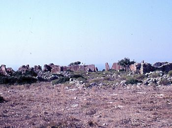
![Randonnée A pied Bugerru/Buggerru - Galleria Henry - Cala Domestica - Buggerru - Photo](https://media.geolcdn.com/t/350/260/f814042e-9b86-4b3c-aad8-4feefb619ff4.jpeg&format=jpg&maxdim=2)
![A pied A pied](https://static1.geolcdn.com/sitytour/trail-icons/100.png)
Km
A pied
![](/images/other/stat-length.png)
![](https://static1.geolcdn.com/siteimages/upload/files/1508320355ic_sort_den_pos_24dp.png)
![](https://static1.geolcdn.com/siteimages/upload/files/1508320355ic_sort_den_neg_24dp.png)
![](https://static1.geolcdn.com/siteimages/upload/files/16400158638029165_repeat_loop_refresh_sync_direction_icon.png)
• Randonnée créée par Ente Foreste della Sardegna.
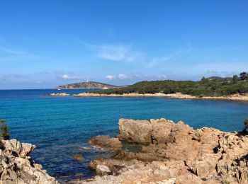
![Randonnée Marche Teulada - Teulada - Photo](https://media.geolcdn.com/t/350/260/c2a895a7-c02c-4001-9ea0-f12824818020.jpg&format=jpg&maxdim=2)
![Marche Marche](https://static1.geolcdn.com/sitytour/trail-icons/101.png)
Km
Marche
![](/images/other/stat-length.png)
![](https://static1.geolcdn.com/siteimages/upload/files/1508320355ic_sort_den_pos_24dp.png)
![](https://static1.geolcdn.com/siteimages/upload/files/1508320355ic_sort_den_neg_24dp.png)
![](https://static1.geolcdn.com/siteimages/upload/files/16400158638029165_repeat_loop_refresh_sync_direction_icon.png)
![Randonnée A pied Armùngia/Armungia - (SI Z25) Armungia - Su Niu 'e S'Achili - Photo](https://media.geolcdn.com/t/350/260/b067f84c-56df-4c37-97f3-3f2d74efd619.jpeg&format=jpg&maxdim=2)
![A pied A pied](https://static1.geolcdn.com/sitytour/trail-icons/100.png)
Km
A pied
![](/images/other/stat-length.png)
![](https://static1.geolcdn.com/siteimages/upload/files/1508320355ic_sort_den_pos_24dp.png)
![](https://static1.geolcdn.com/siteimages/upload/files/1508320355ic_sort_den_neg_24dp.png)
![](https://static1.geolcdn.com/siteimages/upload/files/16400158638029165_repeat_loop_refresh_sync_direction_icon.png)
![Randonnée A pied Santadi - Pantaleo-Guardia is Murteras a S'arcu e' S'Arena (216) - Photo](https://media.geolcdn.com/t/350/260/1f994cce-6765-4660-a7fb-7b6583756990.jpeg&format=jpg&maxdim=2)
![A pied A pied](https://static1.geolcdn.com/sitytour/trail-icons/100.png)
Km
A pied
![](/images/other/stat-length.png)
![](https://static1.geolcdn.com/siteimages/upload/files/1508320355ic_sort_den_pos_24dp.png)
![](https://static1.geolcdn.com/siteimages/upload/files/1508320355ic_sort_den_neg_24dp.png)
![](https://static1.geolcdn.com/siteimages/upload/files/16400158638029165_repeat_loop_refresh_sync_direction_icon.png)
• Randonnée créée par Ente Foreste della Sardegna. ATTENZIONE: PERCORSO IN MANUTENZIONE (alcuni tratti potrebbero risu...
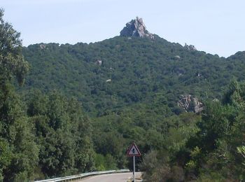
![Randonnée A pied Santadi - Pantaleo – sorgente Is Arrus (215) - Photo](https://media.geolcdn.com/t/350/260/1f994cce-6765-4660-a7fb-7b6583756990.jpeg&format=jpg&maxdim=2)
![A pied A pied](https://static1.geolcdn.com/sitytour/trail-icons/100.png)
Km
A pied
![](/images/other/stat-length.png)
![](https://static1.geolcdn.com/siteimages/upload/files/1508320355ic_sort_den_pos_24dp.png)
![](https://static1.geolcdn.com/siteimages/upload/files/1508320355ic_sort_den_neg_24dp.png)
![](https://static1.geolcdn.com/siteimages/upload/files/16400158638029165_repeat_loop_refresh_sync_direction_icon.png)
• Randonnée créée par Ente Foreste della Sardegna. ATTENZIONE: PERCORSO IN MANUTENZIONE (alcuni tratti potrebbero risu...
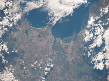
![Randonnée A pied Santadi - Monte Nieddu - Is Allineddus (210) - Photo](https://media.geolcdn.com/t/350/260/c6b9c93d-4452-4a04-b5b6-d0203d4043b0.jpeg&format=jpg&maxdim=2)
![A pied A pied](https://static1.geolcdn.com/sitytour/trail-icons/100.png)
Km
A pied
![](/images/other/stat-length.png)
![](https://static1.geolcdn.com/siteimages/upload/files/1508320355ic_sort_den_pos_24dp.png)
![](https://static1.geolcdn.com/siteimages/upload/files/1508320355ic_sort_den_neg_24dp.png)
![](https://static1.geolcdn.com/siteimages/upload/files/16400158638029165_repeat_loop_refresh_sync_direction_icon.png)
• Randonnée créée par Ente Foreste della Sardegna. ATTENZIONE: PERCORSO IN MANUTENZIONE (alcuni tratti potrebbero risu...
![Randonnée A pied Santadi - Tuppa Granella - Monte Nieddu (207) - Photo](https://media.geolcdn.com/t/350/260/c6b9c93d-4452-4a04-b5b6-d0203d4043b0.jpeg&format=jpg&maxdim=2)
![A pied A pied](https://static1.geolcdn.com/sitytour/trail-icons/100.png)
Km
A pied
![](/images/other/stat-length.png)
![](https://static1.geolcdn.com/siteimages/upload/files/1508320355ic_sort_den_pos_24dp.png)
![](https://static1.geolcdn.com/siteimages/upload/files/1508320355ic_sort_den_neg_24dp.png)
![](https://static1.geolcdn.com/siteimages/upload/files/16400158638029165_repeat_loop_refresh_sync_direction_icon.png)
• Randonnée créée par Ente Foreste della Sardegna. ATTENZIONE: PERCORSO IN MANUTENZIONE (alcuni tratti potrebbero risu...
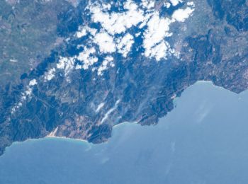
![Randonnée A pied Bugerru/Buggerru - Buggerru - Monte Rosmarino - Pranu Dentis - Photo](https://media.geolcdn.com/t/350/260/f715d9aa-d88b-48cb-99fa-d32e41275e3a.jpeg&format=jpg&maxdim=2)
![A pied A pied](https://static1.geolcdn.com/sitytour/trail-icons/100.png)
Km
A pied
![](/images/other/stat-length.png)
![](https://static1.geolcdn.com/siteimages/upload/files/1508320355ic_sort_den_pos_24dp.png)
![](https://static1.geolcdn.com/siteimages/upload/files/1508320355ic_sort_den_neg_24dp.png)
![](https://static1.geolcdn.com/siteimages/upload/files/16400158638029165_repeat_loop_refresh_sync_direction_icon.png)
• Randonnée créée par Ente Foreste della Sardegna.
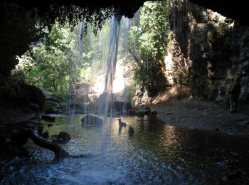
![Randonnée A pied Seulu/Seulo - Su Stampu de Su Turrunu - Guado Salassi - Photo](https://media.geolcdn.com/t/350/260/0f5df1ac-bc45-4699-b8fb-4b8a73d72faa.jpeg&format=jpg&maxdim=2)
![A pied A pied](https://static1.geolcdn.com/sitytour/trail-icons/100.png)
Km
A pied
![](/images/other/stat-length.png)
![](https://static1.geolcdn.com/siteimages/upload/files/1508320355ic_sort_den_pos_24dp.png)
![](https://static1.geolcdn.com/siteimages/upload/files/1508320355ic_sort_den_neg_24dp.png)
![](https://static1.geolcdn.com/siteimages/upload/files/16400158638029165_repeat_loop_refresh_sync_direction_icon.png)
• Randonnée créée par Ente foreste della Sardegna.
![Randonnée A pied Seulu/Seulo - Pala Nuraxi - Bivio Addolì - Photo](https://media.geolcdn.com/t/350/260/0f5df1ac-bc45-4699-b8fb-4b8a73d72faa.jpeg&format=jpg&maxdim=2)
![A pied A pied](https://static1.geolcdn.com/sitytour/trail-icons/100.png)
Km
A pied
![](/images/other/stat-length.png)
![](https://static1.geolcdn.com/siteimages/upload/files/1508320355ic_sort_den_pos_24dp.png)
![](https://static1.geolcdn.com/siteimages/upload/files/1508320355ic_sort_den_neg_24dp.png)
![](https://static1.geolcdn.com/siteimages/upload/files/16400158638029165_repeat_loop_refresh_sync_direction_icon.png)
• Symbole: parallel horizontal bars red white red
![Randonnée A pied Seulu/Seulo - Cussarea - Funtana de Pedassu - Photo](https://media.geolcdn.com/t/350/260/0f5df1ac-bc45-4699-b8fb-4b8a73d72faa.jpeg&format=jpg&maxdim=2)
![A pied A pied](https://static1.geolcdn.com/sitytour/trail-icons/100.png)
Km
A pied
![](/images/other/stat-length.png)
![](https://static1.geolcdn.com/siteimages/upload/files/1508320355ic_sort_den_pos_24dp.png)
![](https://static1.geolcdn.com/siteimages/upload/files/1508320355ic_sort_den_neg_24dp.png)
![](https://static1.geolcdn.com/siteimages/upload/files/16400158638029165_repeat_loop_refresh_sync_direction_icon.png)
• Randonnée créée par Ente foreste della Sardegna.
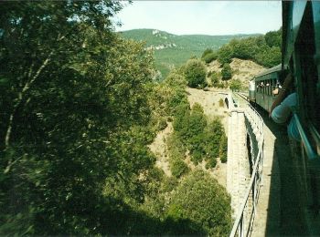
![Randonnée A pied Seui - (SI Z20) Caserma Forestale Montarbu - Taquisara - Photo](https://media.geolcdn.com/t/350/260/3a0fe77d-8f26-4404-8e65-7c46afb5444d.jpeg&format=jpg&maxdim=2)
![A pied A pied](https://static1.geolcdn.com/sitytour/trail-icons/100.png)
Km
A pied
![](/images/other/stat-length.png)
![](https://static1.geolcdn.com/siteimages/upload/files/1508320355ic_sort_den_pos_24dp.png)
![](https://static1.geolcdn.com/siteimages/upload/files/1508320355ic_sort_den_neg_24dp.png)
![](https://static1.geolcdn.com/siteimages/upload/files/16400158638029165_repeat_loop_refresh_sync_direction_icon.png)
• Sentiero Italia CAI 2019
![Randonnée A pied Brucei/Burcei - (SI Z27) Burcei - Su Baccu Malu - Photo](https://media.geolcdn.com/t/350/260/ce60288b-2cd8-4f31-934b-e932940ff0dd.jpeg&format=jpg&maxdim=2)
![A pied A pied](https://static1.geolcdn.com/sitytour/trail-icons/100.png)
Km
A pied
![](/images/other/stat-length.png)
![](https://static1.geolcdn.com/siteimages/upload/files/1508320355ic_sort_den_pos_24dp.png)
![](https://static1.geolcdn.com/siteimages/upload/files/1508320355ic_sort_den_neg_24dp.png)
![](https://static1.geolcdn.com/siteimages/upload/files/16400158638029165_repeat_loop_refresh_sync_direction_icon.png)
![Randonnée A pied Scalepranu/Escalaplano - (SI Z24) Cuile Is Arrantas - Armungia - Photo](https://media.geolcdn.com/t/350/260/acf92f72-ab8b-4c8d-b396-f73e2e46955f.jpeg&format=jpg&maxdim=2)
![A pied A pied](https://static1.geolcdn.com/sitytour/trail-icons/100.png)
Km
A pied
![](/images/other/stat-length.png)
![](https://static1.geolcdn.com/siteimages/upload/files/1508320355ic_sort_den_pos_24dp.png)
![](https://static1.geolcdn.com/siteimages/upload/files/1508320355ic_sort_den_neg_24dp.png)
![](https://static1.geolcdn.com/siteimages/upload/files/16400158638029165_repeat_loop_refresh_sync_direction_icon.png)
![Randonnée A pied Santadi - Gambarussa - Bau Scova (208) - Photo](https://media.geolcdn.com/t/350/260/ext.jpg?maxdim=2&url=https%3A%2F%2Fstatic1.geolcdn.com%2Fsiteimages%2Fupload%2Ffiles%2F1545311037marcheuse_200dpi.jpg)
![A pied A pied](https://static1.geolcdn.com/sitytour/trail-icons/100.png)
Km
A pied
![](/images/other/stat-length.png)
![](https://static1.geolcdn.com/siteimages/upload/files/1508320355ic_sort_den_pos_24dp.png)
![](https://static1.geolcdn.com/siteimages/upload/files/1508320355ic_sort_den_neg_24dp.png)
![](https://static1.geolcdn.com/siteimages/upload/files/16400158638029165_repeat_loop_refresh_sync_direction_icon.png)
• Randonnée créée par Ente Foreste della Sardegna.
![Randonnée A pied Biddanoa 'e Tulu/Villanova Tulo - Raccordo 262-B - Photo](https://media.geolcdn.com/t/350/260/ext.jpg?maxdim=2&url=https%3A%2F%2Fstatic1.geolcdn.com%2Fsiteimages%2Fupload%2Ffiles%2F1545311037marcheuse_200dpi.jpg)
![A pied A pied](https://static1.geolcdn.com/sitytour/trail-icons/100.png)
Km
A pied
![](/images/other/stat-length.png)
![](https://static1.geolcdn.com/siteimages/upload/files/1508320355ic_sort_den_pos_24dp.png)
![](https://static1.geolcdn.com/siteimages/upload/files/1508320355ic_sort_den_neg_24dp.png)
![](https://static1.geolcdn.com/siteimages/upload/files/16400158638029165_repeat_loop_refresh_sync_direction_icon.png)
• Randonnée créée par Ente foreste della Sardegna.
![Randonnée A pied Seulu/Seulo - Villanovatulo - Seulo - Photo](https://media.geolcdn.com/t/350/260/ext.jpg?maxdim=2&url=https%3A%2F%2Fstatic1.geolcdn.com%2Fsiteimages%2Fupload%2Ffiles%2F1545311037marcheuse_200dpi.jpg)
![A pied A pied](https://static1.geolcdn.com/sitytour/trail-icons/100.png)
Km
A pied
![](/images/other/stat-length.png)
![](https://static1.geolcdn.com/siteimages/upload/files/1508320355ic_sort_den_pos_24dp.png)
![](https://static1.geolcdn.com/siteimages/upload/files/1508320355ic_sort_den_neg_24dp.png)
![](https://static1.geolcdn.com/siteimages/upload/files/16400158638029165_repeat_loop_refresh_sync_direction_icon.png)
• Symbole: parallel horizontal bars red white red
![Randonnée A pied Seui - Sadali - Arcu e Spineddai - Photo](https://media.geolcdn.com/t/350/260/ext.jpg?maxdim=2&url=https%3A%2F%2Fstatic1.geolcdn.com%2Fsiteimages%2Fupload%2Ffiles%2F1545311037marcheuse_200dpi.jpg)
![A pied A pied](https://static1.geolcdn.com/sitytour/trail-icons/100.png)
Km
A pied
![](/images/other/stat-length.png)
![](https://static1.geolcdn.com/siteimages/upload/files/1508320355ic_sort_den_pos_24dp.png)
![](https://static1.geolcdn.com/siteimages/upload/files/1508320355ic_sort_den_neg_24dp.png)
![](https://static1.geolcdn.com/siteimages/upload/files/16400158638029165_repeat_loop_refresh_sync_direction_icon.png)
• Symbole: parallel horizontal bars red white red
![Randonnée A pied Biddanoa 'e Tulu/Villanova Tulo - Pranedda Ollastru - Nuraghe Adoni - Photo](https://media.geolcdn.com/t/350/260/ext.jpg?maxdim=2&url=https%3A%2F%2Fstatic1.geolcdn.com%2Fsiteimages%2Fupload%2Ffiles%2F1545311037marcheuse_200dpi.jpg)
![A pied A pied](https://static1.geolcdn.com/sitytour/trail-icons/100.png)
Km
A pied
![](/images/other/stat-length.png)
![](https://static1.geolcdn.com/siteimages/upload/files/1508320355ic_sort_den_pos_24dp.png)
![](https://static1.geolcdn.com/siteimages/upload/files/1508320355ic_sort_den_neg_24dp.png)
![](https://static1.geolcdn.com/siteimages/upload/files/16400158638029165_repeat_loop_refresh_sync_direction_icon.png)
• Randonnée créée par Ente foreste della Sardegna.
20 randonnées affichées sur 42
Application GPS de randonnée GRATUITE
Activités
Régions proches
- Arbus
- Armùngia/Armungia
- Arresi/Sant'Anna Arresi
- Ballau/Ballao
- Barùmini/Barumini
- Bidda Matzràxia/Villamassargia
- Biddacidru/Villacidro
- Biddanoa 'e Tulu/Villanova Tulo
- Biddeputzi/Villaputzu
- Biddesatu/Villasalto
- Biddesorris/Villasor
- Brucei/Burcei
- Bugerru/Buggerru
- Câdesédda/Calasetta
- Carbonia
- Castiadas
- Crabonaxa/Villasimius
- Domunoas/Domusnovas
- Domus De Maria
- Frùmini Majori/Fluminimaggiore
- Gèsturi/Gesturi
- Giba
- Goni
- Gonnesa
- Gonnos/Gonnosfanadiga
- Gùspini/Guspini
- Iglesias
- Masainas
- Murera/Muravera
- Narcau/Narcao
- Patiolla/Dolianova
- Pauli Gerrei/San Nicolò Gerrei
- Piscinas
- Portescusi/Portoscuso
- Sàdili/Sadali
- Santadi
- Santu 'Èngiu/San Gavino Monreale
- Santu Giuanni Suèrgiu/San Giovanni Suergiu
- Santu Idu/San Vito
- Sant’Antioco
- Scalepranu/Escalaplano
- Seui
- Seulu/Seulo
- Siliqua
- Teulada
- Tratalias
- Tuili
- U Pàize/Carloforte