![](/images/other/stat-length.png)
Landes, Nouvelle-Aquitaine : Les meilleures randonnées, itinéraires, parcours, balades et promenades
Landes : découvrez les meilleures randonnées : 1 442 pédestres, 501 à vélo ou VTT et 13 parcours équestres. Tous ces circuits, parcours, itinéraires et activités en plein air sont disponibles dans nos applications SityTrail pour smartphones et tablettes.
Les meilleurs parcours (2013)
![Randonnée Marche Aureilhan - Tour du Lac Aureilhan - Photo](https://media.geolcdn.com/t/350/260/3581577e-2c85-4bb4-ba79-9999d98305eb.jpg&format=jpg&maxdim=2)
![Marche Marche](https://static1.geolcdn.com/sitytour/trail-icons/101.png)
Km
Marche
![](/images/other/stat-length.png)
![](https://static1.geolcdn.com/siteimages/upload/files/1508320355ic_sort_den_pos_24dp.png)
![](https://static1.geolcdn.com/siteimages/upload/files/1508320355ic_sort_den_neg_24dp.png)
![](https://static1.geolcdn.com/siteimages/upload/files/16400158638029165_repeat_loop_refresh_sync_direction_icon.png)
![Randonnée Marche Mées - Circuit des Barthes Neuves Mées le 8juin 2019 - Photo](https://media.geolcdn.com/t/350/260/d81f8504-22bd-48b5-b439-52cfa6be341c.jpg&format=jpg&maxdim=2)
![Marche Marche](https://static1.geolcdn.com/sitytour/trail-icons/101.png)
Km
Marche
![](/images/other/stat-length.png)
![](https://static1.geolcdn.com/siteimages/upload/files/1508320355ic_sort_den_pos_24dp.png)
![](https://static1.geolcdn.com/siteimages/upload/files/1508320355ic_sort_den_neg_24dp.png)
![](https://static1.geolcdn.com/siteimages/upload/files/16400158638029165_repeat_loop_refresh_sync_direction_icon.png)
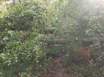
• Circuit facile mais encore très boueux à faire après une période sèche
![Randonnée Course à pied Aureilhan - Balade au fil du lac et du courant - Mimizan - Photo](https://media.geolcdn.com/t/350/260/ext.jpg?maxdim=2&url=https%3A%2F%2Fservices.sitytrail.com%2FGeolivesWS%2FDownloadMedia.ashx%3FTrailID%3D172683%26Media%3D14062_6.jpg)
![Course à pied Course à pied](https://static1.geolcdn.com/sitytour/trail-icons/103.png)
Km
Course à pied
![](/images/other/stat-length.png)
![](https://static1.geolcdn.com/siteimages/upload/files/1508320355ic_sort_den_pos_24dp.png)
![](https://static1.geolcdn.com/siteimages/upload/files/1508320355ic_sort_den_neg_24dp.png)
![](https://static1.geolcdn.com/siteimages/upload/files/16400158638029165_repeat_loop_refresh_sync_direction_icon.png)
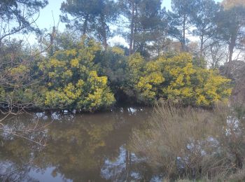
• Agréable circuit en boucle (à parcourir plutôt à VTT) qui chemine le long du Courant des Forges et du Lac d'Aureilhan.
![Randonnée Marche Hagetmau - Randonnée autour de Hagetmau - Lac d'Ages et lacs d'Halco - Photo](https://media.geolcdn.com/t/350/260/ext.jpg?maxdim=2&url=https%3A%2F%2Fservices.sitytrail.com%2FGeolivesWS%2FDownloadMedia.ashx%3FTrailID%3D110420%26Media%3D5895_1.jpg)
![Marche Marche](https://static1.geolcdn.com/sitytour/trail-icons/101.png)
Km
Marche
![](/images/other/stat-length.png)
![](https://static1.geolcdn.com/siteimages/upload/files/1508320355ic_sort_den_pos_24dp.png)
![](https://static1.geolcdn.com/siteimages/upload/files/1508320355ic_sort_den_neg_24dp.png)
![](https://static1.geolcdn.com/siteimages/upload/files/16400158638029165_repeat_loop_refresh_sync_direction_icon.png)
• Circuit proposé par l'Office de Tourisme de Hagetmau. Stationnement : Parking de la crypte de St-Girons que l'on atte...
![Randonnée Vélo Tarnos - Piste cyclable de Tarnos et Ondres - Photo](https://media.geolcdn.com/t/350/260/ext.jpg?maxdim=2&url=https%3A%2F%2Fservices.sitytrail.com%2FGeolivesWS%2FDownloadMedia.ashx%3FTrailID%3D110291%26Media%3D5689_1.jpg)
![Vélo Vélo](https://static1.geolcdn.com/sitytour/trail-icons/200.png)
Km
Vélo
![](/images/other/stat-length.png)
![](https://static1.geolcdn.com/siteimages/upload/files/1508320355ic_sort_den_pos_24dp.png)
![](https://static1.geolcdn.com/siteimages/upload/files/1508320355ic_sort_den_neg_24dp.png)
![](https://static1.geolcdn.com/siteimages/upload/files/16400158638029165_repeat_loop_refresh_sync_direction_icon.png)
• Le vélo est un moyen idéal de découvrir les Landes. D'abord parce que le département est plat, qu'il dispose d'une pi...
![Randonnée V.T.T. Pissos - Pissos - Escoursolles - Landes de Gascogne - Photo](https://media.geolcdn.com/t/350/260/ext.jpg?maxdim=2&url=https%3A%2F%2Fservices.sitytrail.com%2FGeolivesWS%2FDownloadMedia.ashx%3FTrailID%3D108979%26Media%3D2913_1.jpg)
![V.T.T. V.T.T.](https://static1.geolcdn.com/sitytour/trail-icons/202.png)
Km
V.T.T.
![](/images/other/stat-length.png)
![](https://static1.geolcdn.com/siteimages/upload/files/1508320355ic_sort_den_pos_24dp.png)
![](https://static1.geolcdn.com/siteimages/upload/files/1508320355ic_sort_den_neg_24dp.png)
![](https://static1.geolcdn.com/siteimages/upload/files/16400158638029165_repeat_loop_refresh_sync_direction_icon.png)
• Parc Naturel Régional des Landes de Gascogne Situé à cheval entre les départements des Landes et de la Gironde, dans ...
![Randonnée Marche Moliets-et-Maâ - balade dans les pins avec vue sur dune - Photo](https://media.geolcdn.com/t/350/260/0218ac8f-b6c0-46e5-b6fe-b779c8db0705.jpg&format=jpg&maxdim=2)
![Marche Marche](https://static1.geolcdn.com/sitytour/trail-icons/101.png)
Km
Marche
![](/images/other/stat-length.png)
![](https://static1.geolcdn.com/siteimages/upload/files/1508320355ic_sort_den_pos_24dp.png)
![](https://static1.geolcdn.com/siteimages/upload/files/1508320355ic_sort_den_neg_24dp.png)
![](https://static1.geolcdn.com/siteimages/upload/files/16400158638029165_repeat_loop_refresh_sync_direction_icon.png)
• belle
![Randonnée Marche Hagetmau - HAGETMAU TERRA AVENTURA](https://media.geolcdn.com/t/350/260/24030744-5e4b-4d44-a727-5b3b0c107276.jpg&format=jpg&maxdim=2)
![Marche Marche](https://static1.geolcdn.com/sitytour/trail-icons/101.png)
Km
Marche
![](/images/other/stat-length.png)
![](https://static1.geolcdn.com/siteimages/upload/files/1508320355ic_sort_den_pos_24dp.png)
![](https://static1.geolcdn.com/siteimages/upload/files/1508320355ic_sort_den_neg_24dp.png)
![](https://static1.geolcdn.com/siteimages/upload/files/16400158638029165_repeat_loop_refresh_sync_direction_icon.png)
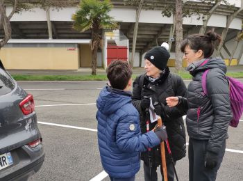
• superbe balade. Je ne soupçonnais pas les capacities sportive de ce gros village .
![Randonnée Marche Rion-des-Landes - retjons, prit, carreyre - 7 - Photo](https://media.geolcdn.com/t/350/260/ff91d5e6-2d63-47a1-ad7b-823d37ac495d.jpg&format=jpg&maxdim=2)
![Marche Marche](https://static1.geolcdn.com/sitytour/trail-icons/101.png)
Km
Marche
![](/images/other/stat-length.png)
![](https://static1.geolcdn.com/siteimages/upload/files/1508320355ic_sort_den_pos_24dp.png)
![](https://static1.geolcdn.com/siteimages/upload/files/1508320355ic_sort_den_neg_24dp.png)
![](https://static1.geolcdn.com/siteimages/upload/files/16400158638029165_repeat_loop_refresh_sync_direction_icon.png)
![Randonnée Marche Moliets-et-Maâ - MOLIETS le courant d huchet 290 7700 - Photo](https://media.geolcdn.com/t/350/260/11eb8d60-2334-433e-941c-ab21d54ad840.jpg&format=jpg&maxdim=2)
![Marche Marche](https://static1.geolcdn.com/sitytour/trail-icons/101.png)
Km
Marche
![](/images/other/stat-length.png)
![](https://static1.geolcdn.com/siteimages/upload/files/1508320355ic_sort_den_pos_24dp.png)
![](https://static1.geolcdn.com/siteimages/upload/files/1508320355ic_sort_den_neg_24dp.png)
![](https://static1.geolcdn.com/siteimages/upload/files/16400158638029165_repeat_loop_refresh_sync_direction_icon.png)
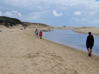
• temps effectif de marche la prochaine fois on fera l'autre partie de Leon a Pichelebe
![Randonnée Marche Léon - Etang VSP 10km - Photo](https://media.geolcdn.com/t/350/260/0f991cfe-6bda-4037-a335-2a4be6192310.jpg&format=jpg&maxdim=2)
![Marche Marche](https://static1.geolcdn.com/sitytour/trail-icons/101.png)
Km
Marche
![](/images/other/stat-length.png)
![](https://static1.geolcdn.com/siteimages/upload/files/1508320355ic_sort_den_pos_24dp.png)
![](https://static1.geolcdn.com/siteimages/upload/files/1508320355ic_sort_den_neg_24dp.png)
![](https://static1.geolcdn.com/siteimages/upload/files/16400158638029165_repeat_loop_refresh_sync_direction_icon.png)
![Randonnée V.T.T. Biarrotte - Fetes Biarrotte 2013 - Photo](https://media.geolcdn.com/t/350/260/ext.jpg?maxdim=2&url=https%3A%2F%2Fstatic1.geolcdn.com%2Fsiteimages%2Fupload%2Ffiles%2F1524743154velo.jpg)
![V.T.T. V.T.T.](https://static1.geolcdn.com/sitytour/trail-icons/202.png)
Km
V.T.T.
![](/images/other/stat-length.png)
![](https://static1.geolcdn.com/siteimages/upload/files/1508320355ic_sort_den_pos_24dp.png)
![](https://static1.geolcdn.com/siteimages/upload/files/1508320355ic_sort_den_neg_24dp.png)
![](https://static1.geolcdn.com/siteimages/upload/files/16400158638029165_repeat_loop_refresh_sync_direction_icon.png)
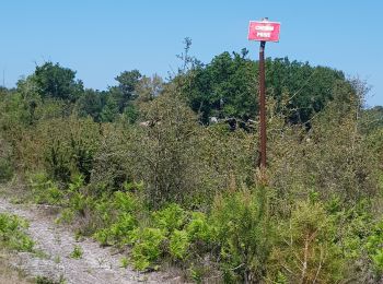
• Parcours à travers bois et chemins. Attention en période humide le passage après l'Adour est particulièrement boueux.
![Randonnée Autre activité Soustons - soustons 1 - Photo](https://media.geolcdn.com/t/350/260/ext.jpg?maxdim=2&url=https%3A%2F%2Fstatic1.geolcdn.com%2Fsiteimages%2Fupload%2Ffiles%2F1545311037marcheuse_200dpi.jpg)
![Autre activité Autre activité](https://static1.geolcdn.com/sitytour/trail-icons/900.png)
Km
Autre activité
![](/images/other/stat-length.png)
![](https://static1.geolcdn.com/siteimages/upload/files/1508320355ic_sort_den_pos_24dp.png)
![](https://static1.geolcdn.com/siteimages/upload/files/1508320355ic_sort_den_neg_24dp.png)
![](https://static1.geolcdn.com/siteimages/upload/files/16400158638029165_repeat_loop_refresh_sync_direction_icon.png)
•
![Randonnée Marche Biscarrosse - Biscarosse En Chon - Photo](https://media.geolcdn.com/t/350/260/ext.jpg?maxdim=2&url=https%3A%2F%2Fstatic1.geolcdn.com%2Fsiteimages%2Fupload%2Ffiles%2F1553511878bg_sport_marche.png)
![Marche Marche](https://static1.geolcdn.com/sitytour/trail-icons/101.png)
Km
Marche
![](/images/other/stat-length.png)
![](https://static1.geolcdn.com/siteimages/upload/files/1508320355ic_sort_den_pos_24dp.png)
![](https://static1.geolcdn.com/siteimages/upload/files/1508320355ic_sort_den_neg_24dp.png)
![](https://static1.geolcdn.com/siteimages/upload/files/16400158638029165_repeat_loop_refresh_sync_direction_icon.png)
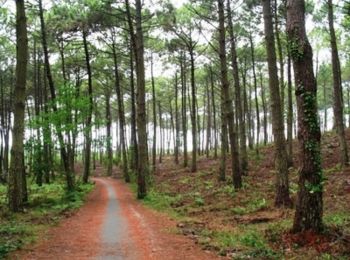
• Entre forêt et lac. Départ et arrivés sont dans un camping fermé, mais il existe un chemin accessible quelques mètre...
![Randonnée V.T.T. Vieux-Boucau-les-Bains - Soustons→étang hardy - Photo](https://media.geolcdn.com/t/350/260/ext.jpg?maxdim=2&url=https%3A%2F%2Fstatic1.geolcdn.com%2Fsiteimages%2Fupload%2Ffiles%2F1524743154velo.jpg)
![V.T.T. V.T.T.](https://static1.geolcdn.com/sitytour/trail-icons/202.png)
Km
V.T.T.
![](/images/other/stat-length.png)
![](https://static1.geolcdn.com/siteimages/upload/files/1508320355ic_sort_den_pos_24dp.png)
![](https://static1.geolcdn.com/siteimages/upload/files/1508320355ic_sort_den_neg_24dp.png)
![](https://static1.geolcdn.com/siteimages/upload/files/16400158638029165_repeat_loop_refresh_sync_direction_icon.png)
•
![Randonnée V.T.T. Tartas - VTT à Tartas - Photo](https://media.geolcdn.com/t/350/260/ext.jpg?maxdim=2&url=https%3A%2F%2Fstatic1.geolcdn.com%2Fsiteimages%2Fupload%2Ffiles%2F1524743154velo.jpg)
![V.T.T. V.T.T.](https://static1.geolcdn.com/sitytour/trail-icons/202.png)
Km
V.T.T.
![](/images/other/stat-length.png)
![](https://static1.geolcdn.com/siteimages/upload/files/1508320355ic_sort_den_pos_24dp.png)
![](https://static1.geolcdn.com/siteimages/upload/files/1508320355ic_sort_den_neg_24dp.png)
![](https://static1.geolcdn.com/siteimages/upload/files/16400158638029165_repeat_loop_refresh_sync_direction_icon.png)
• Le Centenaire de la Pédale Tarusate 2012- 34km - Tartas. La première moitié est du single avec des passages technique...
![Randonnée Marche Seignosse - Dunes et forêts à Seignosse le Penon - Photo](https://media.geolcdn.com/t/350/260/ext.jpg?maxdim=2&url=https%3A%2F%2Fstatic1.geolcdn.com%2Fsiteimages%2Fupload%2Ffiles%2F1553511878bg_sport_marche.png)
![Marche Marche](https://static1.geolcdn.com/sitytour/trail-icons/101.png)
Km
Marche
![](/images/other/stat-length.png)
![](https://static1.geolcdn.com/siteimages/upload/files/1508320355ic_sort_den_pos_24dp.png)
![](https://static1.geolcdn.com/siteimages/upload/files/1508320355ic_sort_den_neg_24dp.png)
![](https://static1.geolcdn.com/siteimages/upload/files/16400158638029165_repeat_loop_refresh_sync_direction_icon.png)
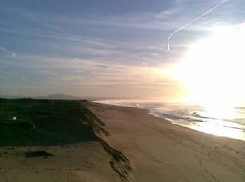
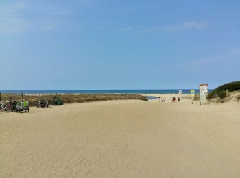
• Ce circuit démarre au syndicat d'initiative du Penon. A travers dunes, au cœur de la forêt de Seignosse, il conduit a...
![Randonnée Vélo Bénesse-Maremne - Boucles des lacs - Benesse - Photo](https://media.geolcdn.com/t/350/260/ext.jpg?maxdim=2&url=https%3A%2F%2Fstatic1.geolcdn.com%2Fsiteimages%2Fupload%2Ffiles%2F1524743154velo.jpg)
![Vélo Vélo](https://static1.geolcdn.com/sitytour/trail-icons/200.png)
Km
Vélo
![](/images/other/stat-length.png)
![](https://static1.geolcdn.com/siteimages/upload/files/1508320355ic_sort_den_pos_24dp.png)
![](https://static1.geolcdn.com/siteimages/upload/files/1508320355ic_sort_den_neg_24dp.png)
![](https://static1.geolcdn.com/siteimages/upload/files/16400158638029165_repeat_loop_refresh_sync_direction_icon.png)
• Circuit qui permet d'approcher la forêt landaise ainsi que les lacs. Possibilité d'autres activités, jogging, cheval,...
![Randonnée Marche Capbreton - Capbreton le boudigaut la chapelle - Photo](https://media.geolcdn.com/t/350/260/0f280e2b-cfd3-47c7-9425-b7e5235e1ad5.jpg&format=jpg&maxdim=2)
![Marche Marche](https://static1.geolcdn.com/sitytour/trail-icons/101.png)
Km
Marche
![](/images/other/stat-length.png)
![](https://static1.geolcdn.com/siteimages/upload/files/1508320355ic_sort_den_pos_24dp.png)
![](https://static1.geolcdn.com/siteimages/upload/files/1508320355ic_sort_den_neg_24dp.png)
![](https://static1.geolcdn.com/siteimages/upload/files/16400158638029165_repeat_loop_refresh_sync_direction_icon.png)
• février 2025 balade facile le long du Boudigaut
![Randonnée Marche Eugénie-les-Bains - EUGENIE LES BAINS par Bahus Soubiran revue et corrigée](https://media.geolcdn.com/t/350/260/f0339ad3-d44b-4eb8-b534-a88237142a7c.jpg&format=jpg&maxdim=2)
![Marche Marche](https://static1.geolcdn.com/sitytour/trail-icons/101.png)
Km
Marche
![](/images/other/stat-length.png)
![](https://static1.geolcdn.com/siteimages/upload/files/1508320355ic_sort_den_pos_24dp.png)
![](https://static1.geolcdn.com/siteimages/upload/files/1508320355ic_sort_den_neg_24dp.png)
![](https://static1.geolcdn.com/siteimages/upload/files/16400158638029165_repeat_loop_refresh_sync_direction_icon.png)
20 randonnées affichées sur 2013
Application GPS de randonnée GRATUITE
Activités
Régions proches
- Aire-sur-l'Adour
- Amou
- Angoumé
- Angresse
- Arboucave
- Arengosse
- Argelos
- Arsague
- Artassenx
- Arthez-d'Armagnac
- Arue
- Audignon
- Audon
- Aureilhan
- Aurice
- Azur
- Bahus-Soubiran
- Baigts
- Banos
- Bas-Mauco
- Bascons
- Bassercles
- Bastennes
- Bégaar
- Belhade
- Bélis
- Bélus
- Bénesse-Maremne
- Benquet
- Betbezer-d'Armagnac
- Beylongue
- Beyries
- Biarrotte
- Bias
- Biscarrosse
- Bonnegarde
- Bordères-et-Lamensans
- Bostens
- Bougue
- Bourriot-Bergonce
- Brassempouy
- Bretagne-de-Marsan
- Brocas
- Buanes
- Cachen
- Cagnotte
- Callen
- Campagne
- Campet-et-Lamolère
- Candresse
- Canenx-et-Réaut
- Capbreton
- Carcarès-Sainte-Croix
- Carcen-Ponson
- Cassen
- Castaignos-Souslens
- Castelner
- Castets
- Cauna
- Cauneille
- Caupenne
- Cazalis
- Cazères-sur-l'Adour
- Cère
- Clèdes
- Clermont
- Commensacq
- Coudures
- Créon-d'Armagnac
- Dax
- Doazit
- Donzacq
- Duhort-Bachen
- Escalans
- Escource
- Estibeaux
- Eugénie-les-Bains
- Eyres-Moncube
- Fargues
- Gaas
- Gabarret
- Gaillères
- Gamarde-les-Bains
- Garein
- Gastes
- Gaujacq
- Geaune
- Geloux
- Gourbera
- Gousse
- Gouts
- Grenade-sur-l'Adour
- Habas
- Hagetmau
- Hastingues
- Haut-Mauco
- Herm
- Herré
- Heugas
- Hinx
- Hontanx
- Horsarrieu
- Josse
- Labastide-Chalosse
- Labastide-d'Armagnac
- Labatut
- Labenne
- Labouheyre
- Labrit
- Lacquy
- Laglorieuse
- Lagrange
- Laluque
- Larbey
- Larrivière-Saint-Savin
- Latrille
- Laurède
- Le Frêche
- Le Sen
- Léon
- Lesgor
- Lesperon
- Lévignacq
- Linxe
- Liposthey
- Lit-et-Mixe
- Losse
- Louer
- Lourquen
- Lubbon
- Lucbardez-et-Bargues
- Lüe
- Luglon
- Lussagnet
- Luxey
- Magescq
- Maillas
- Maillères
- Mano
- Mant
- Mauries
- Maurrin
- Mauvezin-d'Armagnac
- Maylis
- Mazerolles
- Mées
- Meilhan
- Messanges
- Mézos
- Mimbaste
- Mimizan
- Miramont-Sensacq
- Moliets-et-Maâ
- Momuy
- Monségur
- Mont-de-Marsan
- Montaut
- Montfort-en-Chalosse
- Montgaillard
- Montsoué
- Morcenx-la-Nouvelle
- Moustey
- Mugron
- Narrosse
- Nassiet
- Nerbis
- Nousse
- Oeyregave
- Oeyreluy
- Onard
- Ondres
- Onesse-Laharie
- Orist
- Orthevielle
- Orx
- Ossages
- Ousse-Suzan
- Parentis-en-Born
- Parleboscq
- Payros-Cazautets
- Perquie
- Peyre
- Peyrehorade
- Pimbo
- Pissos
- Pomarez
- Pontenx-les-Forges
- Pontonx-sur-l'Adour
- Port-de-Lanne
- Pouillon
- Pouydesseaux
- Poyanne
- Préchacq-les-Bains
- Pujo-le-Plan
- Retjons
- Rion-des-Landes
- Rivière-Saas-et-Gourby
- Roquefort
- Sabres
- Saint-André-de-Seignanx
- Saint-Avit
- Saint-Barthélemy
- Saint-Cricq-Chalosse
- Saint-Cricq-du-Gave
- Saint-Étienne-d'Orthe
- Saint-Gein
- Saint-Geours-de-Maremne
- Saint-Gor
- Saint-Jean-de-Marsacq
- Saint-Julien-en-Born
- Saint-Justin
- Saint-Laurent-de-Gosse
- Saint-Loubouer
- Saint-Martin-d'Oney
- Saint-Martin-de-Hinx
- Saint-Martin-de-Seignanx
- Saint-Maurice-sur-Adour
- Saint-Michel-Escalus
- Saint-Pandelon
- Saint-Paul-en-Born
- Saint-Paul-lès-Dax
- Saint-Perdon
- Saint-Pierre-du-Mont
- Saint-Sever
- Saint-Vincent-de-Paul
- Saint-Vincent-de-Tyrosse
- Saint-Yaguen
- Sainte-Colombe
- Sainte-Eulalie-en-Born
- Sainte-Foy
- Sainte-Marie-de-Gosse
- Samadet
- Sanguinet
- Sarbazan
- Sarraziet
- Sarron
- Saubion
- Saubrigues
- Saubusse
- Saugnacq-et-Muret
- Seignosse
- Serres-Gaston
- Siest
- Soorts-Hossegor
- Sorbets
- Sorde-l'Abbaye
- Sore
- Sort-en-Chalosse
- Souprosse
- Soustons
- Taller
- Tarnos
- Tartas
- Tercis-les-Bains
- Téthieu
- Tilh
- Tosse
- Toulouzette
- Trensacq
- Uchacq-et-Parentis
- Urgons
- Uza
- Vert
- Vielle-Saint-Girons
- Vielle-Soubiran
- Vieux-Boucau-les-Bains
- Villenave
- Villeneuve-de-Marsan
- Ychoux
- Ygos-Saint-Saturnin
- Yzosse