![](/images/other/stat-length.png)
- Randonnées
- Outdoor
- France
- Pays de la Loire
- Sarthe
Sarthe, Pays de la Loire : Les meilleures randonnées, itinéraires, parcours, balades et promenades
Sarthe : découvrez les meilleures randonnées : 1 034 pédestres, 252 à vélo ou VTT et 29 parcours équestres. Tous ces circuits, parcours, itinéraires et activités en plein air sont disponibles dans nos applications SityTrail pour smartphones et tablettes.
Les meilleurs parcours (1332)
![Randonnée Marche Pontvallain - pontvallain circuit bleu - Photo](https://media.geolcdn.com/t/350/260/ext.jpg?maxdim=2&url=https%3A%2F%2Fservices.sitytrail.com%2FGeolivesWS%2FDownloadMedia.ashx%3FTrailID%3D162486%26Media%3D20121108100753.jpeg)
![Marche Marche](https://static1.geolcdn.com/sitytour/trail-icons/101.png)
Km
Marche
![](/images/other/stat-length.png)
![](https://static1.geolcdn.com/siteimages/upload/files/1508320355ic_sort_den_pos_24dp.png)
![](https://static1.geolcdn.com/siteimages/upload/files/1508320355ic_sort_den_neg_24dp.png)
![](https://static1.geolcdn.com/siteimages/upload/files/16400158638029165_repeat_loop_refresh_sync_direction_icon.png)
• facile
![Randonnée V.T.T. Changé - Boucle Le Mans - Changé - Brettes - Parigné - Challes 53 km - Photo](https://media.geolcdn.com/t/350/260/ext.jpg?maxdim=2&url=https%3A%2F%2Fservices.sitytrail.com%2FGeolivesWS%2FDownloadMedia.ashx%3FTrailID%3D172382%26Media%3D13727_1.jpg)
![V.T.T. V.T.T.](https://static1.geolcdn.com/sitytour/trail-icons/202.png)
Km
V.T.T.
![](/images/other/stat-length.png)
![](https://static1.geolcdn.com/siteimages/upload/files/1508320355ic_sort_den_pos_24dp.png)
![](https://static1.geolcdn.com/siteimages/upload/files/1508320355ic_sort_den_neg_24dp.png)
![](https://static1.geolcdn.com/siteimages/upload/files/16400158638029165_repeat_loop_refresh_sync_direction_icon.png)
• Boucle depuis le parking du Verger au Mans. Passage à proximité de Ruaudin, Brettes les Pins. Le parcours rejoint ens...
![Randonnée V.T.T. Saint-Léonard-des-Bois - Espace VTT FFC des Alpes Mancelles - Les Buttes - Balisage n°5 - Photo](https://media.geolcdn.com/t/350/260/ext.jpg?maxdim=2&url=https%3A%2F%2Fservices.sitytrail.com%2FGeolivesWS%2FDownloadMedia.ashx%3FTrailID%3D105108%26Media%3D8706_1.jpg)
![V.T.T. V.T.T.](https://static1.geolcdn.com/sitytour/trail-icons/202.png)
Km
V.T.T.
![](/images/other/stat-length.png)
![](https://static1.geolcdn.com/siteimages/upload/files/1508320355ic_sort_den_pos_24dp.png)
![](https://static1.geolcdn.com/siteimages/upload/files/1508320355ic_sort_den_neg_24dp.png)
![](https://static1.geolcdn.com/siteimages/upload/files/16400158638029165_repeat_loop_refresh_sync_direction_icon.png)
• Cette boucle au départ du Domaine du Gasseau à côté de Saint Léonard des Bois n'est pas très longue mais son dénivelé...
![Randonnée V.T.T. Saint-Léonard-des-Bois - Espace VTT FFC des Alpes Mancelles - Le Val - Balisage n°6 - Photo](https://media.geolcdn.com/t/350/260/ext.jpg?maxdim=2&url=https%3A%2F%2Fservices.sitytrail.com%2FGeolivesWS%2FDownloadMedia.ashx%3FTrailID%3D105107%26Media%3D8702_2.jpg)
![V.T.T. V.T.T.](https://static1.geolcdn.com/sitytour/trail-icons/202.png)
Km
V.T.T.
![](/images/other/stat-length.png)
![](https://static1.geolcdn.com/siteimages/upload/files/1508320355ic_sort_den_pos_24dp.png)
![](https://static1.geolcdn.com/siteimages/upload/files/1508320355ic_sort_den_neg_24dp.png)
![](https://static1.geolcdn.com/siteimages/upload/files/16400158638029165_repeat_loop_refresh_sync_direction_icon.png)
• Cette petite boucle entre Saint Léonard des Bois et Saint Cénéri le Gérei débute par une montée assez raide jusqu'à u...
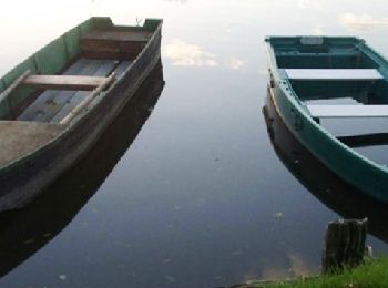
![Randonnée Marche Sablé-sur-Sarthe - En forêt de Pincé - Photo](https://media.geolcdn.com/t/350/260/ext.jpg?maxdim=2&url=https%3A%2F%2Fservices.sitytrail.com%2FGeolivesWS%2FDownloadMedia.ashx%3FTrailID%3D102584%26Media%3D3480_1.jpg)
![Marche Marche](https://static1.geolcdn.com/sitytour/trail-icons/101.png)
Km
Marche
![](/images/other/stat-length.png)
![](https://static1.geolcdn.com/siteimages/upload/files/1508320355ic_sort_den_pos_24dp.png)
![](https://static1.geolcdn.com/siteimages/upload/files/1508320355ic_sort_den_neg_24dp.png)
![](https://static1.geolcdn.com/siteimages/upload/files/16400158638029165_repeat_loop_refresh_sync_direction_icon.png)
• La forêt de Pincé avec ses chemins de randonnée (Un topoguide est disponible à l’Office de Tourisme du Pays de Sablé)
![Randonnée Marche Bonnétable - la vive parence - Photo](https://media.geolcdn.com/t/350/260/ext.jpg?maxdim=2&url=https%3A%2F%2Fstatic1.geolcdn.com%2Fsiteimages%2Fupload%2Ffiles%2F1553511878bg_sport_marche.png)
![Marche Marche](https://static1.geolcdn.com/sitytour/trail-icons/101.png)
Km
Marche
![](/images/other/stat-length.png)
![](https://static1.geolcdn.com/siteimages/upload/files/1508320355ic_sort_den_pos_24dp.png)
![](https://static1.geolcdn.com/siteimages/upload/files/1508320355ic_sort_den_neg_24dp.png)
![](https://static1.geolcdn.com/siteimages/upload/files/16400158638029165_repeat_loop_refresh_sync_direction_icon.png)
• départ parking du château , realisable par temps humide
![Randonnée Marche Saint-Léonard-des-Bois - St Léonard Narbonne 10km - Photo](https://media.geolcdn.com/t/350/260/ext.jpg?maxdim=2&url=https%3A%2F%2Fstatic1.geolcdn.com%2Fsiteimages%2Fupload%2Ffiles%2F1553511878bg_sport_marche.png)
![Marche Marche](https://static1.geolcdn.com/sitytour/trail-icons/101.png)
Km
Marche
![](/images/other/stat-length.png)
![](https://static1.geolcdn.com/siteimages/upload/files/1508320355ic_sort_den_pos_24dp.png)
![](https://static1.geolcdn.com/siteimages/upload/files/1508320355ic_sort_den_neg_24dp.png)
![](https://static1.geolcdn.com/siteimages/upload/files/16400158638029165_repeat_loop_refresh_sync_direction_icon.png)
• Départ spot bord Sarthe
![Randonnée A pied Saint-Paul-le-Gaultier - Le Bois de Chemasson - Photo](https://media.geolcdn.com/t/350/260/ff95c566-5307-4d11-b561-b3411b7fcbe5.jpeg&format=jpg&maxdim=2)
![A pied A pied](https://static1.geolcdn.com/sitytour/trail-icons/100.png)
Km
A pied
![](/images/other/stat-length.png)
![](https://static1.geolcdn.com/siteimages/upload/files/1508320355ic_sort_den_pos_24dp.png)
![](https://static1.geolcdn.com/siteimages/upload/files/1508320355ic_sort_den_neg_24dp.png)
![](https://static1.geolcdn.com/siteimages/upload/files/16400158638029165_repeat_loop_refresh_sync_direction_icon.png)
• Envie de nature, envie de patrimoine, envie d’activités? Et si vous veniez explorer les Alpes Mancelles! Site web: h...
![Randonnée A pied Saint-Léonard-des-Bois - Vallée de Misère - Photo](https://media.geolcdn.com/t/350/260/7fc7be85-cc05-431c-a859-1b7cad4d3195.jpeg&format=jpg&maxdim=2)
![A pied A pied](https://static1.geolcdn.com/sitytour/trail-icons/100.png)
Km
A pied
![](/images/other/stat-length.png)
![](https://static1.geolcdn.com/siteimages/upload/files/1508320355ic_sort_den_pos_24dp.png)
![](https://static1.geolcdn.com/siteimages/upload/files/1508320355ic_sort_den_neg_24dp.png)
![](https://static1.geolcdn.com/siteimages/upload/files/16400158638029165_repeat_loop_refresh_sync_direction_icon.png)
• Envie de nature, envie de patrimoine, envie d’activités? Et si vous veniez explorer les Alpes Mancelles! Site web: h...
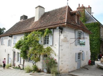
![Randonnée A pied Saint-Léonard-des-Bois - Les méandres de la Sarthe - Photo](https://media.geolcdn.com/t/350/260/59495368-fec3-427c-ab17-f336a308f404.jpeg&format=jpg&maxdim=2)
![A pied A pied](https://static1.geolcdn.com/sitytour/trail-icons/100.png)
Km
A pied
![](/images/other/stat-length.png)
![](https://static1.geolcdn.com/siteimages/upload/files/1508320355ic_sort_den_pos_24dp.png)
![](https://static1.geolcdn.com/siteimages/upload/files/1508320355ic_sort_den_neg_24dp.png)
![](https://static1.geolcdn.com/siteimages/upload/files/16400158638029165_repeat_loop_refresh_sync_direction_icon.png)
• Site web: http://randomontdesavaloirs.free.fr/
![Randonnée A pied Saint-Jean-de-la-Motte - Sentier de la Mare aux Cochons - Photo](https://media.geolcdn.com/t/350/260/57e54e19-dee3-4b3f-8763-a2fb5e9d29a7.jpeg&format=jpg&maxdim=2)
![A pied A pied](https://static1.geolcdn.com/sitytour/trail-icons/100.png)
Km
A pied
![](/images/other/stat-length.png)
![](https://static1.geolcdn.com/siteimages/upload/files/1508320355ic_sort_den_pos_24dp.png)
![](https://static1.geolcdn.com/siteimages/upload/files/1508320355ic_sort_den_neg_24dp.png)
![](https://static1.geolcdn.com/siteimages/upload/files/16400158638029165_repeat_loop_refresh_sync_direction_icon.png)
• Randonnée créée par Les Sentiers de la Motte.
![Randonnée A pied Saint-Jean-de-la-Motte - Sentier du Château de Gallerande - Photo](https://media.geolcdn.com/t/350/260/57e54e19-dee3-4b3f-8763-a2fb5e9d29a7.jpeg&format=jpg&maxdim=2)
![A pied A pied](https://static1.geolcdn.com/sitytour/trail-icons/100.png)
Km
A pied
![](/images/other/stat-length.png)
![](https://static1.geolcdn.com/siteimages/upload/files/1508320355ic_sort_den_pos_24dp.png)
![](https://static1.geolcdn.com/siteimages/upload/files/1508320355ic_sort_den_neg_24dp.png)
![](https://static1.geolcdn.com/siteimages/upload/files/16400158638029165_repeat_loop_refresh_sync_direction_icon.png)
• Randonnée créée par Les Sentiers de la Motte.
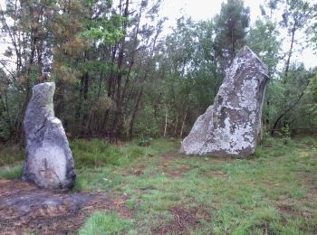
![Randonnée A pied Saint-Jean-de-la-Motte - Sentier des Menhirs - Photo](https://media.geolcdn.com/t/350/260/3b7462e0-43cd-484c-8512-9fdccca9e4e8.jpeg&format=jpg&maxdim=2)
![A pied A pied](https://static1.geolcdn.com/sitytour/trail-icons/100.png)
Km
A pied
![](/images/other/stat-length.png)
![](https://static1.geolcdn.com/siteimages/upload/files/1508320355ic_sort_den_pos_24dp.png)
![](https://static1.geolcdn.com/siteimages/upload/files/1508320355ic_sort_den_neg_24dp.png)
![](https://static1.geolcdn.com/siteimages/upload/files/16400158638029165_repeat_loop_refresh_sync_direction_icon.png)
• Randonnée créée par Les Sentiers de la Motte.
![Randonnée Marche Neufchâtel-en-Saosnois - Perseigne - Abbaye 8,3 km - Photo](https://media.geolcdn.com/t/350/260/ext.jpg?maxdim=2&url=https%3A%2F%2Fstatic1.geolcdn.com%2Fsiteimages%2Fupload%2Ffiles%2F1553511878bg_sport_marche.png)
![Marche Marche](https://static1.geolcdn.com/sitytour/trail-icons/101.png)
Km
Marche
![](/images/other/stat-length.png)
![](https://static1.geolcdn.com/siteimages/upload/files/1508320355ic_sort_den_pos_24dp.png)
![](https://static1.geolcdn.com/siteimages/upload/files/1508320355ic_sort_den_neg_24dp.png)
![](https://static1.geolcdn.com/siteimages/upload/files/16400158638029165_repeat_loop_refresh_sync_direction_icon.png)
• Départ et Arrivée : Abbaye de Perseigne - Maison des Randonnées
![Randonnée V.T.T. Arnage - Raid arche nature 5 avril 2014 - Photo](https://media.geolcdn.com/t/350/260/ext.jpg?maxdim=2&url=https%3A%2F%2Fstatic1.geolcdn.com%2Fsiteimages%2Fupload%2Ffiles%2F1524743154velo.jpg)
![V.T.T. V.T.T.](https://static1.geolcdn.com/sitytour/trail-icons/202.png)
Km
V.T.T.
![](/images/other/stat-length.png)
![](https://static1.geolcdn.com/siteimages/upload/files/1508320355ic_sort_den_pos_24dp.png)
![](https://static1.geolcdn.com/siteimages/upload/files/1508320355ic_sort_den_neg_24dp.png)
![](https://static1.geolcdn.com/siteimages/upload/files/16400158638029165_repeat_loop_refresh_sync_direction_icon.png)
• Avec Laurent
![Randonnée Marche Arçonnay - Arconnay - Photo](https://media.geolcdn.com/t/350/260/ext.jpg?maxdim=2&url=https%3A%2F%2Fstatic1.geolcdn.com%2Fsiteimages%2Fupload%2Ffiles%2F1553511878bg_sport_marche.png)
![Marche Marche](https://static1.geolcdn.com/sitytour/trail-icons/101.png)
Km
Marche
![](/images/other/stat-length.png)
![](https://static1.geolcdn.com/siteimages/upload/files/1508320355ic_sort_den_pos_24dp.png)
![](https://static1.geolcdn.com/siteimages/upload/files/1508320355ic_sort_den_neg_24dp.png)
![](https://static1.geolcdn.com/siteimages/upload/files/16400158638029165_repeat_loop_refresh_sync_direction_icon.png)
•
![Randonnée Marche Fyé - château de Meslay - Fresnay - Photo](https://media.geolcdn.com/t/350/260/ext.jpg?maxdim=2&url=https%3A%2F%2Fstatic1.geolcdn.com%2Fsiteimages%2Fupload%2Ffiles%2F1553511878bg_sport_marche.png)
![Marche Marche](https://static1.geolcdn.com/sitytour/trail-icons/101.png)
Km
Marche
![](/images/other/stat-length.png)
![](https://static1.geolcdn.com/siteimages/upload/files/1508320355ic_sort_den_pos_24dp.png)
![](https://static1.geolcdn.com/siteimages/upload/files/1508320355ic_sort_den_neg_24dp.png)
![](https://static1.geolcdn.com/siteimages/upload/files/16400158638029165_repeat_loop_refresh_sync_direction_icon.png)
• week end alpes Mancelles
![Randonnée V.T.T. La Flèche - La Flèche Sud - Photo](https://media.geolcdn.com/t/350/260/ext.jpg?maxdim=2&url=https%3A%2F%2Fstatic1.geolcdn.com%2Fsiteimages%2Fupload%2Ffiles%2F1524743154velo.jpg)
![V.T.T. V.T.T.](https://static1.geolcdn.com/sitytour/trail-icons/202.png)
Km
V.T.T.
![](/images/other/stat-length.png)
![](https://static1.geolcdn.com/siteimages/upload/files/1508320355ic_sort_den_pos_24dp.png)
![](https://static1.geolcdn.com/siteimages/upload/files/1508320355ic_sort_den_neg_24dp.png)
![](https://static1.geolcdn.com/siteimages/upload/files/16400158638029165_repeat_loop_refresh_sync_direction_icon.png)
• Bonne boucle au départ de la Flèche. Départ par piste cyclable «voie verte - route du miel». Assez facile.
![Randonnée Marche Saint-Mars-d'Outillé - Saint Mars d'Outillé - Circuit bleu - Photo](https://media.geolcdn.com/t/350/260/ext.jpg?maxdim=2&url=https%3A%2F%2Fstatic1.geolcdn.com%2Fsiteimages%2Fupload%2Ffiles%2F1553511878bg_sport_marche.png)
![Marche Marche](https://static1.geolcdn.com/sitytour/trail-icons/101.png)
Km
Marche
![](/images/other/stat-length.png)
![](https://static1.geolcdn.com/siteimages/upload/files/1508320355ic_sort_den_pos_24dp.png)
![](https://static1.geolcdn.com/siteimages/upload/files/1508320355ic_sort_den_neg_24dp.png)
![](https://static1.geolcdn.com/siteimages/upload/files/16400158638029165_repeat_loop_refresh_sync_direction_icon.png)
• Départ sur la place en face du centre de secours.
![Randonnée V.T.T. Pruillé-le-Chétif - Saint George du Bois - Pruillé le Chétif - Photo](https://media.geolcdn.com/t/350/260/ext.jpg?maxdim=2&url=https%3A%2F%2Fstatic1.geolcdn.com%2Fsiteimages%2Fupload%2Ffiles%2F1524743154velo.jpg)
![V.T.T. V.T.T.](https://static1.geolcdn.com/sitytour/trail-icons/202.png)
Km
V.T.T.
![](/images/other/stat-length.png)
![](https://static1.geolcdn.com/siteimages/upload/files/1508320355ic_sort_den_pos_24dp.png)
![](https://static1.geolcdn.com/siteimages/upload/files/1508320355ic_sort_den_neg_24dp.png)
![](https://static1.geolcdn.com/siteimages/upload/files/16400158638029165_repeat_loop_refresh_sync_direction_icon.png)
• Petite balade en foret, facile d'accès, en chemin carrossable la plupart du temps. Agréable et bien pour se dégourdir...
20 randonnées affichées sur 1332
Application GPS de randonnée GRATUITE
Activités
Régions proches
- Aigné
- Aillières-Beauvoir
- Allonnes
- Ancinnes
- Arçonnay
- Ardenay-sur-Mérize
- Arnage
- Arthezé
- Asnières-sur-Vègre
- Assé-le-Boisne
- Assé-le-Riboul
- Aubigné-Racan
- Auvers-le-Hamon
- Auvers-sous-Montfaucon
- Avessé
- Avezé
- Avoise
- Ballon-Saint Mars
- Bazouges Cré sur Loir
- Beaufay
- Beaumont-Pied-de-Bœuf
- Beaumont-sur-Dême
- Beaumont-sur-Sarthe
- Beillé
- Berfay
- Bernay-Neuvy-en-Champagne
- Bérus
- Bessé-sur-Braye
- Béthon
- Blèves
- Boëssé-le-Sec
- Bonnétable
- Bouër
- Bouloire
- Bourg-le-Roi
- Bousse
- Brains-sur-Gée
- Brette-les-Pins
- Briosne-lès-Sables
- Brûlon
- Cérans-Foulletourte
- Chahaignes
- Challes
- Champagné
- Champfleur
- Champrond
- Changé
- Chantenay-Villedieu
- Chassillé
- Château-l'Hermitage
- Chemiré-en-Charnie
- Chenay
- Chenu
- Chérancé
- Chérisay
- Cherré-Au
- Chevillé
- Clermont-Créans
- Conflans-sur-Anille
- Congé-sur-Orne
- Conlie
- Connerré
- Contilly
- Coudrecieux
- Coulaines
- Coulans-sur-Gée
- Coulongé
- Courcebœufs
- Courcelles-la-Forêt
- Courcemont
- Courdemanche
- Courgenard
- Courtillers
- Crannes-en-Champagne
- Crissé
- Crosmières
- Cures
- Dehault
- Dissay-sous-Courcillon
- Dollon
- Domfront-en-Champagne
- Douillet
- Duneau
- Dureil
- Écommoy
- Écorpain
- Épineu-le-Chevreuil
- Étival-lès-le-Mans
- Fatines
- Fercé-sur-Sarthe
- Fillé
- Flée
- Fresnay-sur-Sarthe
- Fyé
- Gesnes-le-Gandelin
- Grandchamp
- Gréez-sur-Roc
- Guécélard
- Joué-en-Charnie
- Joué-l'Abbé
- Juigné-sur-Sarthe
- Juillé
- Jupilles
- La Bazoge
- La Bosse
- La Bruère-sur-Loir
- La Chapelle-Huon
- La Chapelle-Saint-Aubin
- La Chapelle-Saint-Fray
- La Chapelle-Saint-Rémy
- La Chapelle-aux-Choux
- La Chapelle-d'Aligné
- La Chapelle-du-Bois
- La Chartre-sur-le-Loir
- La Ferté-Bernard
- La Flèche
- La Fontaine-Saint-Martin
- La Guierche
- La Milesse
- La Suze-sur-Sarthe
- Laigné-en-Belin
- Lamnay
- Lavardin
- Lavaré
- Lavernat
- Le Breil-sur-Mérize
- Le Grand-Lucé
- Le Grez
- Le Luart
- Le Lude
- Le Mans
- Les Mées
- Lhomme
- Ligron
- Livet-en-Saosnois
- Loir en Vallée
- Lombron
- Longnes
- Loué
- Louplande
- Louvigny
- Louzes
- Lucé-sous-Ballon
- Luceau
- Luché-Pringé
- Maigné
- Maisoncelles
- Malicorne-sur-Sarthe
- Mamers
- Mansigné
- Marçon
- Mareil-en-Champagne
- Maresché
- Marigné-Laillé
- Marolles-les-Braults
- Marolles-lès-Saint-Calais
- Mayet
- Melleray
- Mézeray
- Mézières-sous-Lavardin
- Mézières-sur-Ponthouin
- Moncé-en-Belin
- Mont-Saint-Jean
- Montaillé
- Montbizot
- Montfort-le-Gesnois
- Montmirail
- Montreuil-le-Chétif
- Montreuil-le-Henri
- Montval-sur-Loir
- Moulins-le-Carbonnel
- Mulsanne
- Neufchâtel-en-Saosnois
- Neuvillalais
- Neuville-sur-Sarthe
- Neuvillette-en-Charnie
- Nogent-le-Bernard
- Notre-Dame-du-Pé
- Noyen-sur-Sarthe
- Oisseau-le-Petit
- Oizé
- Parcé-sur-Sarthe
- Parennes
- Parigné-l'Évêque
- Parigné-le-Pôlin
- Pezé-le-Robert
- Piacé
- Pincé
- Pirmil
- Poillé-sur-Vègre
- Pontvallain
- Précigné
- Préval
- Prévelles
- Pruillé-l'Éguillé
- Pruillé-le-Chétif
- Requeil
- Roézé-sur-Sarthe
- Rouessé-Fontaine
- Rouessé-Vassé
- Rouez
- Rouillon
- Ruaudin
- Ruillé-en-Champagne
- Sablé-sur-Sarthe
- Saint-Aubin-de-Locquenay
- Saint-Aubin-des-Coudrais
- Saint-Biez-en-Belin
- Saint-Calais
- Saint-Célerin
- Saint-Christophe-du-Jambet
- Saint-Christophe-en-Champagne
- Saint-Corneille
- Saint-Cosme-en-Vairais
- Saint-Denis-d'Orques
- Saint-Denis-des-Coudrais
- Saint-Georges-de-la-Couée
- Saint-Georges-du-Bois
- Saint-Georges-du-Rosay
- Saint-Georges-le-Gaultier
- Saint-Germain-d'Arcé
- Saint-Gervais-de-Vic
- Saint-Gervais-en-Belin
- Saint-Jean-d'Assé
- Saint-Jean-de-la-Motte
- Saint-Jean-des-Échelles
- Saint-Jean-du-Bois
- Saint-Léonard-des-Bois
- Saint-Longis
- Saint-Maixent
- Saint-Mars-d'Outillé
- Saint-Mars-de-Locquenay
- Saint-Mars-la-Brière
- Saint-Martin-des-Monts
- Saint-Michel-de-Chavaignes
- Saint-Ouen-de-Mimbré
- Saint-Ouen-en-Belin
- Saint-Paterne - Le Chevain
- Saint-Paul-le-Gaultier
- Saint-Pavace
- Saint-Pierre-de-Chevillé
- Saint-Pierre-des-Ormes
- Saint-Pierre-du-Lorouër
- Saint-Rémy-de-Sillé
- Saint-Rémy-du-Val
- Saint-Saturnin
- Saint-Symphorien
- Saint-Ulphace
- Saint-Victeur
- Saint-Vincent-des-Prés
- Saint-Vincent-du-Lorouër
- Sainte-Jamme-sur-Sarthe
- Sainte-Sabine-sur-Longève
- Sarcé
- Sargé-lès-le-Mans
- Savigné-l'Évêque
- Sceaux-sur-Huisne
- Ségrie
- Semur-en-Vallon
- Sillé-le-Guillaume
- Sillé-le-Philippe
- Solesmes
- Sougé-le-Ganelon
- Souillé
- Souligné-Flacé
- Souligné-sous-Ballon
- Soulitré
- Souvigné-sur-Même
- Spay
- Surfonds
- Tassé
- Tassillé
- Teloché
- Tennie
- Thoiré-sur-Dinan
- Thorée-les-Pins
- Thorigné-sur-Dué
- Torcé-en-Vallée
- Trangé
- Tresson
- Tuffé Val de la Chéronne
- Vaas
- Val-d'Étangson
- Valennes
- Vallon-sur-Gée
- Vancé
- Verneil-le-Chétif
- Vezot
- Vibraye
- Villaines-la-Carelle
- Villaines-la-Gonais
- Villaines-sous-Lucé
- Villeneuve-en-Perseigne
- Vion
- Vivoin
- Voivres-lès-le-Mans
- Volnay
- Yvré-l'Évêque
- Yvré-le-Pôlin