![](/images/other/stat-length.png)
Rhône, Auvergne-Rhône-Alpes : Les meilleures randonnées, itinéraires, parcours, balades et promenades
Rhône : découvrez les meilleures randonnées : 2 787 pédestres, 507 à vélo ou VTT et 566 parcours équestres. Tous ces circuits, parcours, itinéraires et activités en plein air sont disponibles dans nos applications SityTrail pour smartphones et tablettes.
Les meilleurs parcours (4185)
![Randonnée Marche L'Arbresle - L'Arbresle Fiche Verte n°9 - Photo](https://media.geolcdn.com/t/350/260/00218e51-a692-486e-8923-38995b6815db.jpg&format=jpg&maxdim=2)
![Marche Marche](https://static1.geolcdn.com/sitytour/trail-icons/101.png)
Km
Marche
![](/images/other/stat-length.png)
![](https://static1.geolcdn.com/siteimages/upload/files/1508320355ic_sort_den_pos_24dp.png)
![](https://static1.geolcdn.com/siteimages/upload/files/1508320355ic_sort_den_neg_24dp.png)
![](https://static1.geolcdn.com/siteimages/upload/files/16400158638029165_repeat_loop_refresh_sync_direction_icon.png)
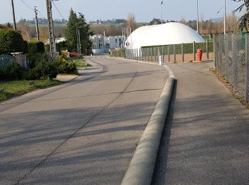
• Fiche rando donnée par l'office de tourisme de L'Arbresle
![Randonnée Marche Mornant - Mornant-Lac de la Madone à St Sorlin - Photo](https://media.geolcdn.com/t/350/260/a7fe3626-6640-4450-bfe5-8d72b58566d1.jpg&format=jpg&maxdim=2)
![Marche Marche](https://static1.geolcdn.com/sitytour/trail-icons/101.png)
Km
Marche
![](/images/other/stat-length.png)
![](https://static1.geolcdn.com/siteimages/upload/files/1508320355ic_sort_den_pos_24dp.png)
![](https://static1.geolcdn.com/siteimages/upload/files/1508320355ic_sort_den_neg_24dp.png)
![](https://static1.geolcdn.com/siteimages/upload/files/16400158638029165_repeat_loop_refresh_sync_direction_icon.png)
• Promenade sympathique faite avec des enfants de 4 et 6 ans.
![Randonnée Marche Marennes - 69 marennes-villette-V2-17km-420m - Photo](https://media.geolcdn.com/t/350/260/25f97240-4655-4bff-897e-e00f442ce49e.jpg&format=jpg&maxdim=2)
![Marche Marche](https://static1.geolcdn.com/sitytour/trail-icons/101.png)
Km
Marche
![](/images/other/stat-length.png)
![](https://static1.geolcdn.com/siteimages/upload/files/1508320355ic_sort_den_pos_24dp.png)
![](https://static1.geolcdn.com/siteimages/upload/files/1508320355ic_sort_den_neg_24dp.png)
![](https://static1.geolcdn.com/siteimages/upload/files/16400158638029165_repeat_loop_refresh_sync_direction_icon.png)
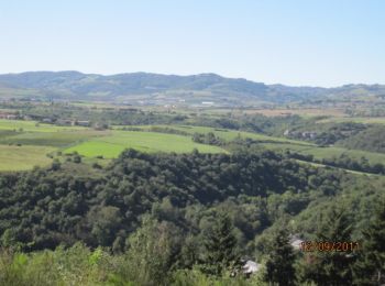
• Départ cimetière de Marennes Belle balade à faire dans les 2 sens en forêt , peu de goudron
![Randonnée V.T.T. Lozanne - La 5ème Vélozannaise (2014-VTT-45km) - Lozanne - Photo](https://media.geolcdn.com/t/350/260/ext.jpg?maxdim=2&url=https%3A%2F%2Fservices.sitytrail.com%2FGeolivesWS%2FDownloadMedia.ashx%3FTrailID%3D318042%26Media%3D17513_6.jpg)
![V.T.T. V.T.T.](https://static1.geolcdn.com/sitytour/trail-icons/202.png)
Km
V.T.T.
![](/images/other/stat-length.png)
![](https://static1.geolcdn.com/siteimages/upload/files/1508320355ic_sort_den_pos_24dp.png)
![](https://static1.geolcdn.com/siteimages/upload/files/1508320355ic_sort_den_neg_24dp.png)
![](https://static1.geolcdn.com/siteimages/upload/files/16400158638029165_repeat_loop_refresh_sync_direction_icon.png)
• Parking à la gare et départ de la salle Constant Martin (petite place face à la gare de Lozanne). Les DérAILLEURS, se...
![Randonnée V.T.T. Cours - VTT autour de Thel et Ranchal - Cours la Ville - Photo](https://media.geolcdn.com/t/350/260/ext.jpg?maxdim=2&url=https%3A%2F%2Fservices.sitytrail.com%2FGeolivesWS%2FDownloadMedia.ashx%3FTrailID%3D173231%26Media%3D14836_6.jpg)
![V.T.T. V.T.T.](https://static1.geolcdn.com/sitytour/trail-icons/202.png)
Km
V.T.T.
![](/images/other/stat-length.png)
![](https://static1.geolcdn.com/siteimages/upload/files/1508320355ic_sort_den_pos_24dp.png)
![](https://static1.geolcdn.com/siteimages/upload/files/1508320355ic_sort_den_neg_24dp.png)
![](https://static1.geolcdn.com/siteimages/upload/files/16400158638029165_repeat_loop_refresh_sync_direction_icon.png)
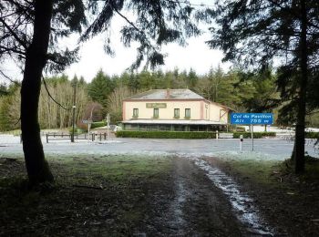
• Parking au col du Portillon (alti. 755 m), qui se situe sur la D 64 entre Cours-la-Ville et Thel, Ranchal. Le départ ...
![Randonnée V.T.T. Saint-Martin-en-Haut - 19ème Croisée des Monts du Lyonnais (2012-VTT-25km) / Saint-Martin-en-Haut - Photo](https://media.geolcdn.com/t/350/260/ext.jpg?maxdim=2&url=https%3A%2F%2Fservices.sitytrail.com%2FGeolivesWS%2FDownloadMedia.ashx%3FTrailID%3D129837%26Media%3D13390_6.jpg)
![V.T.T. V.T.T.](https://static1.geolcdn.com/sitytour/trail-icons/202.png)
Km
V.T.T.
![](/images/other/stat-length.png)
![](https://static1.geolcdn.com/siteimages/upload/files/1508320355ic_sort_den_pos_24dp.png)
![](https://static1.geolcdn.com/siteimages/upload/files/1508320355ic_sort_den_neg_24dp.png)
![](https://static1.geolcdn.com/siteimages/upload/files/16400158638029165_repeat_loop_refresh_sync_direction_icon.png)
• Parking et départ du stade. Cette randonnée est organisée par le Club « VTT des Monts » de Saint-Martin-en-Haut et se...
![Randonnée Marche Deux-Grosnes - Circuit de Saint-Jacques des Arrêts - Photo](https://media.geolcdn.com/t/350/260/ext.jpg?maxdim=2&url=https%3A%2F%2Fservices.sitytrail.com%2FGeolivesWS%2FDownloadMedia.ashx%3FTrailID%3D112082%26Media%3D9805_3.jpg)
![Marche Marche](https://static1.geolcdn.com/sitytour/trail-icons/101.png)
Km
Marche
![](/images/other/stat-length.png)
![](https://static1.geolcdn.com/siteimages/upload/files/1508320355ic_sort_den_pos_24dp.png)
![](https://static1.geolcdn.com/siteimages/upload/files/1508320355ic_sort_den_neg_24dp.png)
![](https://static1.geolcdn.com/siteimages/upload/files/16400158638029165_repeat_loop_refresh_sync_direction_icon.png)
• Circuit proposé par l’office de tourisme du Haut-Beaujolais. Départ de la place des Anciens Combattants de Saint-Jacq...
![Randonnée V.T.T. Taluyers - De Taluyers aux landes de Montagny - Photo](https://media.geolcdn.com/t/350/260/ext.jpg?maxdim=2&url=https%3A%2F%2Fservices.sitytrail.com%2FGeolivesWS%2FDownloadMedia.ashx%3FTrailID%3D107499%26Media%3D12444_5.jpg)
![V.T.T. V.T.T.](https://static1.geolcdn.com/sitytour/trail-icons/202.png)
Km
V.T.T.
![](/images/other/stat-length.png)
![](https://static1.geolcdn.com/siteimages/upload/files/1508320355ic_sort_den_pos_24dp.png)
![](https://static1.geolcdn.com/siteimages/upload/files/1508320355ic_sort_den_neg_24dp.png)
![](https://static1.geolcdn.com/siteimages/upload/files/16400158638029165_repeat_loop_refresh_sync_direction_icon.png)
• Belle boucle effectuée le 13/11/11. Départ Taluyers, parking facile au niveau du prieuré. Direction St Laurent d'Agny...
![Randonnée Marche Trèves - Chemin de Fer à Trèves - Photo](https://media.geolcdn.com/t/350/260/ext.jpg?maxdim=2&url=https%3A%2F%2Fservices.sitytrail.com%2FGeolivesWS%2FDownloadMedia.ashx%3FTrailID%3D107163%26Media%3D12007_3.jpg)
![Marche Marche](https://static1.geolcdn.com/sitytour/trail-icons/101.png)
Km
Marche
![](/images/other/stat-length.png)
![](https://static1.geolcdn.com/siteimages/upload/files/1508320355ic_sort_den_pos_24dp.png)
![](https://static1.geolcdn.com/siteimages/upload/files/1508320355ic_sort_den_neg_24dp.png)
![](https://static1.geolcdn.com/siteimages/upload/files/16400158638029165_repeat_loop_refresh_sync_direction_icon.png)
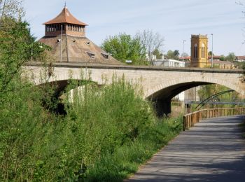
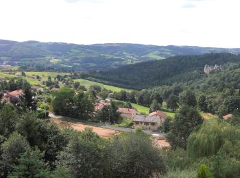
• Cette promenade vous mènera sur la première voie de chemin de fer construite en 1827. A cette époque, elle reliait St...
![Randonnée Marche Saint-Just-d'Avray - Des mollets d'aciers - Saint Just d'Avray - Photo](https://media.geolcdn.com/t/350/260/ext.jpg?maxdim=2&url=https%3A%2F%2Fservices.sitytrail.com%2FGeolivesWS%2FDownloadMedia.ashx%3FTrailID%3D105228%26Media%3D8877_2.jpg)
![Marche Marche](https://static1.geolcdn.com/sitytour/trail-icons/101.png)
Km
Marche
![](/images/other/stat-length.png)
![](https://static1.geolcdn.com/siteimages/upload/files/1508320355ic_sort_den_pos_24dp.png)
![](https://static1.geolcdn.com/siteimages/upload/files/1508320355ic_sort_den_neg_24dp.png)
![](https://static1.geolcdn.com/siteimages/upload/files/16400158638029165_repeat_loop_refresh_sync_direction_icon.png)
• Une promenade le nez dans les sapins, quelques beaux points de vue, et surtout plein de montées. J’ai coupé au Col de...
![Randonnée Marche Ranchal - Ranchal village vert - Photo](https://media.geolcdn.com/t/350/260/ext.jpg?maxdim=2&url=https%3A%2F%2Fservices.sitytrail.com%2FGeolivesWS%2FDownloadMedia.ashx%3FTrailID%3D105056%26Media%3D8641_6.jpg)
![Marche Marche](https://static1.geolcdn.com/sitytour/trail-icons/101.png)
Km
Marche
![](/images/other/stat-length.png)
![](https://static1.geolcdn.com/siteimages/upload/files/1508320355ic_sort_den_pos_24dp.png)
![](https://static1.geolcdn.com/siteimages/upload/files/1508320355ic_sort_den_neg_24dp.png)
![](https://static1.geolcdn.com/siteimages/upload/files/16400158638029165_repeat_loop_refresh_sync_direction_icon.png)
• Jolie balade assez facile et diversifiée de grand bois de sapin à traverser. Cette promenade d’une dizaine de kilomèt...
![Randonnée Marche Pollionnay - Pollionnay, Croix du Ban, la Luère 7,5 Km - Photo](https://media.geolcdn.com/t/350/260/ext.jpg?maxdim=2&url=https%3A%2F%2Fservices.sitytrail.com%2FGeolivesWS%2FDownloadMedia.ashx%3FTrailID%3D104654%26Media%3D8048_4.jpg)
![Marche Marche](https://static1.geolcdn.com/sitytour/trail-icons/101.png)
Km
Marche
![](/images/other/stat-length.png)
![](https://static1.geolcdn.com/siteimages/upload/files/1508320355ic_sort_den_pos_24dp.png)
![](https://static1.geolcdn.com/siteimages/upload/files/1508320355ic_sort_den_neg_24dp.png)
![](https://static1.geolcdn.com/siteimages/upload/files/16400158638029165_repeat_loop_refresh_sync_direction_icon.png)
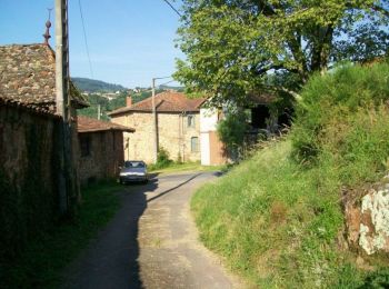
• Le départ de ce tracé se fait du lieu-dit "Lamure" à Pollionnay et plutôt dans le sens inverse des aiguilles d'une mo...
![Randonnée Marche Ternand - Ternand - Létra - Photo](https://media.geolcdn.com/t/350/260/d73b31f3-847d-4c86-9759-810d2e04500a.jpg&format=jpg&maxdim=2)
![Marche Marche](https://static1.geolcdn.com/sitytour/trail-icons/101.png)
Km
Marche
![](/images/other/stat-length.png)
![](https://static1.geolcdn.com/siteimages/upload/files/1508320355ic_sort_den_pos_24dp.png)
![](https://static1.geolcdn.com/siteimages/upload/files/1508320355ic_sort_den_neg_24dp.png)
![](https://static1.geolcdn.com/siteimages/upload/files/16400158638029165_repeat_loop_refresh_sync_direction_icon.png)
![Randonnée Marche Grézieu-le-Marché - Grézieu Le Marché - St Symphorien sur Coise - Photo](https://media.geolcdn.com/t/350/260/6498a247-2882-46f3-87b1-37d4824a8e43.jpg&format=jpg&maxdim=2)
![Marche Marche](https://static1.geolcdn.com/sitytour/trail-icons/101.png)
Km
Marche
![](/images/other/stat-length.png)
![](https://static1.geolcdn.com/siteimages/upload/files/1508320355ic_sort_den_pos_24dp.png)
![](https://static1.geolcdn.com/siteimages/upload/files/1508320355ic_sort_den_neg_24dp.png)
![](https://static1.geolcdn.com/siteimages/upload/files/16400158638029165_repeat_loop_refresh_sync_direction_icon.png)
![Randonnée Marche Pollionnay - Pollionnay - Col de la Croix du Ban - Saint Bel - Photo](https://media.geolcdn.com/t/350/260/8ef9381a-0165-43ee-bec7-dd3c247c912c.jpg&format=jpg&maxdim=2)
![Marche Marche](https://static1.geolcdn.com/sitytour/trail-icons/101.png)
Km
Marche
![](/images/other/stat-length.png)
![](https://static1.geolcdn.com/siteimages/upload/files/1508320355ic_sort_den_pos_24dp.png)
![](https://static1.geolcdn.com/siteimages/upload/files/1508320355ic_sort_den_neg_24dp.png)
![](https://static1.geolcdn.com/siteimages/upload/files/16400158638029165_repeat_loop_refresh_sync_direction_icon.png)
• Les Monts Lyonnais Les Mandrières, Le Rizou, Bois des Allemands, Col de la Croix du Ban (Parking Départ), Bois Charn...
![Randonnée Marche Messimy - De Messimy au belvédère du Piragoy en boucle - Photo](https://media.geolcdn.com/t/350/260/4f6a03fe-103d-4ea3-ac7c-d9a11a0a7724.jpg&format=jpg&maxdim=2)
![Marche Marche](https://static1.geolcdn.com/sitytour/trail-icons/101.png)
Km
Marche
![](/images/other/stat-length.png)
![](https://static1.geolcdn.com/siteimages/upload/files/1508320355ic_sort_den_pos_24dp.png)
![](https://static1.geolcdn.com/siteimages/upload/files/1508320355ic_sort_den_neg_24dp.png)
![](https://static1.geolcdn.com/siteimages/upload/files/16400158638029165_repeat_loop_refresh_sync_direction_icon.png)
![Randonnée Marche Lentilly - Santier des vaches LENTILLY - Photo](https://media.geolcdn.com/t/350/260/571590e7-6ce0-4ff1-b403-0f445cf01256.jpg&format=jpg&maxdim=2)
![Marche Marche](https://static1.geolcdn.com/sitytour/trail-icons/101.png)
Km
Marche
![](/images/other/stat-length.png)
![](https://static1.geolcdn.com/siteimages/upload/files/1508320355ic_sort_den_pos_24dp.png)
![](https://static1.geolcdn.com/siteimages/upload/files/1508320355ic_sort_den_neg_24dp.png)
![](https://static1.geolcdn.com/siteimages/upload/files/16400158638029165_repeat_loop_refresh_sync_direction_icon.png)
![Randonnée A pied Les Halles - Les Halles - Photo](https://media.geolcdn.com/t/350/260/21d7aa2f-2038-49c8-b8b4-b2d7e33dc17c.jpg&format=jpg&maxdim=2)
![A pied A pied](https://static1.geolcdn.com/sitytour/trail-icons/100.png)
Km
A pied
![](/images/other/stat-length.png)
![](https://static1.geolcdn.com/siteimages/upload/files/1508320355ic_sort_den_pos_24dp.png)
![](https://static1.geolcdn.com/siteimages/upload/files/1508320355ic_sort_den_neg_24dp.png)
![](https://static1.geolcdn.com/siteimages/upload/files/16400158638029165_repeat_loop_refresh_sync_direction_icon.png)
• Boucle (80 % de sentiers non goudronnés) sur la partie nord du village de Les Halles, passant également sur les comm...
![Randonnée Marche Deux-Grosnes - Ouroux - Photo](https://media.geolcdn.com/t/350/260/8cef6e4d-d107-4e31-8a02-a874193353f3.jpg&format=jpg&maxdim=2)
![Marche Marche](https://static1.geolcdn.com/sitytour/trail-icons/101.png)
Km
Marche
![](/images/other/stat-length.png)
![](https://static1.geolcdn.com/siteimages/upload/files/1508320355ic_sort_den_pos_24dp.png)
![](https://static1.geolcdn.com/siteimages/upload/files/1508320355ic_sort_den_neg_24dp.png)
![](https://static1.geolcdn.com/siteimages/upload/files/16400158638029165_repeat_loop_refresh_sync_direction_icon.png)
• Belle randonnée
![Randonnée Marche Val d'Oingt - Oingt (69) Beaujolais - Photo](https://media.geolcdn.com/t/350/260/ext.jpg?maxdim=2&url=https%3A%2F%2Fservices.sitytrail.com%2FGeolivesWS%2FDownloadMedia.ashx%3FTrailID%3D717640%26Media%3D20161208145812.jpg)
![Marche Marche](https://static1.geolcdn.com/sitytour/trail-icons/101.png)
Km
Marche
![](/images/other/stat-length.png)
![](https://static1.geolcdn.com/siteimages/upload/files/1508320355ic_sort_den_pos_24dp.png)
![](https://static1.geolcdn.com/siteimages/upload/files/1508320355ic_sort_den_neg_24dp.png)
![](https://static1.geolcdn.com/siteimages/upload/files/16400158638029165_repeat_loop_refresh_sync_direction_icon.png)
• Belle randonnée - Départ parking de l'école Gaspard de Riche de Prony
20 randonnées affichées sur 4185
Application GPS de randonnée GRATUITE
Activités
Régions proches
- Affoux
- Aigueperse
- Alix
- Ambérieux
- Amplepuis
- Ampuis
- Ancy
- Anse
- Arnas
- Aveize
- Azolette
- Bagnols
- Beaujeu
- Beauvallon
- Belleville-en-Beaujolais
- Belmont-d'Azergues
- Bessenay
- Bibost
- Blacé
- Brignais
- Brindas
- Brullioles
- Brussieu
- Bully
- Cenves
- Cercié
- Chabanière
- Chambost-Allières
- Chambost-Longessaigne
- Chamelet
- Chaponnay
- Chaponost
- Charentay
- Charnay
- Chasselay
- Châtillon
- Chaussan
- Chazay-d'Azergues
- Chénas
- Chénelette
- Chessy
- Chevinay
- Chiroubles
- Civrieux-d'Azergues
- Claveisolles
- Cogny
- Coise
- Colombier-Saugnieu
- Communay
- Condrieu
- Corcelles-en-Beaujolais
- Cours
- Courzieu
- Cublize
- Denicé
- Deux-Grosnes
- Dième
- Dommartin
- Dracé
- Duerne
- Échalas
- Émeringes
- Éveux
- Fleurie
- Fleurieux-sur-l'Arbresle
- Frontenas
- Genas
- Gleizé
- Grandris
- Grézieu-la-Varenne
- Grézieu-le-Marché
- Haute-Rivoire
- Jons
- Joux
- Juliénas
- Jullié
- L'Arbresle
- La Chapelle-sur-Coise
- Lacenas
- Lachassagne
- Lamure-sur-Azergues
- Lancié
- Lantignié
- Larajasse
- Le Breuil
- Le Perréon
- Légny
- Lentilly
- Les Ardillats
- Les Chères
- Les Haies
- Les Halles
- Les Sauvages
- Létra
- Limas
- Loire-sur-Rhône
- Longes
- Longessaigne
- Lozanne
- Lucenay
- Marchampt
- Marcilly-d'Azergues
- Marcy
- Marennes
- Meaux-la-Montagne
- Messimy
- Meys
- Millery
- Moiré
- Montagny
- Montmelas-Saint-Sorlin
- Montromant
- Montrottier
- Morancé
- Mornant
- Odenas
- Orliénas
- Pollionnay
- Pomeys
- Pommiers
- Porte des Pierres Dorées
- Poule-les-Écharmeaux
- Propières
- Pusignan
- Quincié-en-Beaujolais
- Ranchal
- Régnié-Durette
- Riverie
- Rivolet
- Ronno
- Rontalon
- Sain-Bel
- Saint-André-la-Côte
- Saint-Appolinaire
- Saint-Bonnet-de-Mure
- Saint-Bonnet-des-Bruyères
- Saint-Bonnet-le-Troncy
- Saint-Clément-de-Vers
- Saint-Clément-les-Places
- Saint-Clément-sur-Valsonne
- Saint-Cyr-le-Chatoux
- Saint-Cyr-sur-le-Rhône
- Saint-Didier-sur-Beaujeu
- Saint-Étienne-des-Oullières
- Saint-Étienne-la-Varenne
- Saint-Forgeux
- Saint-Genis-l'Argentière
- Saint-Georges-de-Reneins
- Saint-Germain-Nuelles
- Saint-Igny-de-Vers
- Saint-Jean-des-Vignes
- Saint-Jean-la-Bussière
- Saint-Julien
- Saint-Julien-sur-Bibost
- Saint-Just-d'Avray
- Saint-Lager
- Saint-Laurent-d'Agny
- Saint-Laurent-de-Chamousset
- Saint-Laurent-de-Mure
- Saint-Marcel-l'Éclairé
- Saint-Martin-en-Haut
- Saint-Nizier-d'Azergues
- Saint-Pierre-de-Chandieu
- Saint-Pierre-la-Palud
- Saint-Romain-de-Popey
- Saint-Romain-en-Gal
- Saint-Romain-en-Gier
- Saint-Symphorien-d'Ozon
- Saint-Symphorien-sur-Coise
- Saint-Vérand
- Saint-Vincent-de-Reins
- Sainte-Catherine
- Sainte-Colombe
- Sainte-Consorce
- Sainte-Foy-l'Argentière
- Sainte-Paule
- Salles-Arbuissonnas-en-Beaujolais
- Sarcey
- Savigny
- Sérézin-du-Rhône
- Simandres
- Soucieu-en-Jarrest
- Sourcieux-les-Mines
- Souzy
- Taluyers
- Taponas
- Tarare
- Ternand
- Ternay
- Theizé
- Thizy-les-Bourgs
- Thurins
- Toussieu
- Trèves
- Tupin-et-Semons
- Val d'Oingt
- Valsonne
- Vaugneray
- Vaux-en-Beaujolais
- Vauxrenard
- Vernay
- Ville-sur-Jarnioux
- Villechenève
- Villefranche-sur-Saône
- Villié-Morgon
- Vindry-sur-Turdine
- Vourles
- Yzeron