


13,3 km | 17,3 km-effort
Chasselay : découvrez les meilleures randonnées : 37 pédestres, 1 à vélo ou VTT et 200 parcours équestres. Tous ces circuits, parcours, itinéraires et activités en plein air sont disponibles dans nos applications SityTrail pour smartphones et tablettes.

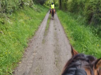
Randonnée équestre


• bonjour foret plaine par chasselay , le cheval c'est trop génial !!!!
Randonnée équestre
• test sity trail
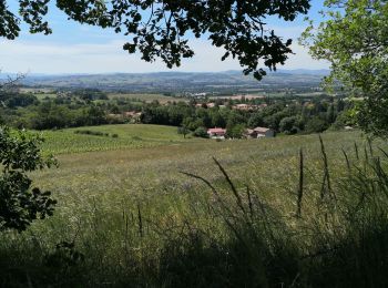
Marche
• Paysages variés. Belle vue... Pour enfants de 3 et 5 ans.
Marche
• Départ et retour de Chasselay vers les Monts d’or Croix du Mont Verdun
Marche
Marche
• belle ballade dans les bois

 15.168
sport
• Attention passage à niveau et grosse route sur 800m

Marche
• Belle rando sympa.
Cheval
• jef variante hangar montagnards
Marche
• Monter dans le relief au-dessus de Chasselay
Marche
• Petite balade boueuse
Marche
• Beaucoup de sous bois et un peu de été.. très jolie randonnée
Marche
• Petite marie
Marche
• Facile
Marche
Marche
• Tre bien

Trail
• Sous bois
Randonnée équestre
• Manon Chloé
Marche
• Départ et retour : parking Henriette Bresson proche de l'église. Lurany, la Chair, Fromenteaux, Bois du Plâtre, Hauta...

Autre activité
• P
20 randonnées affichées sur 300
Application GPS de randonnée GRATUITE
 SityTrail
IGN / Instituts géographiques
SityTrail World
Le monde est à vous