![](/images/other/stat-length.png)
- Randonnées
- Outdoor
- Allemagne
- Basse-Saxe
- Hamelin-Pyrmont (arrondissement)
Hamelin-Pyrmont (arrondissement), Basse-Saxe : Les meilleures randonnées, itinéraires, parcours, balades et promenades
Hamelin-Pyrmont (arrondissement) : découvrez les meilleures randonnées : 26 pédestres. Tous ces circuits, parcours, itinéraires et activités en plein air sont disponibles dans nos applications SityTrail pour smartphones et tablettes.
Les meilleurs parcours (26)
![Randonnée A pied Salzhemmendorf - SA3 Kanstein Rundwanderweg - Photo](https://media.geolcdn.com/t/350/260/db49aa31-23f4-4f59-8037-dffe03993ac9.jpeg&format=jpg&maxdim=2)
![A pied A pied](https://static1.geolcdn.com/sitytour/trail-icons/100.png)
Km
A pied
![](/images/other/stat-length.png)
![](https://static1.geolcdn.com/siteimages/upload/files/1508320355ic_sort_den_pos_24dp.png)
![](https://static1.geolcdn.com/siteimages/upload/files/1508320355ic_sort_den_neg_24dp.png)
![](https://static1.geolcdn.com/siteimages/upload/files/16400158638029165_repeat_loop_refresh_sync_direction_icon.png)
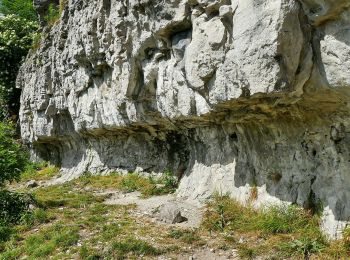
• Symbole: blaue Buchstaben und Ziffer SA3 auf gelbem Grund
![Randonnée A pied Aerzen - AE5 Streckenwanderung von Aerzen in Richtung Bad Pyrmont zum Spelunkenturm - Photo](https://media.geolcdn.com/t/350/260/e08f74b0-8011-4f49-b49b-46164d34b4a8.jpeg&format=jpg&maxdim=2)
![A pied A pied](https://static1.geolcdn.com/sitytour/trail-icons/100.png)
Km
A pied
![](/images/other/stat-length.png)
![](https://static1.geolcdn.com/siteimages/upload/files/1508320355ic_sort_den_pos_24dp.png)
![](https://static1.geolcdn.com/siteimages/upload/files/1508320355ic_sort_den_neg_24dp.png)
![](https://static1.geolcdn.com/siteimages/upload/files/16400158638029165_repeat_loop_refresh_sync_direction_icon.png)
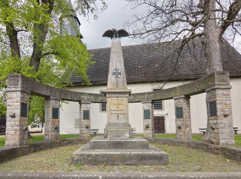
• Site web: http://pages.et4.de/de/westliches-weserbergland_neu/default/detail/Tour/142147D97660C05CA339E1F21C247CAE/...
![Randonnée A pied Aerzen - AE8 Rundwanderung auf dem nördlichen Lüninbergsberg oberhalb Schloss Schwöbber - Photo](https://media.geolcdn.com/t/350/260/d1fe35f7-a585-47c6-b892-d30b143072ae.jpeg&format=jpg&maxdim=2)
![A pied A pied](https://static1.geolcdn.com/sitytour/trail-icons/100.png)
Km
A pied
![](/images/other/stat-length.png)
![](https://static1.geolcdn.com/siteimages/upload/files/1508320355ic_sort_den_pos_24dp.png)
![](https://static1.geolcdn.com/siteimages/upload/files/1508320355ic_sort_den_neg_24dp.png)
![](https://static1.geolcdn.com/siteimages/upload/files/16400158638029165_repeat_loop_refresh_sync_direction_icon.png)
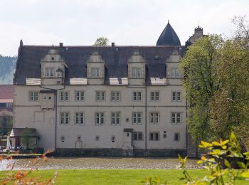
• Die komplett ausgeschilderten Rundwanderwege im Westlichen Weserbergland eignen sich gut für Tageswanderungen und Tag...
![Randonnée A pied Aerzen - AE2 Rundwanderweg südlich von Aerzen - Photo](https://media.geolcdn.com/t/350/260/5a4cb40a-fb3f-4773-88d0-27cb9eabe1a0.jpeg&format=jpg&maxdim=2)
![A pied A pied](https://static1.geolcdn.com/sitytour/trail-icons/100.png)
Km
A pied
![](/images/other/stat-length.png)
![](https://static1.geolcdn.com/siteimages/upload/files/1508320355ic_sort_den_pos_24dp.png)
![](https://static1.geolcdn.com/siteimages/upload/files/1508320355ic_sort_den_neg_24dp.png)
![](https://static1.geolcdn.com/siteimages/upload/files/16400158638029165_repeat_loop_refresh_sync_direction_icon.png)
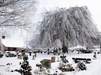
• Site web: https://www.westliches-weserbergland.de/die-wanderregion/fern-und-rundwanderwege/rundwanderwege#/de/westl...
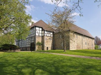
![Randonnée A pied Aerzen - AE1 Rundwanderweg am nördlichen Waldrand des Schierholzberges bei Aerzen - Photo](https://media.geolcdn.com/t/350/260/4be67d73-791b-499c-9873-0b24291b784b.jpeg&format=jpg&maxdim=2)
![A pied A pied](https://static1.geolcdn.com/sitytour/trail-icons/100.png)
Km
A pied
![](/images/other/stat-length.png)
![](https://static1.geolcdn.com/siteimages/upload/files/1508320355ic_sort_den_pos_24dp.png)
![](https://static1.geolcdn.com/siteimages/upload/files/1508320355ic_sort_den_neg_24dp.png)
![](https://static1.geolcdn.com/siteimages/upload/files/16400158638029165_repeat_loop_refresh_sync_direction_icon.png)
• Wandern, Radfahren, Nordic Walking, Pilgertouren oder Stadtrundgänge. Hier finden Sie alle Touren im Weserbergland im...
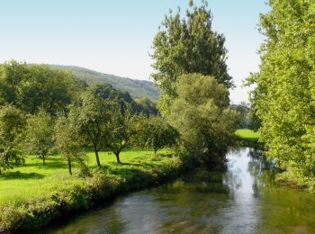
![Randonnée A pied Emmerthal - ET4 Rundwanderweg Emmerthal - Schloss Hämelschenburg - Photo](https://media.geolcdn.com/t/350/260/403b01ac-3b7e-47a8-9819-de7626caa425.jpeg&format=jpg&maxdim=2)
![A pied A pied](https://static1.geolcdn.com/sitytour/trail-icons/100.png)
Km
A pied
![](/images/other/stat-length.png)
![](https://static1.geolcdn.com/siteimages/upload/files/1508320355ic_sort_den_pos_24dp.png)
![](https://static1.geolcdn.com/siteimages/upload/files/1508320355ic_sort_den_neg_24dp.png)
![](https://static1.geolcdn.com/siteimages/upload/files/16400158638029165_repeat_loop_refresh_sync_direction_icon.png)
• Das natour.NAH.zentrum Schillat- Höhle ist der ideale Ausgangspunkt für Strecken- und Rundwandertouren. Der Weserberg...
![Randonnée A pied Emmerthal - ET6 Rundwanderweg Schmale Haube - Photo](https://media.geolcdn.com/t/350/260/403b01ac-3b7e-47a8-9819-de7626caa425.jpeg&format=jpg&maxdim=2)
![A pied A pied](https://static1.geolcdn.com/sitytour/trail-icons/100.png)
Km
A pied
![](/images/other/stat-length.png)
![](https://static1.geolcdn.com/siteimages/upload/files/1508320355ic_sort_den_pos_24dp.png)
![](https://static1.geolcdn.com/siteimages/upload/files/1508320355ic_sort_den_neg_24dp.png)
![](https://static1.geolcdn.com/siteimages/upload/files/16400158638029165_repeat_loop_refresh_sync_direction_icon.png)
• Symbole: blaue 6 auf gelbem Grund Site web: https://pages.et4.de/de/westliches-weserbergland_neu/default/detail/Tou...
![Randonnée A pied Hamelin - HM1 Rundweg Finkenborn-Riepen - Photo](https://media.geolcdn.com/t/350/260/c1904621-a43f-417a-824a-3f3917202538.jpeg&format=jpg&maxdim=2)
![A pied A pied](https://static1.geolcdn.com/sitytour/trail-icons/100.png)
Km
A pied
![](/images/other/stat-length.png)
![](https://static1.geolcdn.com/siteimages/upload/files/1508320355ic_sort_den_pos_24dp.png)
![](https://static1.geolcdn.com/siteimages/upload/files/1508320355ic_sort_den_neg_24dp.png)
![](https://static1.geolcdn.com/siteimages/upload/files/16400158638029165_repeat_loop_refresh_sync_direction_icon.png)
• Symbole: blaue Buchstaben HM und blaue Ziffer 1 auf gelbem Grund
![Randonnée A pied Emmerthal - ET2 Rundwanderweg um den Bückeberg - Photo](https://media.geolcdn.com/t/350/260/8308299f-d4e2-40a8-ae64-ba5977bc0a66.jpeg&format=jpg&maxdim=2)
![A pied A pied](https://static1.geolcdn.com/sitytour/trail-icons/100.png)
Km
A pied
![](/images/other/stat-length.png)
![](https://static1.geolcdn.com/siteimages/upload/files/1508320355ic_sort_den_pos_24dp.png)
![](https://static1.geolcdn.com/siteimages/upload/files/1508320355ic_sort_den_neg_24dp.png)
![](https://static1.geolcdn.com/siteimages/upload/files/16400158638029165_repeat_loop_refresh_sync_direction_icon.png)
• Das natour.NAH.zentrum Schillat- Höhle ist der ideale Ausgangspunkt für Strecken- und Rundwandertouren. Der Weserberg...
![Randonnée A pied Emmerthal - ET8 Schloss Hämelschenburg-Amelgatzen-Emmerauen-Schloss Hämelschenburg - Photo](https://media.geolcdn.com/t/350/260/403b01ac-3b7e-47a8-9819-de7626caa425.jpeg&format=jpg&maxdim=2)
![A pied A pied](https://static1.geolcdn.com/sitytour/trail-icons/100.png)
Km
A pied
![](/images/other/stat-length.png)
![](https://static1.geolcdn.com/siteimages/upload/files/1508320355ic_sort_den_pos_24dp.png)
![](https://static1.geolcdn.com/siteimages/upload/files/1508320355ic_sort_den_neg_24dp.png)
![](https://static1.geolcdn.com/siteimages/upload/files/16400158638029165_repeat_loop_refresh_sync_direction_icon.png)
• Das natour.NAH.zentrum Schillat- Höhle ist der ideale Ausgangspunkt für Strecken- und Rundwandertouren. Der Weserberg...
![Randonnée A pied Emmerthal - ET5 Vom Schloss Hämelschenburg rund um den Baßberg - Photo](https://media.geolcdn.com/t/350/260/403b01ac-3b7e-47a8-9819-de7626caa425.jpeg&format=jpg&maxdim=2)
![A pied A pied](https://static1.geolcdn.com/sitytour/trail-icons/100.png)
Km
A pied
![](/images/other/stat-length.png)
![](https://static1.geolcdn.com/siteimages/upload/files/1508320355ic_sort_den_pos_24dp.png)
![](https://static1.geolcdn.com/siteimages/upload/files/1508320355ic_sort_den_neg_24dp.png)
![](https://static1.geolcdn.com/siteimages/upload/files/16400158638029165_repeat_loop_refresh_sync_direction_icon.png)
• Das natour.NAH.zentrum Schillat- Höhle ist der ideale Ausgangspunkt für Strecken- und Rundwandertouren. Der Weserberg...
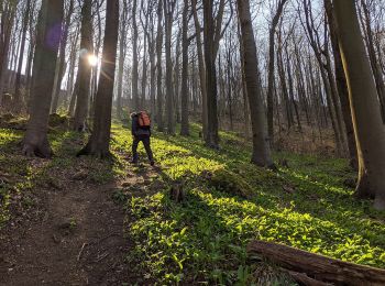
![Randonnée A pied Coppenbrügge - CO3 Schlossweg - Photo](https://media.geolcdn.com/t/350/260/9710bbae-696a-45d0-b76b-fb1783259e84.jpeg&format=jpg&maxdim=2)
![A pied A pied](https://static1.geolcdn.com/sitytour/trail-icons/100.png)
Km
A pied
![](/images/other/stat-length.png)
![](https://static1.geolcdn.com/siteimages/upload/files/1508320355ic_sort_den_pos_24dp.png)
![](https://static1.geolcdn.com/siteimages/upload/files/1508320355ic_sort_den_neg_24dp.png)
![](https://static1.geolcdn.com/siteimages/upload/files/16400158638029165_repeat_loop_refresh_sync_direction_icon.png)
• Symbole: blaue Buchstaben und Ziffer CO 3 auf gelbem Grund Site web: http://www.ith-sagen.de/wp-content/uploads/201...
![Randonnée A pied Salzhemmendorf - CO4 Pilgerweg - Photo](https://media.geolcdn.com/t/350/260/181ff2ce-2b3b-41ad-8183-e2f428502ed3.jpeg&format=jpg&maxdim=2)
![A pied A pied](https://static1.geolcdn.com/sitytour/trail-icons/100.png)
Km
A pied
![](/images/other/stat-length.png)
![](https://static1.geolcdn.com/siteimages/upload/files/1508320355ic_sort_den_pos_24dp.png)
![](https://static1.geolcdn.com/siteimages/upload/files/1508320355ic_sort_den_neg_24dp.png)
![](https://static1.geolcdn.com/siteimages/upload/files/16400158638029165_repeat_loop_refresh_sync_direction_icon.png)
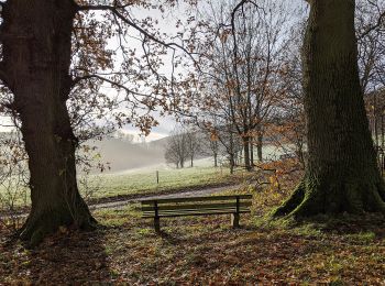
• Symbole: blaue Buchstaben und Ziffer CO 4 auf gelbem Grund Site web: http://www.ith-sagen.de/wp-content/uploads/201...
![Randonnée A pied Bad Pyrmont - Lügder Rundweg - Photo](https://media.geolcdn.com/t/350/260/88287009-7567-4df4-804a-6b9c5a0669c1.jpeg&format=jpg&maxdim=2)
![A pied A pied](https://static1.geolcdn.com/sitytour/trail-icons/100.png)
Km
A pied
![](/images/other/stat-length.png)
![](https://static1.geolcdn.com/siteimages/upload/files/1508320355ic_sort_den_pos_24dp.png)
![](https://static1.geolcdn.com/siteimages/upload/files/1508320355ic_sort_den_neg_24dp.png)
![](https://static1.geolcdn.com/siteimages/upload/files/16400158638029165_repeat_loop_refresh_sync_direction_icon.png)
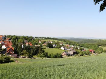
• Symbole: rotes L im rotem Kreis
![Randonnée A pied Aerzen - AE4 Rundwanderweg in Aerzen in Richtung Bad Pyrmont - Photo](https://media.geolcdn.com/t/350/260/cd8479eb-bb4a-4057-8f52-ff07d7c63a8a.jpeg&format=jpg&maxdim=2)
![A pied A pied](https://static1.geolcdn.com/sitytour/trail-icons/100.png)
Km
A pied
![](/images/other/stat-length.png)
![](https://static1.geolcdn.com/siteimages/upload/files/1508320355ic_sort_den_pos_24dp.png)
![](https://static1.geolcdn.com/siteimages/upload/files/1508320355ic_sort_den_neg_24dp.png)
![](https://static1.geolcdn.com/siteimages/upload/files/16400158638029165_repeat_loop_refresh_sync_direction_icon.png)
• Site web: http://pages.et4.de/de/westliches-weserbergland_neu/default/detail/Tour/35EE872A102293FAEC9D975465AD52CB/...
![Randonnée A pied Aerzen - AE9 Rundtour auf dem Ahornberg bei Reinerbeck - Photo](https://media.geolcdn.com/t/350/260/2d13f593-6c02-4a36-a6db-f224b26b5946.jpeg&format=jpg&maxdim=2)
![A pied A pied](https://static1.geolcdn.com/sitytour/trail-icons/100.png)
Km
A pied
![](/images/other/stat-length.png)
![](https://static1.geolcdn.com/siteimages/upload/files/1508320355ic_sort_den_pos_24dp.png)
![](https://static1.geolcdn.com/siteimages/upload/files/1508320355ic_sort_den_neg_24dp.png)
![](https://static1.geolcdn.com/siteimages/upload/files/16400158638029165_repeat_loop_refresh_sync_direction_icon.png)
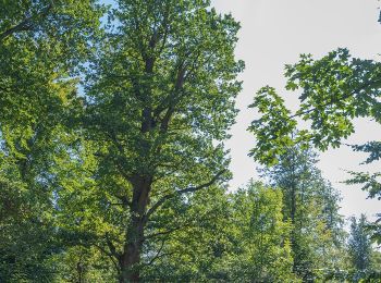
• Site web: https://www.westliches-weserbergland.de/die-wanderregion/fern-und-rundwanderwege/rundwanderwege#/de/westl...
![Randonnée A pied Aerzen - AE7 Rundwanderweg auf dem Lüningsberg zwischen Waldquelle und Ahorn - Photo](https://media.geolcdn.com/t/350/260/2d13f593-6c02-4a36-a6db-f224b26b5946.jpeg&format=jpg&maxdim=2)
![A pied A pied](https://static1.geolcdn.com/sitytour/trail-icons/100.png)
Km
A pied
![](/images/other/stat-length.png)
![](https://static1.geolcdn.com/siteimages/upload/files/1508320355ic_sort_den_pos_24dp.png)
![](https://static1.geolcdn.com/siteimages/upload/files/1508320355ic_sort_den_neg_24dp.png)
![](https://static1.geolcdn.com/siteimages/upload/files/16400158638029165_repeat_loop_refresh_sync_direction_icon.png)
• Die komplett ausgeschilderten Rundwanderwege im Westlichen Weserbergland eignen sich gut für Tageswanderungen und Tag...
![Randonnée A pied Aerzen - AE3 Rundwanderweg über den Schierholzberg - Photo](https://media.geolcdn.com/t/350/260/cd8479eb-bb4a-4057-8f52-ff07d7c63a8a.jpeg&format=jpg&maxdim=2)
![A pied A pied](https://static1.geolcdn.com/sitytour/trail-icons/100.png)
Km
A pied
![](/images/other/stat-length.png)
![](https://static1.geolcdn.com/siteimages/upload/files/1508320355ic_sort_den_pos_24dp.png)
![](https://static1.geolcdn.com/siteimages/upload/files/1508320355ic_sort_den_neg_24dp.png)
![](https://static1.geolcdn.com/siteimages/upload/files/16400158638029165_repeat_loop_refresh_sync_direction_icon.png)
• Die komplett ausgeschilderten Rundwanderwege im Westlichen Weserbergland eignen sich gut für Tageswanderungen und Tag...
![Randonnée A pied Hessisch Oldendorf - HO13 - Friedrichshagen-Route - Photo](https://media.geolcdn.com/t/350/260/fadbacb7-844f-4cdb-9125-789c662789ff.jpeg&format=jpg&maxdim=2)
![A pied A pied](https://static1.geolcdn.com/sitytour/trail-icons/100.png)
Km
A pied
![](/images/other/stat-length.png)
![](https://static1.geolcdn.com/siteimages/upload/files/1508320355ic_sort_den_pos_24dp.png)
![](https://static1.geolcdn.com/siteimages/upload/files/1508320355ic_sort_den_neg_24dp.png)
![](https://static1.geolcdn.com/siteimages/upload/files/16400158638029165_repeat_loop_refresh_sync_direction_icon.png)
• Das natour.NAH.zentrum Schillat- Höhle ist der ideale Ausgangspunkt für Strecken- und Rundwandertouren. Der Weserberg...
![Randonnée A pied Emmerthal - ET10 Von Lüntorf über den Uchtelberg nach Welsede und zurück - Photo](https://media.geolcdn.com/t/350/260/ext.jpg?maxdim=2&url=https%3A%2F%2Fstatic1.geolcdn.com%2Fsiteimages%2Fupload%2Ffiles%2F1545311037marcheuse_200dpi.jpg)
![A pied A pied](https://static1.geolcdn.com/sitytour/trail-icons/100.png)
Km
A pied
![](/images/other/stat-length.png)
![](https://static1.geolcdn.com/siteimages/upload/files/1508320355ic_sort_den_pos_24dp.png)
![](https://static1.geolcdn.com/siteimages/upload/files/1508320355ic_sort_den_neg_24dp.png)
![](https://static1.geolcdn.com/siteimages/upload/files/16400158638029165_repeat_loop_refresh_sync_direction_icon.png)
• Das natour.NAH.zentrum Schillat- Höhle ist der ideale Ausgangspunkt für Strecken- und Rundwandertouren. Der Weserberg...
20 randonnées affichées sur 26
Application GPS de randonnée GRATUITE