![](/images/other/stat-length.png)
Emmerthal, Hamelin-Pyrmont (arrondissement) : Les meilleures randonnées, itinéraires, parcours, balades et promenades
Emmerthal : découvrez les meilleures randonnées : 10 pédestres. Tous ces circuits, parcours, itinéraires et activités en plein air sont disponibles dans nos applications SityTrail pour smartphones et tablettes.
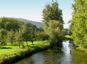
Les meilleurs parcours (10)
![Randonnée A pied Emmerthal - ET4 Rundwanderweg Emmerthal - Schloss Hämelschenburg - Photo](https://media.geolcdn.com/t/350/260/403b01ac-3b7e-47a8-9819-de7626caa425.jpeg&format=jpg&maxdim=2)
![A pied A pied](https://static1.geolcdn.com/sitytour/trail-icons/100.png)
Km
A pied
![](/images/other/stat-length.png)
![](https://static1.geolcdn.com/siteimages/upload/files/1508320355ic_sort_den_pos_24dp.png)
![](https://static1.geolcdn.com/siteimages/upload/files/1508320355ic_sort_den_neg_24dp.png)
![](https://static1.geolcdn.com/siteimages/upload/files/16400158638029165_repeat_loop_refresh_sync_direction_icon.png)
• Das natour.NAH.zentrum Schillat- Höhle ist der ideale Ausgangspunkt für Strecken- und Rundwandertouren. Der Weserberg...
![Randonnée A pied Emmerthal - ET6 Rundwanderweg Schmale Haube - Photo](https://media.geolcdn.com/t/350/260/403b01ac-3b7e-47a8-9819-de7626caa425.jpeg&format=jpg&maxdim=2)
![A pied A pied](https://static1.geolcdn.com/sitytour/trail-icons/100.png)
Km
A pied
![](/images/other/stat-length.png)
![](https://static1.geolcdn.com/siteimages/upload/files/1508320355ic_sort_den_pos_24dp.png)
![](https://static1.geolcdn.com/siteimages/upload/files/1508320355ic_sort_den_neg_24dp.png)
![](https://static1.geolcdn.com/siteimages/upload/files/16400158638029165_repeat_loop_refresh_sync_direction_icon.png)
• Symbole: blaue 6 auf gelbem Grund Site web: https://pages.et4.de/de/westliches-weserbergland_neu/default/detail/Tou...
![Randonnée A pied Emmerthal - ET2 Rundwanderweg um den Bückeberg - Photo](https://media.geolcdn.com/t/350/260/8308299f-d4e2-40a8-ae64-ba5977bc0a66.jpeg&format=jpg&maxdim=2)
![A pied A pied](https://static1.geolcdn.com/sitytour/trail-icons/100.png)
Km
A pied
![](/images/other/stat-length.png)
![](https://static1.geolcdn.com/siteimages/upload/files/1508320355ic_sort_den_pos_24dp.png)
![](https://static1.geolcdn.com/siteimages/upload/files/1508320355ic_sort_den_neg_24dp.png)
![](https://static1.geolcdn.com/siteimages/upload/files/16400158638029165_repeat_loop_refresh_sync_direction_icon.png)
• Das natour.NAH.zentrum Schillat- Höhle ist der ideale Ausgangspunkt für Strecken- und Rundwandertouren. Der Weserberg...
![Randonnée A pied Emmerthal - ET8 Schloss Hämelschenburg-Amelgatzen-Emmerauen-Schloss Hämelschenburg - Photo](https://media.geolcdn.com/t/350/260/403b01ac-3b7e-47a8-9819-de7626caa425.jpeg&format=jpg&maxdim=2)
![A pied A pied](https://static1.geolcdn.com/sitytour/trail-icons/100.png)
Km
A pied
![](/images/other/stat-length.png)
![](https://static1.geolcdn.com/siteimages/upload/files/1508320355ic_sort_den_pos_24dp.png)
![](https://static1.geolcdn.com/siteimages/upload/files/1508320355ic_sort_den_neg_24dp.png)
![](https://static1.geolcdn.com/siteimages/upload/files/16400158638029165_repeat_loop_refresh_sync_direction_icon.png)
• Das natour.NAH.zentrum Schillat- Höhle ist der ideale Ausgangspunkt für Strecken- und Rundwandertouren. Der Weserberg...
![Randonnée A pied Emmerthal - ET5 Vom Schloss Hämelschenburg rund um den Baßberg - Photo](https://media.geolcdn.com/t/350/260/403b01ac-3b7e-47a8-9819-de7626caa425.jpeg&format=jpg&maxdim=2)
![A pied A pied](https://static1.geolcdn.com/sitytour/trail-icons/100.png)
Km
A pied
![](/images/other/stat-length.png)
![](https://static1.geolcdn.com/siteimages/upload/files/1508320355ic_sort_den_pos_24dp.png)
![](https://static1.geolcdn.com/siteimages/upload/files/1508320355ic_sort_den_neg_24dp.png)
![](https://static1.geolcdn.com/siteimages/upload/files/16400158638029165_repeat_loop_refresh_sync_direction_icon.png)
• Das natour.NAH.zentrum Schillat- Höhle ist der ideale Ausgangspunkt für Strecken- und Rundwandertouren. Der Weserberg...
![Randonnée A pied Emmerthal - ET10 Von Lüntorf über den Uchtelberg nach Welsede und zurück - Photo](https://media.geolcdn.com/t/350/260/ext.jpg?maxdim=2&url=https%3A%2F%2Fstatic1.geolcdn.com%2Fsiteimages%2Fupload%2Ffiles%2F1545311037marcheuse_200dpi.jpg)
![A pied A pied](https://static1.geolcdn.com/sitytour/trail-icons/100.png)
Km
A pied
![](/images/other/stat-length.png)
![](https://static1.geolcdn.com/siteimages/upload/files/1508320355ic_sort_den_pos_24dp.png)
![](https://static1.geolcdn.com/siteimages/upload/files/1508320355ic_sort_den_neg_24dp.png)
![](https://static1.geolcdn.com/siteimages/upload/files/16400158638029165_repeat_loop_refresh_sync_direction_icon.png)
• Das natour.NAH.zentrum Schillat- Höhle ist der ideale Ausgangspunkt für Strecken- und Rundwandertouren. Der Weserberg...
![Randonnée A pied Emmerthal - ET12 Rundwanderweg Grohnder Blick 2 - Photo](https://media.geolcdn.com/t/350/260/ext.jpg?maxdim=2&url=https%3A%2F%2Fstatic1.geolcdn.com%2Fsiteimages%2Fupload%2Ffiles%2F1545311037marcheuse_200dpi.jpg)
![A pied A pied](https://static1.geolcdn.com/sitytour/trail-icons/100.png)
Km
A pied
![](/images/other/stat-length.png)
![](https://static1.geolcdn.com/siteimages/upload/files/1508320355ic_sort_den_pos_24dp.png)
![](https://static1.geolcdn.com/siteimages/upload/files/1508320355ic_sort_den_neg_24dp.png)
![](https://static1.geolcdn.com/siteimages/upload/files/16400158638029165_repeat_loop_refresh_sync_direction_icon.png)
• Das natour.NAH.zentrum Schillat- Höhle ist der ideale Ausgangspunkt für Strecken- und Rundwandertouren. Der Weserberg...
![Randonnée A pied Emmerthal - ET11 Rundwanderweg Grohnder Blick 1 - Photo](https://media.geolcdn.com/t/350/260/ext.jpg?maxdim=2&url=https%3A%2F%2Fstatic1.geolcdn.com%2Fsiteimages%2Fupload%2Ffiles%2F1545311037marcheuse_200dpi.jpg)
![A pied A pied](https://static1.geolcdn.com/sitytour/trail-icons/100.png)
Km
A pied
![](/images/other/stat-length.png)
![](https://static1.geolcdn.com/siteimages/upload/files/1508320355ic_sort_den_pos_24dp.png)
![](https://static1.geolcdn.com/siteimages/upload/files/1508320355ic_sort_den_neg_24dp.png)
![](https://static1.geolcdn.com/siteimages/upload/files/16400158638029165_repeat_loop_refresh_sync_direction_icon.png)
• Symbole: blaue 11 auf gelbem Grund Site web: https://pages.et4.de/de/westliches-weserbergland_neu/default/detail/To...
![Randonnée A pied Emmerthal - ET13 Rundwanderweg von Lüntorf durch den Wald um den Kurzen Buchbrink herum - Photo](https://media.geolcdn.com/t/350/260/ext.jpg?maxdim=2&url=https%3A%2F%2Fstatic1.geolcdn.com%2Fsiteimages%2Fupload%2Ffiles%2F1545311037marcheuse_200dpi.jpg)
![A pied A pied](https://static1.geolcdn.com/sitytour/trail-icons/100.png)
Km
A pied
![](/images/other/stat-length.png)
![](https://static1.geolcdn.com/siteimages/upload/files/1508320355ic_sort_den_pos_24dp.png)
![](https://static1.geolcdn.com/siteimages/upload/files/1508320355ic_sort_den_neg_24dp.png)
![](https://static1.geolcdn.com/siteimages/upload/files/16400158638029165_repeat_loop_refresh_sync_direction_icon.png)
• Symbole: blaue 13 auf gelbem Grund Site web: https://pages.et4.de/de/westliches-weserbergland_neu/default/detail/To...
![Randonnée A pied Emmerthal - ET9 Rundwanderweg von Lüntorf nach Amelgatzen - Photo](https://media.geolcdn.com/t/350/260/ext.jpg?maxdim=2&url=https%3A%2F%2Fstatic1.geolcdn.com%2Fsiteimages%2Fupload%2Ffiles%2F1545311037marcheuse_200dpi.jpg)
![A pied A pied](https://static1.geolcdn.com/sitytour/trail-icons/100.png)
Km
A pied
![](/images/other/stat-length.png)
![](https://static1.geolcdn.com/siteimages/upload/files/1508320355ic_sort_den_pos_24dp.png)
![](https://static1.geolcdn.com/siteimages/upload/files/1508320355ic_sort_den_neg_24dp.png)
![](https://static1.geolcdn.com/siteimages/upload/files/16400158638029165_repeat_loop_refresh_sync_direction_icon.png)
• Das natour.NAH.zentrum Schillat- Höhle ist der ideale Ausgangspunkt für Strecken- und Rundwandertouren. Der Weserberg...
10 randonnées affichées sur 10
Application GPS de randonnée GRATUITE