![](/images/other/stat-length.png)
Plech, Landkreis Bayreuth : Les meilleures randonnées, itinéraires, parcours, balades et promenades
Plech : découvrez les meilleures randonnées : 7 pédestres. Tous ces circuits, parcours, itinéraires et activités en plein air sont disponibles dans nos applications SityTrail pour smartphones et tablettes.
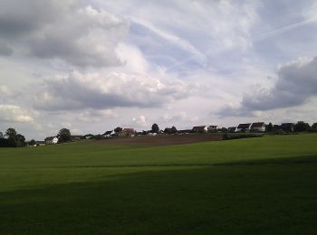
Les meilleurs parcours (7)
![Randonnée A pied Plech - Schusterweg - Photo](https://media.geolcdn.com/t/350/260/7834e4b4-297d-4564-af9d-6a7a9691b7d9.jpeg&format=jpg&maxdim=2)
![A pied A pied](https://static1.geolcdn.com/sitytour/trail-icons/100.png)
Km
A pied
![](/images/other/stat-length.png)
![](https://static1.geolcdn.com/siteimages/upload/files/1508320355ic_sort_den_pos_24dp.png)
![](https://static1.geolcdn.com/siteimages/upload/files/1508320355ic_sort_den_neg_24dp.png)
![](https://static1.geolcdn.com/siteimages/upload/files/16400158638029165_repeat_loop_refresh_sync_direction_icon.png)
• Randonnée créée par Plecher Heimatverein. geprüft (Jan. 2015 by cycling_zno) Symbole: Grüner Ring auf weißem Grund
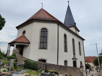
![Randonnée A pied Plech - Geißbock-Runde - Photo](https://media.geolcdn.com/t/350/260/7834e4b4-297d-4564-af9d-6a7a9691b7d9.jpeg&format=jpg&maxdim=2)
![A pied A pied](https://static1.geolcdn.com/sitytour/trail-icons/100.png)
Km
A pied
![](/images/other/stat-length.png)
![](https://static1.geolcdn.com/siteimages/upload/files/1508320355ic_sort_den_pos_24dp.png)
![](https://static1.geolcdn.com/siteimages/upload/files/1508320355ic_sort_den_neg_24dp.png)
![](https://static1.geolcdn.com/siteimages/upload/files/16400158638029165_repeat_loop_refresh_sync_direction_icon.png)
• Randonnée créée par Plecher Heimatverein. geprüft (Jan. 2015 by cycling_zno) Symbole: Schwarzer Walker auf blauem G...
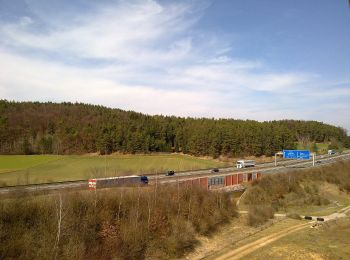
![Randonnée A pied Plech - Löwen-Runde - Photo](https://media.geolcdn.com/t/350/260/3ffe4bd6-65d3-447b-8a83-b8151d0aa446.jpeg&format=jpg&maxdim=2)
![A pied A pied](https://static1.geolcdn.com/sitytour/trail-icons/100.png)
Km
A pied
![](/images/other/stat-length.png)
![](https://static1.geolcdn.com/siteimages/upload/files/1508320355ic_sort_den_pos_24dp.png)
![](https://static1.geolcdn.com/siteimages/upload/files/1508320355ic_sort_den_neg_24dp.png)
![](https://static1.geolcdn.com/siteimages/upload/files/16400158638029165_repeat_loop_refresh_sync_direction_icon.png)
• Randonnée créée par Plecher Heimatverein. geprüft (Jan. 2015 by cycling_zno) Symbole: Schwarzer Walker auf gelbem G...
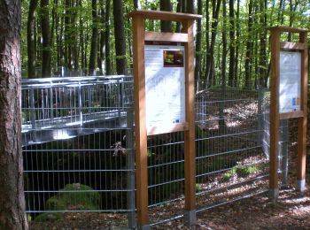
![Randonnée A pied Plech - Wolfs-Runde - Photo](https://media.geolcdn.com/t/350/260/ea511d12-fd94-40e6-8d36-f90d70284fa7.jpeg&format=jpg&maxdim=2)
![A pied A pied](https://static1.geolcdn.com/sitytour/trail-icons/100.png)
Km
A pied
![](/images/other/stat-length.png)
![](https://static1.geolcdn.com/siteimages/upload/files/1508320355ic_sort_den_pos_24dp.png)
![](https://static1.geolcdn.com/siteimages/upload/files/1508320355ic_sort_den_neg_24dp.png)
![](https://static1.geolcdn.com/siteimages/upload/files/16400158638029165_repeat_loop_refresh_sync_direction_icon.png)
• Randonnée créée par Plecher Heimatverein. geprüft (Jan. 2015 by cycling_zno) Symbole: Schwarzer Walker auf grünem G...
![Randonnée A pied Plech - Plecher Höhlenweg - Photo](https://media.geolcdn.com/t/350/260/e869367d-db36-4110-8279-a7fecdff124b.jpeg&format=jpg&maxdim=2)
![A pied A pied](https://static1.geolcdn.com/sitytour/trail-icons/100.png)
Km
A pied
![](/images/other/stat-length.png)
![](https://static1.geolcdn.com/siteimages/upload/files/1508320355ic_sort_den_pos_24dp.png)
![](https://static1.geolcdn.com/siteimages/upload/files/1508320355ic_sort_den_neg_24dp.png)
![](https://static1.geolcdn.com/siteimages/upload/files/16400158638029165_repeat_loop_refresh_sync_direction_icon.png)
• Randonnée créée par Plecher Heimatverein. geprüft (Jan. 2015 by cycling_zno) Symbole: Gelber Pfeil auf weißem Grund
![Randonnée A pied Plech - Rundweg um den Großen Berg - Photo](https://media.geolcdn.com/t/350/260/ext.jpg?maxdim=2&url=https%3A%2F%2Fstatic1.geolcdn.com%2Fsiteimages%2Fupload%2Ffiles%2F1545311037marcheuse_200dpi.jpg)
![A pied A pied](https://static1.geolcdn.com/sitytour/trail-icons/100.png)
Km
A pied
![](/images/other/stat-length.png)
![](https://static1.geolcdn.com/siteimages/upload/files/1508320355ic_sort_den_pos_24dp.png)
![](https://static1.geolcdn.com/siteimages/upload/files/1508320355ic_sort_den_neg_24dp.png)
![](https://static1.geolcdn.com/siteimages/upload/files/16400158638029165_repeat_loop_refresh_sync_direction_icon.png)
• Randonnée créée par Plecher Heimatverein. geprüft (Jan. 2015 by cycling_zno) Symbole: Roter senkrechter Strich auf ...
![Randonnée A pied Plech - Kulturlandschaftsweg Plech - Photo](https://media.geolcdn.com/t/350/260/ext.jpg?maxdim=2&url=https%3A%2F%2Fstatic1.geolcdn.com%2Fsiteimages%2Fupload%2Ffiles%2F1545311037marcheuse_200dpi.jpg)
![A pied A pied](https://static1.geolcdn.com/sitytour/trail-icons/100.png)
Km
A pied
![](/images/other/stat-length.png)
![](https://static1.geolcdn.com/siteimages/upload/files/1508320355ic_sort_den_pos_24dp.png)
![](https://static1.geolcdn.com/siteimages/upload/files/1508320355ic_sort_den_neg_24dp.png)
![](https://static1.geolcdn.com/siteimages/upload/files/16400158638029165_repeat_loop_refresh_sync_direction_icon.png)
• Randonnée créée par Plecher Heimatverein. geprüft (Jan. 2015 by cycling_zno) Symbole: Schwarzes Logo auf gelbem Grund
7 randonnées affichées sur 7
Application GPS de randonnée GRATUITE