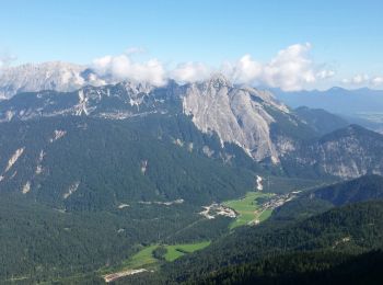
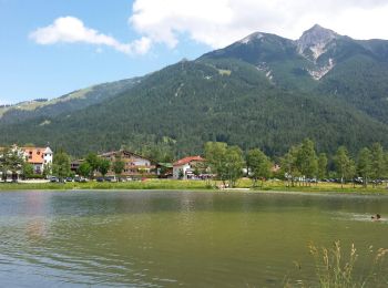
![](/images/other/stat-length.png)
- Randonnées
- Outdoor
- Autriche
- Tyrol
- Bezirk Innsbruck-Land
Bezirk Innsbruck-Land, Tyrol : Les meilleures randonnées, itinéraires, parcours, balades et promenades
Bezirk Innsbruck-Land : découvrez les meilleures randonnées : 108 pédestres et 7 à vélo ou VTT. Tous ces circuits, parcours, itinéraires et activités en plein air sont disponibles dans nos applications SityTrail pour smartphones et tablettes.
Les meilleurs parcours (120)
![Randonnée Marche Gemeinde Seefeld in Tirol - Les hauteurs de Seefeld - Photo](https://media.geolcdn.com/t/350/260/ext.jpg?maxdim=2&url=https%3A%2F%2Fservices.sitytrail.com%2FGeolivesWS%2FDownloadMedia.ashx%3FTrailID%3D608758%26Media%3Dfix__20160730095135.jpg)
![Marche Marche](https://static1.geolcdn.com/sitytour/trail-icons/101.png)
Km
Marche
![](/images/other/stat-length.png)
![](https://static1.geolcdn.com/siteimages/upload/files/1508320355ic_sort_den_pos_24dp.png)
![](https://static1.geolcdn.com/siteimages/upload/files/1508320355ic_sort_den_neg_24dp.png)
![](https://static1.geolcdn.com/siteimages/upload/files/16400158638029165_repeat_loop_refresh_sync_direction_icon.png)
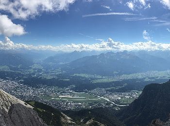
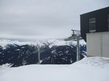
• Faite le 30/07/2016 avec notre fils de 11 ans. Montée avec le funiculaire jusqu'à la Rosshütte puis le téléphérique j...
![Randonnée Marche Gemeinde Leutasch - Leutascher Geistelklamm - Photo](https://media.geolcdn.com/t/350/260/ext.jpg?maxdim=2&url=https%3A%2F%2Fservices.sitytrail.com%2FGeolivesWS%2FDownloadMedia.ashx%3FTrailID%3D450001%26Media%3Dfix__20150723133419.jpg)
![Marche Marche](https://static1.geolcdn.com/sitytour/trail-icons/101.png)
Km
Marche
![](/images/other/stat-length.png)
![](https://static1.geolcdn.com/siteimages/upload/files/1508320355ic_sort_den_pos_24dp.png)
![](https://static1.geolcdn.com/siteimages/upload/files/1508320355ic_sort_den_neg_24dp.png)
![](https://static1.geolcdn.com/siteimages/upload/files/16400158638029165_repeat_loop_refresh_sync_direction_icon.png)
• Faite le 23/07/2015 avec notre fils de 10 ans.
![Randonnée Marche Gemeinde Seefeld in Tirol - Seefelder Spitze et pied de la Reither Spitze - Photo](https://media.geolcdn.com/t/350/260/ext.jpg?maxdim=2&url=https%3A%2F%2Fservices.sitytrail.com%2FGeolivesWS%2FDownloadMedia.ashx%3FTrailID%3D449997%26Media%3Dfix__20150722134415.jpg)
![Marche Marche](https://static1.geolcdn.com/sitytour/trail-icons/101.png)
Km
Marche
![](/images/other/stat-length.png)
![](https://static1.geolcdn.com/siteimages/upload/files/1508320355ic_sort_den_pos_24dp.png)
![](https://static1.geolcdn.com/siteimages/upload/files/1508320355ic_sort_den_neg_24dp.png)
![](https://static1.geolcdn.com/siteimages/upload/files/16400158638029165_repeat_loop_refresh_sync_direction_icon.png)
• Faite le 22/07/2015 avec notre fils de 10 ans. Montée avec le funiculaire jusqu'à la Rosshütte puis le téléphérique j...
![Randonnée Marche Gemeinde Seefeld in Tirol - Les lacs - Wildmoos - Möserersee - Photo](https://media.geolcdn.com/t/350/260/ext.jpg?maxdim=2&url=https%3A%2F%2Fservices.sitytrail.com%2FGeolivesWS%2FDownloadMedia.ashx%3FTrailID%3D449996%26Media%3Dfix__20150721150101.jpg)
![Marche Marche](https://static1.geolcdn.com/sitytour/trail-icons/101.png)
Km
Marche
![](/images/other/stat-length.png)
![](https://static1.geolcdn.com/siteimages/upload/files/1508320355ic_sort_den_pos_24dp.png)
![](https://static1.geolcdn.com/siteimages/upload/files/1508320355ic_sort_den_neg_24dp.png)
![](https://static1.geolcdn.com/siteimages/upload/files/16400158638029165_repeat_loop_refresh_sync_direction_icon.png)
• Faite le 21/07/2015 avec notre fils de 10 ans. Randonnée guidée gratuite proposée par Sport Aktiv et les hotels de Se...
![Randonnée Marche Gemeinde Seefeld in Tirol - Mösern - Gschwandtkopf - Reith - Photo](https://media.geolcdn.com/t/350/260/ext.jpg?maxdim=2&url=https%3A%2F%2Fservices.sitytrail.com%2FGeolivesWS%2FDownloadMedia.ashx%3FTrailID%3D449994%26Media%3Dfix__20150720142243.jpg)
![Marche Marche](https://static1.geolcdn.com/sitytour/trail-icons/101.png)
Km
Marche
![](/images/other/stat-length.png)
![](https://static1.geolcdn.com/siteimages/upload/files/1508320355ic_sort_den_pos_24dp.png)
![](https://static1.geolcdn.com/siteimages/upload/files/1508320355ic_sort_den_neg_24dp.png)
![](https://static1.geolcdn.com/siteimages/upload/files/16400158638029165_repeat_loop_refresh_sync_direction_icon.png)
• Faite le 20/07/2015 avec notre fils de 10 ans. Randonnée guidée gratuite proposée par Sport Aktiv et les Hotels de Se...
![Randonnée Marche Gemeinde Seefeld in Tirol - Seefelder Spitze - Photo](https://media.geolcdn.com/t/350/260/ext.jpg?maxdim=2&url=https%3A%2F%2Fservices.sitytrail.com%2FGeolivesWS%2FDownloadMedia.ashx%3FTrailID%3D449993%26Media%3Dfix__20150719120459.jpg)
![Marche Marche](https://static1.geolcdn.com/sitytour/trail-icons/101.png)
Km
Marche
![](/images/other/stat-length.png)
![](https://static1.geolcdn.com/siteimages/upload/files/1508320355ic_sort_den_pos_24dp.png)
![](https://static1.geolcdn.com/siteimages/upload/files/1508320355ic_sort_den_neg_24dp.png)
![](https://static1.geolcdn.com/siteimages/upload/files/16400158638029165_repeat_loop_refresh_sync_direction_icon.png)
• Faite le 19/07/2015 avec notre fils de 10 ans. Montée avec le funiculaire jusqu'à la Rosshütte puis le téléphérique j...
![Randonnée A pied Gemeinde Neustift im Stubaital - Wilde Wasser Weg - Photo](https://media.geolcdn.com/t/350/260/70f39b52-5b6f-4aeb-9e90-b5bb5a6b221b.jpeg&format=jpg&maxdim=2)
![A pied A pied](https://static1.geolcdn.com/sitytour/trail-icons/100.png)
Km
A pied
![](/images/other/stat-length.png)
![](https://static1.geolcdn.com/siteimages/upload/files/1508320355ic_sort_den_pos_24dp.png)
![](https://static1.geolcdn.com/siteimages/upload/files/1508320355ic_sort_den_neg_24dp.png)
![](https://static1.geolcdn.com/siteimages/upload/files/16400158638029165_repeat_loop_refresh_sync_direction_icon.png)
• Symbole: Gelbe Wegweisschilder mit blauer Welle und schwarzer Schrift
![Randonnée A pied Gemeinde Rinn - Hasental-Trail - Photo](https://media.geolcdn.com/t/350/260/2ef403ba-f96e-4e77-a8e7-6adba28f9e16.jpeg&format=jpg&maxdim=2)
![A pied A pied](https://static1.geolcdn.com/sitytour/trail-icons/100.png)
Km
A pied
![](/images/other/stat-length.png)
![](https://static1.geolcdn.com/siteimages/upload/files/1508320355ic_sort_den_pos_24dp.png)
![](https://static1.geolcdn.com/siteimages/upload/files/1508320355ic_sort_den_neg_24dp.png)
![](https://static1.geolcdn.com/siteimages/upload/files/16400158638029165_repeat_loop_refresh_sync_direction_icon.png)
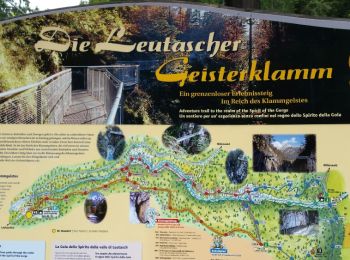
• Site web: https://www.innsbruck.info/wandern/wandern/wanderungen/touren/hasental-trail-38-1.html
![Randonnée Marche Gemeinde Scharnitz - La Voie de l’Aigle : J7 - Photo](https://media.geolcdn.com/t/350/260/b7aeda0d-22e9-4493-a84f-d759a36662b2.jpg&format=jpg&maxdim=2)
![Marche Marche](https://static1.geolcdn.com/sitytour/trail-icons/101.png)
Km
Marche
![](/images/other/stat-length.png)
![](https://static1.geolcdn.com/siteimages/upload/files/1508320355ic_sort_den_pos_24dp.png)
![](https://static1.geolcdn.com/siteimages/upload/files/1508320355ic_sort_den_neg_24dp.png)
![](https://static1.geolcdn.com/siteimages/upload/files/16400158638029165_repeat_loop_refresh_sync_direction_icon.png)
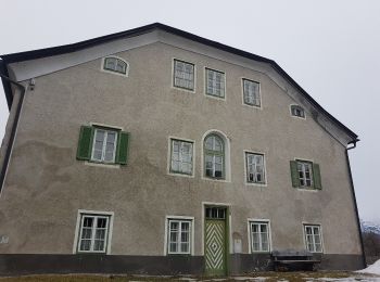
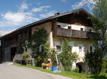
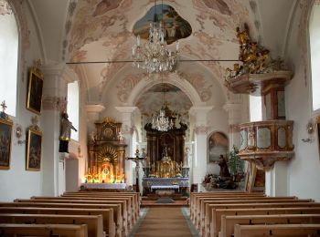
• Trek de 8 jours dans le Tyrol autrichien avec Mettons le Monde en Marche. Parcours de la voie de l'Aigle de Langkampf...
![Randonnée A pied Gemeinde Patsch - Zirbenweg - Photo](https://media.geolcdn.com/t/350/260/4eca3fa3-eff8-445b-b0e4-2745ec756fc8.jpeg&format=jpg&maxdim=2)
![A pied A pied](https://static1.geolcdn.com/sitytour/trail-icons/100.png)
Km
A pied
![](/images/other/stat-length.png)
![](https://static1.geolcdn.com/siteimages/upload/files/1508320355ic_sort_den_pos_24dp.png)
![](https://static1.geolcdn.com/siteimages/upload/files/1508320355ic_sort_den_neg_24dp.png)
![](https://static1.geolcdn.com/siteimages/upload/files/16400158638029165_repeat_loop_refresh_sync_direction_icon.png)
![Randonnée A pied Marktgemeinde Zirl - 50 / 4a Hochzirl - Magdeburger Hütte - Photo](https://media.geolcdn.com/t/350/260/e4f0687c-a820-43fc-9505-9e80c47e2be7.jpeg&format=jpg&maxdim=2)
![A pied A pied](https://static1.geolcdn.com/sitytour/trail-icons/100.png)
Km
A pied
![](/images/other/stat-length.png)
![](https://static1.geolcdn.com/siteimages/upload/files/1508320355ic_sort_den_pos_24dp.png)
![](https://static1.geolcdn.com/siteimages/upload/files/1508320355ic_sort_den_neg_24dp.png)
![](https://static1.geolcdn.com/siteimages/upload/files/16400158638029165_repeat_loop_refresh_sync_direction_icon.png)
![Randonnée A pied Marktgemeinde Zirl - 4 Hochzirl - Rasthaus Brunntal - Photo](https://media.geolcdn.com/t/350/260/471254d9-b058-4185-8140-d488a8964ba2.jpeg&format=jpg&maxdim=2)
![A pied A pied](https://static1.geolcdn.com/sitytour/trail-icons/100.png)
Km
A pied
![](/images/other/stat-length.png)
![](https://static1.geolcdn.com/siteimages/upload/files/1508320355ic_sort_den_pos_24dp.png)
![](https://static1.geolcdn.com/siteimages/upload/files/1508320355ic_sort_den_neg_24dp.png)
![](https://static1.geolcdn.com/siteimages/upload/files/16400158638029165_repeat_loop_refresh_sync_direction_icon.png)
![Randonnée A pied Marktgemeinde Zirl - 56 Kleiner Solstein - Photo](https://media.geolcdn.com/t/350/260/171aa05d-a495-46ab-9351-0f243446a768.jpeg&format=jpg&maxdim=2)
![A pied A pied](https://static1.geolcdn.com/sitytour/trail-icons/100.png)
Km
A pied
![](/images/other/stat-length.png)
![](https://static1.geolcdn.com/siteimages/upload/files/1508320355ic_sort_den_pos_24dp.png)
![](https://static1.geolcdn.com/siteimages/upload/files/1508320355ic_sort_den_neg_24dp.png)
![](https://static1.geolcdn.com/siteimages/upload/files/16400158638029165_repeat_loop_refresh_sync_direction_icon.png)
![Randonnée A pied Marktgemeinde Zirl - 53 Neue Magdeburger Hütte - Kleiner und Großer Solstein - Photo](https://media.geolcdn.com/t/350/260/1e3f2c07-d75c-45d0-9503-b70d2c6d37eb.jpeg&format=jpg&maxdim=2)
![A pied A pied](https://static1.geolcdn.com/sitytour/trail-icons/100.png)
Km
A pied
![](/images/other/stat-length.png)
![](https://static1.geolcdn.com/siteimages/upload/files/1508320355ic_sort_den_pos_24dp.png)
![](https://static1.geolcdn.com/siteimages/upload/files/1508320355ic_sort_den_neg_24dp.png)
![](https://static1.geolcdn.com/siteimages/upload/files/16400158638029165_repeat_loop_refresh_sync_direction_icon.png)
![Randonnée A pied Gemeinde Gschnitz - Wanderweg 60 - Innsbrucker Hütte - Photo](https://media.geolcdn.com/t/350/260/85954afa-06c9-4ad7-aabb-abd14ad21489.jpeg&format=jpg&maxdim=2)
![A pied A pied](https://static1.geolcdn.com/sitytour/trail-icons/100.png)
Km
A pied
![](/images/other/stat-length.png)
![](https://static1.geolcdn.com/siteimages/upload/files/1508320355ic_sort_den_pos_24dp.png)
![](https://static1.geolcdn.com/siteimages/upload/files/1508320355ic_sort_den_neg_24dp.png)
![](https://static1.geolcdn.com/siteimages/upload/files/16400158638029165_repeat_loop_refresh_sync_direction_icon.png)
![Randonnée A pied Gemeinde Ampass - Rundwanderweg Ebenwald - Photo](https://media.geolcdn.com/t/350/260/663f064d-6b92-441b-ac0a-74247308b578.jpeg&format=jpg&maxdim=2)
![A pied A pied](https://static1.geolcdn.com/sitytour/trail-icons/100.png)
Km
A pied
![](/images/other/stat-length.png)
![](https://static1.geolcdn.com/siteimages/upload/files/1508320355ic_sort_den_pos_24dp.png)
![](https://static1.geolcdn.com/siteimages/upload/files/1508320355ic_sort_den_neg_24dp.png)
![](https://static1.geolcdn.com/siteimages/upload/files/16400158638029165_repeat_loop_refresh_sync_direction_icon.png)
![Randonnée A pied Gemeinde Ampass - Rundwanderweg Herztal - Photo](https://media.geolcdn.com/t/350/260/441c147d-ba1e-4054-afb1-3b436f27998e.jpeg&format=jpg&maxdim=2)
![A pied A pied](https://static1.geolcdn.com/sitytour/trail-icons/100.png)
Km
A pied
![](/images/other/stat-length.png)
![](https://static1.geolcdn.com/siteimages/upload/files/1508320355ic_sort_den_pos_24dp.png)
![](https://static1.geolcdn.com/siteimages/upload/files/1508320355ic_sort_den_neg_24dp.png)
![](https://static1.geolcdn.com/siteimages/upload/files/16400158638029165_repeat_loop_refresh_sync_direction_icon.png)
![Randonnée A pied Gemeinde Rinn - Rundwanderweg Poltental - Photo](https://media.geolcdn.com/t/350/260/51a02d20-5582-44b5-b69e-1765736a126e.jpeg&format=jpg&maxdim=2)
![A pied A pied](https://static1.geolcdn.com/sitytour/trail-icons/100.png)
Km
A pied
![](/images/other/stat-length.png)
![](https://static1.geolcdn.com/siteimages/upload/files/1508320355ic_sort_den_pos_24dp.png)
![](https://static1.geolcdn.com/siteimages/upload/files/1508320355ic_sort_den_neg_24dp.png)
![](https://static1.geolcdn.com/siteimages/upload/files/16400158638029165_repeat_loop_refresh_sync_direction_icon.png)
![Randonnée A pied Gemeinde Rinn - Rundwanderweg Hasental - Photo](https://media.geolcdn.com/t/350/260/27dfb8ee-3ee4-40ad-a10e-f6085849f734.jpeg&format=jpg&maxdim=2)
![A pied A pied](https://static1.geolcdn.com/sitytour/trail-icons/100.png)
Km
A pied
![](/images/other/stat-length.png)
![](https://static1.geolcdn.com/siteimages/upload/files/1508320355ic_sort_den_pos_24dp.png)
![](https://static1.geolcdn.com/siteimages/upload/files/1508320355ic_sort_den_neg_24dp.png)
![](https://static1.geolcdn.com/siteimages/upload/files/16400158638029165_repeat_loop_refresh_sync_direction_icon.png)
![Randonnée A pied Gemeinde Obernberg am Brenner - Wanderweg Nr. 41 - Photo](https://media.geolcdn.com/t/350/260/d17b924a-01de-4f6a-a666-8b42267172f1.jpeg&format=jpg&maxdim=2)
![A pied A pied](https://static1.geolcdn.com/sitytour/trail-icons/100.png)
Km
A pied
![](/images/other/stat-length.png)
![](https://static1.geolcdn.com/siteimages/upload/files/1508320355ic_sort_den_pos_24dp.png)
![](https://static1.geolcdn.com/siteimages/upload/files/1508320355ic_sort_den_neg_24dp.png)
![](https://static1.geolcdn.com/siteimages/upload/files/16400158638029165_repeat_loop_refresh_sync_direction_icon.png)
• Symbole: rot-weiss-rot
20 randonnées affichées sur 120
Application GPS de randonnée GRATUITE
Activités
Régions proches
- Gemeinde Absam
- Gemeinde Ampass
- Gemeinde Axams
- Gemeinde Birgitz
- Gemeinde Ellbögen
- Gemeinde Gnadenwald
- Gemeinde Götzens
- Gemeinde Gries am Brenner
- Gemeinde Gries im Sellrain
- Gemeinde Grinzens
- Gemeinde Gschnitz
- Gemeinde Leutasch
- Gemeinde Mieders
- Gemeinde Mühlbachl
- Gemeinde Mutters
- Gemeinde Natters
- Gemeinde Navis
- Gemeinde Neustift im Stubaital
- Gemeinde Obernberg am Brenner
- Gemeinde Oberperfuss
- Gemeinde Patsch
- Gemeinde Reith bei Seefeld
- Gemeinde Rinn
- Gemeinde Sankt Sigmund im Sellrain
- Gemeinde Scharnitz
- Gemeinde Schönberg im Stubaital
- Gemeinde Seefeld in Tirol
- Gemeinde Sellrain
- Gemeinde Telfes im Stubai
- Gemeinde Thaur
- Gemeinde Tulfes
- Gemeinde Vals
- Gemeinde Volders
- Gemeinde Wattenberg
- Gemeinde Wildermieming
- Marktgemeinde Fulpmes
- Marktgemeinde Rum
- Marktgemeinde Telfs
- Marktgemeinde Wattens
- Marktgemeinde Zirl
- Stadt Hall in Tirol