


11,4 km | 12,3 km-effort
Burgenland : découvrez les meilleures randonnées : 172 pédestres. Tous ces circuits, parcours, itinéraires et activités en plein air sont disponibles dans nos applications SityTrail pour smartphones et tablettes.
A pied


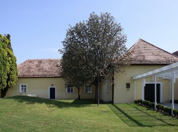
• Randonnée créée par Tourismusverband Siegendorf.
A pied
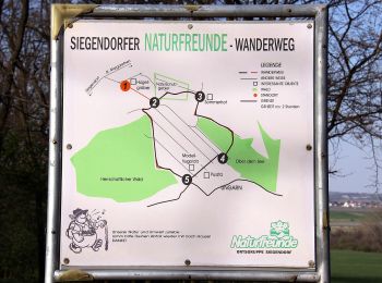
• Randonnée créée par Naturfreunde Ortsgruppe Siegendorf.
A pied
• Randonnée créée par Tourismusverband Siegendorf.
A pied
• Randonnée créée par Tourismusverband Siegendorf.
A pied
• Randonnée créée par Tourismusverband Siegendorf.
A pied
• Randonnée créée par Tourismusverband Siegendorf.
A pied
• Randonnée créée par Tourismusverband Siegendorf.
A pied
• Randonnée créée par Tourismus Südburgenland.
A pied
• Randonnée créée par Tourismus Südburgenland.
A pied
• Randonnée créée par Tourismus Südburgenland.
A pied
• Randonnée créée par Gemeinde Schützen am Gebirge.
A pied
• Randonnée créée par Bewegungsarena Hornbach. Symbole: blauer Pfeil, 4
A pied
• Randonnée créée par Via.Carnuntum.
A pied
• Randonnée créée par Tourismusverband Edelstal.
A pied
• Randonnée créée par Naturfreunde Mattersburg. insgesamt sehr schlecht markiert Symbole: rot-weiss-rot 921
A pied
• Symbole: Weißer Pfeil mit Schriftzug "Kreuz & Quer-Weg" auf gelbem Hintergrund
A pied
• Randonnée créée par Leithaland. Symbole: Weißer Pfeil mit Schriftzug "Kreuz & Quer-Weg" auf rotbraunem Hintergrund
A pied
• Randonnée créée par Leithaland. beim Hohen Berg teilweise fast zugewachsen
A pied
• Randonnée créée par Bewegungsarena Hornbach. Symbole: roter Pfeil, 2
A pied
• Randonnée créée par Tourismusverband Region Rosalia. Symbole: grünes Schild mit Pfeil
20 randonnées affichées sur 172
Application GPS de randonnée GRATUITE
 SityTrail
IGN / Instituts géographiques
SityTrail World
Le monde est à vous