![](/images/other/stat-length.png)
- Randonnées
- Outdoor
- Autriche
- Basse-Autriche
- Bezirk Neunkirchen
Bezirk Neunkirchen, Basse-Autriche : Les meilleures randonnées, itinéraires, parcours, balades et promenades
Bezirk Neunkirchen : découvrez les meilleures randonnées : 315 pédestres. Tous ces circuits, parcours, itinéraires et activités en plein air sont disponibles dans nos applications SityTrail pour smartphones et tablettes.
Les meilleurs parcours (315)
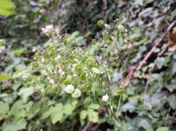
![Randonnée A pied Gemeinde Trattenbach - Themenweg Forst und Jagd - Photo](https://media.geolcdn.com/t/350/260/a9b47770-9a19-44ce-a4fc-643e6ffdeecd.jpeg&format=jpg&maxdim=2)
![A pied A pied](https://static1.geolcdn.com/sitytour/trail-icons/100.png)
Km
A pied
![](/images/other/stat-length.png)
![](https://static1.geolcdn.com/siteimages/upload/files/1508320355ic_sort_den_pos_24dp.png)
![](https://static1.geolcdn.com/siteimages/upload/files/1508320355ic_sort_den_neg_24dp.png)
![](https://static1.geolcdn.com/siteimages/upload/files/16400158638029165_repeat_loop_refresh_sync_direction_icon.png)
• hat mit Forst und Jagd wenig zu tun, aber heißt halt so
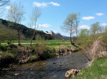
![Randonnée A pied Gemeinde Payerbach - Payerbach - Steinhöfler - Photo](https://media.geolcdn.com/t/350/260/35bed2ee-e677-4a7b-b649-9bc6d92cee68.jpeg&format=jpg&maxdim=2)
![A pied A pied](https://static1.geolcdn.com/sitytour/trail-icons/100.png)
Km
A pied
![](/images/other/stat-length.png)
![](https://static1.geolcdn.com/siteimages/upload/files/1508320355ic_sort_den_pos_24dp.png)
![](https://static1.geolcdn.com/siteimages/upload/files/1508320355ic_sort_den_neg_24dp.png)
![](https://static1.geolcdn.com/siteimages/upload/files/16400158638029165_repeat_loop_refresh_sync_direction_icon.png)
• Der ÖTK gilt als Pionier des Fremdenverkehrs. Heute ist der ÖTK mit über 360 Kursen und geführten Touren in 50 Freize...
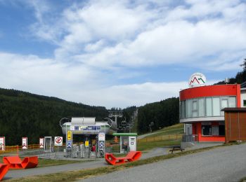
![Randonnée A pied Mönichkirchen - Rund um den Kogel (Mönichkirchen) - Photo](https://media.geolcdn.com/t/350/260/cba83622-7bd2-4d18-a21b-1472c027f513.jpeg&format=jpg&maxdim=2)
![A pied A pied](https://static1.geolcdn.com/sitytour/trail-icons/100.png)
Km
A pied
![](/images/other/stat-length.png)
![](https://static1.geolcdn.com/siteimages/upload/files/1508320355ic_sort_den_pos_24dp.png)
![](https://static1.geolcdn.com/siteimages/upload/files/1508320355ic_sort_den_neg_24dp.png)
![](https://static1.geolcdn.com/siteimages/upload/files/16400158638029165_repeat_loop_refresh_sync_direction_icon.png)
• Symbole: blau-gelb-blau
![Randonnée A pied Gemeinde Würflach - Erlebnisweg Johannesbachklamm - Photo](https://media.geolcdn.com/t/350/260/e50695a8-ad92-4c43-b3d8-703a7530c6a4.jpeg&format=jpg&maxdim=2)
![A pied A pied](https://static1.geolcdn.com/sitytour/trail-icons/100.png)
Km
A pied
![](/images/other/stat-length.png)
![](https://static1.geolcdn.com/siteimages/upload/files/1508320355ic_sort_den_pos_24dp.png)
![](https://static1.geolcdn.com/siteimages/upload/files/1508320355ic_sort_den_neg_24dp.png)
![](https://static1.geolcdn.com/siteimages/upload/files/16400158638029165_repeat_loop_refresh_sync_direction_icon.png)
• Symbole: gezeichnete Hand auf weiß-grüne Tafel
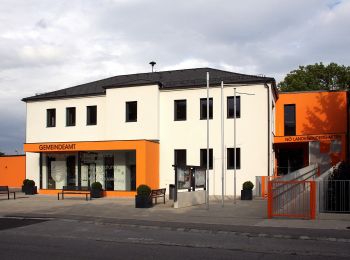
![Randonnée A pied Gemeinde Würflach - Rundweg 4 - Photo](https://media.geolcdn.com/t/350/260/f79cf879-9ff5-4921-96db-7d2f52410a41.jpeg&format=jpg&maxdim=2)
![A pied A pied](https://static1.geolcdn.com/sitytour/trail-icons/100.png)
Km
A pied
![](/images/other/stat-length.png)
![](https://static1.geolcdn.com/siteimages/upload/files/1508320355ic_sort_den_pos_24dp.png)
![](https://static1.geolcdn.com/siteimages/upload/files/1508320355ic_sort_den_neg_24dp.png)
![](https://static1.geolcdn.com/siteimages/upload/files/16400158638029165_repeat_loop_refresh_sync_direction_icon.png)
• wird nicht mehr in Stand gehalten
![Randonnée A pied Gemeinde Würflach - Würflach - Marterl Maria Drei Linden (Rundwanderweg) - Photo](https://media.geolcdn.com/t/350/260/f79cf879-9ff5-4921-96db-7d2f52410a41.jpeg&format=jpg&maxdim=2)
![A pied A pied](https://static1.geolcdn.com/sitytour/trail-icons/100.png)
Km
A pied
![](/images/other/stat-length.png)
![](https://static1.geolcdn.com/siteimages/upload/files/1508320355ic_sort_den_pos_24dp.png)
![](https://static1.geolcdn.com/siteimages/upload/files/1508320355ic_sort_den_neg_24dp.png)
![](https://static1.geolcdn.com/siteimages/upload/files/16400158638029165_repeat_loop_refresh_sync_direction_icon.png)
• Randonnée créée par Gemeinde Würflach. Symbole: 1 auf gelbem Grund
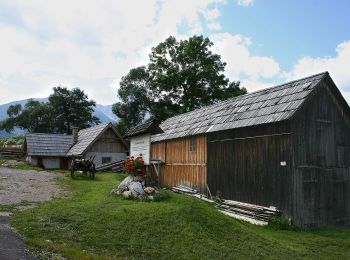
![Randonnée A pied Gemeinde Puchberg am Schneeberg - Puchberg Nordic Walking - Photo](https://media.geolcdn.com/t/350/260/f170616c-a09e-482a-acaa-c3366a12ca67.jpeg&format=jpg&maxdim=2)
![A pied A pied](https://static1.geolcdn.com/sitytour/trail-icons/100.png)
Km
A pied
![](/images/other/stat-length.png)
![](https://static1.geolcdn.com/siteimages/upload/files/1508320355ic_sort_den_pos_24dp.png)
![](https://static1.geolcdn.com/siteimages/upload/files/1508320355ic_sort_den_neg_24dp.png)
![](https://static1.geolcdn.com/siteimages/upload/files/16400158638029165_repeat_loop_refresh_sync_direction_icon.png)
• Randonnée créée par Tourismusverein Puchberg. Symbole: grüne Strecke, NW
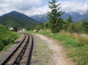
![Randonnée A pied Gemeinde Puchberg am Schneeberg - Puchberg Laufstrecke 3 - Photo](https://media.geolcdn.com/t/350/260/9b4f61dc-5937-4b0d-b443-e6f51c2b4c6d.jpeg&format=jpg&maxdim=2)
![A pied A pied](https://static1.geolcdn.com/sitytour/trail-icons/100.png)
Km
A pied
![](/images/other/stat-length.png)
![](https://static1.geolcdn.com/siteimages/upload/files/1508320355ic_sort_den_pos_24dp.png)
![](https://static1.geolcdn.com/siteimages/upload/files/1508320355ic_sort_den_neg_24dp.png)
![](https://static1.geolcdn.com/siteimages/upload/files/16400158638029165_repeat_loop_refresh_sync_direction_icon.png)
• Randonnée créée par Tourismusverein Puchberg. Symbole: gelbe Strecke, L3
![Randonnée A pied Gemeinde Puchberg am Schneeberg - Puchberg Laufstrecke 2 - Photo](https://media.geolcdn.com/t/350/260/f170616c-a09e-482a-acaa-c3366a12ca67.jpeg&format=jpg&maxdim=2)
![A pied A pied](https://static1.geolcdn.com/sitytour/trail-icons/100.png)
Km
A pied
![](/images/other/stat-length.png)
![](https://static1.geolcdn.com/siteimages/upload/files/1508320355ic_sort_den_pos_24dp.png)
![](https://static1.geolcdn.com/siteimages/upload/files/1508320355ic_sort_den_neg_24dp.png)
![](https://static1.geolcdn.com/siteimages/upload/files/16400158638029165_repeat_loop_refresh_sync_direction_icon.png)
• Randonnée créée par Tourismusverein Puchberg. Symbole: blaue Strecke, L2
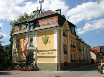
![Randonnée A pied Gemeinde Puchberg am Schneeberg - Puchberg Laufstrecke 1 - Photo](https://media.geolcdn.com/t/350/260/cfa04fdc-169a-4996-8ba7-d63c0e5f47a5.jpeg&format=jpg&maxdim=2)
![A pied A pied](https://static1.geolcdn.com/sitytour/trail-icons/100.png)
Km
A pied
![](/images/other/stat-length.png)
![](https://static1.geolcdn.com/siteimages/upload/files/1508320355ic_sort_den_pos_24dp.png)
![](https://static1.geolcdn.com/siteimages/upload/files/1508320355ic_sort_den_neg_24dp.png)
![](https://static1.geolcdn.com/siteimages/upload/files/16400158638029165_repeat_loop_refresh_sync_direction_icon.png)
• Randonnée créée par Tourismusverein Puchberg. Symbole: rote Strecke, L1
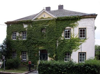
![Randonnée A pied Gemeinde Würflach - Orgelbau-Allgäuer Runde - Photo](https://media.geolcdn.com/t/350/260/1f55884a-f647-4c18-9034-94fc09c9018f.jpeg&format=jpg&maxdim=2)
![A pied A pied](https://static1.geolcdn.com/sitytour/trail-icons/100.png)
Km
A pied
![](/images/other/stat-length.png)
![](https://static1.geolcdn.com/siteimages/upload/files/1508320355ic_sort_den_pos_24dp.png)
![](https://static1.geolcdn.com/siteimages/upload/files/1508320355ic_sort_den_neg_24dp.png)
![](https://static1.geolcdn.com/siteimages/upload/files/16400158638029165_repeat_loop_refresh_sync_direction_icon.png)
• Randonnée créée par Runnersfun. Symbole: oranger Pfeil, Wü2
![Randonnée A pied Gemeinde Würflach - 3 Linden Runde - Photo](https://media.geolcdn.com/t/350/260/1f55884a-f647-4c18-9034-94fc09c9018f.jpeg&format=jpg&maxdim=2)
![A pied A pied](https://static1.geolcdn.com/sitytour/trail-icons/100.png)
Km
A pied
![](/images/other/stat-length.png)
![](https://static1.geolcdn.com/siteimages/upload/files/1508320355ic_sort_den_pos_24dp.png)
![](https://static1.geolcdn.com/siteimages/upload/files/1508320355ic_sort_den_neg_24dp.png)
![](https://static1.geolcdn.com/siteimages/upload/files/16400158638029165_repeat_loop_refresh_sync_direction_icon.png)
• Randonnée créée par Runnersfun. Symbole: blauer Pfeil, Wü1
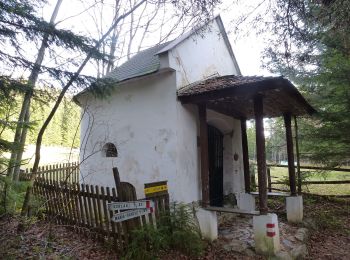
![Randonnée A pied Gemeinde Schottwien - Rundwanderweg - Photo](https://media.geolcdn.com/t/350/260/db4fa6e5-ce96-4cdc-8273-42b6f040655b.jpeg&format=jpg&maxdim=2)
![A pied A pied](https://static1.geolcdn.com/sitytour/trail-icons/100.png)
Km
A pied
![](/images/other/stat-length.png)
![](https://static1.geolcdn.com/siteimages/upload/files/1508320355ic_sort_den_pos_24dp.png)
![](https://static1.geolcdn.com/siteimages/upload/files/1508320355ic_sort_den_neg_24dp.png)
![](https://static1.geolcdn.com/siteimages/upload/files/16400158638029165_repeat_loop_refresh_sync_direction_icon.png)
• Randonnée créée par ?. http://wiki.openstreetmap.org/wiki/WikiProject_Austria/Wanderwege Symbole: Schilder
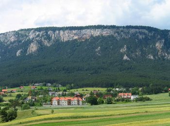
![Randonnée A pied Gemeinde Höflein an der Hohen Wand - Erlebnisweg](https://media.geolcdn.com/t/350/260/960fe85b-3cef-48ec-a010-b76d552f7441.jpeg&format=jpg&maxdim=2)
![A pied A pied](https://static1.geolcdn.com/sitytour/trail-icons/100.png)
Km
A pied
![](/images/other/stat-length.png)
![](https://static1.geolcdn.com/siteimages/upload/files/1508320355ic_sort_den_pos_24dp.png)
![](https://static1.geolcdn.com/siteimages/upload/files/1508320355ic_sort_den_neg_24dp.png)
![](https://static1.geolcdn.com/siteimages/upload/files/16400158638029165_repeat_loop_refresh_sync_direction_icon.png)
• Symbole: gezeichnete Hand auf weiß-grüne Tafel
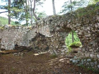
![Randonnée A pied Gemeinde Schrattenbach - tut gut Route 4: Grablinger Tour - Photo](https://media.geolcdn.com/t/350/260/3fc821f4-3807-4c5d-bfdb-e02d2ef77d63.jpeg&format=jpg&maxdim=2)
![A pied A pied](https://static1.geolcdn.com/sitytour/trail-icons/100.png)
Km
A pied
![](/images/other/stat-length.png)
![](https://static1.geolcdn.com/siteimages/upload/files/1508320355ic_sort_den_pos_24dp.png)
![](https://static1.geolcdn.com/siteimages/upload/files/1508320355ic_sort_den_neg_24dp.png)
![](https://static1.geolcdn.com/siteimages/upload/files/16400158638029165_repeat_loop_refresh_sync_direction_icon.png)
• Randonnée créée par Gemeinde Schrattenbach.
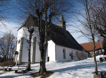
![Randonnée A pied Mönichkirchen - tut gut Route 3 Mönichkirchen - Photo](https://media.geolcdn.com/t/350/260/99e11728-f97b-47e6-9042-539edbb939ca.jpeg&format=jpg&maxdim=2)
![A pied A pied](https://static1.geolcdn.com/sitytour/trail-icons/100.png)
Km
A pied
![](/images/other/stat-length.png)
![](https://static1.geolcdn.com/siteimages/upload/files/1508320355ic_sort_den_pos_24dp.png)
![](https://static1.geolcdn.com/siteimages/upload/files/1508320355ic_sort_den_neg_24dp.png)
![](https://static1.geolcdn.com/siteimages/upload/files/16400158638029165_repeat_loop_refresh_sync_direction_icon.png)
• Symbole: violetter Punkt
![Randonnée A pied Mönichkirchen - tut gut Route 2 Mönichkirchen - Photo](https://media.geolcdn.com/t/350/260/1bc95260-d95c-4f7c-af33-75b396050d27.jpeg&format=jpg&maxdim=2)
![A pied A pied](https://static1.geolcdn.com/sitytour/trail-icons/100.png)
Km
A pied
![](/images/other/stat-length.png)
![](https://static1.geolcdn.com/siteimages/upload/files/1508320355ic_sort_den_pos_24dp.png)
![](https://static1.geolcdn.com/siteimages/upload/files/1508320355ic_sort_den_neg_24dp.png)
![](https://static1.geolcdn.com/siteimages/upload/files/16400158638029165_repeat_loop_refresh_sync_direction_icon.png)
• Symbole: grüner Punkt
![Randonnée A pied Feistritz am Wechsel - Rundwanderweg 10 (Urban-Kapelle - Feistritz - Grottendorf - Hollabrunn - Urban-Kapelle) - Photo](https://media.geolcdn.com/t/350/260/3b2c8ecd-1b3c-45ac-a950-85a706da3537.jpeg&format=jpg&maxdim=2)
![A pied A pied](https://static1.geolcdn.com/sitytour/trail-icons/100.png)
Km
A pied
![](/images/other/stat-length.png)
![](https://static1.geolcdn.com/siteimages/upload/files/1508320355ic_sort_den_pos_24dp.png)
![](https://static1.geolcdn.com/siteimages/upload/files/1508320355ic_sort_den_neg_24dp.png)
![](https://static1.geolcdn.com/siteimages/upload/files/16400158638029165_repeat_loop_refresh_sync_direction_icon.png)
• Symbole: grünes Schild mit Schuh
![Randonnée A pied Feistritz am Wechsel - Feistritz am Wechsel - Hollabrunn über Steinbichel - Photo](https://media.geolcdn.com/t/350/260/69173b9b-3432-4d70-9800-dbb92f0fc1ba.jpeg&format=jpg&maxdim=2)
![A pied A pied](https://static1.geolcdn.com/sitytour/trail-icons/100.png)
Km
A pied
![](/images/other/stat-length.png)
![](https://static1.geolcdn.com/siteimages/upload/files/1508320355ic_sort_den_pos_24dp.png)
![](https://static1.geolcdn.com/siteimages/upload/files/1508320355ic_sort_den_neg_24dp.png)
![](https://static1.geolcdn.com/siteimages/upload/files/16400158638029165_repeat_loop_refresh_sync_direction_icon.png)
• Symbole: grünes Schild mit Schuh
![Randonnée A pied Gemeinde Natschbach-Loipersbach - Rundwanderwege Natschbach - Loipersbach - Lindgrub L1 - Photo](https://media.geolcdn.com/t/350/260/4a26559f-2e49-428b-a60c-f98b2f105364.jpeg&format=jpg&maxdim=2)
![A pied A pied](https://static1.geolcdn.com/sitytour/trail-icons/100.png)
Km
A pied
![](/images/other/stat-length.png)
![](https://static1.geolcdn.com/siteimages/upload/files/1508320355ic_sort_den_pos_24dp.png)
![](https://static1.geolcdn.com/siteimages/upload/files/1508320355ic_sort_den_neg_24dp.png)
![](https://static1.geolcdn.com/siteimages/upload/files/16400158638029165_repeat_loop_refresh_sync_direction_icon.png)
• Randonnée créée par Dorferneuerungsverein Trio Aktiv.
20 randonnées affichées sur 315
Application GPS de randonnée GRATUITE
Activités
Régions proches
- Breitenau
- Feistritz am Wechsel
- Gemeinde Aspang
- Gemeinde Aspangberg-St.Peter
- Gemeinde Breitenstein
- Gemeinde Bürg-Vöstenhof
- Gemeinde Edlitz
- Gemeinde Enzenreith
- Gemeinde Gloggnitz
- Gemeinde Grafenbach-Sankt Valentin
- Gemeinde Grünbach am Schneeberg
- Gemeinde Höflein an der Hohen Wand
- Gemeinde Kirchberg am Wechsel
- Gemeinde Natschbach-Loipersbach
- Gemeinde Neunkirchen
- Gemeinde Otterthal
- Gemeinde Payerbach
- Gemeinde Pitten
- Gemeinde Prigglitz
- Gemeinde Puchberg am Schneeberg
- Gemeinde Raach am Hochgebirge
- Gemeinde Reichenau an der Rax
- Gemeinde Scheiblingkirchen-Thernberg
- Gemeinde Schottwien
- Gemeinde Schrattenbach
- Gemeinde Schwarzau am Steinfeld
- Gemeinde Schwarzau im Gebirge
- Gemeinde Seebenstein
- Gemeinde Semmering
- Gemeinde St. Corona am Wechsel
- Gemeinde St. Egyden am Steinfeld
- Gemeinde Ternitz
- Gemeinde Thomasberg
- Gemeinde Trattenbach
- Gemeinde Warth
- Gemeinde Wartmannstetten
- Gemeinde Willendorf
- Gemeinde Würflach
- Gemeinde Zöbern
- Grimmenstein
- Mönichkirchen