![](/images/other/stat-length.png)
- Randonnées
- Outdoor
- Autriche
- Basse-Autriche
- Bezirk Neunkirchen
- Gemeinde Pitten
Gemeinde Pitten, Bezirk Neunkirchen : Les meilleures randonnées, itinéraires, parcours, balades et promenades
Gemeinde Pitten : découvrez les meilleures randonnées : 9 pédestres. Tous ces circuits, parcours, itinéraires et activités en plein air sont disponibles dans nos applications SityTrail pour smartphones et tablettes.
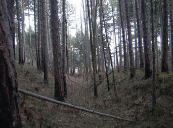
Les meilleurs parcours (9)
![Randonnée A pied Gemeinde Pitten - Pittental Hochwechsel Rundwanderweg 2 - Photo](https://media.geolcdn.com/t/350/260/5e4f954b-08a3-46d6-ba23-5e45727b0ca2.jpeg&format=jpg&maxdim=2)
![A pied A pied](https://static1.geolcdn.com/sitytour/trail-icons/100.png)
Km
A pied
![](/images/other/stat-length.png)
![](https://static1.geolcdn.com/siteimages/upload/files/1508320355ic_sort_den_pos_24dp.png)
![](https://static1.geolcdn.com/siteimages/upload/files/1508320355ic_sort_den_neg_24dp.png)
![](https://static1.geolcdn.com/siteimages/upload/files/16400158638029165_repeat_loop_refresh_sync_direction_icon.png)
• Symbole: grünes Schild mit Schuh
![Randonnée A pied Gemeinde Pitten - Pitten - Seebenstein über Hubertuskapelle - Photo](https://media.geolcdn.com/t/350/260/e31de09f-4b88-4c85-9978-c5b2b1666cd0.jpeg&format=jpg&maxdim=2)
![A pied A pied](https://static1.geolcdn.com/sitytour/trail-icons/100.png)
Km
A pied
![](/images/other/stat-length.png)
![](https://static1.geolcdn.com/siteimages/upload/files/1508320355ic_sort_den_pos_24dp.png)
![](https://static1.geolcdn.com/siteimages/upload/files/1508320355ic_sort_den_neg_24dp.png)
![](https://static1.geolcdn.com/siteimages/upload/files/16400158638029165_repeat_loop_refresh_sync_direction_icon.png)
• Randonnée créée par Touristenverein "Die Naturfreunde", Ortsgruppe Pitten. Symbole: grüner, waagrechter Balken
![Randonnée A pied Gemeinde Pitten - Sparkassenrunde (Pitten) - Photo](https://media.geolcdn.com/t/350/260/9ca20396-ccbb-4712-bd80-bf6d5941cbbe.jpeg&format=jpg&maxdim=2)
![A pied A pied](https://static1.geolcdn.com/sitytour/trail-icons/100.png)
Km
A pied
![](/images/other/stat-length.png)
![](https://static1.geolcdn.com/siteimages/upload/files/1508320355ic_sort_den_pos_24dp.png)
![](https://static1.geolcdn.com/siteimages/upload/files/1508320355ic_sort_den_neg_24dp.png)
![](https://static1.geolcdn.com/siteimages/upload/files/16400158638029165_repeat_loop_refresh_sync_direction_icon.png)
• Randonnée créée par Runnersfun. Symbole: grüner Pfeil
![Randonnée A pied Gemeinde Pitten - Pitten (Grafenkreuz) - Leiding - Stupfenreith - Photo](https://media.geolcdn.com/t/350/260/5e4f954b-08a3-46d6-ba23-5e45727b0ca2.jpeg&format=jpg&maxdim=2)
![A pied A pied](https://static1.geolcdn.com/sitytour/trail-icons/100.png)
Km
A pied
![](/images/other/stat-length.png)
![](https://static1.geolcdn.com/siteimages/upload/files/1508320355ic_sort_den_pos_24dp.png)
![](https://static1.geolcdn.com/siteimages/upload/files/1508320355ic_sort_den_neg_24dp.png)
![](https://static1.geolcdn.com/siteimages/upload/files/16400158638029165_repeat_loop_refresh_sync_direction_icon.png)
• Randonnée créée par Österreichischer Touristenklub, Sektion Wiener Neustadt. Symbole: grüner, waagrechter Balken
![Randonnée A pied Gemeinde Pitten - Hubertus Kapelle Runde - Photo](https://media.geolcdn.com/t/350/260/e31de09f-4b88-4c85-9978-c5b2b1666cd0.jpeg&format=jpg&maxdim=2)
![A pied A pied](https://static1.geolcdn.com/sitytour/trail-icons/100.png)
Km
A pied
![](/images/other/stat-length.png)
![](https://static1.geolcdn.com/siteimages/upload/files/1508320355ic_sort_den_pos_24dp.png)
![](https://static1.geolcdn.com/siteimages/upload/files/1508320355ic_sort_den_neg_24dp.png)
![](https://static1.geolcdn.com/siteimages/upload/files/16400158638029165_repeat_loop_refresh_sync_direction_icon.png)
• Randonnée créée par www.runnersfun.com. Symbole: Weiße Tafel mit blauem Pfeil
![Randonnée A pied Gemeinde Pitten - Guntrams Runde - Photo](https://media.geolcdn.com/t/350/260/936143e1-261c-46f2-b8a0-450816077573.jpeg&format=jpg&maxdim=2)
![A pied A pied](https://static1.geolcdn.com/sitytour/trail-icons/100.png)
Km
A pied
![](/images/other/stat-length.png)
![](https://static1.geolcdn.com/siteimages/upload/files/1508320355ic_sort_den_pos_24dp.png)
![](https://static1.geolcdn.com/siteimages/upload/files/1508320355ic_sort_den_neg_24dp.png)
![](https://static1.geolcdn.com/siteimages/upload/files/16400158638029165_repeat_loop_refresh_sync_direction_icon.png)
• Randonnée créée par www.runnersfun.com. Symbole: Weiße Tafel mit gelbem Pfeil
![Randonnée A pied Gemeinde Pitten - Pittener Rundwanderweg - Photo](https://media.geolcdn.com/t/350/260/a9397693-dff6-4c1b-a392-fb132a8e94b3.jpeg&format=jpg&maxdim=2)
![A pied A pied](https://static1.geolcdn.com/sitytour/trail-icons/100.png)
Km
A pied
![](/images/other/stat-length.png)
![](https://static1.geolcdn.com/siteimages/upload/files/1508320355ic_sort_den_pos_24dp.png)
![](https://static1.geolcdn.com/siteimages/upload/files/1508320355ic_sort_den_neg_24dp.png)
![](https://static1.geolcdn.com/siteimages/upload/files/16400158638029165_repeat_loop_refresh_sync_direction_icon.png)
• Symbole: Gelbe Tafel mit schwarzer Schrift "Pittener Rundwander Weg", violettes Dreieck
![Randonnée A pied Gemeinde Pitten - Naturlehrpfad Pitten - Sautern - Photo](https://media.geolcdn.com/t/350/260/9ca20396-ccbb-4712-bd80-bf6d5941cbbe.jpeg&format=jpg&maxdim=2)
![A pied A pied](https://static1.geolcdn.com/sitytour/trail-icons/100.png)
Km
A pied
![](/images/other/stat-length.png)
![](https://static1.geolcdn.com/siteimages/upload/files/1508320355ic_sort_den_pos_24dp.png)
![](https://static1.geolcdn.com/siteimages/upload/files/1508320355ic_sort_den_neg_24dp.png)
![](https://static1.geolcdn.com/siteimages/upload/files/16400158638029165_repeat_loop_refresh_sync_direction_icon.png)
![Randonnée A pied Gemeinde Pitten - Pittener Rundwanderweg - Abkürzung über Weißjackl - Photo](https://media.geolcdn.com/t/350/260/ext.jpg?maxdim=2&url=https%3A%2F%2Fstatic1.geolcdn.com%2Fsiteimages%2Fupload%2Ffiles%2F1545311037marcheuse_200dpi.jpg)
![A pied A pied](https://static1.geolcdn.com/sitytour/trail-icons/100.png)
Km
A pied
![](/images/other/stat-length.png)
![](https://static1.geolcdn.com/siteimages/upload/files/1508320355ic_sort_den_pos_24dp.png)
![](https://static1.geolcdn.com/siteimages/upload/files/1508320355ic_sort_den_neg_24dp.png)
![](https://static1.geolcdn.com/siteimages/upload/files/16400158638029165_repeat_loop_refresh_sync_direction_icon.png)
• Symbole: Kleine gelbe Tafel mit schwarzer Schrift "Pittener Rundwander Weg"
9 randonnées affichées sur 9
Application GPS de randonnée GRATUITE